

- Forecast
- Maps
- Live
- Weather State
- Spot Information
Racelafaa Surf Forecast
/ Central Morocco (31 surf breaks) /
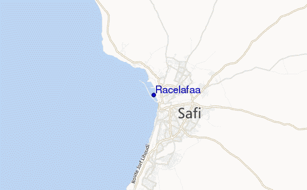
Racelafaa surf Forecast / Central Morocco / Morocco
- Map Icons:
 Break
Break Live Wave Height (m)
 Live Wind Speed (km/h)
 Surf Rating (10 Max)
 Ocean Swells (m)
- Wind Speed (km/h)
How big are the waves at Racelafaa today?
The current surf forecast for Racelafaa at 3AM is: 0.5m 10s primary swell from a West-northwest direction and 0.2m 13s secondary swell from a West-northwest direction (forecast issued at 12:00am April 24). An open ocean swell of 1.1m 6s is not directed at the surf break. The wind direction is predicted to be cross-offshore and the swell rating is 2.
| Time (+01) & Date | Wave Height | Wave Period |
|---|---|---|
| Morning (24 Apr) | 1.5ft (0.4m) | 12s |
| Afternoon (24 Apr) | 2.5ft (0.7m) | 12s |
| Evening (24 Apr) | 4.5ft (1.4m) | 6s |
Table - waves today at Racelafaa. (Swell directed towards the surf break)
Wednesday 24 | Thursday 25 | Friday 26 | Saturday 27 | Sunday 28 | Monday 29 | Tuesday 30 | Wednesday 01 | |||||||||||||||||||||||||||||||||||||||||||||||||||||
| 10 PM | 1 AM | 4 AM | 7 AM | 10 AM | 1 PM | 4 PM | 7 PM | 10 PM | 1 AM | 4 AM | 7 AM | 10 AM | 1 PM | 4 PM | 7 PM | 10 PM | 1 AM | 4 AM | 7 AM | 10 AM | 1 PM | 4 PM | 7 PM | 10 PM | 1 AM | 4 AM | 7 AM | 10 AM | 1 PM | 4 PM | 7 PM | 10 PM | 1 AM | 4 AM | 7 AM | 10 AM | 1 PM | 4 PM | 7 PM | 10 PM | 1 AM | 4 AM | 7 AM | 10 AM | 1 PM | 4 PM | 7 PM | 10 PM | 1 AM | 4 AM | 7 AM | 10 AM | 1 PM | 4 PM | 7 PM | 10 PM | 1 AM | 4 AM | 7 AM | |
Rating (10 max) | ||||||||||||||||||||||||||||||||||||||||||||||||||||||||||||
Swell Height Map |  |   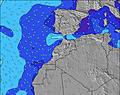 | 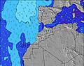 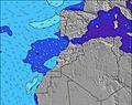 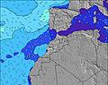 | 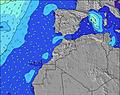 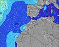 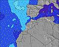 | 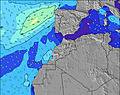   |    | 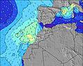 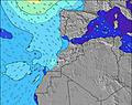 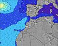 | 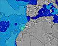 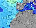 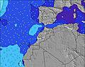 | 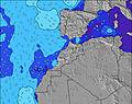 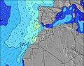 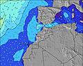 | |||||||||||||||||||||||||||||||||||||||||||||||||||
| Wave Height (m) & direction (?) | ||||||||||||||||||||||||||||||||||||||||||||||||||||||||||||
| Period(s) (?) | 10 | 10 | 9 | 13 | 12 | 6 | 12 | 6 | 6 | 11 | 10 | 10 | 10 | 8 | 8 | 7 | 7 | 7 | 8 | 7 | 7 | 7 | 8 | 7 | 7 | 7 | 7 | 7 | 7 | 7 | 7 | 7 | 16 | 14 | 14 | 13 | 13 | 13 | 12 | 12 | 12 | 11 | 11 | 11 | 10 | 10 | 10 | 10 | 10 | 10 | 10 | 10 | 10 | 9 | 9 | 8 | 7 | 8 | 8 | 8 |
Wave (?)Graph | ||||||||||||||||||||||||||||||||||||||||||||||||||||||||||||
| Energy (?) | 56 | 52 | 50 | 49 | 58 | 89 | 119 | 121 | 148 | 119 | 94 | 102 | 100 | 120 | 140 | 160 | 176 | 186 | 176 | 164 | 140 | 117 | 120 | 117 | 97 | 74 | 51 | 50 | 38 | 70 | 127 | 202 | 728 | 1736 | 2982 | 2549 | 1922 | 1626 | 1415 | 1180 | 974 | 836 | 725 | 652 | 604 | 543 | 648 | 432 | 574 | 574 | 574 | 516 | 506 | 455 | 505 | 504 | 439 | 408 | 329 | 300 |
Wind (km/h) | ||||||||||||||||||||||||||||||||||||||||||||||||||||||||||||
| Wind State (?) onshore cross-onshore cross-shore cross-offshore offshore glassy | cross- off | cross- off | cross- off | cross- off | cross- off | cross | cross | cross- off | cross- off | cross- off | cross- off | cross- off | cross- off | cross | cross | cross | cross- off | cross- off | cross- off | cross- off | cross- off | cross- on | cross- on | cross- on | cross- on | on | cross | cross- on | glass | cross- on | cross- on | cross | cross- off | cross- off | cross- off | cross- off | cross- off | cross- on | cross | cross | cross | cross- off | cross- off | cross- off | cross- off | cross | cross | cross | cross- off | cross- off | off | off | cross- off | cross | cross | cross- off | cross- off | cross- off | cross- off | cross- off |
High Tide / height (m) | 2:59AM 2.49 | 3:15PM 2.49 | 3:29AM 2.45 | 3:45PM 2.48 | 4:01AM 2.38 | 4:16PM 2.42 | 4:35AM 2.28 | 4:51PM 2.34 | 5:14AM 2.16 | 5:33PM 2.23 | 6:01AM 2.02 | 6:25PM 2.12 | 7:04AM 1.90 | 7:35PM 2.04 | ||||||||||||||||||||||||||||||||||||||||||||||
Low Tide / height (m) | 8:47PM 0.26 | 9:02AM 0.22 | 9:18PM 0.24 | 9:31AM 0.25 | 9:50PM 0.27 | 10:01AM 0.32 | 10:23PM 0.33 | 10:35AM 0.41 | 11:01PM 0.43 | 11:12AM 0.53 | 11:45PM 0.55 | 11:59AM 0.66 | 12:43AM 0.67 | 1:00PM 0.79 | 2:00AM 0.73 | |||||||||||||||||||||||||||||||||||||||||||||
Wednesday 24 | Thursday 25 | Friday 26 | Saturday 27 | Sunday 28 | Monday 29 | Tuesday 30 | Wednesday 01 | |||||||||||||||||||||||||||||||||||||||||||||||||||||
| Sunrise | - | - | - | 6:56 | - | - | - | - | - | - | - | 6:56 | - | - | - | - | - | - | - | 6:54 | - | - | - | - | - | - | - | 6:54 | - | - | - | - | - | - | - | 6:52 | - | - | - | - | - | - | - | 6:52 | - | - | - | - | - | - | - | 6:50 | - | - | - | - | - | - | - | 6:50 |
| Sunset | - | - | - | - | - | - | - | 8:13 | - | - | - | - | - | - | - | 8:13 | - | - | - | - | - | - | - | 8:14 | - | - | - | - | - | - | - | 8:15 | - | - | - | - | - | - | - | 8:15 | - | - | - | - | - | - | - | 8:15 | - | - | - | - | - | - | - | 8:16 | - | - | - | - |
Rain (mm) | - | - | - | - | - | - | - | - | - | - | - | - | - | - | - | - | - | - | - | - | - | - | - | - | - | - | - | - | 1 | - | - | - | - | - | - | - | - | - | - | - | - | - | - | - | - | - | - | - | - | - | - | - | - | - | - | - | - | - | - | - |
| Temp. °C | 20 | 18 | 16 | 15 | 21 | 22 | 21 | 20 | 17 | 16 | 15 | 15 | 17 | 18 | 17 | 17 | 16 | 15 | 14 | 14 | 17 | 17 | 17 | 17 | 17 | 17 | 16 | 16 | 15 | 17 | 17 | 17 | 17 | 16 | 15 | 14 | 16 | 17 | 17 | 17 | 16 | 16 | 16 | 15 | 16 | 16 | 17 | 17 | 16 | 15 | 14 | 14 | 17 | 17 | 18 | 17 | 16 | 15 | 14 | 14 |
| Feels °C (?) | 13 | 13 | 12 | 10 | 15 | 15 | 14 | 13 | 12 | 14 | 13 | 13 | 15 | 14 | 12 | 12 | 12 | 12 | 11 | 11 | 15 | 12 | 12 | 13 | 14 | 16 | 14 | 14 | 15 | 14 | 13 | 12 | 13 | 13 | 12 | 11 | 13 | 11 | 11 | 11 | 11 | 12 | 13 | 13 | 12 | 10 | 11 | 11 | 10 | 11 | 10 | 10 | 13 | 11 | 10 | 10 | 9 | 9 | 10 | 11 |
FREE! Surf-Forecast.com widget for your website
The surf report / weather widget below is available to embed on third party websites free of charge and provides a summary of our Racelafaa surf forecast. Simply grab the html code snippet that we provide and paste it into your own site. You can choose your preferred language and metric/imperial units for the surf forecast feed to suit users of your site. Click here to get the code.


 Nearest