

- Forecast
- Maps
- Live
- Weather State
- Spot Information
Raglan-Indicators Surf Forecast
/ Raglan and West Waikato (7 surf breaks) /
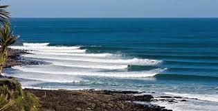
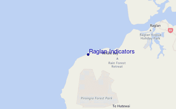
Raglan-Indicators surf Forecast / Raglan and West Waikato / New Zealand
- Map Icons:
 Break
Break Live Wave Height (m)
 Live Wind Speed (km/h)
 Surf Rating (10 Max)
 Ocean Swells (m)
- Wind Speed (km/h)
How big are the waves at Raglan-Indicators today?
The current surf forecast for Raglan-Indicators at 3AM is: 1.5m 13s primary swell from a West-southwest direction and 0.3m 5s secondary swell from a Northwest direction (forecast issued at 11:00pm April 19). The wind direction is predicted to be cross-shore and the swell rating is 3.
| Time (NZST) & Date | Wave Height | Wave Period |
|---|---|---|
| Morning (20 Apr) | 5ft (1.5m) | 14s |
| Afternoon (20 Apr) | 5ft (1.5m) | 14s |
| Evening (20 Apr) | 4.5ft (1.4m) | 13s |
Table - waves today at Raglan-Indicators. (Swell directed towards the surf break)
Saturday 20 | Sunday 21 | Monday 22 | Tuesday 23 | Wednesday 24 | Thursday 25 | Friday 26 | Saturday 27 | |||||||||||||||||||||||||||||||||||||||||||||||||||||
| 9 PM | 0 AM | 3 AM | 6 AM | 9 AM | 12 PM | 3 PM | 6 PM | 9 PM | 0 AM | 3 AM | 6 AM | 9 AM | 12 PM | 3 PM | 6 PM | 9 PM | 0 AM | 3 AM | 6 AM | 9 AM | 12 PM | 3 PM | 6 PM | 9 PM | 0 AM | 3 AM | 6 AM | 9 AM | 12 PM | 3 PM | 6 PM | 9 PM | 0 AM | 3 AM | 6 AM | 9 AM | 12 PM | 3 PM | 6 PM | 9 PM | 0 AM | 3 AM | 6 AM | 9 AM | 12 PM | 3 PM | 6 PM | 9 PM | 0 AM | 3 AM | 6 AM | 9 AM | 12 PM | 3 PM | 6 PM | 9 PM | 0 AM | 3 AM | 6 AM | |
Rating (10 max) | ||||||||||||||||||||||||||||||||||||||||||||||||||||||||||||
Swell Height Map |  |    |    |    |  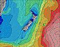 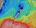 |  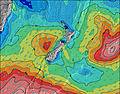 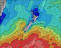 |  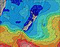 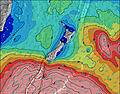 |  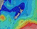 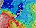 | 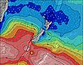 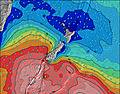 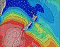 | |||||||||||||||||||||||||||||||||||||||||||||||||||
| Wave Height (m) & direction (?) | ||||||||||||||||||||||||||||||||||||||||||||||||||||||||||||
| Period(s) (?) | 13 | 13 | 13 | 14 | 14 | 14 | 14 | 13 | 13 | 13 | 13 | 13 | 13 | 13 | 13 | 12 | 8 | 8 | 8 | 14 | 13 | 13 | 13 | 13 | 14 | 14 | 14 | 13 | 13 | 13 | 14 | 14 | 13 | 13 | 16 | 15 | 14 | 14 | 14 | 14 | 14 | 14 | 14 | 13 | 14 | 17 | 16 | 16 | 16 | 16 | 16 | 15 | 15 | 15 | 15 | 14 | 14 | 13 | 13 | 13 |
Wave (?)Graph | ||||||||||||||||||||||||||||||||||||||||||||||||||||||||||||
| Energy (?) | 768 | 756 | 768 | 791 | 802 | 791 | 779 | 711 | 700 | 690 | 596 | 587 | 578 | 1297 | 1500 | 1667 | 897 | 897 | 861 | 2430 | 2459 | 586 | 595 | 634 | 643 | 643 | 733 | 722 | 1018 | 1018 | 1033 | 1033 | 824 | 837 | 1437 | 1193 | 982 | 969 | 862 | 862 | 702 | 682 | 643 | 553 | 643 | 640 | 1569 | 1447 | 1493 | 1411 | 1341 | 1079 | 1578 | 1825 | 3331 | 4107 | 4639 | 4138 | 3606 | 3550 |
Wind (km/h) | ||||||||||||||||||||||||||||||||||||||||||||||||||||||||||||
| Wind State (?) onshore cross-onshore cross-shore cross-offshore offshore glassy | glass | cross- on | cross | cross- off | cross- off | cross- off | cross- off | cross- off | cross- off | off | cross- off | cross- off | cross- off | cross- off | cross | cross- off | cross- off | cross | cross | cross | cross- off | cross | cross- off | cross- off | off | cross- off | cross- off | cross- off | cross- off | on | cross- on | cross- off | cross- off | cross- off | cross- off | cross- off | cross | cross | cross- off | glass | glass | cross- off | cross- off | cross- off | cross- off | cross- off | cross- off | cross- off | cross- off | cross- off | cross- off | cross | cross | cross | cross | cross | cross | cross | cross | cross- off |
High Tide / height (m) | 7:09PM 2.34 | 7:26AM 2.51 | 7:50PM 2.49 | 8:03AM 2.64 | 8:26PM 2.64 | 8:38AM 2.74 | 9:00PM 2.76 | 9:11AM 2.81 | 9:33PM 2.85 | 9:44AM 2.85 | 10:05PM 2.89 | 10:17AM 2.84 | 10:38PM 2.89 | 10:51AM 2.80 | 11:13PM 2.85 | |||||||||||||||||||||||||||||||||||||||||||||
Low Tide / height (m) | 1:12AM 0.72 | 1:39PM 0.58 | 1:54AM 0.59 | 2:16PM 0.44 | 2:31AM 0.47 | 2:50PM 0.33 | 3:05AM 0.38 | 3:22PM 0.25 | 3:39AM 0.32 | 3:55PM 0.22 | 4:13AM 0.31 | 4:28PM 0.23 | 4:48AM 0.33 | 5:03PM 0.27 | 5:25AM 0.39 | |||||||||||||||||||||||||||||||||||||||||||||
Saturday 20 | Sunday 21 | Monday 22 | Tuesday 23 | Wednesday 24 | Thursday 25 | Friday 26 | Saturday 27 | |||||||||||||||||||||||||||||||||||||||||||||||||||||
| Sunrise | - | - | - | - | 6:52 | - | - | - | - | - | - | - | 6:52 | - | - | - | - | - | - | - | 6:54 | - | - | - | - | - | - | - | 6:54 | - | - | - | - | - | - | - | 6:56 | - | - | - | - | - | - | - | 6:56 | - | - | - | - | - | - | - | 6:56 | - | - | - | - | - | - | - |
| Sunset | - | - | - | - | - | - | 5:45 | - | - | - | - | - | - | - | 5:45 | - | - | - | - | - | - | - | 5:43 | - | - | - | - | - | - | - | 5:42 | - | - | - | - | - | - | - | 5:40 | - | - | - | - | - | - | - | 5:39 | - | - | - | - | - | - | - | 5:37 | - | - | - | - | - |
Rain (mm) | - | 1 | 4 | 4 | 2 | 4 | 11 | 7 | 1 | 1 | - | - | - | - | - | - | - | - | - | - | - | - | - | - | - | - | - | - | - | - | - | - | - | - | - | - | - | - | - | - | - | - | - | - | - | - | - | - | - | 7 | 13 | 19 | 2 | 1 | 1 | 1 | 1 | 2 | 1 | 1 |
| Temp. °C | 16 | 16 | 15 | 14 | 14 | 14 | 15 | 15 | 15 | 15 | 15 | 15 | 16 | 17 | 16 | 15 | 15 | 15 | 16 | 16 | 16 | 17 | 18 | 16 | 16 | 15 | 14 | 13 | 15 | 17 | 17 | 16 | 15 | 15 | 14 | 15 | 15 | 15 | 15 | 14 | 13 | 11 | 11 | 10 | 12 | 17 | 18 | 16 | 15 | 15 | 15 | 16 | 17 | 17 | 16 | 15 | 13 | 13 | 13 | 12 |
| Feels °C (?) | 17 | 15 | 15 | 13 | 11 | 11 | 13 | 13 | 14 | 15 | 15 | 13 | 13 | 13 | 11 | 11 | 11 | 11 | 11 | 11 | 11 | 14 | 16 | 14 | 15 | 13 | 12 | 12 | 15 | 16 | 16 | 16 | 15 | 15 | 14 | 14 | 13 | 12 | 13 | 13 | 12 | 9 | 9 | 7 | 9 | 14 | 16 | 14 | 14 | 15 | 14 | 14 | 16 | 13 | 10 | 8 | 5 | 5 | 5 | 5 |
FREE! Surf-Forecast.com widget for your website
The surf report / weather widget below is available to embed on third party websites free of charge and provides a summary of our Raglan-Indicators surf forecast. Simply grab the html code snippet that we provide and paste it into your own site. You can choose your preferred language and metric/imperial units for the surf forecast feed to suit users of your site. Click here to get the code.


 Nearest