Hurricane Melissa Set To Be Most Powerful To Strike Caribbean.
Melissa's peak winds of 160mph make it the most powerful hurricane since Gilbert in 1988. Meanwhile the Atlantic comes alive with waves for the next 12 days.
What began as a cluster of thunderstorms off the coast of West Africa last week has intensified into a Category 4 Hurricane as of Monday morning European time. It is then expected to intensify even further, transforming into a rare Category 5 hurricane and making landfall in Jamaica. Peak winds of 160mph are forecast, making it the most powerful since Hurricane Gilbert in 1988. The minimum central pressure is forecast to drop to 917 mb. The destructive winds and storm surges could cause catastrophic flooding and widespread damage to Jamaica and Cuba.
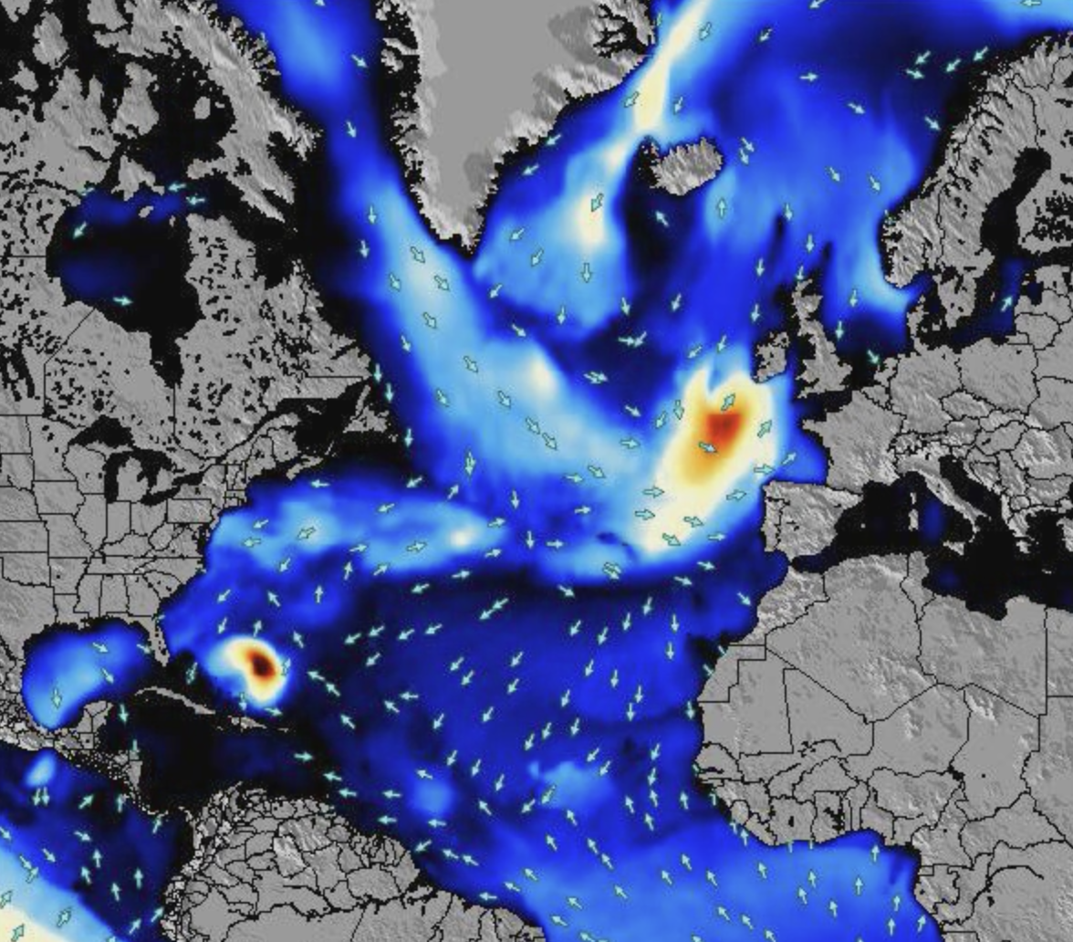
Our 12-day wave energy map has Melissa, that speck in the left bottom corner, making her move, while on her tail is another orange blob.
The storm is currently moving west around 3 mph, but is expected to make a slow turn toward the northwest and north on Monday and Tuesday. It will then accelerate northeastward, into the Atlantic, and run parallel to America’s East Coast during the week. By Saturday, it should be level with New York. It is here that Melissa gets interesting for surfers. The eastern seaboard will get a run of fun, but not epic, swell running up to Halloween. Onshore winds could be a spoiler, though.
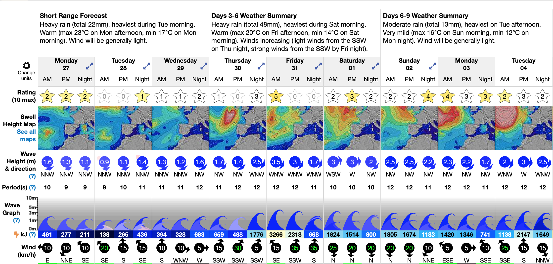
As the storm tracks west, it loses its hurricane status and transforms into a low-pressure system that should blast Europe’s west-facing coasts by next weekend. These aren’t the classic Northern Atlantic winter storms, and come with shorter-period swell and stronger winds. Yet most big wave surfers, whether based in Nazare, the Basque Country, or Ireland, will be keeping a close eye to see if there will be windows of opportunity.
Meanwhile, with Surf-Forecast premium 12-day forecasts, we can see that as the remnants of Melissa trail off into the ether, another deep low is forecast to form in the eastern Atlantic and head west towards Europe. The Atlantic shows a spreading ink spot on our energy rating maps as both sides of the pond get another round of raw and jagged waves well into next week.
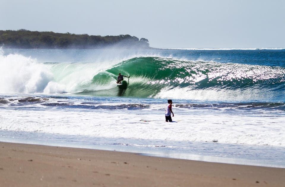
While we fear for Jamaica and the Caribbean islanders, the Atlantic is set to provide waves for days. We’ll keep you posted.