

- Forecast
- Maps
- Live
- Weather State
- Spot Information
Double Island Point - North Coast Surf Forecast
/ QLD – North Coast (14 breaks) / Queensland (74 breaks) /
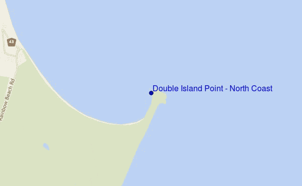
Double Island Point - North Coast surf Forecast / QLD – North Coast / Australia
- Map Icons:
 Break
Break Live Wave Height (m)
 Live Wind Speed (km/h)
 Surf Rating (10 Max)
 Ocean Swells (m)
- Wind Speed (km/h)
How big are the waves at Double Island Point - North Coast today?
The current surf forecast for Double Island Point - North Coast at 2PM is: 1.6m 6s primary swell from a South-southeast direction and 1.0m 9s secondary swell from a East direction, 0.3m 11s secondary swell from a Northeast direction (forecast issued at 09:00am April 26). The wind direction is predicted to be offshore and the swell rating is 2.
| Time (AEST) & Date | Wave Height | Wave Period |
|---|---|---|
| Morning (26 Apr) | 3.5ft (1.0m) | 9s |
| Afternoon (26 Apr) | 3.5ft (1.1m) | 9s |
| Evening (26 Apr) | 6ft (1.9m) | 7s |
Table - waves today at Double Island Point - North Coast. (Swell directed towards the surf break)
Friday 26 | Saturday 27 | Sunday 28 | Monday 29 | Tuesday 30 | Wednesday 01 | Thursday 02 | Friday 03 | |||||||||||||||||||||||||||||||||||||||||||||||||||||
| 7 AM | 10 AM | 1 PM | 4 PM | 7 PM | 10 PM | 1 AM | 4 AM | 7 AM | 10 AM | 1 PM | 4 PM | 7 PM | 10 PM | 1 AM | 4 AM | 7 AM | 10 AM | 1 PM | 4 PM | 7 PM | 10 PM | 1 AM | 4 AM | 7 AM | 10 AM | 1 PM | 4 PM | 7 PM | 10 PM | 1 AM | 4 AM | 7 AM | 10 AM | 1 PM | 4 PM | 7 PM | 10 PM | 1 AM | 4 AM | 7 AM | 10 AM | 1 PM | 4 PM | 7 PM | 10 PM | 1 AM | 4 AM | 7 AM | 10 AM | 1 PM | 4 PM | 7 PM | 10 PM | 1 AM | 4 AM | 7 AM | 10 AM | 1 PM | 4 PM | |
Rating (10 max) | ||||||||||||||||||||||||||||||||||||||||||||||||||||||||||||
Swell Height Map |    |  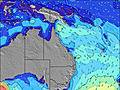 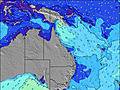 | 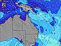 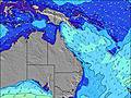  |    |  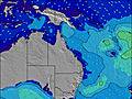 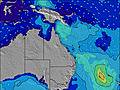 | 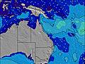 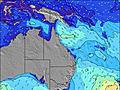  |    | 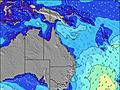 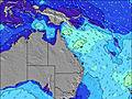 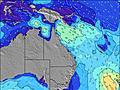 | ||||||||||||||||||||||||||||||||||||||||||||||||||||
| Wave Height (m) & direction (?) | ||||||||||||||||||||||||||||||||||||||||||||||||||||||||||||
| Period(s) (?) | 9 | 9 | 6 | 9 | 7 | 7 | 7 | 7 | 6 | 6 | 11 | 8 | 10 | 10 | 9 | 6 | 6 | 6 | 6 | 6 | 7 | 7 | 7 | 7 | 7 | 7 | 7 | 7 | 8 | 8 | 8 | 8 | 8 | 8 | 8 | 8 | 8 | 8 | 8 | 8 | 8 | 8 | 8 | 8 | 9 | 6 | 7 | 7 | 7 | 7 | 7 | 7 | 7 | 8 | 12 | 12 | 11 | 11 | 11 | 11 |
Wave (?)Graph | ||||||||||||||||||||||||||||||||||||||||||||||||||||||||||||
| Energy (?) | 152 | 159 | 196 | 193 | 323 | 323 | 323 | 226 | 263 | 150 | 18 | 132 | 18 | 17 | 78 | 188 | 218 | 207 | 197 | 215 | 261 | 298 | 265 | 233 | 210 | 203 | 181 | 168 | 221 | 266 | 294 | 263 | 256 | 223 | 221 | 204 | 210 | 191 | 173 | 173 | 168 | 172 | 141 | 167 | 12 | 328 | 545 | 607 | 611 | 640 | 465 | 363 | 365 | 470 | 470 | 478 | 278 | 263 | 217 | 217 |
Wind (km/h) | ||||||||||||||||||||||||||||||||||||||||||||||||||||||||||||
| Wind State (?) onshore cross-onshore cross-shore cross-offshore offshore glassy | off | off | off | off | off | off | cross- off | off | off | off | off | off | cross- off | cross- off | cross- off | cross- off | cross- off | cross- off | cross- off | cross- off | cross- off | cross- off | cross- off | cross- off | cross- off | cross- off | cross- off | cross- off | cross- off | cross- off | cross- off | cross- off | cross- off | cross- off | off | off | cross- off | cross- off | cross- off | off | off | off | off | off | off | off | off | off | off | off | off | off | off | off | off | off | off | off | off | off |
High Tide / height (m) | 9:04AM 1.18 | 9:34PM 1.64 | 9:44AM 1.09 | 10:16PM 1.61 | 10:31AM 1.01 | 11:06PM 1.57 | 11:31AM 0.93 | 12:06AM 1.54 | 12:48PM 0.90 | 1:15AM 1.53 | 2:14PM 0.94 | 2:24AM 1.55 | 3:28PM 1.06 | 3:28AM 1.59 | ||||||||||||||||||||||||||||||||||||||||||||||
Low Tide / height (m) | 2:58PM 0.19 | 4:10AM 0.30 | 3:32PM 0.25 | 5:01AM 0.34 | 4:12PM 0.31 | 6:03AM 0.38 | 5:03PM 0.38 | 7:16AM 0.38 | 6:10PM 0.45 | 8:30AM 0.33 | 7:34PM 0.47 | 9:32AM 0.25 | 8:59PM 0.45 | 10:23AM 0.14 | ||||||||||||||||||||||||||||||||||||||||||||||
Friday 26 | Saturday 27 | Sunday 28 | Monday 29 | Tuesday 30 | Wednesday 01 | Thursday 02 | Friday 03 | |||||||||||||||||||||||||||||||||||||||||||||||||||||
| Sunrise | 6:07 | - | - | - | - | - | - | - | 6:07 | - | - | - | - | - | - | - | 6:09 | - | - | - | - | - | - | - | 6:09 | - | - | - | - | - | - | - | 6:09 | - | - | - | - | - | - | - | 6:09 | - | - | - | - | - | - | - | 6:11 | - | - | - | - | - | - | - | 6:11 | - | - | - |
| Sunset | - | - | - | 5:21 | - | - | - | - | - | - | - | 5:20 | - | - | - | - | - | - | - | 5:20 | - | - | - | - | - | - | - | 5:19 | - | - | - | - | - | - | - | 5:17 | - | - | - | - | - | - | - | 5:16 | - | - | - | - | - | - | - | 5:15 | - | - | - | - | - | - | - | 5:15 |
Rain (mm) | - | 2 | 2 | 2 | 1 | 1 | - | - | - | - | - | 1 | 1 | 1 | - | - | - | 1 | - | - | - | 1 | 1 | - | - | - | 1 | 1 | 1 | - | - | 1 | 2 | 1 | - | - | - | - | - | - | - | - | - | - | 1 | 2 | 2 | 1 | - | - | - | - | 1 | 1 | - | - | - | - | 1 | 1 |
| Temp. °C | 21 | 21 | 21 | 21 | 22 | 22 | 22 | 22 | 21 | 22 | 22 | 22 | 22 | 22 | 22 | 22 | 22 | 22 | 23 | 22 | 22 | 22 | 22 | 22 | 21 | 22 | 22 | 22 | 22 | 23 | 22 | 21 | 21 | 22 | 23 | 22 | 22 | 22 | 21 | 21 | 21 | 22 | 22 | 21 | 21 | 21 | 21 | 20 | 19 | 20 | 21 | 21 | 21 | 21 | 21 | 20 | 20 | 21 | 21 | 21 |
| Feels °C (?) | 18 | 17 | 17 | 17 | 18 | 18 | 17 | 17 | 17 | 18 | 19 | 18 | 18 | 18 | 18 | 19 | 19 | 18 | 19 | 18 | 18 | 19 | 19 | 20 | 19 | 20 | 20 | 20 | 20 | 21 | 21 | 20 | 19 | 20 | 21 | 20 | 21 | 21 | 20 | 19 | 18 | 18 | 18 | 18 | 17 | 17 | 16 | 16 | 15 | 15 | 16 | 16 | 16 | 16 | 17 | 16 | 16 | 17 | 17 | 17 |
FREE! Surf-Forecast.com widget for your website
The surf report / weather widget below is available to embed on third party websites free of charge and provides a summary of our Double Island Point - North Coast surf forecast. Simply grab the html code snippet that we provide and paste it into your own site. You can choose your preferred language and metric/imperial units for the surf forecast feed to suit users of your site. Click here to get the code.


 Nearest