

- Forecast
- Maps
- Live
- Weather State
- Spot Information
Mntafufu Surf Forecast
/ Eastern Cape – Wild Coast (51 surf breaks) /

Mntafufu surf Forecast / Eastern Cape – Wild Coast / South Africa
- Map Icons:
 Break
Break Live Wave Height (m)
 Live Wind Speed (km/h)
 Surf Rating (10 Max)
 Ocean Swells (m)
- Wind Speed (km/h)
How big are the waves at Mntafufu today?
The current surf forecast for Mntafufu at 1AM is: 0.7m 14s primary swell from a Southwest direction and 1.1m 8s secondary swell from a East-northeast direction (forecast issued at 07:00pm May 21). An open ocean swell of 0.5m 4s is not directed at the surf break. The wind direction is predicted to be cross-offshore and the swell rating is 3.
| Time (SAST) & Date | Wave Height | Wave Period |
|---|---|---|
| Morning (22 May) | 2.5ft (0.8m) | 15s |
| Afternoon (22 May) | 4.5ft (1.3m) | 16s |
| Evening (22 May) | 3ft (0.9m) | 14s |
Table - waves today at Mntafufu. (Swell directed towards the surf break)
Tuesday 21 | Wednesday 22 | Thursday 23 | Friday 24 | Saturday 25 | Sunday 26 | Monday 27 | Tuesday 28 | Wed 29 | ||||||||||||||||||||||||||||||||||||||||||||||||||||
| 5 PM | 8 PM | 11 PM | 2 AM | 5 AM | 8 AM | 11 AM | 2 PM | 5 PM | 8 PM | 11 PM | 2 AM | 5 AM | 8 AM | 11 AM | 2 PM | 5 PM | 8 PM | 11 PM | 2 AM | 5 AM | 8 AM | 11 AM | 2 PM | 5 PM | 8 PM | 11 PM | 2 AM | 5 AM | 8 AM | 11 AM | 2 PM | 5 PM | 8 PM | 11 PM | 2 AM | 5 AM | 8 AM | 11 AM | 2 PM | 5 PM | 8 PM | 11 PM | 2 AM | 5 AM | 8 AM | 11 AM | 2 PM | 5 PM | 8 PM | 11 PM | 2 AM | 5 AM | 8 AM | 11 AM | 2 PM | 5 PM | 8 PM | 11 PM | 2 AM | |
Rating (10 max) | ||||||||||||||||||||||||||||||||||||||||||||||||||||||||||||
Swell Height Map |   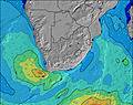 |    |  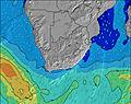  |  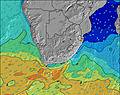 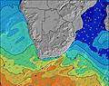 |    |    |    |    |    | |||||||||||||||||||||||||||||||||||||||||||||||||||
| Wave Height (m) & direction (?) | ||||||||||||||||||||||||||||||||||||||||||||||||||||||||||||
| Period(s) (?) | 8 | 8 | 8 | 14 | 14 | 15 | 15 | 17 | 16 | 15 | 14 | 9 | 8 | 9 | 9 | 9 | 9 | 9 | 9 | 6 | 7 | 15 | 15 | 10 | 9 | 9 | 14 | 14 | 14 | 14 | 14 | 14 | 14 | 13 | 13 | 13 | 13 | 13 | 13 | 14 | 14 | 8 | 8 | 8 | 15 | 15 | 18 | 19 | 18 | 17 | 17 | 16 | 16 | 16 | 16 | 15 | 15 | 15 | 15 | 19 |
Wave (?)Graph | ||||||||||||||||||||||||||||||||||||||||||||||||||||||||||||
| Energy (?) | 357 | 356 | 469 | 206 | 208 | 242 | 398 | 848 | 649 | 377 | 261 | 419 | 464 | 264 | 258 | 222 | 227 | 193 | 162 | 229 | 136 | 148 | 223 | 422 | 390 | 362 | 362 | 357 | 352 | 312 | 246 | 239 | 232 | 225 | 195 | 192 | 189 | 238 | 249 | 303 | 303 | 356 | 569 | 587 | 539 | 1305 | 5387 | 10156 | 10070 | 8509 | 6188 | 4310 | 3714 | 2865 | 2276 | 1924 | 1658 | 1658 | 1355 | 2182 |
Wind (km/h) | ||||||||||||||||||||||||||||||||||||||||||||||||||||||||||||
| Wind State (?) onshore cross-onshore cross-shore cross-offshore offshore glassy | cross- on | cross- on | cross- off | off | off | off | glass | cross- on | on | cross | cross | cross | cross | cross | cross- on | cross- on | cross- off | cross- off | cross- off | cross- off | cross- off | cross- off | cross | cross | cross- on | on | on | cross- on | cross- on | cross- on | cross- on | on | cross- on | cross- on | cross | cross | cross- off | off | cross- off | cross- off | cross- off | off | off | off | off | cross- off | glass | on | cross- on | cross- on | cross | cross | cross | cross | cross- on | cross- on | cross- on | cross | cross- off | off |
High Tide / height (m) | 2:42PM 1.42 | 2:51AM 1.59 | 3:12PM 1.48 | 3:22AM 1.62 | 3:44PM 1.51 | 3:54AM 1.63 | 4:16PM 1.51 | 4:27AM 1.61 | 4:51PM 1.50 | 5:03AM 1.57 | 5:29PM 1.46 | 5:42AM 1.50 | 6:13PM 1.40 | 6:26AM 1.40 | 7:06PM 1.35 | |||||||||||||||||||||||||||||||||||||||||||||
Low Tide / height (m) | 8:37PM 0.26 | 9:05AM 0.18 | 9:09PM 0.22 | 9:36AM 0.14 | 9:41PM 0.19 | 10:08AM 0.13 | 10:15PM 0.20 | 10:41AM 0.14 | 10:51PM 0.23 | 11:18AM 0.18 | 11:30PM 0.29 | 11:58AM 0.24 | 12:16AM 0.37 | 12:45PM 0.32 | 1:12AM 0.47 | |||||||||||||||||||||||||||||||||||||||||||||
Tuesday 21 | Wednesday 22 | Thursday 23 | Friday 24 | Saturday 25 | Sunday 26 | Monday 27 | Tuesday 28 | Wed 29 | ||||||||||||||||||||||||||||||||||||||||||||||||||||
| Sunrise | - | - | - | - | - | 6:47 | - | - | - | - | - | - | - | 6:47 | - | - | - | - | - | - | - | 6:48 | - | - | - | - | - | - | - | 6:48 | - | - | - | - | - | - | - | 6:48 | - | - | - | - | - | - | - | 6:50 | - | - | - | - | - | - | - | 6:50 | - | - | - | - | - | - |
| Sunset | 5:08 | - | - | - | - | - | - | - | 5:08 | - | - | - | - | - | - | - | 5:07 | - | - | - | - | - | - | - | 5:07 | - | - | - | - | - | - | - | 5:07 | - | - | - | - | - | - | - | 5:07 | - | - | - | - | - | - | - | 5:07 | - | - | - | - | - | - | - | 5:06 | - | - | - |
Rain (mm) | - | - | - | - | - | - | - | - | - | - | - | - | - | - | - | - | - | 1 | - | - | 1 | 1 | 1 | - | - | 1 | 1 | 1 | 1 | 1 | 1 | 1 | - | - | - | - | - | - | - | - | - | - | - | - | - | - | - | - | - | - | - | - | - | - | - | - | - | - | - | - |
| Temp. °C | 26 | 25 | 21 | 19 | 19 | 19 | 23 | 23 | 21 | 19 | 19 | 18 | 18 | 19 | 25 | 26 | 22 | 21 | 21 | 20 | 20 | 20 | 20 | 20 | 19 | 19 | 19 | 18 | 18 | 18 | 20 | 21 | 20 | 19 | 18 | 17 | 16 | 18 | 22 | 22 | 21 | 19 | 18 | 17 | 16 | 16 | 21 | 22 | 20 | 18 | 17 | 17 | 17 | 18 | 24 | 27 | 24 | 23 | 23 | 22 |
| Feels °C (?) | 24 | 23 | 20 | 18 | 18 | 18 | 24 | 24 | 23 | 21 | 20 | 19 | 18 | 19 | 24 | 26 | 21 | 19 | 18 | 18 | 18 | 19 | 19 | 19 | 19 | 19 | 19 | 18 | 18 | 18 | 19 | 19 | 18 | 18 | 17 | 16 | 15 | 16 | 17 | 17 | 17 | 17 | 16 | 16 | 15 | 15 | 21 | 20 | 19 | 17 | 16 | 16 | 16 | 16 | 22 | 25 | 22 | 21 | 19 | 19 |
FREE! Surf-Forecast.com widget for your website
The surf report / weather widget below is available to embed on third party websites free of charge and provides a summary of our Mntafufu surf forecast. Simply grab the html code snippet that we provide and paste it into your own site. You can choose your preferred language and metric/imperial units for the surf forecast feed to suit users of your site. Click here to get the code.


 Nearest