- Forecast
- Maps
- Live
- Weather State
- Spot Information
Mouse Rock Golfvoorspelling
/ CAL – San Luis Obispo (23 breaks) / California (404 breaks) /
Golfvoorspellingen
Surfen in Mouse RockVoorspelling / CAL – San Luis Obispo / USA
Verwachting wordt bijgewerkt binnen uur min s Forecast update imminent
Mouse Rock golfvoorspelling is voor open zee vlakbij de kust. Brekende golven zullen vaak kleiner zijn op beschuttende stranden.
De zeetemperatuur in Mouse Rock vandaag is
15.0° C
(Wat 1.2°C kouder is dan gemiddeld voor deze tijd van het jaar)Wordt bijgewerkt binnen uur min s Forecast update imminent
Saturday 26 | Sunday 27 | Monday 28 | ||||||||||||||||||||||
| 2 AM | 5 AM | 8 AM | 11 AM | 2 PM | 5 PM | 8 PM | 11 PM | 2 AM | 5 AM | 8 AM | 11 AM | 2 PM | 5 PM | 8 PM | 11 PM | 2 AM | 5 AM | 8 AM | 11 AM | 2 PM | 5 PM | 8 PM | 11 PM | |
Waardering (10 max) | ||||||||||||||||||||||||
Golfhoogte kaart |    |    |   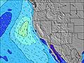 | |||||||||||||||||||||
| Golfhoogte (m) & richting (?) | ||||||||||||||||||||||||
| Periode(s) (?) | 20 | 20 | 20 | 20 | 20 | 19 | 19 | 19 | 18 | 18 | 18 | 18 | 18 | 18 | 18 | 6 | 6 | 17 | 17 | 17 | 17 | 5 | 6 | 7 |
Golf (?)Grafiek | ||||||||||||||||||||||||
| Energie (?) | 94 | 89 | 88 | 87 | 167 | 181 | 156 | 90 | 81 | 118 | 64 | 94 | 169 | 181 | 215 | 432 | 357 | 151 | 141 | 166 | 182 | 160 | 293 | 709 |
Wind (km/h) | ||||||||||||||||||||||||
| Wind (?) onshore cross-onshore cross-shore cross-offshore offshore glasachtig | on | on | glass | on | on | on | on | on | cross- on | glass | glass | on | on | on | on | glass | glass | glass | glass | on | on | on | on | glass |
Vloed / hoogte (m) | 11:12PM 1.88 | 12:48PM 1.28 | 11:52PM 1.75 | 1:22PM 1.30 | 12:32AM 1.58 | 1:55PM 1.32 | ||||||||||||||||||
Eb / hoogte (m) | 6:18AM -0.25 | 5:49PM 0.58 | 6:51AM -0.12 | 6:36PM 0.59 | 7:22AM 0.03 | 7:27PM 0.60 | ||||||||||||||||||
Saturday 26 | Sunday 27 | Monday 28 | ||||||||||||||||||||||
| Zonsopgang | - | - | 6:07 | - | - | - | - | - | - | - | 6:07 | - | - | - | - | - | - | - | 6:07 | - | - | - | - | - |
| Zonsondergang | - | - | - | - | - | - | 8:12 | - | - | - | - | - | - | - | 8:10 | - | - | - | - | - | - | - | 8:09 | - |
Regen (mm) | - | - | - | - | - | - | - | - | - | - | - | - | - | - | - | - | - | - | - | - | - | - | - | - |
| Temp. °C | 13 | 14 | 15 | 18 | 19 | 17 | 14 | 13 | 13 | 13 | 15 | 19 | 20 | 19 | 15 | 14 | 14 | 15 | 17 | 21 | 22 | 21 | 16 | 15 |
| Feels °C (?) | 13 | 14 | 15 | 17 | 17 | 15 | 13 | 12 | 13 | 13 | 15 | 18 | 19 | 17 | 14 | 15 | 14 | 15 | 17 | 20 | 21 | 19 | 15 | 16 |
- Map Icons:
 Break
Break Live Wave Height (m)
 Live Wind Speed (km/h)
 Surf Rating (10 Max)
 Ocean Swells (m)
- Wind Speed (km/h)
 Recente Eyeball Golfberichten voor CAL - San Luis Obispo

Expand
<
>
View all
27 km away, 1 h 22 min ago

9 km/h
WNW
0.0
15.0
Air / Water (°C)
Please reload the page to see if there are any updates.
GRATIS Surf-Forecast.com widget voor je website
Het gratis surfbericht/weer widget hieronder is beschikbaar voor websites en geeft een samenvatting van de golfvoorspelling voor Mouse Rock. Kopieer de HTML-code en plak deze in je eigen site. Je kunt je eigen voorkeurstaal en eenheden kiezen zodat de voorspelling afgesteld is op de gebruikers van jouw site. Klik hier voor de code.


 Nearest