- Forecast
- Maps
- Live
- Weather State
- Spot Information
Ngor Rights Golfvoorspelling
/ Senegal (18 surf breaks) /Golfvoorspellingen:

Surfen in Ngor RightsVoorspelling / Senegal / Senegal
Verwachting wordt bijgewerkt binnen uur min s Forecast update imminent
Ngor Rights golfvoorspelling is voor open zee vlakbij de kust. Brekende golven zullen vaak kleiner zijn op beschuttende stranden.
De zeetemperatuur in Ngor Rights vandaag is
20.2° C
(Wat 1.5°C kouder is dan gemiddeld voor deze tijd van het jaar)Wordt bijgewerkt binnen uur min s Forecast update imminent
Voorspelling Lange TermijnMeestal droog. Very mild (max 19°C op zaterdagavond, min 18°C op maandagochtend). Voornamelijk frisse wind. | ||||||||||||||||||||||||
Sunday 26 | Monday 27 | Tuesday 28 | ||||||||||||||||||||||
9 PM | 12 AM | 3 AM | 6 AM | 9 AM | 12 PM | 3 PM | 6 PM | 9 PM | 12 AM | 3 AM | 6 AM | 9 AM | 12 PM | 3 PM | 6 PM | 9 PM | 12 AM | 3 AM | 6 AM | 9 AM | 12 PM | 3 PM | 6 PM | |
Golfhoogte kaart | 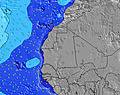 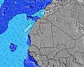 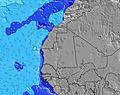 | 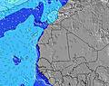 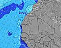 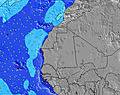 | 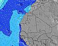 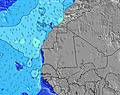 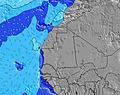 | |||||||||||||||||||||
NNW 11 | NNW 11 | NNW 12 | NNW 8 | NNW 12 | NNW 12 | NNW 8 | NNW 8 | NNW 8 | NNW 8 | NNW 8 | NNW 8 | NNW 8 | NNW 8 | NNW 8 | NNW 8 | NNW 8 | NNW 8 | NNW 7 | NNW 7 | NNW 7 | NNW 7 | NNW 7 | NNW 7 | |
934 | 917 | 876 | 468 | 1018 | 1018 | 383 | 355 | 319 | 314 | 322 | 322 | 295 | 273 | 234 | 276 | 266 | 266 | 222 | 210 | 225 | 225 | 198 | 204 | |
Wind (km/h) | ||||||||||||||||||||||||
on | cross-on | on | on | on | on | on | cross-on | on | on | on | on | on | on | on | on | on | on | on | on | on | on | on | on | |
Vloed | 5:24AM0.90m | 5:39PM1.12m | 6:25AM0.98m | 6:34PM1.16m | 7:11AM1.06m | |||||||||||||||||||
Eb | 11:01PM0.29m | 11:00AM0.36m | 00:04AM0.24m | 12:06PM0.31m | 00:51AM0.19m | 12:58PM0.25m | ||||||||||||||||||
— | — | — | 6:50 | — | — | — | — | — | — | — | 6:48 | — | — | — | — | — | — | — | 6:48 | — | — | — | — | |
— | — | — | — | — | — | — | 7:25 | — | — | — | — | — | — | — | 7:25 | — | — | — | — | — | — | — | 7:25 | |
— | — | — | — | — | — | — | — | — | — | — | — | — | — | — | — | — | — | — | — | — | — | — | — | |
Temp. °C | 19 | 19 | 19 | 19 | 19 | 19 | 19 | 19 | 19 | 19 | 19 | 19 | 18 | 19 | 19 | 19 | 19 | 19 | 18 | 18 | 18 | 18 | 19 | 19 |
16 | 16 | 15 | 15 | 16 | 18 | 19 | 18 | 17 | 17 | 16 | 17 | 15 | 18 | 17 | 17 | 16 | 17 | 15 | 15 | 15 | 15 | 17 | 17 | |
Swell1 Hoogte (m) Richting Periode (s) | NNW 14 | SSW 9 | NNW 13 | NNW 13 | S 9 | NNW 12 | NNW 8 | NNW 8 | NNW 8 | NNW 11 | NNW 11 | NNW 11 | NNW 11 | NNW 11 | NNW 10 | NNW 10 | NNW 10 | NNW 10 | NNW 10 | NNW 10 | NW 11 | NW 11 | NW 11 | NW 11 |
70 | 8 | 69 | 95 | 6 | 1018 | 383 | 355 | 319 | 84 | 109 | 105 | 78 | 66 | 94 | 59 | 40 | 39 | 39 | 37 | 32 | 43 | 43 | 58 | |
Swell2 Hoogte (m) Richting Periode (s) | SSW 9 | SW 15 | SSW 9 | S 9 | SW 15 | S 9 | S 9 | S 9 | NNW 11 | S 9 | S 8 | NW 13 | WNW 13 | WNW 13 | S 8 | WNW 12 | NW 12 | NW 12 | NW 12 | NW 12 | NNW 10 | SSW 16 | SSW 16 | SSW 16 |
8 | 9 | 8 | 6 | 8 | 6 | 6 | 6 | 111 | 6 | 6 | 7 | 17 | 17 | 1 | 15 | 37 | 37 | 37 | 35 | 33 | 25 | 25 | 25 | |
Swell 3 Hoogte (m) Richting Periode (s) | SW 16 | S 12 | SW 15 | SW 15 | S 12 | SW 15 | SW 15 | SW 12 | S 9 | SW 11 | SW 11 | S 8 | S 8 | S 8 | SW 11 | SW 11 | SW 10 | SW 10 | S 10 | SW 10 | SSW 16 | S 10 | NNW 9 | NNW 9 |
10 | 3 | 8 | 8 | 3 | 8 | 8 | 5 | 6 | 5 | 5 | 5 | 1 | 1 | 5 | 4 | 4 | 4 | 2 | 4 | 25 | 8 | 8 | 8 | |
Windgolven Hoogte (m) Richting Periode (s) | NNW 11 | NNW 11 | NNW 12 | NNW 8 | NNW 12 | — | NW 8 | — | — | NNW 8 | NNW 8 | NNW 8 | NNW 8 | NNW 8 | NNW 8 | NNW 8 | NNW 8 | NNW 8 | NNW 7 | NNW 7 | NNW 7 | NNW 7 | NNW 7 | NNW 7 |
934 | 917 | 876 | 468 | 1018 | — | 84 | — | — | 314 | 322 | 322 | 295 | 273 | 234 | 276 | 266 | 266 | 222 | 210 | 225 | 225 | 198 | 204 | |
Dichtstbijzijnd Glasachtig of Offshore | ||||||||||||||||||||||||
Afstand (km) | 1481 | 1190 | 1190 | 932 | 645 | 1481 | 1481 | 932 | 1470 | 644 | 644 | 644 | 932 | 932 | 644 | 1470 | 644 | 614 | 614 | 644 | 614 | 614 | 614 | 614 |
Beste voorspelde golfomstandigheden in Senegal | ||||||||||||||||||||||||
Beste voorspelde golfomstandigheden in Senegal | ||||||||||||||||||||||||
Header Global | ||||||||||||||||||||||||
- Map Icons:
 Break
Break Live Wave Height (m)
 Live Wind Speed (km/h)
 Surf Rating (10 Max)
 Ocean Swells (m)
- Wind Speed (km/h)
GRATIS Surf-Forecast.com widget voor je website
Het gratis surfbericht/weer widget hieronder is beschikbaar voor websites en geeft een samenvatting van de golfvoorspelling voor Ngor Rights. Kopieer de HTML-code en plak deze in je eigen site. Je kunt je eigen voorkeurstaal en eenheden kiezen zodat de voorspelling afgesteld is op de gebruikers van jouw site. Klik hier voor de code.
 Nearest