

- Forecast
- Maps
- Live
- Weather State
- Spot Information

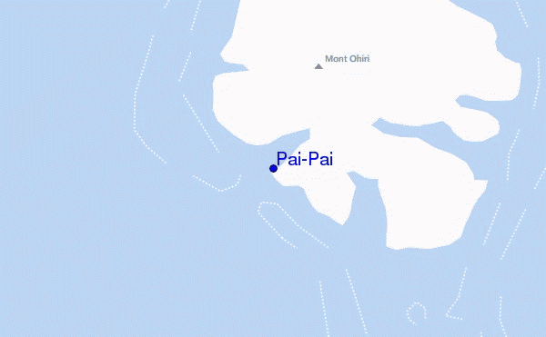
Pai-Pai surf Forecast / Raiatea / French Polynesia
- Map Icons:
 Break
Break Live Wave Height (m)
 Live Wind Speed (km/h)
 Surf Rating (10 Max)
 Ocean Swells (m)
- Wind Speed (km/h)
How big are the waves at Pai-Pai today?
The current surf forecast for Pai-Pai at 10AM is: 1.9m 16s primary swell from a Southwest direction (forecast issued at 07:00am May 12). An open ocean swell of 0.6m 9s is not directed at the surf break, a second open ocean swell of 0.6m 4s is not directed at the surf break. The wind direction is predicted to be cross-offshore and the swell rating is 3.
| Time (-10) & Date | Wave Height | Wave Period |
|---|---|---|
| Morning (12 May) | 6ft (1.9m) | 16s |
| Afternoon (12 May) | 7ft (2.1m) | 15s |
| Evening (12 May) | 7.5ft (2.3m) | 16s |
Table - waves today at Pai-Pai. (Swell directed towards the surf break)
Sunday 12 | Monday 13 | Tuesday 14 | Wednesday 15 | Thursday 16 | Friday 17 | Saturday 18 | Sunday 19 | |||||||||||||||||||||||||||||||||||||||||||||||||||||
| 5 AM | 8 AM | 11 AM | 2 PM | 5 PM | 8 PM | 11 PM | 2 AM | 5 AM | 8 AM | 11 AM | 2 PM | 5 PM | 8 PM | 11 PM | 2 AM | 5 AM | 8 AM | 11 AM | 2 PM | 5 PM | 8 PM | 11 PM | 2 AM | 5 AM | 8 AM | 11 AM | 2 PM | 5 PM | 8 PM | 11 PM | 2 AM | 5 AM | 8 AM | 11 AM | 2 PM | 5 PM | 8 PM | 11 PM | 2 AM | 5 AM | 8 AM | 11 AM | 2 PM | 5 PM | 8 PM | 11 PM | 2 AM | 5 AM | 8 AM | 11 AM | 2 PM | 5 PM | 8 PM | 11 PM | 2 AM | 5 AM | 8 AM | 11 AM | 2 PM | |
Rating (10 max) | ||||||||||||||||||||||||||||||||||||||||||||||||||||||||||||
Swell Height Map |    |    |    |  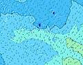 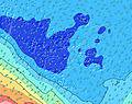 | 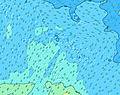 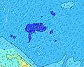 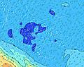 | 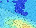 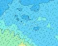 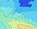 | 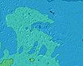 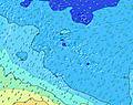 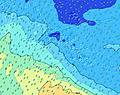 | 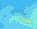  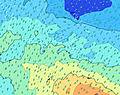 | ||||||||||||||||||||||||||||||||||||||||||||||||||||
| Wave Height (m) & direction (?) | ||||||||||||||||||||||||||||||||||||||||||||||||||||||||||||
| Period(s) (?) | 16 | 16 | 15 | 15 | 16 | 16 | 15 | 15 | 15 | 19 | 18 | 18 | 18 | 17 | 17 | 17 | 17 | 17 | 16 | 16 | 16 | 16 | 16 | 16 | 16 | 15 | 15 | 15 | 19 | 19 | 18 | 17 | 17 | 16 | 16 | 16 | 16 | 15 | 15 | 14 | 14 | 14 | 14 | 14 | 14 | 14 | 14 | 8 | 9 | 13 | 13 | 13 | 8 | 13 | 13 | 13 | 12 | 12 | 9 | 9 |
Wave (?)Graph | ||||||||||||||||||||||||||||||||||||||||||||||||||||||||||||
| Energy (?) | 1373 | 1822 | 1753 | 1788 | 2185 | 2513 | 2325 | 2328 | 2328 | 5350 | 5450 | 5158 | 5296 | 4660 | 4606 | 4177 | 4128 | 3996 | 3934 | 3685 | 3594 | 3369 | 2911 | 2911 | 2793 | 2450 | 2104 | 1822 | 1935 | 4721 | 4094 | 4001 | 3910 | 3137 | 2829 | 2829 | 2543 | 1955 | 1659 | 1321 | 1321 | 1127 | 988 | 862 | 837 | 701 | 589 | 1048 | 1107 | 468 | 396 | 307 | 411 | 242 | 189 | 183 | 175 | 131 | 382 | 373 |
Wind (km/h) | ||||||||||||||||||||||||||||||||||||||||||||||||||||||||||||
| Wind State (?) onshore cross-onshore cross-shore cross-offshore offshore glassy | cross- off | cross- off | cross- off | cross- off | cross | cross- off | cross- off | cross- off | cross- off | cross- off | cross- off | cross- off | cross- off | cross- off | cross- off | cross- off | cross- off | cross- off | cross- off | cross- off | cross- off | cross- off | cross- off | cross- off | cross- off | cross- off | cross- off | cross- off | cross- off | cross- off | cross- off | cross- off | cross- off | cross- off | cross- off | cross- off | cross- off | cross- off | cross- off | cross- off | cross- off | cross- off | cross- off | cross- off | cross- off | cross- off | cross- off | cross- off | cross- off | cross- off | cross- off | cross- off | cross- off | cross- off | off | off | cross- off | cross | cross- on | cross- on |
High Tide / height (m) | 1:30PM 0.18 | 1:28AM 0.12 | 1:44PM 0.15 | 1:09AM 0.11 | 1:45PM 0.13 | 11:52PM 0.11 | 12:55PM 0.12 | 10:01PM 0.13 | 10:51AM 0.12 | 10:07PM 0.16 | 10:30AM 0.14 | 10:27PM 0.18 | 10:37AM 0.16 | 10:47PM 0.19 | 10:51AM 0.17 | |||||||||||||||||||||||||||||||||||||||||||||
Low Tide / height (m) | 7:04AM 0.04 | 8:05PM 0.05 | 7:08AM 0.05 | 8:18PM 0.08 | 6:41AM 0.07 | 6:51PM 0.10 | 5:35AM 0.07 | 4:56PM 0.10 | 5:08AM 0.07 | 4:33PM 0.09 | 5:06AM 0.07 | 4:33PM 0.07 | 5:10AM 0.06 | 4:43PM 0.06 | 5:17AM 0.06 | |||||||||||||||||||||||||||||||||||||||||||||
Sunday 12 | Monday 13 | Tuesday 14 | Wednesday 15 | Thursday 16 | Friday 17 | Saturday 18 | Sunday 19 | |||||||||||||||||||||||||||||||||||||||||||||||||||||
| Sunrise | - | 6:20 | - | - | - | - | - | - | - | 6:20 | - | - | - | - | - | - | - | 6:22 | - | - | - | - | - | - | - | 6:22 | - | - | - | - | - | - | - | 6:22 | - | - | - | - | - | - | - | 6:22 | - | - | - | - | - | - | - | 6:22 | - | - | - | - | - | - | - | 6:22 | - | - |
| Sunset | - | - | - | - | 5:43 | - | - | - | - | - | - | - | 5:42 | - | - | - | - | - | - | - | 5:42 | - | - | - | - | - | - | - | 5:42 | - | - | - | - | - | - | - | 5:42 | - | - | - | - | - | - | - | 5:40 | - | - | - | - | - | - | - | 5:40 | - | - | - | - | - | - | - |
Rain (mm) | - | - | - | - | 1 | 1 | 1 | 2 | 4 | 1 | - | - | - | - | - | - | - | - | - | - | - | - | - | - | - | - | - | - | - | - | - | - | 1 | 1 | 1 | 1 | - | - | - | - | - | - | - | - | - | - | - | - | - | - | 1 | 2 | 1 | 2 | 2 | 2 | 1 | 1 | 2 | 2 |
| Temp. °C | 27 | 27 | 27 | 27 | 27 | 28 | 27 | 27 | 27 | 27 | 27 | 27 | 27 | 27 | 27 | 27 | 27 | 27 | 27 | 27 | 27 | 27 | 27 | 27 | 27 | 27 | 27 | 27 | 27 | 27 | 27 | 27 | 26 | 27 | 27 | 27 | 27 | 27 | 27 | 27 | 27 | 27 | 27 | 27 | 27 | 27 | 27 | 27 | 27 | 27 | 27 | 27 | 27 | 27 | 26 | 26 | 26 | 27 | 27 | 27 |
| Feels °C (?) | 28 | 28 | 27 | 27 | 27 | 28 | 27 | 27 | 27 | 26 | 25 | 25 | 25 | 24 | 25 | 24 | 24 | 24 | 24 | 24 | 25 | 25 | 25 | 26 | 25 | 25 | 25 | 26 | 26 | 26 | 26 | 26 | 24 | 25 | 26 | 25 | 25 | 23 | 24 | 24 | 24 | 23 | 23 | 23 | 23 | 23 | 23 | 23 | 23 | 23 | 25 | 25 | 26 | 26 | 25 | 27 | 27 | 28 | 26 | 27 |
FREE! Surf-Forecast.com widget for your website
The surf report / weather widget below is available to embed on third party websites free of charge and provides a summary of our Pai-Pai surf forecast. Simply grab the html code snippet that we provide and paste it into your own site. You can choose your preferred language and metric/imperial units for the surf forecast feed to suit users of your site. Click here to get the code.


 Nearest