

- Forecast
- Maps
- Live
- Weather State
- Spot Information
Ile d'Oleron - Passe du Trillou Surf Forecast
/ Charente Maritime (28 surf breaks) /
Surf Forecasts
Beach
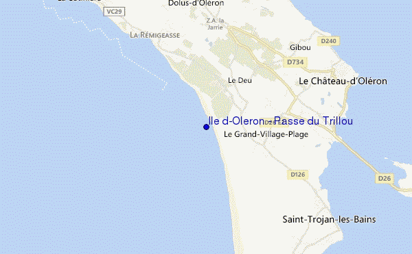
Ile d'Oleron - Passe du Trillou surf Forecast / Charente Maritime / France
48hr Weather and Surf, issued 1 pm Wednesday 01 May 2024 CEST
Forecast update in hr min s Update imminent
Ile d'Oleron - Passe du Trillou surf forecast is for near shore open water. Breaking waves will often be smaller at less exposed spots.
Today's Ile d'Oleron - Passe du Trillou sea temperature is 13.5°C (Statistics for 01 May 1981-2005 - mean: 13.7 °C max: 14.7 °C min: 11.9 °C)
- Map Icons:
 Break
Break Live Wave Height (m)
 Live Wind Speed (km/h)
 Surf Rating (10 Max)
 Ocean Swells (m)
- Wind Speed (km/h)
Ile d'Oleron - Passe du Trillou surf forecast is for near shore open water. Breaking waves will often be smaller at less exposed spots.
Today's Ile d'Oleron - Passe du Trillou sea temperature is 13.5°C (Statistics for 01 May 1981-2005 - mean: 13.7 °C max: 14.7 °C min: 11.9 °C)
How big are the waves at Ile d'Oleron - Passe du Trillou today?
The current surf forecast for Ile d'Oleron - Passe du Trillou at 6PM is: 1.7m 10s primary swell from a West direction (forecast issued at 01:00pm May 01). The wind direction is predicted to be cross-onshore.
| Time (CEST) & Date | Wave Height | Wave Period |
|---|---|---|
| Morning (01 May) | 4.5ft (1.4m) | 9s |
| Afternoon (01 May) | 5ft (1.6m) | 10s |
| Evening (01 May) | 6ft (1.8m) | 10s |
Table - waves today at Ile d'Oleron - Passe du Trillou. (Swell directed towards the surf break)
Updates in hr min s Update imminent
Wednesday 01 | Thursday 02 | Friday 03 | Saturday 04 | Sunday 05 | Monday 06 | Tuesday 07 | Wednesday 08 | |||||||||||||||||||||||||||||||||||||||||||||||||||||
| 11 AM | 2 PM | 5 PM | 8 PM | 11 PM | 2 AM | 5 AM | 8 AM | 11 AM | 2 PM | 5 PM | 8 PM | 11 PM | 2 AM | 5 AM | 8 AM | 11 AM | 2 PM | 5 PM | 8 PM | 11 PM | 2 AM | 5 AM | 8 AM | 11 AM | 2 PM | 5 PM | 8 PM | 11 PM | 2 AM | 5 AM | 8 AM | 11 AM | 2 PM | 5 PM | 8 PM | 11 PM | 2 AM | 5 AM | 8 AM | 11 AM | 2 PM | 5 PM | 8 PM | 11 PM | 2 AM | 5 AM | 8 AM | 11 AM | 2 PM | 5 PM | 8 PM | 11 PM | 2 AM | 5 AM | 8 AM | 11 AM | 2 PM | 5 PM | 8 PM | |
Rating (10 max) | ||||||||||||||||||||||||||||||||||||||||||||||||||||||||||||
Swell Height Map |    |    |    |    |   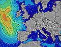 |  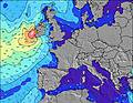 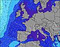 |  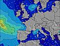  |    | ||||||||||||||||||||||||||||||||||||||||||||||||||||
| Wave Height (m) & direction (?) | ||||||||||||||||||||||||||||||||||||||||||||||||||||||||||||
| Period(s) (?) | 10 | 10 | 10 | 11 | 10 | 10 | 10 | 10 | 10 | 10 | 11 | 10 | 10 | 10 | 6 | 7 | 7 | 7 | 7 | 7 | 7 | 7 | 7 | 7 | 8 | 5 | 8 | 10 | 9 | 9 | 9 | 10 | 10 | 10 | 10 | 10 | 10 | 10 | 9 | 9 | 9 | 8 | 8 | 9 | 9 | 9 | 9 | 9 | 8 | 8 | 8 | 8 | 7 | 9 | 9 | 9 | 9 | 11 | 11 | 11 |
Wave (?)Graph | ||||||||||||||||||||||||||||||||||||||||||||||||||||||||||||
| Energy (?) | 377 | 510 | 598 | 723 | 706 | 680 | 739 | 969 | 832 | 792 | 999 | 478 | 263 | 197 | 192 | 383 | 355 | 240 | 292 | 251 | 143 | 159 | 103 | 68 | 78 | 98 | 483 | 654 | 517 | 404 | 318 | 319 | 279 | 386 | 480 | 847 | 930 | 725 | 528 | 450 | 425 | 568 | 755 | 1190 | 1185 | 916 | 753 | 525 | 392 | 289 | 173 | 169 | 79 | 190 | 103 | 81 | 79 | 73 | 111 | 111 |
Wind (km/h) | ||||||||||||||||||||||||||||||||||||||||||||||||||||||||||||
| Wind State (?) onshore cross-onshore cross-shore cross-offshore offshore glassy | cross- off | cross | cross- on | cross- on | cross- on | cross- on | cross- on | cross- on | cross- on | on | on | on | on | on | on | on | on | on | on | on | cross- on | cross | cross- off | cross- off | cross- on | on | on | on | on | cross- on | cross- on | cross- on | cross- on | cross- off | cross- on | on | cross- on | cross- on | cross- on | cross- on | on | on | on | on | cross- on | cross- on | on | cross- on | cross- on | cross- on | cross- on | cross- on | cross- on | cross- on | cross- on | cross- on | cross- on | cross- on | cross- on | cross |
High Tide / height (m) | 10:19AM 3.15 | 11:45PM 3.37 | 1:11PM 3.27 | 1:32AM 3.62 | 2:17PM 3.58 | 2:32AM 3.97 | 3:08PM 3.93 | 3:21AM 4.30 | 3:52PM 4.25 | 4:06AM 4.57 | 4:33PM 4.50 | 4:49AM 4.71 | 5:11PM 4.65 | 5:30AM 4.73 | 5:48PM 4.68 | |||||||||||||||||||||||||||||||||||||||||||||
Low Tide / height (m) | 5:11PM 1.24 | 5:55AM 1.07 | 6:23PM 1.17 | 7:07AM 0.87 | 7:33PM 0.94 | 8:13AM 0.55 | 8:35PM 0.59 | 9:09AM 0.21 | 9:30PM 0.23 | 9:59AM -0.07 | 10:19PM -0.07 | 10:45AM -0.23 | 11:06PM -0.25 | 11:29AM -0.26 | ||||||||||||||||||||||||||||||||||||||||||||||
Wednesday 01 | Thursday 02 | Friday 03 | Saturday 04 | Sunday 05 | Monday 06 | Tuesday 07 | Wednesday 08 | |||||||||||||||||||||||||||||||||||||||||||||||||||||
| Sunrise | - | - | - | - | - | - | - | 6:50 | - | - | - | - | - | - | - | 6:48 | - | - | - | - | - | - | - | 6:47 | - | - | - | - | - | - | - | 6:45 | - | - | - | - | - | - | - | 6:43 | - | - | - | - | - | - | - | 6:43 | - | - | - | - | - | - | - | 6:41 | - | - | - | - |
| Sunset | - | - | - | 9:13 | - | - | - | - | - | - | - | 9:14 | - | - | - | - | - | - | - | 9:15 | - | - | - | - | - | - | - | 9:16 | - | - | - | - | - | - | - | 9:17 | - | - | - | - | - | - | - | 9:19 | - | - | - | - | - | - | - | 9:20 | - | - | - | - | - | - | - | 9:22 |
Rain (mm) | 1 | - | - | 1 | - | - | 1 | 1 | 1 | - | - | - | - | - | 1 | 1 | 2 | 1 | - | 1 | - | 1 | 2 | 6 | 6 | 1 | - | - | - | - | - | - | 2 | - | - | - | - | - | 9 | 1 | 1 | 3 | - | 1 | - | - | - | - | - | - | - | - | - | - | - | - | - | - | - | - |
| Temp. °C | 10 | 11 | 12 | 12 | 12 | 12 | 12 | 12 | 13 | 13 | 13 | 13 | 13 | 12 | 12 | 12 | 12 | 12 | 13 | 13 | 13 | 11 | 10 | 10 | 12 | 15 | 15 | 15 | 14 | 14 | 14 | 15 | 14 | 15 | 17 | 16 | 16 | 16 | 14 | 14 | 14 | 13 | 14 | 14 | 14 | 13 | 13 | 13 | 14 | 14 | 14 | 14 | 13 | 13 | 13 | 13 | 13 | 13 | 13 | 13 |
| Feels °C (?) | 7 | 9 | 8 | 6 | 6 | 5 | 4 | 3 | 5 | 6 | 6 | 7 | 6 | 5 | 6 | 5 | 5 | 5 | 7 | 7 | 10 | 8 | 5 | 5 | 8 | 7 | 7 | 10 | 10 | 10 | 10 | 12 | 13 | 13 | 15 | 14 | 16 | 15 | 8 | 11 | 7 | 8 | 8 | 8 | 8 | 6 | 6 | 6 | 8 | 8 | 9 | 9 | 8 | 9 | 10 | 10 | 10 | 10 | 10 | 9 |
FREE! Surf-Forecast.com widget for your website
The surf report / weather widget below is available to embed on third party websites free of charge and provides a summary of our Ile d'Oleron - Passe du Trillou surf forecast. Simply grab the html code snippet that we provide and paste it into your own site. You can choose your preferred language and metric/imperial units for the surf forecast feed to suit users of your site. Click here to get the code.


 Nearest