

- Forecast
- Maps
- Live
- Weather State
- Spot Information

Surf Forecasts
Beach And Reef
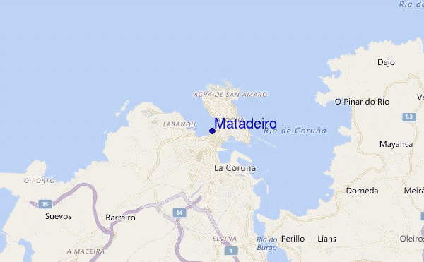
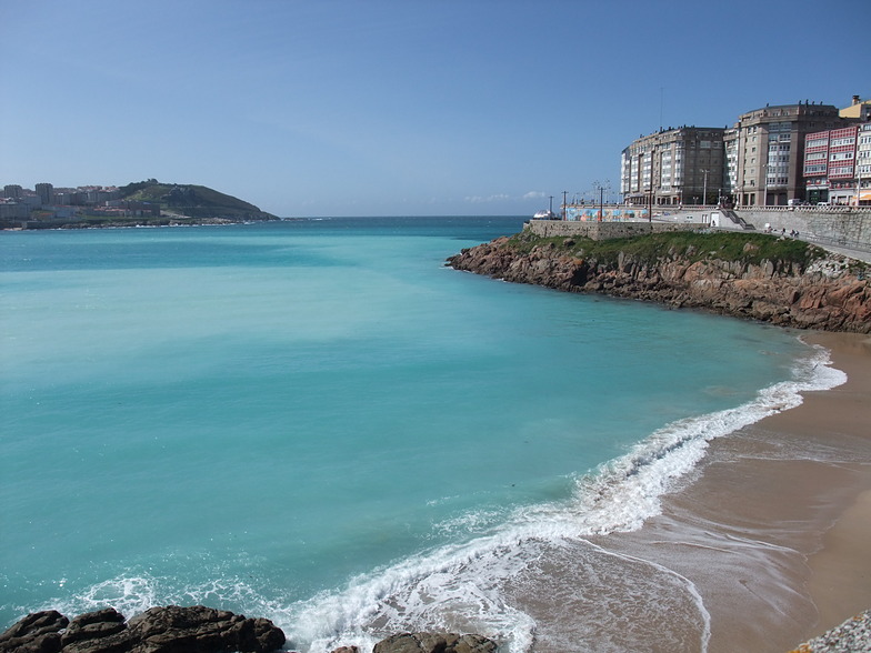
Matadeiro surf Forecast / Galicia / Spain
48hr Weather and Surf, issued 7 am Sunday 28 Apr 2024 CEST
Forecast update in hr min s Update imminent
Matadeiro surf forecast is for near shore open water. Breaking waves will often be smaller at less exposed spots.
Today's Matadeiro sea temperature is 14.2°C (Statistics for 28 Apr 1981-2005 - mean: 14.0 °C max: 15.7 °C min: 12.5 °C)
- Map Icons:
 Break
Break Live Wave Height (m)
 Live Wind Speed (km/h)
 Surf Rating (10 Max)
 Ocean Swells (m)
- Wind Speed (km/h)
Matadeiro surf forecast is for near shore open water. Breaking waves will often be smaller at less exposed spots.
Today's Matadeiro sea temperature is 14.2°C (Statistics for 28 Apr 1981-2005 - mean: 14.0 °C max: 15.7 °C min: 12.5 °C)
How big are the waves at Matadeiro today?
The current surf forecast for Matadeiro at 12PM is: 2.2m 9s primary swell from a Northwest direction and 0.1m 16s secondary swell from a West direction (forecast issued at 07:00am April 28). The wind direction is predicted to be cross-onshore and the swell rating is 2.
| Time (CEST) & Date | Wave Height | Wave Period |
|---|---|---|
| Morning (28 Apr) | 7.5ft (2.3m) | 9s |
| Afternoon (28 Apr) | 7ft (2.1m) | 9s |
| Evening (28 Apr) | 6ft (1.8m) | 9s |
Table - waves today at Matadeiro. (Swell directed towards the surf break)
 Recent Eyeball Surf Reports for Galicia
Expand
<
>
View all
Updates in hr min s Update imminent
Sunday 28 | Monday 29 | Tuesday 30 | Wednesday 01 | Thursday 02 | Friday 03 | Saturday 04 | Sunday 05 | |||||||||||||||||||||||||||||||||||||||||||||||||||||
| 5 AM | 8 AM | 11 AM | 2 PM | 5 PM | 8 PM | 11 PM | 2 AM | 5 AM | 8 AM | 11 AM | 2 PM | 5 PM | 8 PM | 11 PM | 2 AM | 5 AM | 8 AM | 11 AM | 2 PM | 5 PM | 8 PM | 11 PM | 2 AM | 5 AM | 8 AM | 11 AM | 2 PM | 5 PM | 8 PM | 11 PM | 2 AM | 5 AM | 8 AM | 11 AM | 2 PM | 5 PM | 8 PM | 11 PM | 2 AM | 5 AM | 8 AM | 11 AM | 2 PM | 5 PM | 8 PM | 11 PM | 2 AM | 5 AM | 8 AM | 11 AM | 2 PM | 5 PM | 8 PM | 11 PM | 2 AM | 5 AM | 8 AM | 11 AM | 2 PM | |
Rating (10 max) | ||||||||||||||||||||||||||||||||||||||||||||||||||||||||||||
Swell Height Map |    |    |  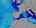 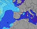 |  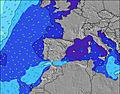 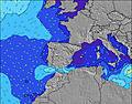 |    |    |  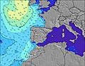 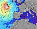 | 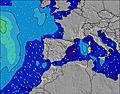 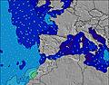 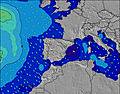 | ||||||||||||||||||||||||||||||||||||||||||||||||||||
| Wave Height (m) & direction (?) | ||||||||||||||||||||||||||||||||||||||||||||||||||||||||||||
| Period(s) (?) | 11 | 9 | 9 | 9 | 9 | 9 | 9 | 8 | 9 | 9 | 8 | 8 | 12 | 12 | 12 | 7 | 8 | 8 | 8 | 8 | 9 | 9 | 10 | 10 | 10 | 10 | 10 | 11 | 11 | 11 | 11 | 11 | 10 | 10 | 10 | 10 | 10 | 10 | 11 | 11 | 10 | 10 | 10 | 9 | 9 | 9 | 9 | 8 | 8 | 8 | 7 | 10 | 10 | 10 | 9 | 7 | 7 | 7 | 7 | 8 |
Wave (?)Graph | ||||||||||||||||||||||||||||||||||||||||||||||||||||||||||||
| Energy (?) | 1518 | 1015 | 854 | 734 | 626 | 525 | 429 | 354 | 309 | 275 | 232 | 100 | 106 | 113 | 145 | 155 | 219 | 270 | 384 | 273 | 759 | 948 | 1274 | 1578 | 1675 | 1708 | 1849 | 1862 | 1782 | 1628 | 1527 | 1498 | 1288 | 1009 | 904 | 833 | 832 | 622 | 712 | 712 | 983 | 404 | 315 | 395 | 528 | 488 | 380 | 268 | 181 | 80 | 71 | 71 | 131 | 424 | 445 | 311 | 191 | 200 | 212 | 297 |
Wind (km/h) | ||||||||||||||||||||||||||||||||||||||||||||||||||||||||||||
| Wind State (?) onshore cross-onshore cross-shore cross-offshore offshore glassy | cross- on | cross- on | cross- on | cross- on | cross- on | on | on | glass | off | off | off | cross | cross | cross- off | off | off | off | cross- off | cross | cross | cross | cross | cross- off | cross- off | cross- off | cross- off | cross- off | cross- off | cross- off | cross- off | cross- off | off | off | off | off | off | cross- off | cross- off | off | off | cross- off | cross- off | off | off | cross- off | cross- off | cross- off | glass | cross | cross | cross- off | cross- off | cross- off | cross- off | cross- off | cross- off | cross- off | cross- off | cross- off | cross |
High Tide / height (m) | 7:34AM 2.84 | 7:53PM 2.93 | 8:19AM 2.67 | 8:43PM 2.78 | 9:19AM 2.51 | 9:49PM 2.67 | 10:38AM 2.41 | 11:11PM 2.65 | 12:07PM 2.46 | 12:32AM 2.78 | 1:22PM 2.65 | 1:40AM 3.00 | 2:22PM 2.90 | 2:37AM 3.23 | ||||||||||||||||||||||||||||||||||||||||||||||
Low Tide / height (m) | 1:37PM 0.68 | 2:08AM 0.71 | 2:22PM 0.84 | 3:03AM 0.85 | 3:22PM 0.99 | 4:17AM 0.94 | 4:40PM 1.07 | 5:44AM 0.89 | 6:07PM 1.01 | 7:02AM 0.70 | 7:21PM 0.82 | 8:03AM 0.44 | 8:21PM 0.56 | 8:55AM 0.20 | ||||||||||||||||||||||||||||||||||||||||||||||
Sunday 28 | Monday 29 | Tuesday 30 | Wednesday 01 | Thursday 02 | Friday 03 | Saturday 04 | Sunday 05 | |||||||||||||||||||||||||||||||||||||||||||||||||||||
| Sunrise | - | 7:30 | - | - | - | - | - | - | - | 7:28 | - | - | - | - | - | - | - | 7:26 | - | - | - | - | - | - | - | 7:26 | - | - | - | - | - | - | - | 7:24 | - | - | - | - | - | - | - | 7:22 | - | - | - | - | - | - | - | 7:22 | - | - | - | - | - | - | - | 7:20 | - | - |
| Sunset | - | - | - | - | - | 9:31 | - | - | - | - | - | - | - | 9:32 | - | - | - | - | - | - | - | 9:34 | - | - | - | - | - | - | - | 9:35 | - | - | - | - | - | - | - | 9:37 | - | - | - | - | - | - | - | 9:37 | - | - | - | - | - | - | - | 9:38 | - | - | - | - | - | - |
Rain (mm) | 1 | - | - | - | - | - | - | - | - | - | - | - | - | - | - | 1 | 1 | 3 | 4 | 1 | 1 | - | 2 | 2 | 2 | 1 | 2 | 2 | 2 | 2 | 1 | 1 | - | - | 2 | 1 | 2 | 2 | - | 2 | 5 | 8 | 9 | 8 | 1 | 1 | 1 | 6 | 8 | 10 | 2 | 3 | 1 | - | - | - | 1 | 1 | 1 | 2 |
| Temp. °C | 9 | 9 | 11 | 13 | 13 | 12 | 10 | 8 | 7 | 6 | 11 | 13 | 15 | 14 | 12 | 11 | 12 | 12 | 12 | 12 | 12 | 12 | 10 | 9 | 8 | 8 | 10 | 11 | 11 | 11 | 9 | 8 | 7 | 8 | 10 | 12 | 13 | 13 | 12 | 11 | 11 | 11 | 13 | 14 | 15 | 15 | 13 | 13 | 13 | 11 | 12 | 12 | 15 | 14 | 12 | 11 | 10 | 10 | 13 | 14 |
| Feels °C (?) | 6 | 6 | 8 | 9 | 9 | 8 | 8 | 6 | 5 | 3 | 9 | 10 | 11 | 10 | 8 | 7 | 9 | 9 | 9 | 8 | 7 | 7 | 6 | 5 | 4 | 4 | 5 | 6 | 6 | 6 | 5 | 4 | 3 | 4 | 5 | 7 | 8 | 8 | 7 | 7 | 7 | 7 | 9 | 8 | 10 | 13 | 12 | 13 | 12 | 8 | 9 | 9 | 11 | 9 | 8 | 8 | 7 | 7 | 10 | 11 |
FREE! Surf-Forecast.com widget for your website
The surf report / weather widget below is available to embed on third party websites free of charge and provides a summary of our Matadeiro surf forecast. Simply grab the html code snippet that we provide and paste it into your own site. You can choose your preferred language and metric/imperial units for the surf forecast feed to suit users of your site. Click here to get the code.


 Nearest