

- Forecast
- Maps
- Live
- Weather State
- Spot Information
Raglan-Manu Bay Golfvoorspelling
/ Raglan and West Waikato (8 surf breaks) /
Surfen in Raglan-Manu BayVoorspelling / Raglan and West Waikato / New Zealand
Thursday 14 | Friday 15 | Saturday 16 | Sunday 17 | Monday 18 | Tuesday 19 | Wednesday 20 | Thursday 21 | Friday 22 | Saturday 23 | Sunday 24 | Mon 25 | |||||||||||||||||||||||||
| nacht | och- tend | mid- dag | nacht | och- tend | mid- dag | nacht | och- tend | mid- dag | nacht | och- tend | mid- dag | nacht | och- tend | mid- dag | nacht | och- tend | mid- dag | nacht | och- tend | mid- dag | nacht | och- tend | mid- dag | nacht | och- tend | mid- dag | nacht | och- tend | mid- dag | nacht | och- tend | mid- dag | nacht | och- tend | mid- dag | |
Waardering (10 max) | ||||||||||||||||||||||||||||||||||||
Golfhoogte kaart |  |  |  |  |  |  |  | 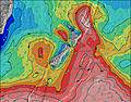 | 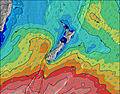 | 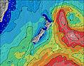 | 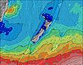 | 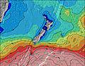 | 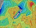 | |||||||||||||||||||||||
| Golfhoogte (m) & richting (?) | ||||||||||||||||||||||||||||||||||||
| Periode(s) (?) | 13 | 13 | 13 | 12 | 10 | 9 | 10 | 8 | 7 | 13 | 13 | 13 | 12 | 12 | 12 | 12 | 11 | 11 | 11 | 7 | 9 | 6 | 7 | 8 | 11 | 11 | 11 | 11 | 17 | 16 | 16 | 15 | 15 | 16 | 16 | 15 |
Golf (?)Grafiek | ||||||||||||||||||||||||||||||||||||
| Energie (?) | 514 | 421 | 257 | 169 | 452 | 324 | 209 | 280 | 455 | 326 | 578 | 526 | 440 | 426 | 304 | 218 | 109 | 79 | 30 | 193 | 318 | 147 | 233 | 508 | 495 | 359 | 419 | 475 | 1377 | 463 | 991 | 551 | 411 | 998 | 817 | 559 |
Wind (km/h) | ||||||||||||||||||||||||||||||||||||
| Wind (?) onshore cross-onshore cross-shore cross-offshore offshore glasachtig | cross- off | cross | cross- on | cross | cross- on | on | cross | cross | cross | off | cross- off | cross | cross | cross- off | cross- off | cross | cross- on | cross | glass | on | cross- on | cross | cross | cross | cross- off | cross- off | cross | glass | cross- off | cross | cross | cross | cross- on | cross- off | glass | cross- on |
Vloed / hoogte (m) | 9:29AM 2.87 | 9:44PM 2.98 | 10:19AM 3.03 | 10:35PM 3.05 | 11:06AM 3.13 | 11:24PM 3.05 | 11:51AM 3.15 | 12:10AM 2.98 | 12:35PM 3.10 | 12:57AM 2.87 | 1:21PM 2.98 | 1:44AM 2.71 | 2:08PM 2.82 | 2:34AM 2.55 | 2:58PM 2.65 | 3:29AM 2.40 | 3:54PM 2.50 | 4:27AM 2.29 | 4:54PM 2.39 | 5:26AM 2.23 | 5:56PM 2.33 | 6:26AM 2.21 | 6:56PM 2.33 | |||||||||||||
Eb / hoogte (m) | 3:14AM 0.13 | 3:40PM 0.15 | 4:04AM 0.01 | 4:29PM 0.05 | 4:52AM -0.04 | 5:17PM 0.03 | 5:39AM -0.01 | 6:04PM 0.09 | 6:25AM 0.09 | 6:51PM 0.22 | 7:10AM 0.24 | 7:40PM 0.38 | 7:56AM 0.42 | 8:30PM 0.55 | 8:44AM 0.60 | 9:24PM 0.70 | 9:37AM 0.76 | 10:19PM 0.79 | 10:35AM 0.86 | 11:17PM 0.84 | 11:38AM 0.90 | 12:18AM 0.82 | 12:43PM 0.88 | |||||||||||||
Thursday 14 | Friday 15 | Saturday 16 | Sunday 17 | Monday 18 | Tuesday 19 | Wednesday 20 | Thursday 21 | Friday 22 | Saturday 23 | Sunday 24 | Mon 25 | |||||||||||||||||||||||||
| Zonsopgang | - | 6:01 | - | - | 6:00 | - | - | 5:58 | - | - | 5:58 | - | - | 5:58 | - | - | 5:56 | - | - | 5:56 | - | - | 5:56 | - | - | 5:54 | - | - | 5:54 | - | - | 5:54 | - | - | 5:54 | - |
| Zonsondergang | - | - | 8:08 | - | - | 8:09 | - | - | 8:10 | - | - | 8:12 | - | - | 8:13 | - | - | 8:14 | - | - | 8:15 | - | - | 8:16 | - | - | 8:17 | - | - | 8:19 | - | - | 8:20 | - | - | 8:21 |
Regen (mm) | - | - | 1 | 10 | 33 | 4 | - | - | - | - | - | - | - | - | - | - | - | - | - | - | 2 | - | - | - | - | - | - | - | - | - | - | - | - | - | - | - |
| Temp. °C | 16 | 23 | 22 | 18 | 17 | 17 | 15 | 15 | 15 | 14 | 17 | 16 | 16 | 17 | 16 | 14 | 16 | 16 | 14 | 17 | 17 | 14 | 16 | 17 | 13 | 14 | 15 | 14 | 15 | 15 | 14 | 15 | 16 | 15 | 19 | 18 |
| Feels °C (?) | 14 | 20 | 19 | 15 | 16 | 16 | 13 | 9 | 8 | 10 | 14 | 12 | 15 | 15 | 12 | 13 | 13 | 13 | 13 | 14 | 15 | 11 | 10 | 11 | 9 | 10 | 12 | 11 | 12 | 12 | 11 | 11 | 14 | 16 | 17 | 16 |
Voorspelling Lange Termijn: Zware regen (totaal 48mm), zwaarst tijdens vrijdagochtend. Warm (max 23°C op donderdagochtend, min 14°C op zaterdagmiddag). Voornamelijk frisse wind. | Dagen 3-6 Weerssamenvatting Meestal droog. Very mild (max 17°C op zondagochtend, min 11°C op zondagavond). Wind zal licht zijn over het algemeen. | Dagen 6-9 Weerssamenvatting Lichte regen (totaal 2mm), vallende meestal op woensdagmiddag. Very mild (max 17°C op woensdagochtend, min 9°C op donderdagavond). Meer wind (kalm op dinsdagavond, frisse wind van de ZZW bij donderdagmiddag). | Voorspelling Korte Termijn: Meestal droog. Very mild (max 19°C op maandagochtend, min 11°C op vrijdagavond). Wind zal licht zijn over het algemeen. | |||||||||||||||||||||||||||||||||
- Map Icons:
 Break
Break Live Wave Height (m)
 Live Wind Speed (km/h)
 Surf Rating (10 Max)
 Ocean Swells (m)
- Wind Speed (km/h)
GRATIS Surf-Forecast.com widget voor je website
Het gratis surfbericht/weer widget hieronder is beschikbaar voor websites en geeft een samenvatting van de golfvoorspelling voor Raglan-Manu Bay. Kopieer de HTML-code en plak deze in je eigen site. Je kunt je eigen voorkeurstaal en eenheden kiezen zodat de voorspelling afgesteld is op de gebruikers van jouw site. Klik hier voor de code.
Informatie over de golfvoorspellingen voor Raglan-Manu Bay
De bovenstaande golfvoorspellingstabel voor Raglan-Manu Bay biedt essentiële informatie om te bepalen of de surfomstandigheden goed zullen zijn in de komende 12 dagen. Een algemene gids voor het surfen bij Raglan-Manu Bay kan worden gevonden door het selecteren van de lokale surfgids optie in het grijze menu. Onze Raglan-Manu Bay golfvoorspelling is uniek omdat deze de golfenergie (power) toont die het werkelijke gevoel van de branding definieert, in plaats van alleen de hoogte of de periode. Surf je regelmatig op dezelfde plek (Raglan-Manu Bay), neem notitie van de golfenergie uit de golfvoorspelling tabel iedere keer dat je gaat. Al snel kun je je eigen surfdagen kiezen op basis van de golfenergie alleen of in combinatie met onze voorspellingen voor offshore wind. Onze sterwaardering zal daarbij helpen en uiteraard vindt je ook de gebruikelijke golfhoogte en de periode in onze golfvoorspelling, evenals meer details over de golfcomponent, onder de optie ervaren gebruiker (klik op de kleine Einstein onder de getijdentabel om deze optie te zien).
Nadere informatie voor veelgestelde vragen over onze surfprognose voor Raglan-Manu Bay kan gevonden worden onder het tabblad 'Help' op de menu hierboven, maar ook door met de muis over de vraagtekens op de golfvoorspellingstabel zelf te gaan. Let steeds op dat de voorspelling geschikt is voor open water dicht bij de kust en dat lokale factoren op elke surfstrand invloed hebben op de uiteindelijke brekende golfhoogte, zoals het strand/rif profiel, waterdieptes ver van het strand en beschutting.
Raglan-Manu Bay is 42 km (26 miles) from Hamilton. If you plan a holiday in Raglan and West Waikato, look for hotels and other accommodation in Hamilton. Hamilton has rooms for a wide range of budgets as well as car hire and transport links.


 Nearest