- Forecast
- Maps
- Live
- Weather State
- Spot Information
Golfvoorspellingen:

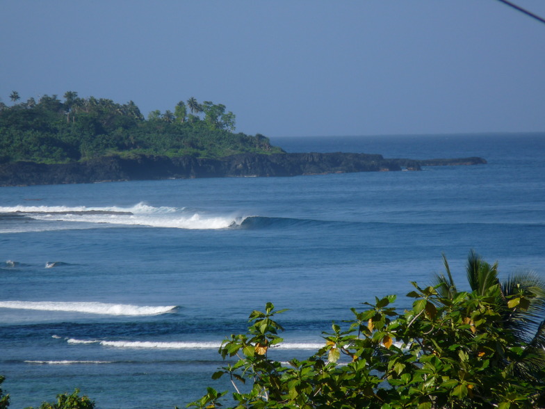
Surfen in SalailuaVoorspelling / Savaii / Samoa
Verwachting wordt bijgewerkt binnen uur min s Forecast update imminent
Salailua golfvoorspelling is voor open zee vlakbij de kust. Brekende golven zullen vaak kleiner zijn op beschuttende stranden.
De zeetemperatuur in Salailua vandaag is
28.6° C
(Wat normaal is voor deze tijd van het jaar)Wordt bijgewerkt binnen uur min s Forecast update imminent
Tuesday 04 | Wednesday 05 | Thursday 06 | Friday 07 | |||||||||||||||||||||
| 10 AM | 1 PM | 4 PM | 7 PM | 10 PM | 1 AM | 4 AM | 7 AM | 10 AM | 1 PM | 4 PM | 7 PM | 10 PM | 1 AM | 4 AM | 7 AM | 10 AM | 1 PM | 4 PM | 7 PM | 10 PM | 1 AM | 4 AM | 7 AM | |
Waardering (10 max) | ||||||||||||||||||||||||
Golfhoogte kaart |    |    |  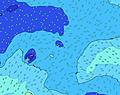 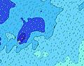 |  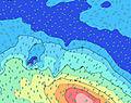 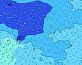 | ||||||||||||||||||||
| Golfhoogte (m) & richting (?) | ||||||||||||||||||||||||
| Periode(s) (?) | 16 | 16 | 15 | 14 | 14 | 13 | 13 | 12 | 12 | 12 | 12 | 11 | 11 | 11 | 11 | 16 | 16 | 16 | 15 | 15 | 14 | 14 | 13 | 13 |
Golf (?)Grafiek | ||||||||||||||||||||||||
| 125 | 176 | 216 | 202 | 232 | 225 | 260 | 190 | 184 | 178 | 129 | 125 | 123 | 89 | 87 | 125 | 124 | 172 | 155 | 150 | 257 | 232 | 170 | 167 | |
Wind (km/h) | ||||||||||||||||||||||||
| Wind (?) onshore cross-onshore cross-shore cross-offshore offshore glasachtig | cross- off | cross- off | cross- off | cross- off | off | off | off | off | off | off | off | off | off | glass | glass | glass | glass | cross- off | glass | off | cross- off | cross- off | cross- off | cross- off |
Vloed / hoogte (m) | 5:08PM 1.36 | 5:35AM 1.27 | 5:55PM 1.40 | 6:26AM 1.25 | 6:46PM 1.41 | |||||||||||||||||||
Eb / hoogte (m) | 10:52AM 0.05 | 11:26PM 0.00 | 11:39AM 0.03 | 12:17AM -0.04 | 12:29PM 0.04 | 1:11AM -0.04 | ||||||||||||||||||
Tuesday 04 | Wednesday 05 | Thursday 06 | Friday 07 | |||||||||||||||||||||
| Zonsopgang | - | - | - | - | - | - | - | 5:54 | - | - | - | - | - | - | - | 5:54 | - | - | - | - | - | - | - | 5:54 |
| Zonsondergang | - | - | 6:31 | - | - | - | - | - | - | - | 6:32 | - | - | - | - | - | - | - | 6:32 | - | - | - | - | - |
Regen (mm) | - | - | - | 1 | 1 | 1 | 2 | 2 | 2 | 3 | 2 | 2 | 2 | 1 | 2 | 2 | 3 | 3 | 1 | 1 | - | 1 | 1 | - |
| Temp. °C | 28 | 28 | 28 | 28 | 28 | 28 | 27 | 28 | 28 | 28 | 28 | 28 | 28 | 28 | 27 | 27 | 28 | 28 | 28 | 28 | 28 | 28 | 28 | 28 |
| Feels °C (?) | 29 | 28 | 28 | 28 | 29 | 31 | 29 | 30 | 29 | 30 | 30 | 30 | 31 | 32 | 31 | 31 | 32 | 32 | 31 | 32 | 31 | 30 | 30 | 29 |
- Map Icons:
 Break
Break Live Wave Height (m)
 Live Wind Speed (km/h)
 Surf Rating (10 Max)
 Ocean Swells (m)
- Wind Speed (km/h)
GRATIS Surf-Forecast.com widget voor je website
Het gratis surfbericht/weer widget hieronder is beschikbaar voor websites en geeft een samenvatting van de golfvoorspelling voor Salailua. Kopieer de HTML-code en plak deze in je eigen site. Je kunt je eigen voorkeurstaal en eenheden kiezen zodat de voorspelling afgesteld is op de gebruikers van jouw site. Klik hier voor de code.
 Nearest