

- Forecast
- Maps
- Live
- Weather State
- Spot Information

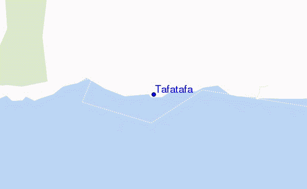
Tafatafa surf Forecast / Upolu / Samoa
- Map Icons:
 Break
Break Live Wave Height (m)
 Live Wind Speed (km/h)
 Surf Rating (10 Max)
 Ocean Swells (m)
- Wind Speed (km/h)
How big are the waves at Tafatafa today?
The current surf forecast for Tafatafa at 5AM is: 1.1m 12s primary swell from a South direction and 0.7m 15s secondary swell from a Southwest direction (forecast issued at 12:00am April 27). An open ocean swell of 0.9m 11s is not directed at the surf break. The wind direction is predicted to be cross-onshore.
| Time (+13) & Date | Wave Height | Wave Period |
|---|---|---|
| Morning (27 Apr) | 3.5ft (1.0m) | 12s |
| Afternoon (27 Apr) | 3ft (0.9m) | 12s |
| Evening (27 Apr) | 2.5ft (0.8m) | 12s |
Table - waves today at Tafatafa. (Swell directed towards the surf break)
Saturday 27 | Sunday 28 | Monday 29 | Tuesday 30 | Wednesday 01 | Thursday 02 | Friday 03 | Saturday 04 | |||||||||||||||||||||||||||||||||||||||||||||||||||||
| 10 PM | 1 AM | 4 AM | 7 AM | 10 AM | 1 PM | 4 PM | 7 PM | 10 PM | 1 AM | 4 AM | 7 AM | 10 AM | 1 PM | 4 PM | 7 PM | 10 PM | 1 AM | 4 AM | 7 AM | 10 AM | 1 PM | 4 PM | 7 PM | 10 PM | 1 AM | 4 AM | 7 AM | 10 AM | 1 PM | 4 PM | 7 PM | 10 PM | 1 AM | 4 AM | 7 AM | 10 AM | 1 PM | 4 PM | 7 PM | 10 PM | 1 AM | 4 AM | 7 AM | 10 AM | 1 PM | 4 PM | 7 PM | 10 PM | 1 AM | 4 AM | 7 AM | 10 AM | 1 PM | 4 PM | 7 PM | 10 PM | 1 AM | 4 AM | 7 AM | |
Rating (10 max) | ||||||||||||||||||||||||||||||||||||||||||||||||||||||||||||
Swell Height Map |  |    | 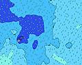 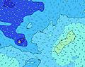 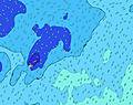 | 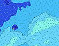 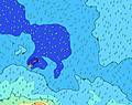  | 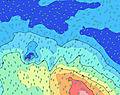 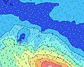 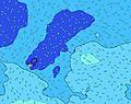 | 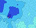 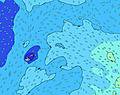 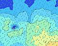 | 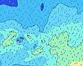 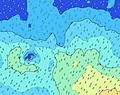 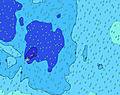 | 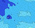 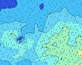 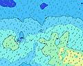 | 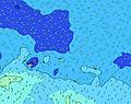 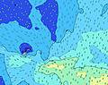 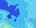 | |||||||||||||||||||||||||||||||||||||||||||||||||||
| Wave Height (m) & direction (?) | ||||||||||||||||||||||||||||||||||||||||||||||||||||||||||||
| Period(s) (?) | 13 | 13 | 13 | 12 | 12 | 12 | 12 | 12 | 12 | 18 | 18 | 16 | 16 | 16 | 16 | 16 | 16 | 15 | 15 | 15 | 14 | 14 | 14 | 14 | 14 | 14 | 15 | 15 | 15 | 15 | 15 | 15 | 15 | 14 | 14 | 14 | 14 | 14 | 14 | 14 | 14 | 14 | 14 | 13 | 13 | 13 | 13 | 13 | 13 | 14 | 14 | 14 | 15 | 14 | 13 | 13 | 13 | 12 | 12 | 12 |
Wave (?)Graph | ||||||||||||||||||||||||||||||||||||||||||||||||||||||||||||
| Energy (?) | 423 | 411 | 380 | 362 | 295 | 285 | 224 | 220 | 171 | 154 | 152 | 211 | 264 | 306 | 427 | 421 | 349 | 322 | 360 | 355 | 350 | 346 | 336 | 336 | 401 | 341 | 597 | 605 | 684 | 724 | 704 | 695 | 623 | 536 | 529 | 529 | 469 | 401 | 395 | 336 | 331 | 280 | 268 | 212 | 208 | 208 | 140 | 140 | 142 | 158 | 162 | 167 | 176 | 198 | 239 | 229 | 218 | 256 | 189 | 183 |
Wind (km/h) | ||||||||||||||||||||||||||||||||||||||||||||||||||||||||||||
| Wind State (?) onshore cross-onshore cross-shore cross-offshore offshore glassy | cross | cross | cross- on | cross- on | cross | cross | cross | cross- on | cross- on | cross- on | cross- on | cross | cross | cross | cross | cross | cross | cross | cross | cross | cross | cross- off | cross | cross | cross | cross | cross | cross | cross | cross | cross | cross | cross | cross | cross | cross- on | cross | cross | cross | cross | cross | cross | cross | cross | cross- off | cross | cross | cross- off | cross | cross- off | cross | cross | cross | cross | cross | cross | cross | cross | cross | cross- off |
High Tide / height (m) | 8:26PM 0.84 | 8:38AM 0.96 | 9:13PM 0.81 | 9:25AM 0.94 | 10:07PM 0.79 | 10:20AM 0.93 | 11:07PM 0.79 | 11:21AM 0.93 | 12:11AM 0.82 | 12:25PM 0.96 | 1:13AM 0.87 | 1:28PM 1.00 | 2:11AM 0.95 | 2:27PM 1.05 | 3:05AM 1.03 | |||||||||||||||||||||||||||||||||||||||||||||
Low Tide / height (m) | 2:17AM 0.27 | 3:03PM 0.22 | 3:01AM 0.29 | 3:54PM 0.23 | 3:53AM 0.31 | 4:50PM 0.24 | 4:53AM 0.31 | 5:52PM 0.23 | 5:59AM 0.30 | 6:54PM 0.20 | 7:07AM 0.27 | 7:53PM 0.15 | 8:11AM 0.21 | 8:48PM 0.11 | ||||||||||||||||||||||||||||||||||||||||||||||
Saturday 27 | Sunday 28 | Monday 29 | Tuesday 30 | Wednesday 01 | Thursday 02 | Friday 03 | Saturday 04 | |||||||||||||||||||||||||||||||||||||||||||||||||||||
| Sunrise | - | - | - | 6:33 | - | - | - | - | - | - | - | 6:35 | - | - | - | - | - | - | - | 6:35 | - | - | - | - | - | - | - | 6:35 | - | - | - | - | - | - | - | 6:35 | - | - | - | - | - | - | - | 6:35 | - | - | - | - | - | - | - | 6:35 | - | - | - | - | - | - | - | 6:35 |
| Sunset | - | - | - | - | - | - | 6:13 | - | - | - | - | - | - | - | 6:12 | - | - | - | - | - | - | - | 6:12 | - | - | - | - | - | - | - | 6:10 | - | - | - | - | - | - | - | 6:10 | - | - | - | - | - | - | - | 6:09 | - | - | - | - | - | - | - | 6:09 | - | - | - | - | - |
Rain (mm) | - | - | - | 1 | - | 1 | 1 | 1 | - | - | - | - | 2 | - | - | - | 1 | 1 | 1 | 1 | 1 | - | - | - | - | - | - | 1 | 1 | 1 | 1 | 1 | 2 | 1 | 1 | 1 | 1 | 1 | 1 | 1 | 2 | 2 | 1 | 3 | 3 | 1 | 2 | 4 | 3 | 1 | 3 | - | - | - | - | 1 | 3 | 2 | 2 | 3 |
| Temp. °C | 29 | 29 | 29 | 29 | 29 | 29 | 29 | 29 | 29 | 29 | 29 | 29 | 29 | 29 | 29 | 29 | 29 | 29 | 29 | 29 | 29 | 29 | 29 | 29 | 29 | 29 | 29 | 29 | 29 | 29 | 29 | 29 | 29 | 29 | 29 | 29 | 29 | 29 | 29 | 29 | 29 | 29 | 29 | 29 | 28 | 28 | 28 | 27 | 28 | 28 | 28 | 27 | 28 | 28 | 28 | 28 | 29 | 28 | 29 | 28 |
| Feels °C (?) | 30 | 30 | 31 | 30 | 30 | 30 | 30 | 29 | 29 | 30 | 29 | 29 | 30 | 29 | 30 | 29 | 29 | 30 | 31 | 31 | 30 | 31 | 31 | 31 | 31 | 31 | 31 | 31 | 30 | 30 | 31 | 31 | 30 | 30 | 30 | 30 | 29 | 30 | 30 | 29 | 29 | 29 | 29 | 29 | 28 | 29 | 28 | 29 | 30 | 30 | 29 | 26 | 27 | 27 | 28 | 29 | 30 | 29 | 30 | 28 |
FREE! Surf-Forecast.com widget for your website
The surf report / weather widget below is available to embed on third party websites free of charge and provides a summary of our Tafatafa surf forecast. Simply grab the html code snippet that we provide and paste it into your own site. You can choose your preferred language and metric/imperial units for the surf forecast feed to suit users of your site. Click here to get the code.


 Nearest