

- Forecast
- Maps
- Live
- Weather State
- Spot Information

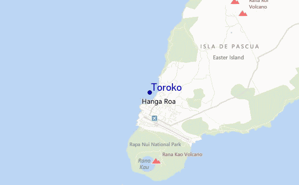
Toroko surf Forecast / Easter Island / Chile
- Map Icons:
 Break
Break Live Wave Height (m)
 Live Wind Speed (km/h)
 Surf Rating (10 Max)
 Ocean Swells (m)
- Wind Speed (km/h)
How big are the waves at Toroko today?
The current surf forecast for Toroko at 7AM is: 2.0m 17s primary swell from a Southwest direction and 0.7m 10s secondary swell from a South-southeast direction (forecast issued at 05:00am May 03). An open ocean swell of 2.3m 8s is not directed at the surf break. The wind direction is predicted to be cross-offshore and the swell rating is 2.
| Time (-06) & Date | Wave Height | Wave Period |
|---|---|---|
| Morning (03 May) | 6.5ft (2.0m) | 16s |
| Afternoon (03 May) | 6ft (1.8m) | 16s |
| Evening (03 May) | 5ft (1.6m) | 15s |
Table - waves today at Toroko. (Swell directed towards the surf break)
Friday 03 | Saturday 04 | Sunday 05 | Monday 06 | Tuesday 07 | Wednesday 08 | Thursday 09 | Friday 10 | |||||||||||||||||||||||||||||||||||||||||||||||||||||
| 3 AM | 6 AM | 9 AM | 12 PM | 3 PM | 6 PM | 9 PM | 0 AM | 3 AM | 6 AM | 9 AM | 12 PM | 3 PM | 6 PM | 9 PM | 0 AM | 3 AM | 6 AM | 9 AM | 12 PM | 3 PM | 6 PM | 9 PM | 0 AM | 3 AM | 6 AM | 9 AM | 12 PM | 3 PM | 6 PM | 9 PM | 0 AM | 3 AM | 6 AM | 9 AM | 12 PM | 3 PM | 6 PM | 9 PM | 0 AM | 3 AM | 6 AM | 9 AM | 12 PM | 3 PM | 6 PM | 9 PM | 0 AM | 3 AM | 6 AM | 9 AM | 12 PM | 3 PM | 6 PM | 9 PM | 0 AM | 3 AM | 6 AM | 9 AM | 12 PM | |
Rating (10 max) | ||||||||||||||||||||||||||||||||||||||||||||||||||||||||||||
Swell Height Map |    | 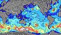 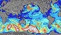 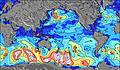 | 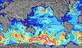 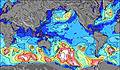 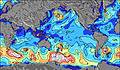 | 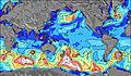 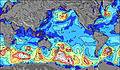 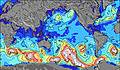 | 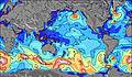 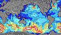 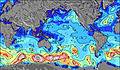 | 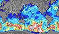 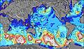 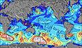 | 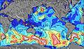 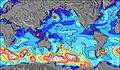 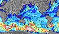 | 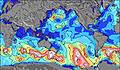 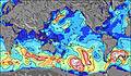 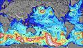 | ||||||||||||||||||||||||||||||||||||||||||||||||||||
| Wave Height (m) & direction (?) | ||||||||||||||||||||||||||||||||||||||||||||||||||||||||||||
| Period(s) (?) | 17 | 17 | 16 | 16 | 16 | 16 | 15 | 15 | 14 | 14 | 14 | 14 | 13 | 13 | 13 | 13 | 13 | 16 | 16 | 16 | 15 | 14 | 14 | 14 | 14 | 14 | 14 | 13 | 21 | 20 | 19 | 19 | 19 | 18 | 18 | 18 | 18 | 17 | 17 | 17 | 17 | 16 | 16 | 16 | 16 | 16 | 15 | 15 | 15 | 15 | 15 | 15 | 15 | 15 | 14 | 14 | 14 | 13 | 13 | 13 |
Wave (?)Graph | ||||||||||||||||||||||||||||||||||||||||||||||||||||||||||||
| Energy (?) | 2499 | 2386 | 1992 | 1675 | 1654 | 1392 | 1053 | 1011 | 825 | 813 | 632 | 579 | 451 | 437 | 380 | 315 | 228 | 226 | 284 | 551 | 509 | 482 | 425 | 352 | 347 | 342 | 323 | 219 | 222 | 400 | 546 | 730 | 1173 | 1175 | 1255 | 1241 | 1213 | 1145 | 1209 | 1366 | 1350 | 1137 | 1096 | 1210 | 1210 | 1194 | 988 | 936 | 936 | 1025 | 1154 | 1169 | 1123 | 1108 | 1077 | 1004 | 885 | 778 | 1200 | 628 |
Wind (km/h) | ||||||||||||||||||||||||||||||||||||||||||||||||||||||||||||
| Wind State (?) onshore cross-onshore cross-shore cross-offshore offshore glassy | cross- off | cross- off | cross- off | cross- off | cross- off | cross- off | cross- off | cross- off | cross- off | cross- off | cross- off | cross- off | cross- off | cross- off | cross- off | cross- off | cross- off | cross- off | cross- off | cross- off | cross- off | cross- off | cross- off | cross- off | cross- off | cross- off | cross- off | cross- off | cross- off | cross- off | cross- off | cross- off | cross- off | cross- off | cross- off | cross | cross- off | cross- off | cross- off | cross- off | cross- off | cross | cross | cross | cross | cross | cross | cross | cross- on | cross- on | cross- on | cross- on | cross- on | cross- on | cross- on | cross- on | cross- on | cross- on | cross- on | cross- on |
High Tide / height (m) | 1:32AM 0.72 | 1:54PM 0.77 | 2:23AM 0.79 | 2:47PM 0.79 | 3:12AM 0.84 | 3:37PM 0.79 | 4:00AM 0.87 | 4:27PM 0.77 | 4:47AM 0.87 | 5:17PM 0.73 | 5:36AM 0.85 | 6:07PM 0.68 | 6:25AM 0.81 | 6:59PM 0.62 | 7:16AM 0.75 | |||||||||||||||||||||||||||||||||||||||||||||
Low Tide / height (m) | 7:32AM 0.17 | 7:59PM 0.12 | 8:25AM 0.11 | 8:46PM 0.09 | 9:16AM 0.07 | 9:33PM 0.08 | 10:07AM 0.05 | 10:20PM 0.10 | 10:58AM 0.06 | 11:07PM 0.13 | 11:49AM 0.09 | 11:56PM 0.18 | 12:43PM 0.13 | 12:48AM 0.24 | ||||||||||||||||||||||||||||||||||||||||||||||
Friday 03 | Saturday 04 | Sunday 05 | Monday 06 | Tuesday 07 | Wednesday 08 | Thursday 09 | Friday 10 | |||||||||||||||||||||||||||||||||||||||||||||||||||||
| Sunrise | - | - | 7:43 | - | - | - | - | - | - | - | 7:45 | - | - | - | - | - | - | - | 7:45 | - | - | - | - | - | - | - | 7:46 | - | - | - | - | - | - | - | 7:46 | - | - | - | - | - | - | - | 7:47 | - | - | - | - | - | - | - | 7:47 | - | - | - | - | - | - | - | 7:48 | - |
| Sunset | - | - | - | - | - | 6:44 | - | - | - | - | - | - | - | 6:43 | - | - | - | - | - | - | - | 6:42 | - | - | - | - | - | - | - | 6:42 | - | - | - | - | - | - | - | 6:40 | - | - | - | - | - | - | - | 6:39 | - | - | - | - | - | - | - | 6:39 | - | - | - | - | - | - |
Rain (mm) | 1 | 1 | - | - | - | - | - | 1 | 1 | 1 | 1 | - | - | - | - | - | - | - | - | - | - | - | - | - | 1 | 1 | 2 | 2 | - | - | - | - | 2 | 5 | 8 | 6 | - | - | - | - | 1 | 1 | 2 | 2 | 2 | 1 | - | - | - | - | - | 1 | - | 1 | 1 | 3 | 3 | 3 | 3 | 6 |
| Temp. °C | 21 | 21 | 21 | 21 | 21 | 21 | 21 | 21 | 21 | 21 | 21 | 21 | 21 | 21 | 21 | 21 | 21 | 21 | 21 | 21 | 20 | 20 | 21 | 20 | 20 | 20 | 20 | 21 | 21 | 21 | 21 | 21 | 20 | 19 | 19 | 19 | 20 | 20 | 21 | 21 | 21 | 21 | 21 | 21 | 21 | 21 | 22 | 22 | 22 | 22 | 22 | 22 | 22 | 22 | 22 | 22 | 22 | 21 | 21 | 21 |
| Feels °C (?) | 16 | 15 | 15 | 16 | 16 | 17 | 16 | 17 | 17 | 16 | 16 | 16 | 17 | 17 | 17 | 17 | 17 | 17 | 17 | 17 | 16 | 16 | 17 | 15 | 16 | 16 | 16 | 16 | 17 | 17 | 17 | 18 | 17 | 16 | 16 | 15 | 16 | 17 | 17 | 18 | 19 | 19 | 19 | 19 | 18 | 19 | 20 | 20 | 20 | 21 | 21 | 20 | 20 | 21 | 20 | 19 | 19 | 18 | 18 | 17 |
FREE! Surf-Forecast.com widget for your website
The surf report / weather widget below is available to embed on third party websites free of charge and provides a summary of our Toroko surf forecast. Simply grab the html code snippet that we provide and paste it into your own site. You can choose your preferred language and metric/imperial units for the surf forecast feed to suit users of your site. Click here to get the code.


 Nearest