
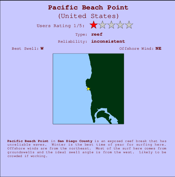
Pacific Beach Point Surf Guide
Pacific Beach Point in San Diego County is an exposed reef break that has unreliable waves. Winter is the optimum time of year for surfing here. Offshore winds are from the northeast. Most of the surf here comes from groundswells and the best swell direction is from the west. There is a right hand reef break. It's often crowded here. Take care of .
Pacific Beach Point Spot Info
| Type: | Rating: | Reliability: | Todays Sea Temp*: |
|---|---|---|---|
| inconsistent | 22.1°C*ocean temperature recorded from satellite |
Surfing Pacific Beach Point:
The best conditions reported for surf at Pacific Beach Point occur when a West swell combines with an offshore wind direction from the Northeast.

Voorspelde Golfenergie (Kracht): 12 uur


Pacific Beach Point Surf:
Wednesday, 15 July 2026, 09:08 Local time| Wednesday 15 | ||||
| 8AM | 11AM | 2PM | 5PM | |
| Wave (m) | ||||
| Periode (s) | 18 | 17 | 17 | 16 |
| Wind (km/h) | ||||
| Wind | cross- on |
cross- on |
cross- on |
on |
- /breaks/Pacific-Beach-Point/forecasts/latest
Pacific Beach Point Surf Guide
Pacific Beach Point in San Diego County is an exposed reef break that has unreliable waves. Winter is the optimum time of year for surfing here. Offshore winds are from the northeast. Most of the surf here comes from groundswells and the best swell direction is from the west. There is a right hand reef break. It's often crowded here. Take care of .
Pacific Beach Point Spot Info
Type: Rating: Reliability: Todays Sea Temp*:  Reef
Reef 1
1inconsistent 22.1°C*ocean temperature recorded from satelliteSurfing Pacific Beach Point:
The best conditions reported for surf at Pacific Beach Point occur when a West swell combines with an offshore wind direction from the Northeast.
Voorspelde Golfenergie (Kracht): 12 uur
Gebruik de tabbladen hierboven om de zeewatertemperatuur bij Pacific Beach Point te bekijken, foto's van Pacific Beach Point, Pacific Beach Point gedetailleerde golfvoorspellingen, wind- en weersvoorspellingen, Pacific Beach Point webcams, actuele wind in CAL - San Diego County live weerstations en Pacific Beach Point getijdenvoorspellingen. De link van United States golfkaarten opent een grote afbeelding van United States en de omliggende zeeën. Deze golfkaarten kunnen worden dynamisch gemaakt worden met de verschillende golfcomponenten, golfenergie, golfperiode, golfhoogte, samen met de wind en weersvoorspellingen, het actuele weer en de zeetoestand volgens golfboeien uit United States, langskomende schepen en weerstations op de kust. Elk voorspelling pagina's voor dit surfstrand zijn voorzien van een wereldwijde en regionale golfzoeker om de beste surfsomstandigheden in het gebied rond Pacific Beach Point te vinden.
Pacific Beach Point Surf:
Wednesday, 15 July 2026, 09:08 Local timeWednesday 15 8AM 11AM 2PM 5PM Wave (m) Periode (s) 18 17 17 16 Wind (km/h) Wind cross-
oncross-
oncross-
onon - /breaks/Pacific-Beach-Point/forecasts/latest
- /breaks/Pacific-Beach-Point/forecasts/latest/six_day
Pacific Beach Point Surf Guide
Pacific Beach Point in San Diego County is an exposed reef break that has unreliable waves. Winter is the optimum time of year for surfing here. Offshore winds are from the northeast. Most of the surf here comes from groundswells and the best swell direction is from the west. There is a right hand reef break. It's often crowded here. Take care of .
Pacific Beach Point Spot Info
Type: Rating: Reliability: Todays Sea Temp*: Reef1inconsistent 22.1°C*ocean temperature recorded from satelliteSurfing Pacific Beach Point:
The best conditions reported for surf at Pacific Beach Point occur when a West swell combines with an offshore wind direction from the Northeast.
Voorspelde Golfenergie (Kracht): 12 uur
Gebruik de tabbladen hierboven om de zeewatertemperatuur bij Pacific Beach Point te bekijken, foto's van Pacific Beach Point, Pacific Beach Point gedetailleerde golfvoorspellingen, wind- en weersvoorspellingen, Pacific Beach Point webcams, actuele wind in CAL - San Diego County live weerstations en Pacific Beach Point getijdenvoorspellingen. De link van United States golfkaarten opent een grote afbeelding van United States en de omliggende zeeën. Deze golfkaarten kunnen worden dynamisch gemaakt worden met de verschillende golfcomponenten, golfenergie, golfperiode, golfhoogte, samen met de wind en weersvoorspellingen, het actuele weer en de zeetoestand volgens golfboeien uit United States, langskomende schepen en weerstations op de kust. Elk voorspelling pagina's voor dit surfstrand zijn voorzien van een wereldwijde en regionale golfzoeker om de beste surfsomstandigheden in het gebied rond Pacific Beach Point te vinden.
Pacific Beach Point Surf:
Wednesday, 15 July 2026, 09:08 Local timeWednesday 15 8AM 11AM 2PM 5PM Wave (m) Periode (s) 18 17 17 16 Wind (km/h) Wind cross-
oncross-
oncross-
onon - /breaks/Pacific-Beach-Point/forecasts/latest
Pacific Beach Point Surf Guide
Pacific Beach Point in San Diego County is an exposed reef break that has unreliable waves. Winter is the optimum time of year for surfing here. Offshore winds are from the northeast. Most of the surf here comes from groundswells and the best swell direction is from the west. There is a right hand reef break. It's often crowded here. Take care of .
Pacific Beach Point Spot Info
Type: Rating: Reliability: Todays Sea Temp*: Reef1inconsistent 22.1°C*ocean temperature recorded from satelliteSurfing Pacific Beach Point:
The best conditions reported for surf at Pacific Beach Point occur when a West swell combines with an offshore wind direction from the Northeast.
Voorspelde Golfenergie (Kracht): 12 uur
Gebruik de tabbladen hierboven om de zeewatertemperatuur bij Pacific Beach Point te bekijken, foto's van Pacific Beach Point, Pacific Beach Point gedetailleerde golfvoorspellingen, wind- en weersvoorspellingen, Pacific Beach Point webcams, actuele wind in CAL - San Diego County live weerstations en Pacific Beach Point getijdenvoorspellingen. De link van United States golfkaarten opent een grote afbeelding van United States en de omliggende zeeën. Deze golfkaarten kunnen worden dynamisch gemaakt worden met de verschillende golfcomponenten, golfenergie, golfperiode, golfhoogte, samen met de wind en weersvoorspellingen, het actuele weer en de zeetoestand volgens golfboeien uit United States, langskomende schepen en weerstations op de kust. Elk voorspelling pagina's voor dit surfstrand zijn voorzien van een wereldwijde en regionale golfzoeker om de beste surfsomstandigheden in het gebied rond Pacific Beach Point te vinden.
Pacific Beach Point Surf:
Wednesday, 15 July 2026, 09:08 Local timeWednesday 15 8AM 11AM 2PM 5PM Wave (m) Periode (s) 18 17 17 16 Wind (km/h) Wind cross-
oncross-
oncross-
onon Tide Times:
Voor Crown Point, Mission Bay, California, %{dist} %{km} van %{location}.
VOLGENDE IS OM (lokale tijd) resterende tijd hoog water laag water Pacific Beach Point Tide Times and Tide Chart
Live Weather:
At La Jolla- CA, 7 km from Pacific Beach Point.
calm
(km/h)Air temperature
-°CCurrent weather near Pacific Beach Point
Buoy Data:
At SCRIPPS Nearshore, CA, 4 miles from Pacific Beach Point.
3AM 4AM 5AM 6AM Gegevens Leeftijd 4 hr 3 hr 2 hr 1 hr Golfhoogte (m) 

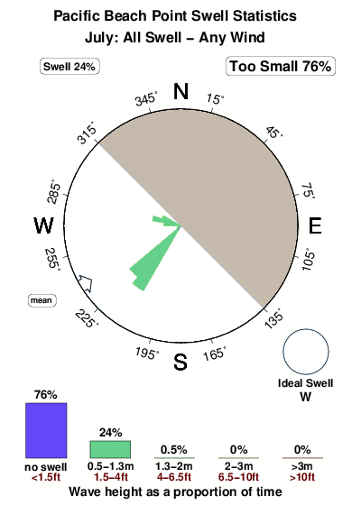
Dominante Periode (s) 5 5 5 5 Overall Pacific Beach Point Surf Consistency and Wind Distribution in July


Wind stats for Pacific Beach Point: see the variation in direction and stength by month.
surffoto's uit
de galerijContourlijnen: Wegen & Rivieren: Kies een surflokatie uit het menu 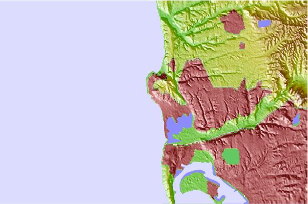
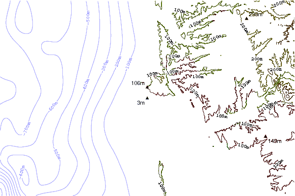
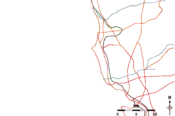
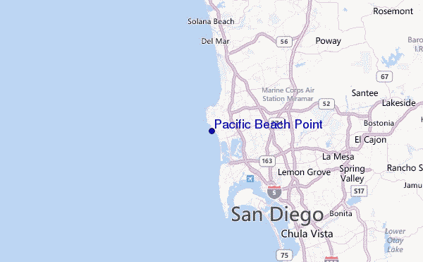
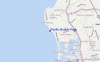
Gebruik deze reliëfkaart om naar de surfspots en de getijdenstations van CAL - San Diego County toe te gaan, in de buurt van Pacific Beach Point.
Andere Dichtbijzijnde Surflocaties van Pacific Beach Point:
(klik op locatienaam voor meer informatie)- Closest Locatie0 mi
- Second closest Locatie0 mi
- Third closest Locatie0 mi
- Fourth closest Locatie1 mi
- Fifth closest Locatie1 mi
Dichtstbijzijnde golfboeien bij Pacific Beach Point:
- Closest golfboei4 mi
- Second closest golfboei4 mi
- Third closest golfboei11 mi
- Fourth closest golfboei14 mi
- Fifth closest golfboei17 mi
Getijdenstations in de buurt van Pacific Beach Point:
- Closest getijdenstationCrown Point, Mission Bay3 mi
- Second closest getijdenstationLa Jolla, Scripps Pier4 mi
- Third closest getijdenstationQuivira Basin, Mission Bay4 mi
- Fourth closest getijdenstationSan Diego, Quarantine Station8 mi
- Fifth closest getijdenstationSan Diego9 mi
Airports
- The closest passenger airport to Pacific Beach Point is San Diego International Lindbergh Fld Airport (SAN) in USA, 11 km (7 miles) away (directly).
- The second nearest airport to Pacific Beach Point is North Island Nas (San Diego) Airport (NZY), also in USA, 13 km (8 miles) away.
- Third is Miramar Mcas Airport (NKX) in USA, 14 km (9 miles) away.
- General Abelardo L Rodriguez International (Tijuana) Airport (TIJ) in Mexico is 41 km (25 miles) away.
- John Wayne Arpt Orange Co (Santa Ana) Airport (SNA) in USA is the fifth nearest airport to Pacific Beach Point and is 111 km (69 miles) away.
- /breaks/Pacific-Beach-Point/forecasts/latest
 Nearest