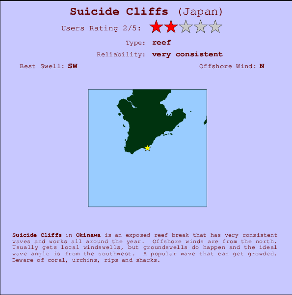
Suicide Cliffs Surf Guide
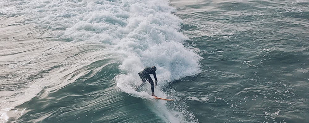
Suicide Cliffs in Okinawa is an exposed reef break that has very consistent surf and works all around the year. Offshore winds blow from the north. Most of the surf comes fis in the form of windswells and the best wave direction is from the southwest. Reef breaks provide lefts and rights. Likely to be crowded if working. Hazards include coral, urchins, rips and sharks.
Suicide Cliffs Spot Info
| Type: | Rating: | Reliability: | Todays Sea Temp*: |
|---|---|---|---|
| very consistent | 29.8°C*ocean temperature recorded from satellite |
Surfing Suicide Cliffs:
The best conditions reported for surf at Suicide Cliffs occur when a Southwest swell combines with an offshore wind direction from the North.
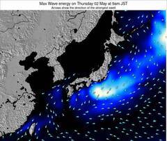
Voorspelde Golfenergie (Kracht): 12 uur


Suicide Cliffs Surf:
Tuesday, 28 July 2026, 18:37 Local time| Tue | Wed | |||
| 6PM | 9PM | 0AM | 3AM | |
| Wave (m) | ||||
| Periode (s) | 8 | 7 | 7 | 7 |
| Wind (km/h) | ||||
| Wind | cross | cross | cross | cross- on |
- /breaks/Suicide-Cliffs/forecasts/latest
Suicide Cliffs Surf Guide
Suicide Cliffs in Okinawa is an exposed reef break that has very consistent surf and works all around the year. Offshore winds blow from the north. Most of the surf comes fis in the form of windswells and the best wave direction is from the southwest. Reef breaks provide lefts and rights. Likely to be crowded if working. Hazards include coral, urchins, rips and sharks.
Suicide Cliffs Spot Info
Type: Rating: Reliability: Todays Sea Temp*:  Reef
Reef 2
2very consistent 29.8°C*ocean temperature recorded from satelliteSurfing Suicide Cliffs:
The best conditions reported for surf at Suicide Cliffs occur when a Southwest swell combines with an offshore wind direction from the North.
Voorspelde Golfenergie (Kracht): 12 uur
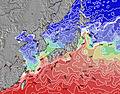
Gebruik de tabbladen hierboven om de zeewatertemperatuur bij Suicide Cliffs te bekijken, foto's van Suicide Cliffs, Suicide Cliffs gedetailleerde golfvoorspellingen, wind- en weersvoorspellingen, Suicide Cliffs webcams, actuele wind in Okinawa live weerstations en Suicide Cliffs getijdenvoorspellingen. De link van Japan golfkaarten opent een grote afbeelding van Japan en de omliggende zeeën. Deze golfkaarten kunnen worden dynamisch gemaakt worden met de verschillende golfcomponenten, golfenergie, golfperiode, golfhoogte, samen met de wind en weersvoorspellingen, het actuele weer en de zeetoestand volgens golfboeien uit Japan, langskomende schepen en weerstations op de kust. Elk voorspelling pagina's voor dit surfstrand zijn voorzien van een wereldwijde en regionale golfzoeker om de beste surfsomstandigheden in het gebied rond Suicide Cliffs te vinden.
Suicide Cliffs Surf:
Tuesday, 28 July 2026, 18:37 Local timeTue Wed 6PM 9PM 0AM 3AM Wave (m) Periode (s) 8 7 7 7 Wind (km/h) Wind cross cross cross cross-
on- /breaks/Suicide-Cliffs/forecasts/latest
- /breaks/Suicide-Cliffs/forecasts/latest/six_day
Suicide Cliffs Surf Guide
Suicide Cliffs in Okinawa is an exposed reef break that has very consistent surf and works all around the year. Offshore winds blow from the north. Most of the surf comes fis in the form of windswells and the best wave direction is from the southwest. Reef breaks provide lefts and rights. Likely to be crowded if working. Hazards include coral, urchins, rips and sharks.
Suicide Cliffs Spot Info
Type: Rating: Reliability: Todays Sea Temp*: Reef2very consistent 29.8°C*ocean temperature recorded from satelliteSurfing Suicide Cliffs:
The best conditions reported for surf at Suicide Cliffs occur when a Southwest swell combines with an offshore wind direction from the North.
Voorspelde Golfenergie (Kracht): 12 uur
Gebruik de tabbladen hierboven om de zeewatertemperatuur bij Suicide Cliffs te bekijken, foto's van Suicide Cliffs, Suicide Cliffs gedetailleerde golfvoorspellingen, wind- en weersvoorspellingen, Suicide Cliffs webcams, actuele wind in Okinawa live weerstations en Suicide Cliffs getijdenvoorspellingen. De link van Japan golfkaarten opent een grote afbeelding van Japan en de omliggende zeeën. Deze golfkaarten kunnen worden dynamisch gemaakt worden met de verschillende golfcomponenten, golfenergie, golfperiode, golfhoogte, samen met de wind en weersvoorspellingen, het actuele weer en de zeetoestand volgens golfboeien uit Japan, langskomende schepen en weerstations op de kust. Elk voorspelling pagina's voor dit surfstrand zijn voorzien van een wereldwijde en regionale golfzoeker om de beste surfsomstandigheden in het gebied rond Suicide Cliffs te vinden.
Suicide Cliffs Surf:
Tuesday, 28 July 2026, 18:37 Local timeTue Wed 6PM 9PM 0AM 3AM Wave (m) Periode (s) 8 7 7 7 Wind (km/h) Wind cross cross cross cross-
on- /breaks/Suicide-Cliffs/forecasts/latest
Suicide Cliffs Surf Guide
Suicide Cliffs in Okinawa is an exposed reef break that has very consistent surf and works all around the year. Offshore winds blow from the north. Most of the surf comes fis in the form of windswells and the best wave direction is from the southwest. Reef breaks provide lefts and rights. Likely to be crowded if working. Hazards include coral, urchins, rips and sharks.
Suicide Cliffs Spot Info
Type: Rating: Reliability: Todays Sea Temp*: Reef2very consistent 29.8°C*ocean temperature recorded from satelliteSurfing Suicide Cliffs:
The best conditions reported for surf at Suicide Cliffs occur when a Southwest swell combines with an offshore wind direction from the North.
Voorspelde Golfenergie (Kracht): 12 uur
Gebruik de tabbladen hierboven om de zeewatertemperatuur bij Suicide Cliffs te bekijken, foto's van Suicide Cliffs, Suicide Cliffs gedetailleerde golfvoorspellingen, wind- en weersvoorspellingen, Suicide Cliffs webcams, actuele wind in Okinawa live weerstations en Suicide Cliffs getijdenvoorspellingen. De link van Japan golfkaarten opent een grote afbeelding van Japan en de omliggende zeeën. Deze golfkaarten kunnen worden dynamisch gemaakt worden met de verschillende golfcomponenten, golfenergie, golfperiode, golfhoogte, samen met de wind en weersvoorspellingen, het actuele weer en de zeetoestand volgens golfboeien uit Japan, langskomende schepen en weerstations op de kust. Elk voorspelling pagina's voor dit surfstrand zijn voorzien van een wereldwijde en regionale golfzoeker om de beste surfsomstandigheden in het gebied rond Suicide Cliffs te vinden.
Suicide Cliffs Surf:
Tuesday, 28 July 2026, 18:37 Local timeTue Wed 6PM 9PM 0AM 3AM Wave (m) Periode (s) 8 7 7 7 Wind (km/h) Wind cross cross cross cross-
onTide Times:
Voor Itoman, Okinawa, Japan, %{dist} %{km} van %{location}.
VOLGENDE IS OM (lokale tijd) resterende tijd hoog water laag water Suicide Cliffs Tide Times and Tide Chart
Live Weather:
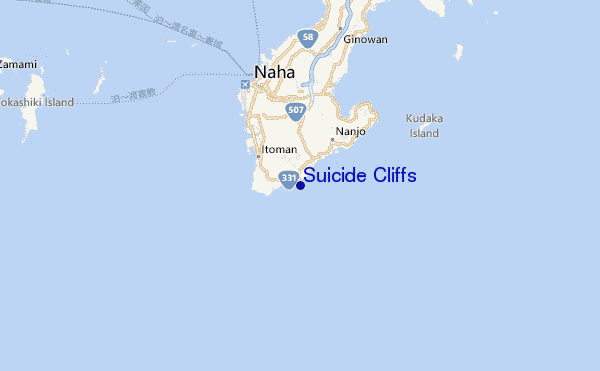
At Naha Airport, 11 km from Suicide Cliffs.
wind obs. (6 kph from 1 degs) was rejected
(km/h)Air temperature
32°COverall Suicide Cliffs Surf Consistency and Wind Distribution in July


Wind stats for Suicide Cliffs: see the variation in direction and stength by month.
surffoto's uit
de galerijContourlijnen: Wegen & Rivieren: Kies een surflokatie uit het menu 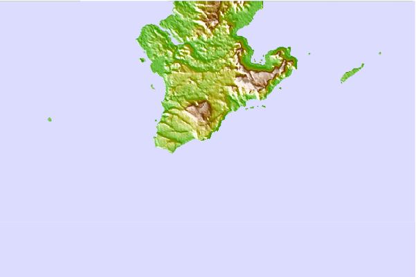
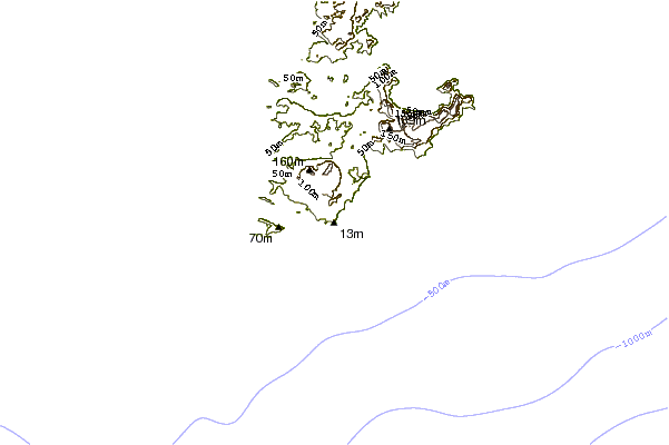
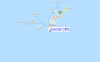
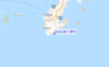
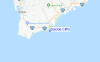
Gebruik deze reliëfkaart om naar de surfspots en de getijdenstations van Okinawa toe te gaan, in de buurt van Suicide Cliffs.
Andere Dichtbijzijnde Surflocaties van Suicide Cliffs:
(klik op locatienaam voor meer informatie)- Closest Locatie3 mi
- Second closest Locatie8 mi
- Third closest Locatie9 mi
- Fourth closest Locatie10 mi
- Fifth closest Locatie11 mi
Dichtstbijzijnde golfboeien bij Suicide Cliffs:
- Closest golfboei12 mi
- Second closest golfboei19 mi
- Third closest golfboei177 mi
- Fourth closest golfboei197 mi
- Fifth closest golfboei256 mi
Getijdenstations in de buurt van Suicide Cliffs:
- Closest getijdenstationItoman4 mi
- Second closest getijdenstationOhu5 mi
- Third closest getijdenstationBaten7 mi
- Fourth closest getijdenstationNaha Ko9 mi
- Fifth closest getijdenstationNaha9 mi
Airports
- The closest passenger airport to Suicide Cliffs is Naha Airport (OKA) in Japan, 14 km (9 miles) away (directly).
- The second nearest airport to Suicide Cliffs is Kadena Ab Airport (DNA), also in Japan, 30 km (19 miles) away.
- Third is Kumejima Airport (UEO) in Japan, 105 km (65 miles) away.
- Yoron Airport (RNJ) in Japan is 126 km (78 miles) away.
- Tokunoshima Airport (TKN), also in Japan is the fifth nearest airport to Suicide Cliffs and is 226 km (140 miles) away.
- /breaks/Suicide-Cliffs/forecasts/latest

 Nearest