
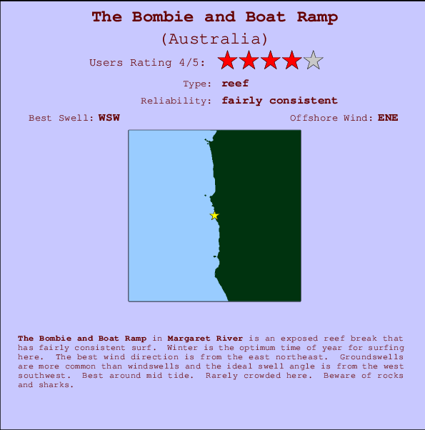
The Bombie and Boat Ramp Surf Guide
The Bombie and Boat Ramp in the Margarets River Area is an exposed reef break that has quite consistent surf. Winter is the best time of year for surfing here. Offshore winds are from the east northeast. Tends to receive distant groundswells and the ideal swell direction is from the west southwest. The left reef break is best, but there is a right reef too.. Best around mid tide. Rarely crowded here. Beware of rocks and sharks.
The Bombie and Boat Ramp Spot Info
| Type: | Rating: | Reliability: | Todays Sea Temp*: |
|---|---|---|---|
| fairly consistent | 19.1°C*ocean temperature recorded from satellite |
Surfing The Bombie and Boat Ramp:
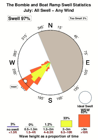
The best conditions reported for surf at The Bombie and Boat Ramp occur when a West-southwest swell combines with an offshore wind direction from the East-northeast.
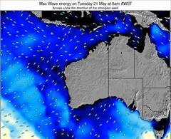
Voorspelde Golfenergie (Kracht): 12 uur

The Bombie and Boat Ramp Surf:
Sunday, 26 July 2026, 19:00 Local time| Sunday 26 | Mon | |||
| 5PM | 8PM | 11PM | 2AM | |
| Wave (m) | ||||
| Periode (s) | 14 | 14 | 13 | 13 |
| Wind (km/h) | ||||
| Wind | cross- on |
cross- on |
cross- on |
cross- on |
- /breaks/The-Bombie-and-Boat-Ramp/forecasts/latest
The Bombie and Boat Ramp Surf Guide
The Bombie and Boat Ramp in the Margarets River Area is an exposed reef break that has quite consistent surf. Winter is the best time of year for surfing here. Offshore winds are from the east northeast. Tends to receive distant groundswells and the ideal swell direction is from the west southwest. The left reef break is best, but there is a right reef too.. Best around mid tide. Rarely crowded here. Beware of rocks and sharks.
The Bombie and Boat Ramp Spot Info
Type: Rating: Reliability: Todays Sea Temp*:  Reef
Reef 4
4fairly consistent 19.1°C*ocean temperature recorded from satelliteSurfing The Bombie and Boat Ramp:
The best conditions reported for surf at The Bombie and Boat Ramp occur when a West-southwest swell combines with an offshore wind direction from the East-northeast.
Voorspelde Golfenergie (Kracht): 12 uur
Gebruik de tabbladen hierboven om de zeewatertemperatuur bij The Bombie and Boat Ramp te bekijken, foto's van The Bombie and Boat Ramp, The Bombie and Boat Ramp gedetailleerde golfvoorspellingen, wind- en weersvoorspellingen, The Bombie and Boat Ramp webcams, actuele wind in WA - Margaret River live weerstations en The Bombie and Boat Ramp getijdenvoorspellingen. De link van Australia golfkaarten opent een grote afbeelding van Australia en de omliggende zeeën. Deze golfkaarten kunnen worden dynamisch gemaakt worden met de verschillende golfcomponenten, golfenergie, golfperiode, golfhoogte, samen met de wind en weersvoorspellingen, het actuele weer en de zeetoestand volgens golfboeien uit Australia, langskomende schepen en weerstations op de kust. Elk voorspelling pagina's voor dit surfstrand zijn voorzien van een wereldwijde en regionale golfzoeker om de beste surfsomstandigheden in het gebied rond The Bombie and Boat Ramp te vinden.
The Bombie and Boat Ramp Surf:
Sunday, 26 July 2026, 19:00 Local timeSunday 26 Mon 5PM 8PM 11PM 2AM Wave (m) Periode (s) 14 14 13 13 Wind (km/h) Wind cross-
oncross-
oncross-
oncross-
on- /breaks/The-Bombie-and-Boat-Ramp/forecasts/latest
- /breaks/The-Bombie-and-Boat-Ramp/forecasts/latest/six_day
The Bombie and Boat Ramp Surf Guide
The Bombie and Boat Ramp in the Margarets River Area is an exposed reef break that has quite consistent surf. Winter is the best time of year for surfing here. Offshore winds are from the east northeast. Tends to receive distant groundswells and the ideal swell direction is from the west southwest. The left reef break is best, but there is a right reef too.. Best around mid tide. Rarely crowded here. Beware of rocks and sharks.
The Bombie and Boat Ramp Spot Info
Type: Rating: Reliability: Todays Sea Temp*: Reef4fairly consistent 19.1°C*ocean temperature recorded from satelliteSurfing The Bombie and Boat Ramp:
The best conditions reported for surf at The Bombie and Boat Ramp occur when a West-southwest swell combines with an offshore wind direction from the East-northeast.
Voorspelde Golfenergie (Kracht): 12 uur
Gebruik de tabbladen hierboven om de zeewatertemperatuur bij The Bombie and Boat Ramp te bekijken, foto's van The Bombie and Boat Ramp, The Bombie and Boat Ramp gedetailleerde golfvoorspellingen, wind- en weersvoorspellingen, The Bombie and Boat Ramp webcams, actuele wind in WA - Margaret River live weerstations en The Bombie and Boat Ramp getijdenvoorspellingen. De link van Australia golfkaarten opent een grote afbeelding van Australia en de omliggende zeeën. Deze golfkaarten kunnen worden dynamisch gemaakt worden met de verschillende golfcomponenten, golfenergie, golfperiode, golfhoogte, samen met de wind en weersvoorspellingen, het actuele weer en de zeetoestand volgens golfboeien uit Australia, langskomende schepen en weerstations op de kust. Elk voorspelling pagina's voor dit surfstrand zijn voorzien van een wereldwijde en regionale golfzoeker om de beste surfsomstandigheden in het gebied rond The Bombie and Boat Ramp te vinden.
The Bombie and Boat Ramp Surf:
Sunday, 26 July 2026, 19:00 Local timeSunday 26 Mon 5PM 8PM 11PM 2AM Wave (m) Periode (s) 14 14 13 13 Wind (km/h) Wind cross-
oncross-
oncross-
oncross-
on- /breaks/The-Bombie-and-Boat-Ramp/forecasts/latest
The Bombie and Boat Ramp Surf Guide
The Bombie and Boat Ramp in the Margarets River Area is an exposed reef break that has quite consistent surf. Winter is the best time of year for surfing here. Offshore winds are from the east northeast. Tends to receive distant groundswells and the ideal swell direction is from the west southwest. The left reef break is best, but there is a right reef too.. Best around mid tide. Rarely crowded here. Beware of rocks and sharks.
The Bombie and Boat Ramp Spot Info
Type: Rating: Reliability: Todays Sea Temp*: Reef4fairly consistent 19.1°C*ocean temperature recorded from satelliteSurfing The Bombie and Boat Ramp:
The best conditions reported for surf at The Bombie and Boat Ramp occur when a West-southwest swell combines with an offshore wind direction from the East-northeast.
Voorspelde Golfenergie (Kracht): 12 uur
Gebruik de tabbladen hierboven om de zeewatertemperatuur bij The Bombie and Boat Ramp te bekijken, foto's van The Bombie and Boat Ramp, The Bombie and Boat Ramp gedetailleerde golfvoorspellingen, wind- en weersvoorspellingen, The Bombie and Boat Ramp webcams, actuele wind in WA - Margaret River live weerstations en The Bombie and Boat Ramp getijdenvoorspellingen. De link van Australia golfkaarten opent een grote afbeelding van Australia en de omliggende zeeën. Deze golfkaarten kunnen worden dynamisch gemaakt worden met de verschillende golfcomponenten, golfenergie, golfperiode, golfhoogte, samen met de wind en weersvoorspellingen, het actuele weer en de zeetoestand volgens golfboeien uit Australia, langskomende schepen en weerstations op de kust. Elk voorspelling pagina's voor dit surfstrand zijn voorzien van een wereldwijde en regionale golfzoeker om de beste surfsomstandigheden in het gebied rond The Bombie and Boat Ramp te vinden.
The Bombie and Boat Ramp Surf:
Sunday, 26 July 2026, 19:00 Local timeSunday 26 Mon 5PM 8PM 11PM 2AM Wave (m) Periode (s) 14 14 13 13 Wind (km/h) Wind cross-
oncross-
oncross-
oncross-
onTide Times:
Voor Margaret River Bommie, %{dist} %{km} van %{location}.
VOLGENDE IS OM (lokale tijd) resterende tijd hoog water laag water The Bombie and Boat Ramp Tide Times and Tide Chart
Live Weather:
At Cape Leeuwin, 44 km from The Bombie and Boat Ramp.
wind obs. (24 kph from 30 degs) was rejected
(km/h)
no reportAir temperature
14.2°COverall The Bombie and Boat Ramp Surf Consistency and Wind Distribution in July
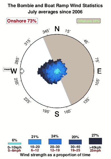


Wind stats for The Bombie and Boat Ramp: see the variation in direction and stength by month.
surffoto's uit
de galerijContourlijnen: Wegen & Rivieren: Kies een surflokatie uit het menu 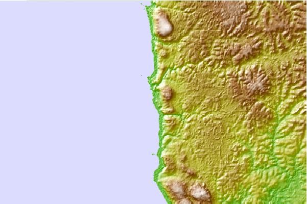
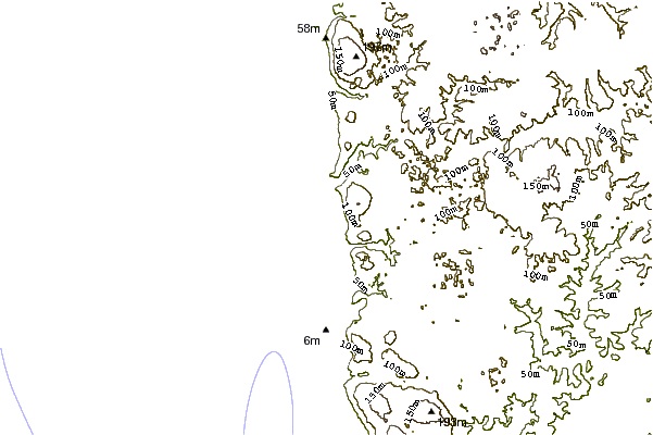
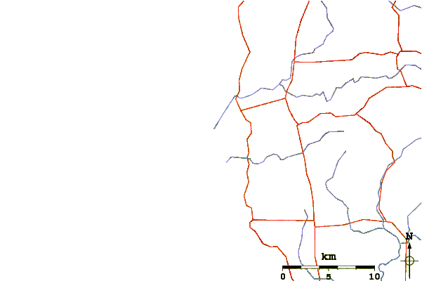
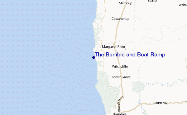
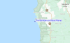
Gebruik deze reliëfkaart om naar de surfspots en de getijdenstations van WA - Margaret River toe te gaan, in de buurt van The Bombie and Boat Ramp.
Andere Dichtbijzijnde Surflocaties van The Bombie and Boat Ramp:
(klik op locatienaam voor meer informatie)- Closest Locatie0 mi
- Second closest Locatie0 mi
- Third closest Locatie1 mi
- Fourth closest Locatie1 mi
- Fifth closest Locatie1 mi
Dichtstbijzijnde golfboeien bij The Bombie and Boat Ramp:
- Closest golfboei1231 mi
- Second closest golfboei1719 mi
- Third closest golfboei1980 mi
- Fourth closest golfboei1999 mi
- Fifth closest golfboei2049 mi
Getijdenstations in de buurt van The Bombie and Boat Ramp:
- Closest getijdenstationCowaramup9 mi
- Second closest getijdenstationHamelin Bay14 mi
- Third closest getijdenstationFlinders Bay25 mi
- Fourth closest getijdenstationBusselton32 mi
- Fifth closest getijdenstationBunbury60 mi
Airports
- The nearest passenger airport to The Bombie and Boat Ramp is Perth Jandakot Airport (JAD) in Australia, which is 227 km (141 miles) away (directly).
- The second closest airport to The Bombie and Boat Ramp is Perth International Airport (PER), also in Australia, 246 km (153 miles) away.
- /breaks/The-Bombie-and-Boat-Ramp/forecasts/latest
 Nearest