
Anaehoomalu Bay_A-Bay Surf Guide
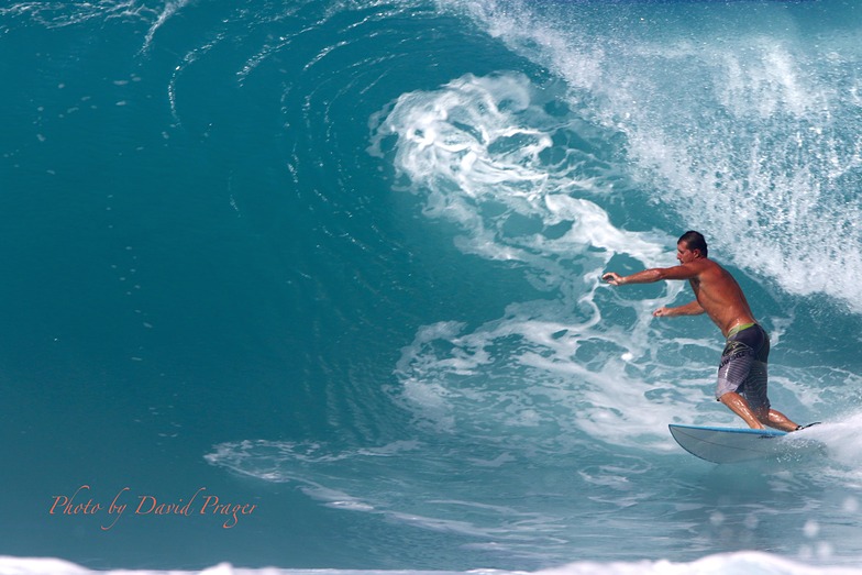
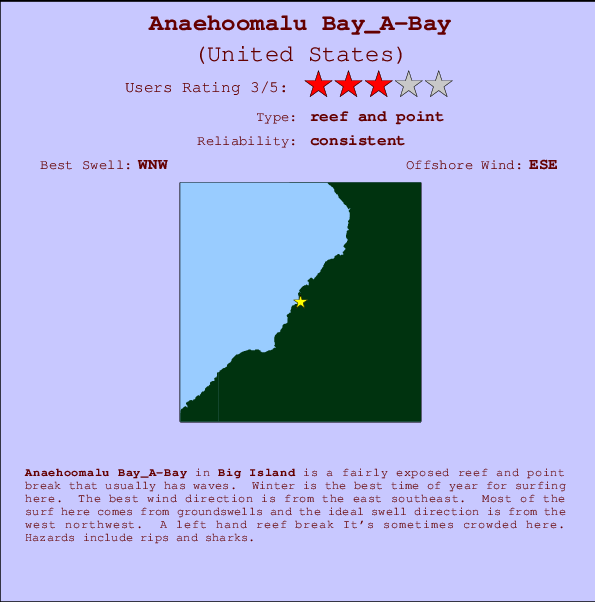
Anaehoomalu Bay_A-Bay in Big Island is a fairly exposed reef and point break that has dependable surf. Winter is the best time of year for surfing here. Offshore winds blow from the east southeast. Tends to receive distant groundswells and the best swell direction is from the northwest. There is a left breaking reef It's sometimes crowded here. Beware of rips and sharks.
Anaehoomalu Bay_A-Bay Spot Info
| Type: | Rating: | Reliability: | Todays Sea Temp*: |
|---|---|---|---|
 Reef and point Reef and point |  3 3 | consistent | 27.6°C*ocean temperature recorded from satellite |
Surfing Anaehoomalu Bay_A-Bay:
The best conditions reported for surf at Anaehoomalu Bay_A-Bay occur when a West-northwest swell combines with an offshore wind direction from the East-southeast.
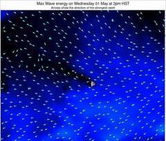
Voorspelde Golfenergie (Kracht): 12 uur
Anaehoomalu Bay_A-Bay Surf:
Wednesday, 7 October 2026, 13:54 Local time| woensdag 07 | ||||
| 11AM | 2PM | 5PM | 8PM | |
| Wave (m) | ||||
| Periode (s) | 18 | 18 | 18 | 18 |
| Wind (km/h) | ||||
| Wind | on | on | cross- on |
glass |
- /breaks/Anaehoomalu-Bay_A-Bay/forecasts/latest
Anaehoomalu Bay_A-Bay Surf Guide
Anaehoomalu Bay_A-Bay in Big Island is a fairly exposed reef and point break that has dependable surf. Winter is the best time of year for surfing here. Offshore winds blow from the east southeast. Tends to receive distant groundswells and the best swell direction is from the northwest. There is a left breaking reef It's sometimes crowded here. Beware of rips and sharks.
Anaehoomalu Bay_A-Bay Spot Info
Type: Rating: Reliability: Todays Sea Temp*: Reef and point3consistent 27.6°C*ocean temperature recorded from satelliteSurfing Anaehoomalu Bay_A-Bay:
The best conditions reported for surf at Anaehoomalu Bay_A-Bay occur when a West-northwest swell combines with an offshore wind direction from the East-southeast.
Voorspelde Golfenergie (Kracht): 12 uur
Gebruik de tabbladen hierboven om de zeewatertemperatuur bij Anaehoomalu Bay_A-Bay te bekijken, foto's van Anaehoomalu Bay_A-Bay, Anaehoomalu Bay_A-Bay gedetailleerde golfvoorspellingen, wind- en weersvoorspellingen, Anaehoomalu Bay_A-Bay webcams, actuele wind in HAW - Big Island live weerstations en Anaehoomalu Bay_A-Bay getijdenvoorspellingen. De link van United States golfkaarten opent een grote afbeelding van United States en de omliggende zeeën. Deze golfkaarten kunnen worden dynamisch gemaakt worden met de verschillende golfcomponenten, golfenergie, golfperiode, golfhoogte, samen met de wind en weersvoorspellingen, het actuele weer en de zeetoestand volgens golfboeien uit United States, langskomende schepen en weerstations op de kust. Elk voorspelling pagina's voor dit surfstrand zijn voorzien van een wereldwijde en regionale golfzoeker om de beste surfsomstandigheden in het gebied rond Anaehoomalu Bay_A-Bay te vinden.
Anaehoomalu Bay_A-Bay Surf:
Wednesday, 7 October 2026, 13:54 Local timewoensdag 07 11AM 2PM 5PM 8PM Wave (m) Periode (s) 18 18 18 18 Wind (km/h) Wind on on cross-
onglass - /breaks/Anaehoomalu-Bay_A-Bay/forecasts/latest
- /breaks/Anaehoomalu-Bay_A-Bay/forecasts/latest/six_day
Anaehoomalu Bay_A-Bay Surf Guide
Anaehoomalu Bay_A-Bay in Big Island is a fairly exposed reef and point break that has dependable surf. Winter is the best time of year for surfing here. Offshore winds blow from the east southeast. Tends to receive distant groundswells and the best swell direction is from the northwest. There is a left breaking reef It's sometimes crowded here. Beware of rips and sharks.
Anaehoomalu Bay_A-Bay Spot Info
Type: Rating: Reliability: Todays Sea Temp*: Reef and point3consistent 27.6°C*ocean temperature recorded from satelliteSurfing Anaehoomalu Bay_A-Bay:
The best conditions reported for surf at Anaehoomalu Bay_A-Bay occur when a West-northwest swell combines with an offshore wind direction from the East-southeast.
Voorspelde Golfenergie (Kracht): 12 uur
Gebruik de tabbladen hierboven om de zeewatertemperatuur bij Anaehoomalu Bay_A-Bay te bekijken, foto's van Anaehoomalu Bay_A-Bay, Anaehoomalu Bay_A-Bay gedetailleerde golfvoorspellingen, wind- en weersvoorspellingen, Anaehoomalu Bay_A-Bay webcams, actuele wind in HAW - Big Island live weerstations en Anaehoomalu Bay_A-Bay getijdenvoorspellingen. De link van United States golfkaarten opent een grote afbeelding van United States en de omliggende zeeën. Deze golfkaarten kunnen worden dynamisch gemaakt worden met de verschillende golfcomponenten, golfenergie, golfperiode, golfhoogte, samen met de wind en weersvoorspellingen, het actuele weer en de zeetoestand volgens golfboeien uit United States, langskomende schepen en weerstations op de kust. Elk voorspelling pagina's voor dit surfstrand zijn voorzien van een wereldwijde en regionale golfzoeker om de beste surfsomstandigheden in het gebied rond Anaehoomalu Bay_A-Bay te vinden.
Anaehoomalu Bay_A-Bay Surf:
Wednesday, 7 October 2026, 13:54 Local timewoensdag 07 11AM 2PM 5PM 8PM Wave (m) Periode (s) 18 18 18 18 Wind (km/h) Wind on on cross-
onglass - /breaks/Anaehoomalu-Bay_A-Bay/forecasts/latest
Anaehoomalu Bay_A-Bay Surf Guide
Anaehoomalu Bay_A-Bay in Big Island is a fairly exposed reef and point break that has dependable surf. Winter is the best time of year for surfing here. Offshore winds blow from the east southeast. Tends to receive distant groundswells and the best swell direction is from the northwest. There is a left breaking reef It's sometimes crowded here. Beware of rips and sharks.
Anaehoomalu Bay_A-Bay Spot Info
Type: Rating: Reliability: Todays Sea Temp*: Reef and point3consistent 27.6°C*ocean temperature recorded from satelliteSurfing Anaehoomalu Bay_A-Bay:
The best conditions reported for surf at Anaehoomalu Bay_A-Bay occur when a West-northwest swell combines with an offshore wind direction from the East-southeast.
Voorspelde Golfenergie (Kracht): 12 uur
Gebruik de tabbladen hierboven om de zeewatertemperatuur bij Anaehoomalu Bay_A-Bay te bekijken, foto's van Anaehoomalu Bay_A-Bay, Anaehoomalu Bay_A-Bay gedetailleerde golfvoorspellingen, wind- en weersvoorspellingen, Anaehoomalu Bay_A-Bay webcams, actuele wind in HAW - Big Island live weerstations en Anaehoomalu Bay_A-Bay getijdenvoorspellingen. De link van United States golfkaarten opent een grote afbeelding van United States en de omliggende zeeën. Deze golfkaarten kunnen worden dynamisch gemaakt worden met de verschillende golfcomponenten, golfenergie, golfperiode, golfhoogte, samen met de wind en weersvoorspellingen, het actuele weer en de zeetoestand volgens golfboeien uit United States, langskomende schepen en weerstations op de kust. Elk voorspelling pagina's voor dit surfstrand zijn voorzien van een wereldwijde en regionale golfzoeker om de beste surfsomstandigheden in het gebied rond Anaehoomalu Bay_A-Bay te vinden.
Anaehoomalu Bay_A-Bay Surf:
Wednesday, 7 October 2026, 13:54 Local timewoensdag 07 11AM 2PM 5PM 8PM Wave (m) Periode (s) 18 18 18 18 Wind (km/h) Wind on on cross-
onglass Tide Times:
Op Anaehoomalu Bay_A-Bay (0 km).
VOLGENDE IS OM (lokale tijd) resterende tijd hoog water laag water Anaehoomalu Bay_A-Bay Tide Times and Tide Chart
Live Weather:
At BUOY-KWHH1, 15 km from Anaehoomalu Bay_A-Bay.
light winds from the W
(km/h)Air temperature
-°CCurrent weather near Anaehoomalu Bay_A-Bay
Buoy Data:
At Hilo, Hawaii, HI, 61 miles from Anaehoomalu Bay_A-Bay.
9AM 10AM 11AM 12PM Gegevens Leeftijd 4 hr 3 hr 2 hr 1 hr Golfhoogte (m) 


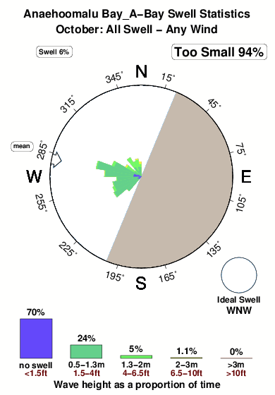
Dominante Periode (s) 15 15 15 15 Overall Anaehoomalu Bay_A-Bay Surf Consistency and Wind Distribution in oktober
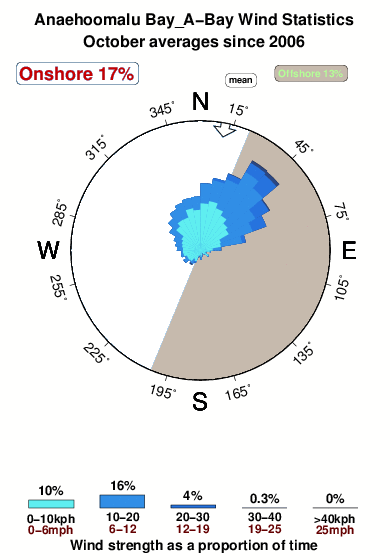


Wind stats for Anaehoomalu Bay_A-Bay: see the variation in direction and stength by month.
surffoto's uit
de galerijContourlijnen: Wegen & Rivieren: Kies een surflokatie uit het menu 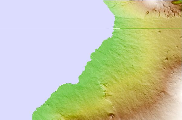
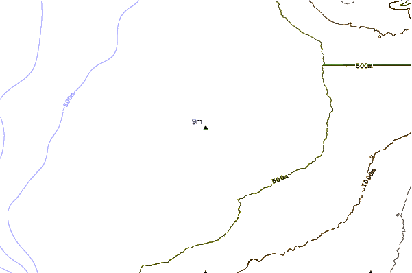
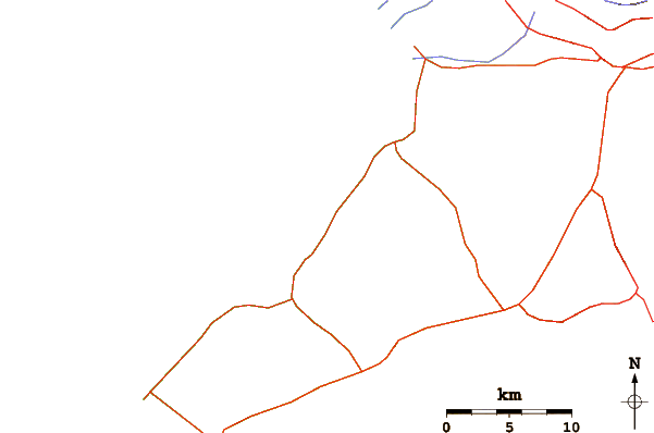
Gebruik deze reliëfkaart om naar de surfspots en de getijdenstations van HAW - Big Island toe te gaan, in de buurt van Anaehoomalu Bay_A-Bay.
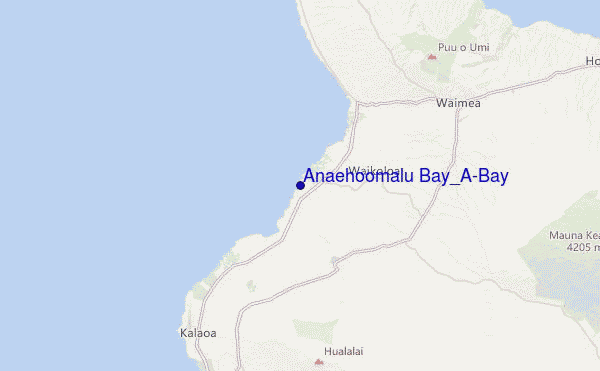
Andere Dichtbijzijnde Surflocaties van Anaehoomalu Bay_A-Bay:
(klik op locatienaam voor meer informatie)- Closest Locatie2 mi
- Second closest Locatie2 mi
- Third closest Locatie3 mi
- Fourth closest Locatie5 mi
- Fifth closest Locatie5 mi
Dichtstbijzijnde golfboeien bij Anaehoomalu Bay_A-Bay:
- Closest golfboei61 mi
- Second closest golfboei84 mi
- Third closest golfboei92 mi
- Fourth closest golfboei155 mi
- Fifth closest golfboei162 mi
Getijdenstations in de buurt van Anaehoomalu Bay_A-Bay:
- Closest getijdenstationKawaihae, Big Island9 mi
- Second closest getijdenstationMahukona Island19 mi
- Third closest getijdenstationKailua Kona, Big Island21 mi
- Fourth closest getijdenstationHolualoa21 mi
- Fifth closest getijdenstationNapoopoo, Kealakekua Bay Island31 mi
Airports
- The closest passenger airport to Anaehoomalu Bay_A-Bay is Waimea Kohala (Kamuela) Airport (MUE) in Usa Hawaii Isl., 25 km (16 miles) away (directly).
- The second nearest airport to Anaehoomalu Bay_A-Bay is Kona International At Keahole Airport (KOA), also in Usa Hawaii Isl., 26 km (16 miles) away.
- Third is Bradshaw Aaf Airport (BSF) in Usa Hawaii Isl., 39 km (24 miles) away.
- Upolu (Opolu) Airport (UPP) in USA is 39 km (24 miles) away.
- Hilo International Airport (ITO) in Usa Hawaii Isl. is the fifth nearest airport to Anaehoomalu Bay_A-Bay and is 91 km (57 miles) away.
- /breaks/Anaehoomalu-Bay_A-Bay/forecasts/latest
 Nearest