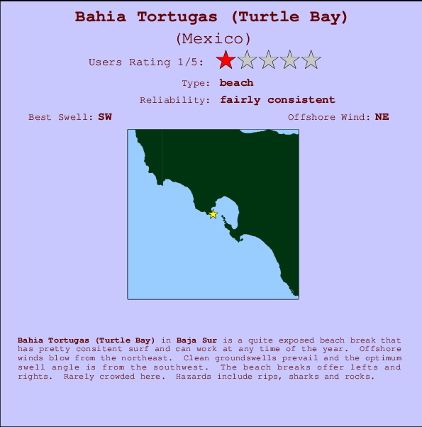
Bahia Tortugas (Turtle Bay) Surf Guide
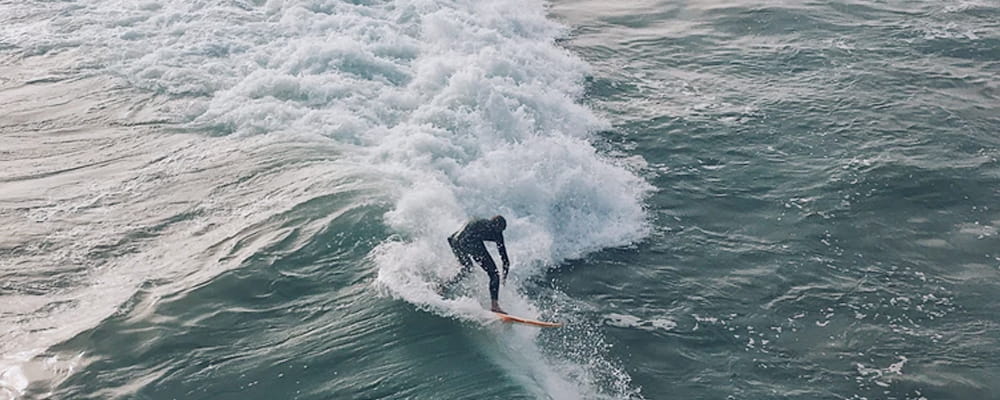
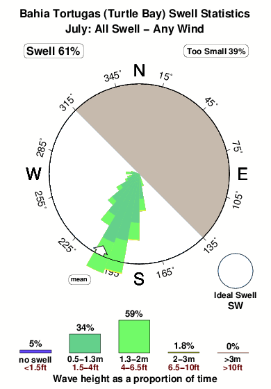
Bahia Tortugas (Turtle Bay) in Baja Sur is a reasonably exposed beach break that has reasonably consistent surf and can work at any time of the year. Offshore winds blow from the northeast. Groundswells more frequent than windswells and the best swell direction is from the southwest. The beach break offers both left and right hand waves. Rarely crowded here. Beware of rips, sharks and rocks.
Bahia Tortugas (Turtle Bay) Spot Info
| Type: | Rating: | Reliability: | Todays Sea Temp*: |
|---|---|---|---|
| fairly consistent | 19.1°C*ocean temperature recorded from satellite |
Surfing Bahia Tortugas (Turtle Bay):
The best conditions reported for surf at Bahia Tortugas (Turtle Bay) occur when a Southwest swell combines with an offshore wind direction from the Northeast.
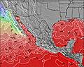
Voorspelde Golfenergie (Kracht): 12 uur


Bahia Tortugas (Turtle Bay) Surf:
Thursday, 16 July 2026, 03:16 Local time| Thursday 16 | ||||
| 2AM | 5AM | 8AM | 11AM | |
| Wave (m) | ||||
| Periode (s) | 16 | 16 | 16 | 16 |
| Wind (km/h) | ||||
| Wind | cross- off |
glass | cross- off |
cross- off |
- /breaks/Bahia-Tortugas/forecasts/latest
Bahia Tortugas (Turtle Bay) Surf Guide
Bahia Tortugas (Turtle Bay) in Baja Sur is a reasonably exposed beach break that has reasonably consistent surf and can work at any time of the year. Offshore winds blow from the northeast. Groundswells more frequent than windswells and the best swell direction is from the southwest. The beach break offers both left and right hand waves. Rarely crowded here. Beware of rips, sharks and rocks.
Bahia Tortugas (Turtle Bay) Spot Info
Type: Rating: Reliability: Todays Sea Temp*:  Beach
Beach 1
1fairly consistent 19.1°C*ocean temperature recorded from satelliteSurfing Bahia Tortugas (Turtle Bay):
The best conditions reported for surf at Bahia Tortugas (Turtle Bay) occur when a Southwest swell combines with an offshore wind direction from the Northeast.
Voorspelde Golfenergie (Kracht): 12 uur
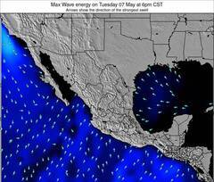
Gebruik de tabbladen hierboven om de zeewatertemperatuur bij Bahia Tortugas (Turtle Bay) te bekijken, foto's van Bahia Tortugas (Turtle Bay), Bahia Tortugas (Turtle Bay) gedetailleerde golfvoorspellingen, wind- en weersvoorspellingen, Bahia Tortugas (Turtle Bay) webcams, actuele wind in Baja Sur live weerstations en Bahia Tortugas (Turtle Bay) getijdenvoorspellingen. De link van Mexico golfkaarten opent een grote afbeelding van Mexico en de omliggende zeeën. Deze golfkaarten kunnen worden dynamisch gemaakt worden met de verschillende golfcomponenten, golfenergie, golfperiode, golfhoogte, samen met de wind en weersvoorspellingen, het actuele weer en de zeetoestand volgens golfboeien uit Mexico, langskomende schepen en weerstations op de kust. Elk voorspelling pagina's voor dit surfstrand zijn voorzien van een wereldwijde en regionale golfzoeker om de beste surfsomstandigheden in het gebied rond Bahia Tortugas (Turtle Bay) te vinden.
Bahia Tortugas (Turtle Bay) Surf:
Thursday, 16 July 2026, 03:16 Local timeThursday 16 2AM 5AM 8AM 11AM Wave (m) Periode (s) 16 16 16 16 Wind (km/h) Wind cross-
offglass cross-
offcross-
off- /breaks/Bahia-Tortugas/forecasts/latest
- /breaks/Bahia-Tortugas/forecasts/latest/six_day
Bahia Tortugas (Turtle Bay) Surf Guide
Bahia Tortugas (Turtle Bay) in Baja Sur is a reasonably exposed beach break that has reasonably consistent surf and can work at any time of the year. Offshore winds blow from the northeast. Groundswells more frequent than windswells and the best swell direction is from the southwest. The beach break offers both left and right hand waves. Rarely crowded here. Beware of rips, sharks and rocks.
Bahia Tortugas (Turtle Bay) Spot Info
Type: Rating: Reliability: Todays Sea Temp*: Beach1fairly consistent 19.1°C*ocean temperature recorded from satelliteSurfing Bahia Tortugas (Turtle Bay):
The best conditions reported for surf at Bahia Tortugas (Turtle Bay) occur when a Southwest swell combines with an offshore wind direction from the Northeast.
Voorspelde Golfenergie (Kracht): 12 uur
Gebruik de tabbladen hierboven om de zeewatertemperatuur bij Bahia Tortugas (Turtle Bay) te bekijken, foto's van Bahia Tortugas (Turtle Bay), Bahia Tortugas (Turtle Bay) gedetailleerde golfvoorspellingen, wind- en weersvoorspellingen, Bahia Tortugas (Turtle Bay) webcams, actuele wind in Baja Sur live weerstations en Bahia Tortugas (Turtle Bay) getijdenvoorspellingen. De link van Mexico golfkaarten opent een grote afbeelding van Mexico en de omliggende zeeën. Deze golfkaarten kunnen worden dynamisch gemaakt worden met de verschillende golfcomponenten, golfenergie, golfperiode, golfhoogte, samen met de wind en weersvoorspellingen, het actuele weer en de zeetoestand volgens golfboeien uit Mexico, langskomende schepen en weerstations op de kust. Elk voorspelling pagina's voor dit surfstrand zijn voorzien van een wereldwijde en regionale golfzoeker om de beste surfsomstandigheden in het gebied rond Bahia Tortugas (Turtle Bay) te vinden.
Bahia Tortugas (Turtle Bay) Surf:
Thursday, 16 July 2026, 03:16 Local timeThursday 16 2AM 5AM 8AM 11AM Wave (m) Periode (s) 16 16 16 16 Wind (km/h) Wind cross-
offglass cross-
offcross-
off- /breaks/Bahia-Tortugas/forecasts/latest
Bahia Tortugas (Turtle Bay) Surf Guide
Bahia Tortugas (Turtle Bay) in Baja Sur is a reasonably exposed beach break that has reasonably consistent surf and can work at any time of the year. Offshore winds blow from the northeast. Groundswells more frequent than windswells and the best swell direction is from the southwest. The beach break offers both left and right hand waves. Rarely crowded here. Beware of rips, sharks and rocks.
Bahia Tortugas (Turtle Bay) Spot Info
Type: Rating: Reliability: Todays Sea Temp*: Beach1fairly consistent 19.1°C*ocean temperature recorded from satelliteSurfing Bahia Tortugas (Turtle Bay):
The best conditions reported for surf at Bahia Tortugas (Turtle Bay) occur when a Southwest swell combines with an offshore wind direction from the Northeast.
Voorspelde Golfenergie (Kracht): 12 uur
Gebruik de tabbladen hierboven om de zeewatertemperatuur bij Bahia Tortugas (Turtle Bay) te bekijken, foto's van Bahia Tortugas (Turtle Bay), Bahia Tortugas (Turtle Bay) gedetailleerde golfvoorspellingen, wind- en weersvoorspellingen, Bahia Tortugas (Turtle Bay) webcams, actuele wind in Baja Sur live weerstations en Bahia Tortugas (Turtle Bay) getijdenvoorspellingen. De link van Mexico golfkaarten opent een grote afbeelding van Mexico en de omliggende zeeën. Deze golfkaarten kunnen worden dynamisch gemaakt worden met de verschillende golfcomponenten, golfenergie, golfperiode, golfhoogte, samen met de wind en weersvoorspellingen, het actuele weer en de zeetoestand volgens golfboeien uit Mexico, langskomende schepen en weerstations op de kust. Elk voorspelling pagina's voor dit surfstrand zijn voorzien van een wereldwijde en regionale golfzoeker om de beste surfsomstandigheden in het gebied rond Bahia Tortugas (Turtle Bay) te vinden.
Bahia Tortugas (Turtle Bay) Surf:
Thursday, 16 July 2026, 03:16 Local timeThursday 16 2AM 5AM 8AM 11AM Wave (m) Periode (s) 16 16 16 16 Wind (km/h) Wind cross-
offglass cross-
offcross-
offTide Times:
Op Bahia Tortugas (Turtle Bay) (0 km).
VOLGENDE IS OM (lokale tijd) resterende tijd hoog water laag water Bahia Tortugas (Turtle Bay) Tide Times and Tide Chart
Live Weather:
At SHIP4964, 75 km from Bahia Tortugas (Turtle Bay).
- Air temperature
-°COverall Bahia Tortugas (Turtle Bay) Surf Consistency and Wind Distribution in July
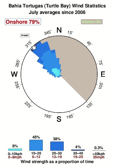


Wind stats for Bahia Tortugas (Turtle Bay): see the variation in direction and stength by month.
surffoto's uit
de galerijContourlijnen: Wegen & Rivieren: Kies een surflokatie uit het menu 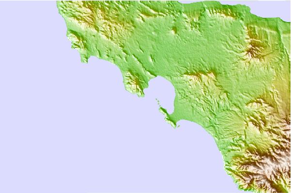
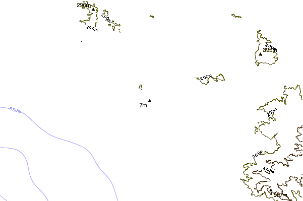
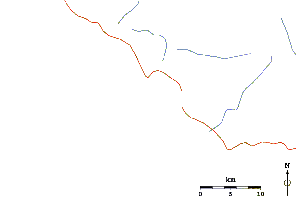
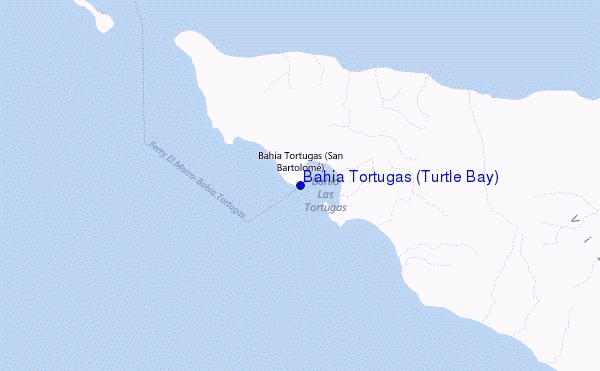
Gebruik deze reliëfkaart om naar de surfspots en de getijdenstations van Baja Sur toe te gaan, in de buurt van Bahia Tortugas (Turtle Bay).
Andere Dichtbijzijnde Surflocaties van Bahia Tortugas (Turtle Bay):
(klik op locatienaam voor meer informatie)- Closest Locatie21 mi
- Second closest Locatie42 mi
- Third closest Locatie53 mi
- Fourth closest Locatie72 mi
- Fifth closest Locatie76 mi
Dichtstbijzijnde golfboeien bij Bahia Tortugas (Turtle Bay):
- Closest golfboei365 mi
- Second closest golfboei369 mi
- Third closest golfboei382 mi
- Fourth closest golfboei384 mi
- Fifth closest golfboei387 mi
Getijdenstations in de buurt van Bahia Tortugas (Turtle Bay):
- Closest getijdenstationBahia de Ballenas105 mi
- Second closest getijdenstationBahia de los Angeles121 mi
- Third closest getijdenstationSanta Rosalia164 mi
- Fourth closest getijdenstationBahia San Juanico179 mi
- Fifth closest getijdenstationPuertecitos186 mi
Airports
- The nearest passenger airport to Bahia Tortugas (Turtle Bay) is General Jose Maria Yanez International (Guaymas) Airport (GYM) in Mexico, which is 392 km (243 miles) away (directly).
- The second closest airport to Bahia Tortugas (Turtle Bay) is Loreto International Airport (LTO), also in Mexico, 399 km (248 miles) away.
- /breaks/Bahia-Tortugas/forecasts/latest
 Nearest