
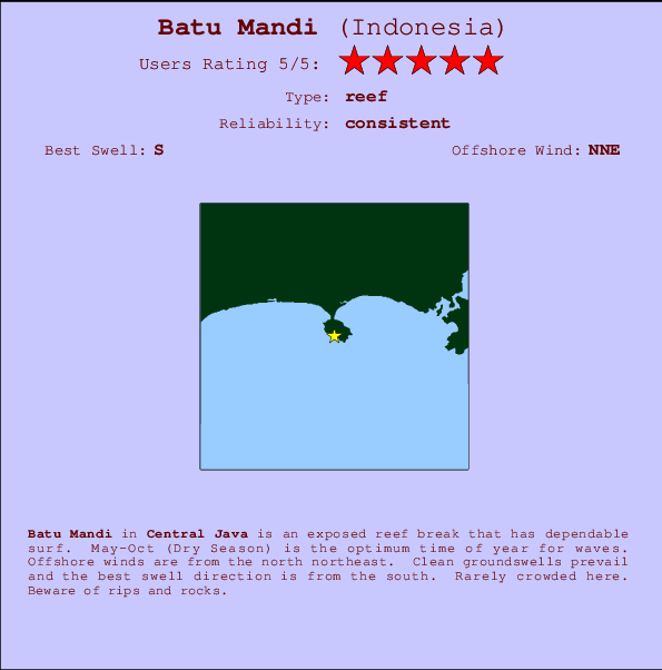
Batu Mandi Surf Guide
Batu Mandi in Central Java is an exposed reef break that has reliable surf. May-Oct (Dry Season) is the best time of year for waves. Works best in offshore winds from the north northeast. Most of the surf here comes from groundswells and the best swell direction is from the south. A reef breaks left. Unlikely to be too crowded, even when the surf is up. Hazards include rips and rocks.
Batu Mandi Spot Info
| Type: | Rating: | Reliability: | Todays Sea Temp*: |
|---|---|---|---|
| consistent | 26.9°C*ocean temperature recorded from satellite |
Surfing Batu Mandi:
The best conditions reported for surf at Batu Mandi occur when a South swell combines with an offshore wind direction from the North-northeast.

Voorspelde Golfenergie (Kracht): 12 uur


Batu Mandi Surf:
Thursday, 16 July 2026, 21:03 Local time| Thu | Friday 17 | |||
| 10PM | 1AM | 4AM | 7AM | |
| Wave (m) | ||||
| Periode (s) | 14 | 14 | 16 | 16 |
| Wind (km/h) | ||||
| Wind | cross | cross- off |
cross | cross |
- /breaks/Batu-Mandi/forecasts/latest
Batu Mandi Surf Guide
Batu Mandi in Central Java is an exposed reef break that has reliable surf. May-Oct (Dry Season) is the best time of year for waves. Works best in offshore winds from the north northeast. Most of the surf here comes from groundswells and the best swell direction is from the south. A reef breaks left. Unlikely to be too crowded, even when the surf is up. Hazards include rips and rocks.
Batu Mandi Spot Info
Type: Rating: Reliability: Todays Sea Temp*:  Reef
Reef 5
5consistent 26.9°C*ocean temperature recorded from satelliteSurfing Batu Mandi:
The best conditions reported for surf at Batu Mandi occur when a South swell combines with an offshore wind direction from the North-northeast.
Voorspelde Golfenergie (Kracht): 12 uur
Gebruik de tabbladen hierboven om de zeewatertemperatuur bij Batu Mandi te bekijken, foto's van Batu Mandi, Batu Mandi gedetailleerde golfvoorspellingen, wind- en weersvoorspellingen, Batu Mandi webcams, actuele wind in Java - Central live weerstations en Batu Mandi getijdenvoorspellingen. De link van Indonesia golfkaarten opent een grote afbeelding van Indonesia en de omliggende zeeën. Deze golfkaarten kunnen worden dynamisch gemaakt worden met de verschillende golfcomponenten, golfenergie, golfperiode, golfhoogte, samen met de wind en weersvoorspellingen, het actuele weer en de zeetoestand volgens golfboeien uit Indonesia, langskomende schepen en weerstations op de kust. Elk voorspelling pagina's voor dit surfstrand zijn voorzien van een wereldwijde en regionale golfzoeker om de beste surfsomstandigheden in het gebied rond Batu Mandi te vinden.
Batu Mandi Surf:
Thursday, 16 July 2026, 21:03 Local timeThu Friday 17 10PM 1AM 4AM 7AM Wave (m) Periode (s) 14 14 16 16 Wind (km/h) Wind cross cross-
offcross cross - /breaks/Batu-Mandi/forecasts/latest
- /breaks/Batu-Mandi/forecasts/latest/six_day
Batu Mandi Surf Guide
Batu Mandi in Central Java is an exposed reef break that has reliable surf. May-Oct (Dry Season) is the best time of year for waves. Works best in offshore winds from the north northeast. Most of the surf here comes from groundswells and the best swell direction is from the south. A reef breaks left. Unlikely to be too crowded, even when the surf is up. Hazards include rips and rocks.
Batu Mandi Spot Info
Type: Rating: Reliability: Todays Sea Temp*: Reef5consistent 26.9°C*ocean temperature recorded from satelliteSurfing Batu Mandi:
The best conditions reported for surf at Batu Mandi occur when a South swell combines with an offshore wind direction from the North-northeast.
Voorspelde Golfenergie (Kracht): 12 uur
Gebruik de tabbladen hierboven om de zeewatertemperatuur bij Batu Mandi te bekijken, foto's van Batu Mandi, Batu Mandi gedetailleerde golfvoorspellingen, wind- en weersvoorspellingen, Batu Mandi webcams, actuele wind in Java - Central live weerstations en Batu Mandi getijdenvoorspellingen. De link van Indonesia golfkaarten opent een grote afbeelding van Indonesia en de omliggende zeeën. Deze golfkaarten kunnen worden dynamisch gemaakt worden met de verschillende golfcomponenten, golfenergie, golfperiode, golfhoogte, samen met de wind en weersvoorspellingen, het actuele weer en de zeetoestand volgens golfboeien uit Indonesia, langskomende schepen en weerstations op de kust. Elk voorspelling pagina's voor dit surfstrand zijn voorzien van een wereldwijde en regionale golfzoeker om de beste surfsomstandigheden in het gebied rond Batu Mandi te vinden.
Batu Mandi Surf:
Thursday, 16 July 2026, 21:03 Local timeThu Friday 17 10PM 1AM 4AM 7AM Wave (m) Periode (s) 14 14 16 16 Wind (km/h) Wind cross cross-
offcross cross - /breaks/Batu-Mandi/forecasts/latest
Batu Mandi Surf Guide
Batu Mandi in Central Java is an exposed reef break that has reliable surf. May-Oct (Dry Season) is the best time of year for waves. Works best in offshore winds from the north northeast. Most of the surf here comes from groundswells and the best swell direction is from the south. A reef breaks left. Unlikely to be too crowded, even when the surf is up. Hazards include rips and rocks.
Batu Mandi Spot Info
Type: Rating: Reliability: Todays Sea Temp*: Reef5consistent 26.9°C*ocean temperature recorded from satelliteSurfing Batu Mandi:
The best conditions reported for surf at Batu Mandi occur when a South swell combines with an offshore wind direction from the North-northeast.
Voorspelde Golfenergie (Kracht): 12 uur
Gebruik de tabbladen hierboven om de zeewatertemperatuur bij Batu Mandi te bekijken, foto's van Batu Mandi, Batu Mandi gedetailleerde golfvoorspellingen, wind- en weersvoorspellingen, Batu Mandi webcams, actuele wind in Java - Central live weerstations en Batu Mandi getijdenvoorspellingen. De link van Indonesia golfkaarten opent een grote afbeelding van Indonesia en de omliggende zeeën. Deze golfkaarten kunnen worden dynamisch gemaakt worden met de verschillende golfcomponenten, golfenergie, golfperiode, golfhoogte, samen met de wind en weersvoorspellingen, het actuele weer en de zeetoestand volgens golfboeien uit Indonesia, langskomende schepen en weerstations op de kust. Elk voorspelling pagina's voor dit surfstrand zijn voorzien van een wereldwijde en regionale golfzoeker om de beste surfsomstandigheden in het gebied rond Batu Mandi te vinden.
Batu Mandi Surf:
Thursday, 16 July 2026, 21:03 Local timeThu Friday 17 10PM 1AM 4AM 7AM Wave (m) Periode (s) 14 14 16 16 Wind (km/h) Wind cross cross-
offcross cross Tide Times:
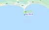
Op Batu Mandi (0 km).
VOLGENDE IS OM (lokale tijd) resterende tijd hoog water laag water Batu Mandi Tide Times and Tide Chart
Live Weather:
At Pamijen Lor wx, 75 km from Batu Mandi.
- Air temperature
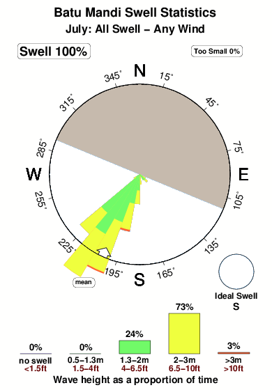
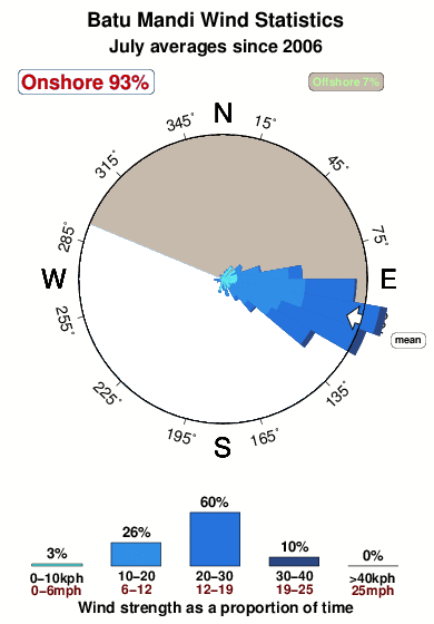
29°COverall Batu Mandi Surf Consistency and Wind Distribution in July
surffoto's uit
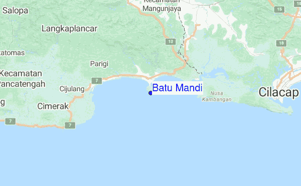
de galerijContourlijnen: Wegen & Rivieren: Kies een surflokatie uit het menu 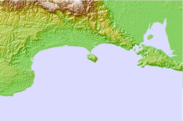
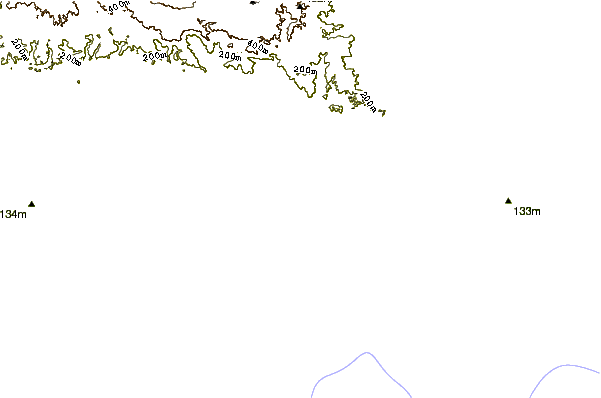
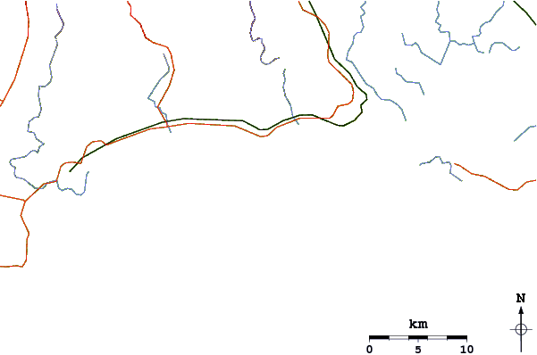
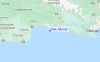
Gebruik deze reliëfkaart om naar de surfspots en de getijdenstations van Java - Central toe te gaan, in de buurt van Batu Mandi.
Andere Dichtbijzijnde Surflocaties van Batu Mandi:
(klik op locatienaam voor meer informatie)- Closest Locatie5 mi
- Second closest Locatie9 mi
- Third closest Locatie11 mi
- Fourth closest Locatie14 mi
- Fifth closest Locatie153 mi
Dichtstbijzijnde golfboeien bij Batu Mandi:
- Closest golfboei2271 mi
- Second closest golfboei2451 mi
- Third closest golfboei2513 mi
- Fourth closest golfboei2576 mi
- Fifth closest golfboei2637 mi
Getijdenstations in de buurt van Batu Mandi:
- Closest getijdenstationAstanajapura64 mi
- Second closest getijdenstationCirebon67 mi
- Third closest getijdenstationTegal67 mi
- Fourth closest getijdenstationPemalang75 mi
- Fifth closest getijdenstationPetarukan79 mi
Airports
- The closest passenger airport to Batu Mandi is Tunggul Wulung (Cilacap) Airport (CXP) in Indonesia, 42 km (26 miles) away (directly).
- The second nearest airport to Batu Mandi is Penggung (Cirebon) Airport (CBN), also in Indonesia, 109 km (68 miles) away.
- Third is Husein Sastranegara (Bandung) Airport (BDO) in Indonesia, 151 km (94 miles) away.
- Adi Sutjipto (Yogyakarta) Airport (JOG) in Indonesia is 196 km (122 miles) away.
- Achmad Yani (Semarang) Airport (SRG), also in Indonesia is the fifth nearest airport to Batu Mandi and is 207 km (129 miles) away.
- /breaks/Batu-Mandi/forecasts/latest


 Nearest