

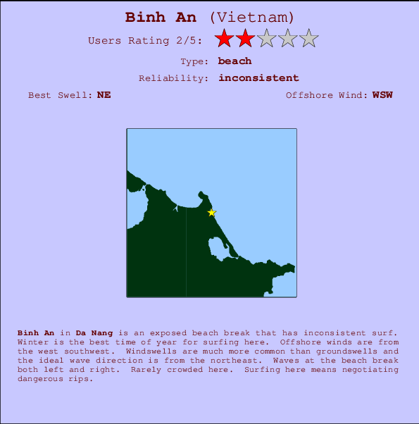
Binh An Surf Guide
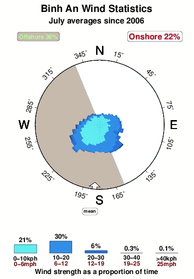
Binh An in Da Nang is an exposed beach break that has inconsistent surf. Winter is the best time of year for surfing here. Offshore winds are from the west southwest. Windswells are much more common than groundswells and the best wave direction is from the northeast. The beach break provides left and right handers. Unlikely to be too crowded, even when the surf is up. Watch out for dangerous rips.
Binh An Spot Info
| Type: | Rating: | Reliability: | Todays Sea Temp*: |
|---|---|---|---|
| inconsistent | 31.3°C*ocean temperature recorded from satellite |
Surfing Binh An:
The best conditions reported for surf at Binh An occur when a Northeast swell combines with an offshore wind direction from the West-southwest.
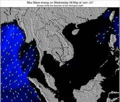
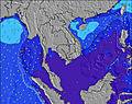
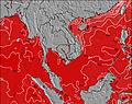
Voorspelde Golfenergie (Kracht): 12 uur

Binh An Surf:
Tuesday, 14 July 2026, 22:16 Local time| Tue | Wednesday 15 | |||
| 10PM | 1AM | 4AM | 7AM | |
| Wave (m) | ||||
| Periode (s) | 7 | 7 | 6 | 4 |
| Wind (km/h) | ||||
| Wind | cross- off |
off | cross- off |
cross- off |
- /breaks/Binh-An/forecasts/latest
Binh An Surf Guide
Binh An in Da Nang is an exposed beach break that has inconsistent surf. Winter is the best time of year for surfing here. Offshore winds are from the west southwest. Windswells are much more common than groundswells and the best wave direction is from the northeast. The beach break provides left and right handers. Unlikely to be too crowded, even when the surf is up. Watch out for dangerous rips.
Binh An Spot Info
Type: Rating: Reliability: Todays Sea Temp*:  Beach
Beach 2
2inconsistent 31.3°C*ocean temperature recorded from satelliteSurfing Binh An:
The best conditions reported for surf at Binh An occur when a Northeast swell combines with an offshore wind direction from the West-southwest.
Voorspelde Golfenergie (Kracht): 12 uur
Gebruik de tabbladen hierboven om de zeewatertemperatuur bij Binh An te bekijken, foto's van Binh An, Binh An gedetailleerde golfvoorspellingen, wind- en weersvoorspellingen, Binh An webcams, actuele wind in Da Nang live weerstations en Binh An getijdenvoorspellingen. De link van Vietnam golfkaarten opent een grote afbeelding van Vietnam en de omliggende zeeën. Deze golfkaarten kunnen worden dynamisch gemaakt worden met de verschillende golfcomponenten, golfenergie, golfperiode, golfhoogte, samen met de wind en weersvoorspellingen, het actuele weer en de zeetoestand volgens golfboeien uit Vietnam, langskomende schepen en weerstations op de kust. Elk voorspelling pagina's voor dit surfstrand zijn voorzien van een wereldwijde en regionale golfzoeker om de beste surfsomstandigheden in het gebied rond Binh An te vinden.
Binh An Surf:
Tuesday, 14 July 2026, 22:16 Local timeTue Wednesday 15 10PM 1AM 4AM 7AM Wave (m) Periode (s) 7 7 6 4 Wind (km/h) Wind cross-
offoff cross-
offcross-
off- /breaks/Binh-An/forecasts/latest
- /breaks/Binh-An/forecasts/latest/six_day
Binh An Surf Guide
Binh An in Da Nang is an exposed beach break that has inconsistent surf. Winter is the best time of year for surfing here. Offshore winds are from the west southwest. Windswells are much more common than groundswells and the best wave direction is from the northeast. The beach break provides left and right handers. Unlikely to be too crowded, even when the surf is up. Watch out for dangerous rips.
Binh An Spot Info
Type: Rating: Reliability: Todays Sea Temp*: Beach2inconsistent 31.3°C*ocean temperature recorded from satelliteSurfing Binh An:
The best conditions reported for surf at Binh An occur when a Northeast swell combines with an offshore wind direction from the West-southwest.
Voorspelde Golfenergie (Kracht): 12 uur
Gebruik de tabbladen hierboven om de zeewatertemperatuur bij Binh An te bekijken, foto's van Binh An, Binh An gedetailleerde golfvoorspellingen, wind- en weersvoorspellingen, Binh An webcams, actuele wind in Da Nang live weerstations en Binh An getijdenvoorspellingen. De link van Vietnam golfkaarten opent een grote afbeelding van Vietnam en de omliggende zeeën. Deze golfkaarten kunnen worden dynamisch gemaakt worden met de verschillende golfcomponenten, golfenergie, golfperiode, golfhoogte, samen met de wind en weersvoorspellingen, het actuele weer en de zeetoestand volgens golfboeien uit Vietnam, langskomende schepen en weerstations op de kust. Elk voorspelling pagina's voor dit surfstrand zijn voorzien van een wereldwijde en regionale golfzoeker om de beste surfsomstandigheden in het gebied rond Binh An te vinden.
Binh An Surf:
Tuesday, 14 July 2026, 22:16 Local timeTue Wednesday 15 10PM 1AM 4AM 7AM Wave (m) Periode (s) 7 7 6 4 Wind (km/h) Wind cross-
offoff cross-
offcross-
off- /breaks/Binh-An/forecasts/latest
Binh An Surf Guide
Binh An in Da Nang is an exposed beach break that has inconsistent surf. Winter is the best time of year for surfing here. Offshore winds are from the west southwest. Windswells are much more common than groundswells and the best wave direction is from the northeast. The beach break provides left and right handers. Unlikely to be too crowded, even when the surf is up. Watch out for dangerous rips.
Binh An Spot Info
Type: Rating: Reliability: Todays Sea Temp*: Beach2inconsistent 31.3°C*ocean temperature recorded from satelliteSurfing Binh An:
The best conditions reported for surf at Binh An occur when a Northeast swell combines with an offshore wind direction from the West-southwest.
Voorspelde Golfenergie (Kracht): 12 uur
Gebruik de tabbladen hierboven om de zeewatertemperatuur bij Binh An te bekijken, foto's van Binh An, Binh An gedetailleerde golfvoorspellingen, wind- en weersvoorspellingen, Binh An webcams, actuele wind in Da Nang live weerstations en Binh An getijdenvoorspellingen. De link van Vietnam golfkaarten opent een grote afbeelding van Vietnam en de omliggende zeeën. Deze golfkaarten kunnen worden dynamisch gemaakt worden met de verschillende golfcomponenten, golfenergie, golfperiode, golfhoogte, samen met de wind en weersvoorspellingen, het actuele weer en de zeetoestand volgens golfboeien uit Vietnam, langskomende schepen en weerstations op de kust. Elk voorspelling pagina's voor dit surfstrand zijn voorzien van een wereldwijde en regionale golfzoeker om de beste surfsomstandigheden in het gebied rond Binh An te vinden.
Binh An Surf:
Tuesday, 14 July 2026, 22:16 Local timeTue Wednesday 15 10PM 1AM 4AM 7AM Wave (m) Periode (s) 7 7 6 4 Wind (km/h) Wind cross-
offoff cross-
offcross-
offTide Times:
Op Binh An (0 km).
VOLGENDE IS OM (lokale tijd) resterende tijd hoog water laag water Binh An Tide Times and Tide Chart
Live Weather:
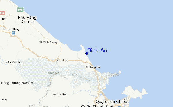
At Da Nang International Airport, 34 km from Binh An.
calm
(km/h)Air temperature
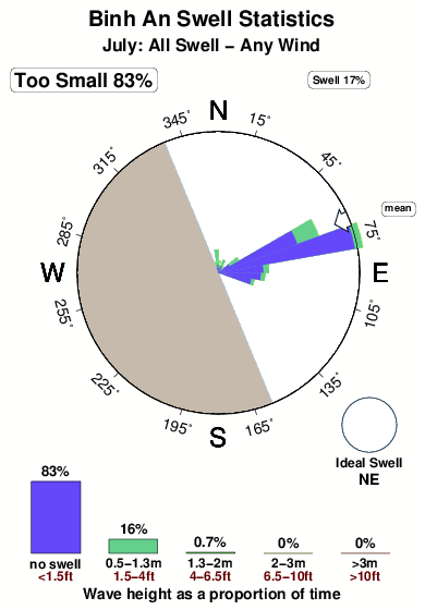
31°COverall Binh An Surf Consistency and Wind Distribution in July
surffoto's uit
de galerijContourlijnen: Wegen & Rivieren: Kies een surflokatie uit het menu 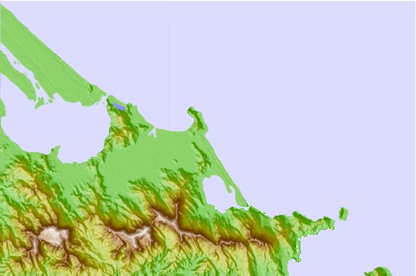
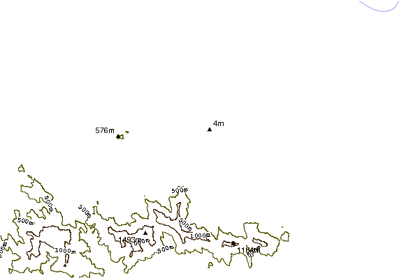
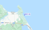
Gebruik deze reliëfkaart om naar de surfspots en de getijdenstations van Da Nang toe te gaan, in de buurt van Binh An.
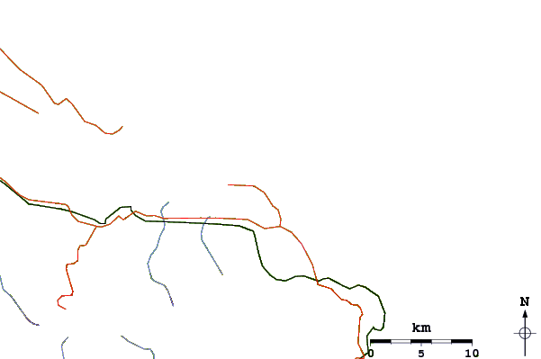
Andere Dichtbijzijnde Surflocaties van Binh An:
(klik op locatienaam voor meer informatie)- Closest Locatie4 mi
- Second closest Locatie14 mi
- Third closest Locatie21 mi
- Fourth closest Locatie24 mi
- Fifth closest Locatie27 mi
Dichtstbijzijnde golfboeien bij Binh An:
- Closest golfboei1179 mi
- Second closest golfboei1259 mi
- Third closest golfboei1435 mi
- Fourth closest golfboei1452 mi
- Fifth closest golfboei1605 mi
Getijdenstations in de buurt van Binh An:
- Closest getijdenstationDa Nang17 mi
- Second closest getijdenstationHoi An35 mi
- Third closest getijdenstationDong Hoi126 mi
- Fourth closest getijdenstationSanya163 mi
- Fifth closest getijdenstationQuy Nhon192 mi
Airports
- The nearest passenger airport to Binh An is Danang International Airport (DAD) in Viet Nam, which is 33 km (20 miles) away (directly).
- The second closest airport to Binh An is Pakse Airport (PKZ) in Laos, 275 km (171 miles) away.
- /breaks/Binh-An/forecasts/latest


 Nearest