
Bushrangers Bay Surf Guide
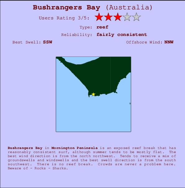
Bushrangers Bay in Mornington Peninsula is an exposed reef break that has pretty consitent surf, although summer tends to be mostly flat. The best wind direction is from the north northwest. Most of the surf here comes from groundswells and the ideal swell direction is from the south southwest. There is no reef break. The location means that it never gets crowded. Watch out for - Rocks - Sharks.
Bushrangers Bay Spot Info
| Type: | Rating: | Reliability: | Todays Sea Temp*: |
|---|---|---|---|
| fairly consistent | 13.9°C*ocean temperature recorded from satellite |
Surfing Bushrangers Bay:
The best conditions reported for surf at Bushrangers Bay occur when a South-southwest swell combines with an offshore wind direction from the North-northwest.

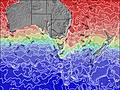
Voorspelde Golfenergie (Kracht): 12 uur


Bushrangers Bay Surf:
Thursday, 16 July 2026, 19:23 Local time| Thu | Fri | |||
| 7PM | 10PM | 1AM | 4AM | |
| Wave (m) | ||||
| Periode (s) | 15 | 15 | 15 | 15 |
| Wind (km/h) | ||||
| Wind | cross- on |
glass | glass | off |
- /breaks/Bushrangers-Bay/forecasts/latest
Bushrangers Bay Surf Guide
Bushrangers Bay in Mornington Peninsula is an exposed reef break that has pretty consitent surf, although summer tends to be mostly flat. The best wind direction is from the north northwest. Most of the surf here comes from groundswells and the ideal swell direction is from the south southwest. There is no reef break. The location means that it never gets crowded. Watch out for - Rocks - Sharks.
Bushrangers Bay Spot Info
Type: Rating: Reliability: Todays Sea Temp*:  Reef
Reef 3
3fairly consistent 13.9°C*ocean temperature recorded from satelliteSurfing Bushrangers Bay:
The best conditions reported for surf at Bushrangers Bay occur when a South-southwest swell combines with an offshore wind direction from the North-northwest.
Voorspelde Golfenergie (Kracht): 12 uur
Gebruik de tabbladen hierboven om de zeewatertemperatuur bij Bushrangers Bay te bekijken, foto's van Bushrangers Bay, Bushrangers Bay gedetailleerde golfvoorspellingen, wind- en weersvoorspellingen, Bushrangers Bay webcams, actuele wind in VIC - Mornington Peninsula live weerstations en Bushrangers Bay getijdenvoorspellingen. De link van Australia golfkaarten opent een grote afbeelding van Australia en de omliggende zeeën. Deze golfkaarten kunnen worden dynamisch gemaakt worden met de verschillende golfcomponenten, golfenergie, golfperiode, golfhoogte, samen met de wind en weersvoorspellingen, het actuele weer en de zeetoestand volgens golfboeien uit Australia, langskomende schepen en weerstations op de kust. Elk voorspelling pagina's voor dit surfstrand zijn voorzien van een wereldwijde en regionale golfzoeker om de beste surfsomstandigheden in het gebied rond Bushrangers Bay te vinden.
Bushrangers Bay Surf:
Thursday, 16 July 2026, 19:23 Local timeThu Fri 7PM 10PM 1AM 4AM Wave (m) Periode (s) 15 15 15 15 Wind (km/h) Wind cross-
onglass glass off - /breaks/Bushrangers-Bay/forecasts/latest
- /breaks/Bushrangers-Bay/forecasts/latest/six_day
Bushrangers Bay Surf Guide
Bushrangers Bay in Mornington Peninsula is an exposed reef break that has pretty consitent surf, although summer tends to be mostly flat. The best wind direction is from the north northwest. Most of the surf here comes from groundswells and the ideal swell direction is from the south southwest. There is no reef break. The location means that it never gets crowded. Watch out for - Rocks - Sharks.
Bushrangers Bay Spot Info
Type: Rating: Reliability: Todays Sea Temp*: Reef3fairly consistent 13.9°C*ocean temperature recorded from satelliteSurfing Bushrangers Bay:
The best conditions reported for surf at Bushrangers Bay occur when a South-southwest swell combines with an offshore wind direction from the North-northwest.
Voorspelde Golfenergie (Kracht): 12 uur
Gebruik de tabbladen hierboven om de zeewatertemperatuur bij Bushrangers Bay te bekijken, foto's van Bushrangers Bay, Bushrangers Bay gedetailleerde golfvoorspellingen, wind- en weersvoorspellingen, Bushrangers Bay webcams, actuele wind in VIC - Mornington Peninsula live weerstations en Bushrangers Bay getijdenvoorspellingen. De link van Australia golfkaarten opent een grote afbeelding van Australia en de omliggende zeeën. Deze golfkaarten kunnen worden dynamisch gemaakt worden met de verschillende golfcomponenten, golfenergie, golfperiode, golfhoogte, samen met de wind en weersvoorspellingen, het actuele weer en de zeetoestand volgens golfboeien uit Australia, langskomende schepen en weerstations op de kust. Elk voorspelling pagina's voor dit surfstrand zijn voorzien van een wereldwijde en regionale golfzoeker om de beste surfsomstandigheden in het gebied rond Bushrangers Bay te vinden.
Bushrangers Bay Surf:
Thursday, 16 July 2026, 19:23 Local timeThu Fri 7PM 10PM 1AM 4AM Wave (m) Periode (s) 15 15 15 15 Wind (km/h) Wind cross-
onglass glass off - /breaks/Bushrangers-Bay/forecasts/latest
Bushrangers Bay Surf Guide
Bushrangers Bay in Mornington Peninsula is an exposed reef break that has pretty consitent surf, although summer tends to be mostly flat. The best wind direction is from the north northwest. Most of the surf here comes from groundswells and the ideal swell direction is from the south southwest. There is no reef break. The location means that it never gets crowded. Watch out for - Rocks - Sharks.
Bushrangers Bay Spot Info
Type: Rating: Reliability: Todays Sea Temp*: Reef3fairly consistent 13.9°C*ocean temperature recorded from satelliteSurfing Bushrangers Bay:
The best conditions reported for surf at Bushrangers Bay occur when a South-southwest swell combines with an offshore wind direction from the North-northwest.
Voorspelde Golfenergie (Kracht): 12 uur
Gebruik de tabbladen hierboven om de zeewatertemperatuur bij Bushrangers Bay te bekijken, foto's van Bushrangers Bay, Bushrangers Bay gedetailleerde golfvoorspellingen, wind- en weersvoorspellingen, Bushrangers Bay webcams, actuele wind in VIC - Mornington Peninsula live weerstations en Bushrangers Bay getijdenvoorspellingen. De link van Australia golfkaarten opent een grote afbeelding van Australia en de omliggende zeeën. Deze golfkaarten kunnen worden dynamisch gemaakt worden met de verschillende golfcomponenten, golfenergie, golfperiode, golfhoogte, samen met de wind en weersvoorspellingen, het actuele weer en de zeetoestand volgens golfboeien uit Australia, langskomende schepen en weerstations op de kust. Elk voorspelling pagina's voor dit surfstrand zijn voorzien van een wereldwijde en regionale golfzoeker om de beste surfsomstandigheden in het gebied rond Bushrangers Bay te vinden.
Bushrangers Bay Surf:
Thursday, 16 July 2026, 19:23 Local timeThu Fri 7PM 10PM 1AM 4AM Wave (m) Periode (s) 15 15 15 15 Wind (km/h) Wind cross-
onglass glass off Tide Times:
Op Bushrangers Bay (0 km).
VOLGENDE IS OM (lokale tijd) resterende tijd hoog water laag water Bushrangers Bay Tide Times and Tide Chart
Live Weather:
At Cerberus Automatic Weather Station, 27 km from Bushrangers Bay.
- Air temperature
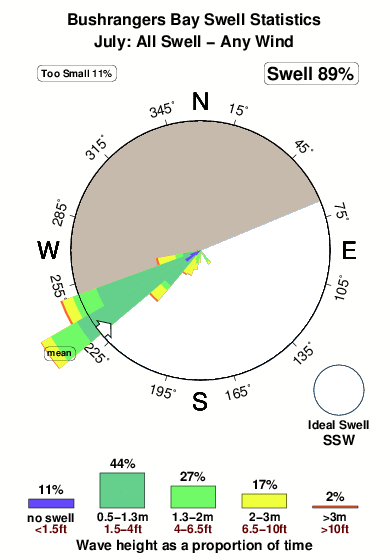
-°COverall Bushrangers Bay Surf Consistency and Wind Distribution in July
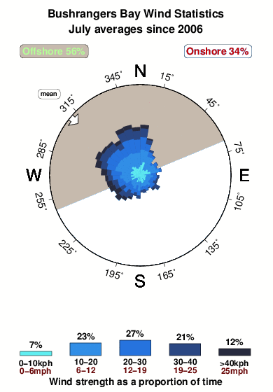


Wind stats for Bushrangers Bay: see the variation in direction and stength by month.
surffoto's uit
de galerijContourlijnen: Wegen & Rivieren: Kies een surflokatie uit het menu 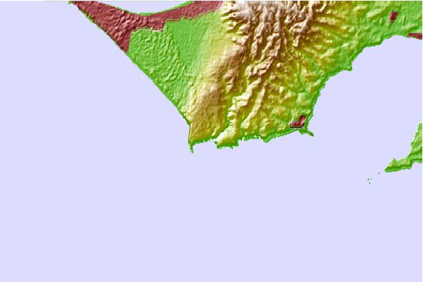
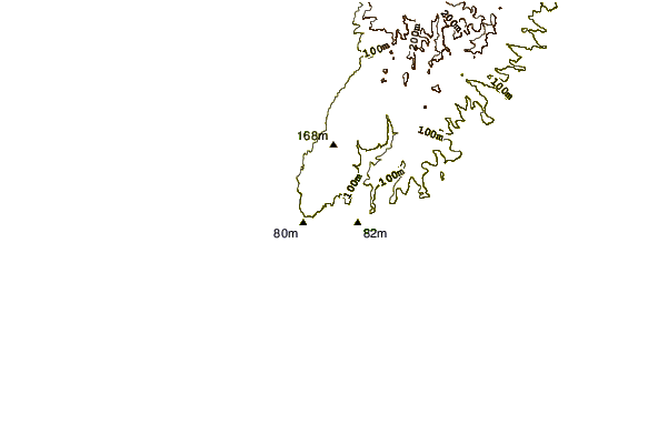
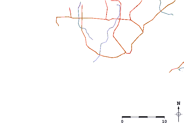
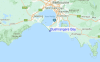
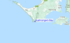
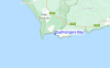
Gebruik deze reliëfkaart om naar de surfspots en de getijdenstations van VIC - Mornington Peninsula toe te gaan, in de buurt van Bushrangers Bay.
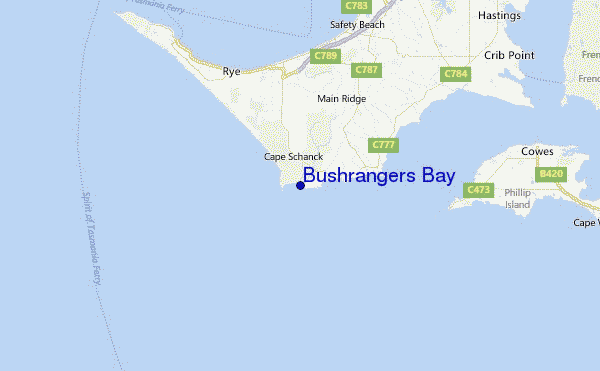
Andere Dichtbijzijnde Surflocaties van Bushrangers Bay:
(klik op locatienaam voor meer informatie)- Closest Locatie1 mi
- Second closest Locatie3 mi
- Third closest Locatie6 mi
- Fourth closest Locatie6 mi
- Fifth closest Locatie6 mi
Dichtstbijzijnde golfboeien bij Bushrangers Bay:
- Closest golfboei251 mi
- Second closest golfboei300 mi
- Third closest golfboei356 mi
- Fourth closest golfboei439 mi
- Fifth closest golfboei485 mi
Getijdenstations in de buurt van Bushrangers Bay:
- Closest getijdenstationPhillip Island17 mi
- Second closest getijdenstationStony Point19 mi
- Third closest getijdenstationWesternport19 mi
- Fourth closest getijdenstationHastings20 mi
- Fifth closest getijdenstationPort Phillip Heads21 mi
Airports
- The closest passenger airport to Bushrangers Bay is Melbourne Moorabbin Airport (MBW) in Australia, 60 km (37 miles) away (directly).
- The second nearest airport to Bushrangers Bay is Avalon Airport (AVV), also in Australia, 63 km (39 miles) away.
- Third is Melbourne Essendon Airport (MEB) in Australia, 85 km (53 miles) away.
- Melbourne International Airport (MEL) in Australia is 91 km (57 miles) away.
- Albury Airport (ABX), also in Australia is the fifth nearest airport to Bushrangers Bay and is 325 km (202 miles) away.
- /breaks/Bushrangers-Bay/forecasts/latest
 Nearest