

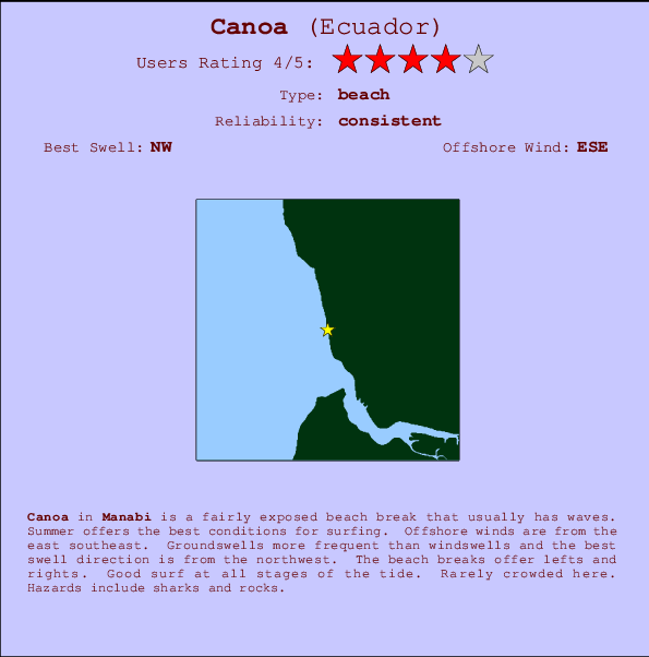
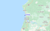
Canoa Surf Guide
Canoa in Manabi is a fairly exposed beach break that has consistent surf. Summer offers the favoured conditions for surfing. Works best in offshore winds from the east southeast. Groundswells are more common than windswells and the ideal swell direction is from the northwest. Waves at the beach break both left and right. Surfable at all stages of the tide. It very rarely gets crowded here. Watch out for sharks and rocks.
Canoa Spot Info
| Type: | Rating: | Reliability: | Todays Sea Temp*: |
|---|---|---|---|
| consistent | 26.8°C*ocean temperature recorded from satellite |
Surfing Canoa:
The best conditions reported for surf at Canoa occur when a Northwest swell combines with an offshore wind direction from the East-southeast.

Voorspelde Golfenergie (Kracht): 12 uur

Canoa Surf:
Thursday, 16 July 2026, 15:15 Local time| Thursday 16 | Fri | |||
| 4PM | 7PM | 10PM | 1AM | |
| Wave (m) | ||||
| Periode (s) | 12 | 14 | 13 | 13 |
| Wind (km/h) | ||||
| Wind | cross- on |
cross- on |
cross- on |
cross- on |
- /breaks/Canoa/forecasts/latest
Canoa Surf Guide
Canoa in Manabi is a fairly exposed beach break that has consistent surf. Summer offers the favoured conditions for surfing. Works best in offshore winds from the east southeast. Groundswells are more common than windswells and the ideal swell direction is from the northwest. Waves at the beach break both left and right. Surfable at all stages of the tide. It very rarely gets crowded here. Watch out for sharks and rocks.
Canoa Spot Info
Type: Rating: Reliability: Todays Sea Temp*:  Beach
Beach 4
4consistent 26.8°C*ocean temperature recorded from satelliteSurfing Canoa:
The best conditions reported for surf at Canoa occur when a Northwest swell combines with an offshore wind direction from the East-southeast.
Voorspelde Golfenergie (Kracht): 12 uur
Gebruik de tabbladen hierboven om de zeewatertemperatuur bij Canoa te bekijken, foto's van Canoa, Canoa gedetailleerde golfvoorspellingen, wind- en weersvoorspellingen, Canoa webcams, actuele wind in Manabi live weerstations en Canoa getijdenvoorspellingen. De link van Ecuador golfkaarten opent een grote afbeelding van Ecuador en de omliggende zeeën. Deze golfkaarten kunnen worden dynamisch gemaakt worden met de verschillende golfcomponenten, golfenergie, golfperiode, golfhoogte, samen met de wind en weersvoorspellingen, het actuele weer en de zeetoestand volgens golfboeien uit Ecuador, langskomende schepen en weerstations op de kust. Elk voorspelling pagina's voor dit surfstrand zijn voorzien van een wereldwijde en regionale golfzoeker om de beste surfsomstandigheden in het gebied rond Canoa te vinden.
Canoa Surf:
Thursday, 16 July 2026, 15:15 Local timeThursday 16 Fri 4PM 7PM 10PM 1AM Wave (m) Periode (s) 12 14 13 13 Wind (km/h) Wind cross-
oncross-
oncross-
oncross-
on- /breaks/Canoa/forecasts/latest
- /breaks/Canoa/forecasts/latest/six_day
Canoa Surf Guide
Canoa in Manabi is a fairly exposed beach break that has consistent surf. Summer offers the favoured conditions for surfing. Works best in offshore winds from the east southeast. Groundswells are more common than windswells and the ideal swell direction is from the northwest. Waves at the beach break both left and right. Surfable at all stages of the tide. It very rarely gets crowded here. Watch out for sharks and rocks.
Canoa Spot Info
Type: Rating: Reliability: Todays Sea Temp*: Beach4consistent 26.8°C*ocean temperature recorded from satelliteSurfing Canoa:
The best conditions reported for surf at Canoa occur when a Northwest swell combines with an offshore wind direction from the East-southeast.
Voorspelde Golfenergie (Kracht): 12 uur
Gebruik de tabbladen hierboven om de zeewatertemperatuur bij Canoa te bekijken, foto's van Canoa, Canoa gedetailleerde golfvoorspellingen, wind- en weersvoorspellingen, Canoa webcams, actuele wind in Manabi live weerstations en Canoa getijdenvoorspellingen. De link van Ecuador golfkaarten opent een grote afbeelding van Ecuador en de omliggende zeeën. Deze golfkaarten kunnen worden dynamisch gemaakt worden met de verschillende golfcomponenten, golfenergie, golfperiode, golfhoogte, samen met de wind en weersvoorspellingen, het actuele weer en de zeetoestand volgens golfboeien uit Ecuador, langskomende schepen en weerstations op de kust. Elk voorspelling pagina's voor dit surfstrand zijn voorzien van een wereldwijde en regionale golfzoeker om de beste surfsomstandigheden in het gebied rond Canoa te vinden.
Canoa Surf:
Thursday, 16 July 2026, 15:15 Local timeThursday 16 Fri 4PM 7PM 10PM 1AM Wave (m) Periode (s) 12 14 13 13 Wind (km/h) Wind cross-
oncross-
oncross-
oncross-
on- /breaks/Canoa/forecasts/latest
Canoa Surf Guide
Canoa in Manabi is a fairly exposed beach break that has consistent surf. Summer offers the favoured conditions for surfing. Works best in offshore winds from the east southeast. Groundswells are more common than windswells and the ideal swell direction is from the northwest. Waves at the beach break both left and right. Surfable at all stages of the tide. It very rarely gets crowded here. Watch out for sharks and rocks.
Canoa Spot Info
Type: Rating: Reliability: Todays Sea Temp*: Beach4consistent 26.8°C*ocean temperature recorded from satelliteSurfing Canoa:
The best conditions reported for surf at Canoa occur when a Northwest swell combines with an offshore wind direction from the East-southeast.
Voorspelde Golfenergie (Kracht): 12 uur
Gebruik de tabbladen hierboven om de zeewatertemperatuur bij Canoa te bekijken, foto's van Canoa, Canoa gedetailleerde golfvoorspellingen, wind- en weersvoorspellingen, Canoa webcams, actuele wind in Manabi live weerstations en Canoa getijdenvoorspellingen. De link van Ecuador golfkaarten opent een grote afbeelding van Ecuador en de omliggende zeeën. Deze golfkaarten kunnen worden dynamisch gemaakt worden met de verschillende golfcomponenten, golfenergie, golfperiode, golfhoogte, samen met de wind en weersvoorspellingen, het actuele weer en de zeetoestand volgens golfboeien uit Ecuador, langskomende schepen en weerstations op de kust. Elk voorspelling pagina's voor dit surfstrand zijn voorzien van een wereldwijde en regionale golfzoeker om de beste surfsomstandigheden in het gebied rond Canoa te vinden.
Canoa Surf:
Thursday, 16 July 2026, 15:15 Local timeThursday 16 Fri 4PM 7PM 10PM 1AM Wave (m) Periode (s) 12 14 13 13 Wind (km/h) Wind cross-
oncross-
oncross-
oncross-
onTide Times:
Voor Puerto de Bahia Caraquez, Ecuador, %{dist} %{km} van %{location}.
VOLGENDE IS OM (lokale tijd) resterende tijd hoog water laag water Canoa Tide Times and Tide Chart
Live Weather:
At Manta/Eloy Alfaro International Airport, 51 km from Canoa.
light winds from the SSE
(km/h)
Dry and partly cloudyAir temperature
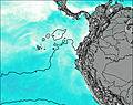
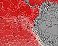
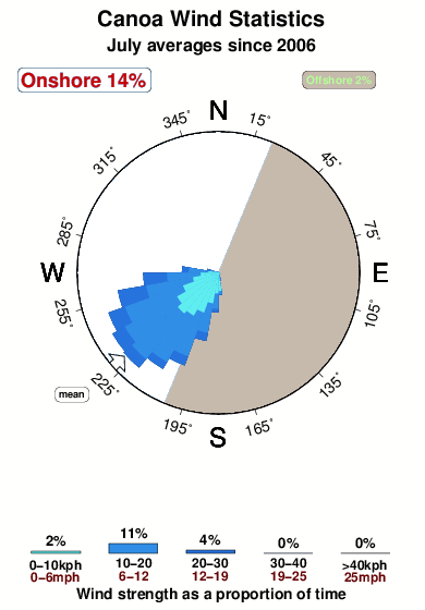
32°COverall Canoa Surf Consistency and Wind Distribution in July
surffoto's uit
de galerijContourlijnen: Wegen & Rivieren: Kies een surflokatie uit het menu 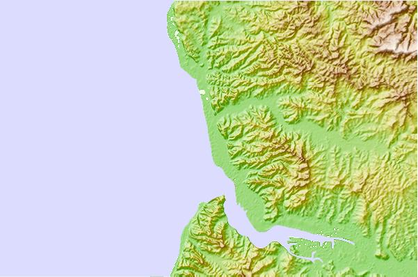
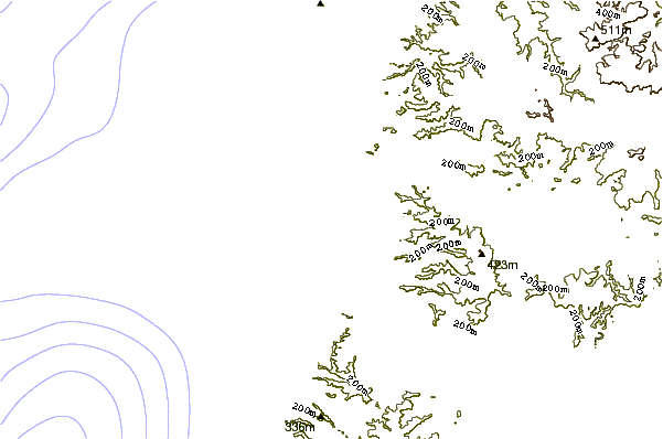
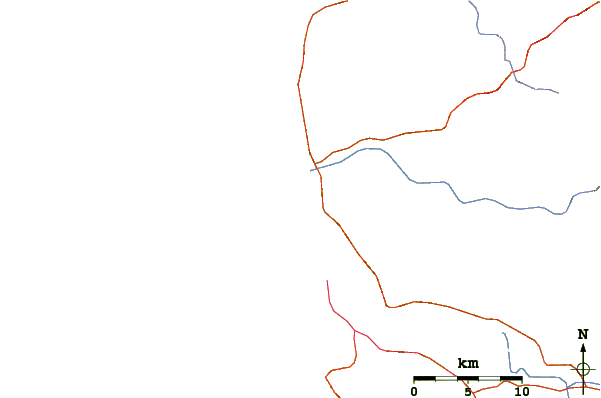
Gebruik deze reliëfkaart om naar de surfspots en de getijdenstations van Manabi toe te gaan, in de buurt van Canoa.
Andere Dichtbijzijnde Surflocaties van Canoa:
(klik op locatienaam voor meer informatie)- Closest Locatie5 mi
- Second closest Locatie7 mi
- Third closest Locatie10 mi
- Fourth closest Locatie12 mi
- Fifth closest Locatie26 mi
Dichtstbijzijnde golfboeien bij Canoa:
- Closest golfboei1203 mi
- Second closest golfboei1343 mi
- Third closest golfboei1445 mi
- Fourth closest golfboei1585 mi
- Fifth closest golfboei1586 mi
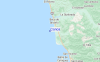
Getijdenstations in de buurt van Canoa:
- Closest getijdenstationPuerto de Bahia Caraquez3 mi
- Second closest getijdenstationManta33 mi
- Third closest getijdenstationPedernales52 mi
- Fourth closest getijdenstationPuerto Lopez76 mi
- Fifth closest getijdenstationMuisne84 mi
Airports
- The closest passenger airport to Canoa is Eloy Alfaro International (Manta) Airport (MEC) in Ecuador, 52 km (32 miles) away (directly).
- The second nearest airport to Canoa is Reales Tamarindos (Portoviejo) Airport (PVO), also in Ecuador, 56 km (35 miles) away.
- Third is Simon Bolivar International (Guayaquil) Airport (GYE) in Ecuador, 190 km (118 miles) away.
- General Ulpiano Paez (Salinas) Airport (SNC) in Ecuador is 194 km (120 miles) away.
- Chachoan (Ambato) Airport (ATF), also in Ecuador is the fifth nearest airport to Canoa and is 221 km (137 miles) away.
- /breaks/Canoa/forecasts/latest


 Nearest