

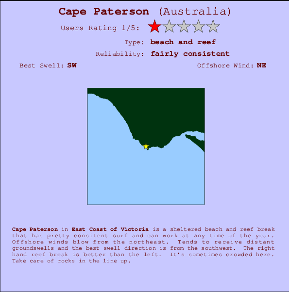
Cape Paterson Surf Guide
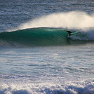
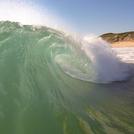
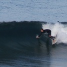
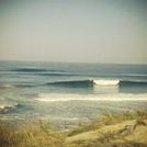
Cape Patterson on the East Coast is a sheltered reef break that has pretty consitent surf and can work at any time of the year. Offshore winds are from the north. Most of the surf here comes from groundswells and the ideal swell direction is from the southwest. The right reef break is best, but there is a left reef too.. When the surf is up, it can get quite busy in the water. Take care to avoid the rocks.
Cape Paterson Spot Info
| Type: | Rating: | Reliability: | Todays Sea Temp*: |
|---|---|---|---|
| fairly consistent | 13.8°C*ocean temperature recorded from satellite |
Surfing Cape Paterson:
The best conditions reported for surf at Cape Paterson occur when a Southwest swell combines with an offshore wind direction from the Northeast.

Voorspelde Golfenergie (Kracht): 12 uur


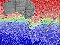
Cape Paterson Surf:
Friday, 17 July 2026, 13:53 Local time| Friday 17 | ||||
| 1PM | 4PM | 7PM | 10PM | |
| Wave (m) | ||||
| Periode (s) | 16 | 16 | 16 | 16 |
| Wind (km/h) | ||||
| Wind | cross | cross- on |
glass | glass |
- /breaks/Cape-Patterson/forecasts/latest
Cape Paterson Surf Guide
Cape Patterson on the East Coast is a sheltered reef break that has pretty consitent surf and can work at any time of the year. Offshore winds are from the north. Most of the surf here comes from groundswells and the ideal swell direction is from the southwest. The right reef break is best, but there is a left reef too.. When the surf is up, it can get quite busy in the water. Take care to avoid the rocks.
Cape Paterson Spot Info
Type: Rating: Reliability: Todays Sea Temp*:  Beach and reef
 1
1fairly consistent 13.8°C*ocean temperature recorded from satelliteSurfing Cape Paterson:
The best conditions reported for surf at Cape Paterson occur when a Southwest swell combines with an offshore wind direction from the Northeast.
Voorspelde Golfenergie (Kracht): 12 uur
Gebruik de tabbladen hierboven om de zeewatertemperatuur bij Cape Paterson te bekijken, foto's van Cape Paterson, Cape Paterson gedetailleerde golfvoorspellingen, wind- en weersvoorspellingen, Cape Paterson webcams, actuele wind in VIC - East Coast live weerstations en Cape Paterson getijdenvoorspellingen. De link van Australia golfkaarten opent een grote afbeelding van Australia en de omliggende zeeën. Deze golfkaarten kunnen worden dynamisch gemaakt worden met de verschillende golfcomponenten, golfenergie, golfperiode, golfhoogte, samen met de wind en weersvoorspellingen, het actuele weer en de zeetoestand volgens golfboeien uit Australia, langskomende schepen en weerstations op de kust. Elk voorspelling pagina's voor dit surfstrand zijn voorzien van een wereldwijde en regionale golfzoeker om de beste surfsomstandigheden in het gebied rond Cape Paterson te vinden.
Cape Paterson Surf:
Friday, 17 July 2026, 13:53 Local timeFriday 17 1PM 4PM 7PM 10PM Wave (m) Periode (s) 16 16 16 16 Wind (km/h) Wind cross cross-
onglass glass - /breaks/Cape-Patterson/forecasts/latest
- /breaks/Cape-Patterson/forecasts/latest/six_day
Cape Paterson Surf Guide
Cape Patterson on the East Coast is a sheltered reef break that has pretty consitent surf and can work at any time of the year. Offshore winds are from the north. Most of the surf here comes from groundswells and the ideal swell direction is from the southwest. The right reef break is best, but there is a left reef too.. When the surf is up, it can get quite busy in the water. Take care to avoid the rocks.
Cape Paterson Spot Info
Type: Rating: Reliability: Todays Sea Temp*: Beach and reef1fairly consistent 13.8°C*ocean temperature recorded from satelliteSurfing Cape Paterson:
The best conditions reported for surf at Cape Paterson occur when a Southwest swell combines with an offshore wind direction from the Northeast.
Voorspelde Golfenergie (Kracht): 12 uur
Gebruik de tabbladen hierboven om de zeewatertemperatuur bij Cape Paterson te bekijken, foto's van Cape Paterson, Cape Paterson gedetailleerde golfvoorspellingen, wind- en weersvoorspellingen, Cape Paterson webcams, actuele wind in VIC - East Coast live weerstations en Cape Paterson getijdenvoorspellingen. De link van Australia golfkaarten opent een grote afbeelding van Australia en de omliggende zeeën. Deze golfkaarten kunnen worden dynamisch gemaakt worden met de verschillende golfcomponenten, golfenergie, golfperiode, golfhoogte, samen met de wind en weersvoorspellingen, het actuele weer en de zeetoestand volgens golfboeien uit Australia, langskomende schepen en weerstations op de kust. Elk voorspelling pagina's voor dit surfstrand zijn voorzien van een wereldwijde en regionale golfzoeker om de beste surfsomstandigheden in het gebied rond Cape Paterson te vinden.
Cape Paterson Surf:
Friday, 17 July 2026, 13:53 Local timeFriday 17 1PM 4PM 7PM 10PM Wave (m) Periode (s) 16 16 16 16 Wind (km/h) Wind cross cross-
onglass glass - /breaks/Cape-Patterson/forecasts/latest
Cape Paterson Surf Guide
Cape Patterson on the East Coast is a sheltered reef break that has pretty consitent surf and can work at any time of the year. Offshore winds are from the north. Most of the surf here comes from groundswells and the ideal swell direction is from the southwest. The right reef break is best, but there is a left reef too.. When the surf is up, it can get quite busy in the water. Take care to avoid the rocks.
Cape Paterson Spot Info
Type: Rating: Reliability: Todays Sea Temp*: Beach and reef1fairly consistent 13.8°C*ocean temperature recorded from satelliteSurfing Cape Paterson:
The best conditions reported for surf at Cape Paterson occur when a Southwest swell combines with an offshore wind direction from the Northeast.
Voorspelde Golfenergie (Kracht): 12 uur
Gebruik de tabbladen hierboven om de zeewatertemperatuur bij Cape Paterson te bekijken, foto's van Cape Paterson, Cape Paterson gedetailleerde golfvoorspellingen, wind- en weersvoorspellingen, Cape Paterson webcams, actuele wind in VIC - East Coast live weerstations en Cape Paterson getijdenvoorspellingen. De link van Australia golfkaarten opent een grote afbeelding van Australia en de omliggende zeeën. Deze golfkaarten kunnen worden dynamisch gemaakt worden met de verschillende golfcomponenten, golfenergie, golfperiode, golfhoogte, samen met de wind en weersvoorspellingen, het actuele weer en de zeetoestand volgens golfboeien uit Australia, langskomende schepen en weerstations op de kust. Elk voorspelling pagina's voor dit surfstrand zijn voorzien van een wereldwijde en regionale golfzoeker om de beste surfsomstandigheden in het gebied rond Cape Paterson te vinden.
Cape Paterson Surf:
Friday, 17 July 2026, 13:53 Local timeFriday 17 1PM 4PM 7PM 10PM Wave (m) Periode (s) 16 16 16 16 Wind (km/h) Wind cross cross-
onglass glass Tide Times:
Op Cape Paterson (0 km).
VOLGENDE IS OM (lokale tijd) resterende tijd hoog water laag water Cape Paterson Tide Times and Tide Chart
Live Weather:
At Pound Creek, 19 km from Cape Paterson.
- Air temperature
-°COverall Cape Paterson Surf Consistency and Wind Distribution in July
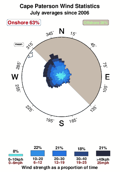


Wind stats for Cape Paterson: see the variation in direction and stength by month.
surffoto's uit
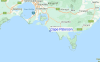
de galerijContourlijnen: Wegen & Rivieren: Kies een surflokatie uit het menu 
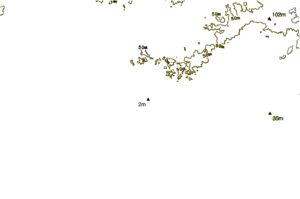
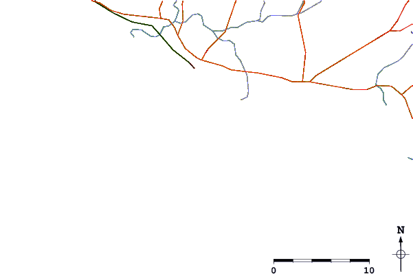
Gebruik deze reliëfkaart om naar de surfspots en de getijdenstations van VIC - East Coast toe te gaan, in de buurt van Cape Paterson.
Andere Dichtbijzijnde Surflocaties van Cape Paterson:
(klik op locatienaam voor meer informatie)- Closest Locatie3 mi
- Second closest Locatie3 mi
- Third closest Locatie8 mi
- Fourth closest Locatie12 mi
- Fifth closest Locatie14 mi
Dichtstbijzijnde golfboeien bij Cape Paterson:
- Closest golfboei240 mi
- Second closest golfboei268 mi
- Third closest golfboei333 mi
- Fourth closest golfboei418 mi
- Fifth closest golfboei469 mi
Getijdenstations in de buurt van Cape Paterson:
- Closest getijdenstationPhillip Island24 mi
- Second closest getijdenstationWaratah Bay25 mi
- Third closest getijdenstationStony Point30 mi
- Fourth closest getijdenstationWesternport30 mi
- Fifth closest getijdenstationHastings35 mi
Airports
- The closest passenger airport to Cape Paterson is Melbourne Moorabbin Airport (MBW) in Australia, 89 km (55 miles) away (directly).
- The second nearest airport to Cape Paterson is Avalon Airport (AVV), also in Australia, 122 km (76 miles) away.
- Third is Melbourne Essendon Airport (MEB) in Australia, 122 km (76 miles) away.
- Melbourne International Airport (MEL) in Australia is 130 km (81 miles) away.
- Albury Airport (ABX), also in Australia is the fifth nearest airport to Cape Paterson and is 314 km (195 miles) away.
- /breaks/Cape-Patterson/forecasts/latest


 Nearest