
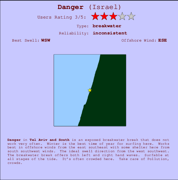
Danger Surf Guide
Danger in Tel Aviv and South is an exposed breakwater break that only works once in a while. Winter is the favoured time of year for surfing here. Offshore winds are from the east southeast with some shelter here from south southwest winds. The ideal swell direction from the west southwest. The breakwater breaks offer lefts and rights. The quality of the surf isn't affected by the tide. Likely to be crowded if working. Beware of Pollution, crowds.
Danger Spot Info
| Type: | Rating: | Reliability: | Todays Sea Temp*: |
|---|---|---|---|
| inconsistent | 28.8°C*ocean temperature recorded from satellite |
Surfing Danger:
The best conditions reported for surf at Danger occur when a West-southwest swell combines with an offshore wind direction from the East-southeast.
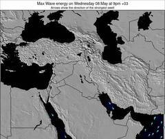
Voorspelde Golfenergie (Kracht): 12 uur

Danger Surf:
Friday, 24 July 2026, 07:10 Local time| Friday 24 | ||||
| 6AM | 9AM | 12PM | 3PM | |
| Wave (m) | ||||
| Periode (s) | 7 | 6 | 6 | 6 |
| Wind (km/h) | ||||
| Wind | cross | cross- on |
cross- on |
cross- on |
- /breaks/Danger/forecasts/latest
Danger Surf Guide
Danger in Tel Aviv and South is an exposed breakwater break that only works once in a while. Winter is the favoured time of year for surfing here. Offshore winds are from the east southeast with some shelter here from south southwest winds. The ideal swell direction from the west southwest. The breakwater breaks offer lefts and rights. The quality of the surf isn't affected by the tide. Likely to be crowded if working. Beware of Pollution, crowds.
Danger Spot Info
Type: Rating: Reliability: Todays Sea Temp*:  Breakwater
 3
3inconsistent 28.8°C*ocean temperature recorded from satelliteSurfing Danger:
The best conditions reported for surf at Danger occur when a West-southwest swell combines with an offshore wind direction from the East-southeast.
Voorspelde Golfenergie (Kracht): 12 uur
Gebruik de tabbladen hierboven om de zeewatertemperatuur bij Danger te bekijken, foto's van Danger, Danger gedetailleerde golfvoorspellingen, wind- en weersvoorspellingen, Danger webcams, actuele wind in Tel Aviv and South live weerstations en Danger getijdenvoorspellingen. De link van Israel golfkaarten opent een grote afbeelding van Israel en de omliggende zeeën. Deze golfkaarten kunnen worden dynamisch gemaakt worden met de verschillende golfcomponenten, golfenergie, golfperiode, golfhoogte, samen met de wind en weersvoorspellingen, het actuele weer en de zeetoestand volgens golfboeien uit Israel, langskomende schepen en weerstations op de kust. Elk voorspelling pagina's voor dit surfstrand zijn voorzien van een wereldwijde en regionale golfzoeker om de beste surfsomstandigheden in het gebied rond Danger te vinden.
Danger Surf:
Friday, 24 July 2026, 07:10 Local timeFriday 24 6AM 9AM 12PM 3PM Wave (m) Periode (s) 7 6 6 6 Wind (km/h) Wind cross cross-
oncross-
oncross-
on- /breaks/Danger/forecasts/latest
- /breaks/Danger/forecasts/latest/six_day
Danger Surf Guide
Danger in Tel Aviv and South is an exposed breakwater break that only works once in a while. Winter is the favoured time of year for surfing here. Offshore winds are from the east southeast with some shelter here from south southwest winds. The ideal swell direction from the west southwest. The breakwater breaks offer lefts and rights. The quality of the surf isn't affected by the tide. Likely to be crowded if working. Beware of Pollution, crowds.
Danger Spot Info
Type: Rating: Reliability: Todays Sea Temp*: Breakwater3inconsistent 28.8°C*ocean temperature recorded from satelliteSurfing Danger:
The best conditions reported for surf at Danger occur when a West-southwest swell combines with an offshore wind direction from the East-southeast.
Voorspelde Golfenergie (Kracht): 12 uur
Gebruik de tabbladen hierboven om de zeewatertemperatuur bij Danger te bekijken, foto's van Danger, Danger gedetailleerde golfvoorspellingen, wind- en weersvoorspellingen, Danger webcams, actuele wind in Tel Aviv and South live weerstations en Danger getijdenvoorspellingen. De link van Israel golfkaarten opent een grote afbeelding van Israel en de omliggende zeeën. Deze golfkaarten kunnen worden dynamisch gemaakt worden met de verschillende golfcomponenten, golfenergie, golfperiode, golfhoogte, samen met de wind en weersvoorspellingen, het actuele weer en de zeetoestand volgens golfboeien uit Israel, langskomende schepen en weerstations op de kust. Elk voorspelling pagina's voor dit surfstrand zijn voorzien van een wereldwijde en regionale golfzoeker om de beste surfsomstandigheden in het gebied rond Danger te vinden.
Danger Surf:
Friday, 24 July 2026, 07:10 Local timeFriday 24 6AM 9AM 12PM 3PM Wave (m) Periode (s) 7 6 6 6 Wind (km/h) Wind cross cross-
oncross-
oncross-
on- /breaks/Danger/forecasts/latest
Danger Surf Guide
Danger in Tel Aviv and South is an exposed breakwater break that only works once in a while. Winter is the favoured time of year for surfing here. Offshore winds are from the east southeast with some shelter here from south southwest winds. The ideal swell direction from the west southwest. The breakwater breaks offer lefts and rights. The quality of the surf isn't affected by the tide. Likely to be crowded if working. Beware of Pollution, crowds.
Danger Spot Info
Type: Rating: Reliability: Todays Sea Temp*: Breakwater3inconsistent 28.8°C*ocean temperature recorded from satelliteSurfing Danger:
The best conditions reported for surf at Danger occur when a West-southwest swell combines with an offshore wind direction from the East-southeast.
Voorspelde Golfenergie (Kracht): 12 uur
Gebruik de tabbladen hierboven om de zeewatertemperatuur bij Danger te bekijken, foto's van Danger, Danger gedetailleerde golfvoorspellingen, wind- en weersvoorspellingen, Danger webcams, actuele wind in Tel Aviv and South live weerstations en Danger getijdenvoorspellingen. De link van Israel golfkaarten opent een grote afbeelding van Israel en de omliggende zeeën. Deze golfkaarten kunnen worden dynamisch gemaakt worden met de verschillende golfcomponenten, golfenergie, golfperiode, golfhoogte, samen met de wind en weersvoorspellingen, het actuele weer en de zeetoestand volgens golfboeien uit Israel, langskomende schepen en weerstations op de kust. Elk voorspelling pagina's voor dit surfstrand zijn voorzien van een wereldwijde en regionale golfzoeker om de beste surfsomstandigheden in het gebied rond Danger te vinden.
Danger Surf:
Friday, 24 July 2026, 07:10 Local timeFriday 24 6AM 9AM 12PM 3PM Wave (m) Periode (s) 7 6 6 6 Wind (km/h) Wind cross cross-
oncross-
oncross-
onTide Times:
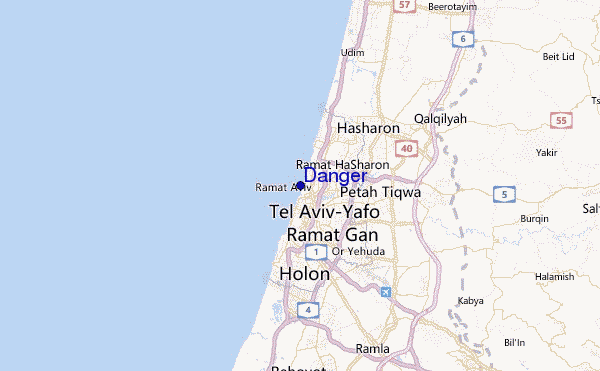
Voor Tel Aviv-Yafo, %{dist} %{km} van %{location}.
VOLGENDE IS OM (lokale tijd) resterende tijd hoog water laag water Danger Tide Times and Tide Chart
Live Weather:
At Marina Herzlia, 6 km from Danger.
light winds from the SSE
(km/h)Air temperature
27.2°Csurffoto's uit
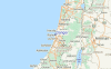
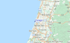
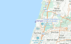
de galerijContourlijnen: Wegen & Rivieren: Kies een surflokatie uit het menu 
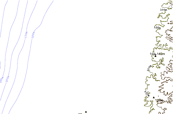
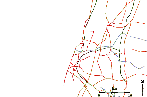
Gebruik deze reliëfkaart om naar de surfspots en de getijdenstations van Tel Aviv and South toe te gaan, in de buurt van Danger.
Andere Dichtbijzijnde Surflocaties van Danger:
(klik op locatienaam voor meer informatie)- Closest Locatie1 mi
- Second closest Locatie1 mi
- Third closest Locatie1 mi
- Fourth closest Locatie1 mi
- Fifth closest Locatie1 mi
Dichtstbijzijnde golfboeien bij Danger:
- Closest golfboei1658 mi
- Second closest golfboei1784 mi
- Third closest golfboei2120 mi
- Fourth closest golfboei2124 mi
- Fifth closest golfboei2139 mi
Getijdenstations in de buurt van Danger:
- Closest getijdenstationTel Aviv-Yafo2 mi
- Second closest getijdenstationRamat Gan3 mi
- Third closest getijdenstationGiv`atayim4 mi
- Fourth closest getijdenstationYafo4 mi
- Fifth closest getijdenstationHerzliya5 mi
Airports
- The closest passenger airport to Danger is Sde Dov (Tel-aviv) Airport (SDV) in Israel, 1 km (1 miles) away (directly).
- The second nearest airport to Danger is Ben Gurion (Tel-aviv) Airport (TLV), also in Israel, 15 km (9 miles) away.
- Third is Jerusalem/atarot Airport (JRS) in Israel, 50 km (31 miles) away.
- Haifa Airport (HFA) in Israel is 82 km (51 miles) away.
- Teyman (Beer-sheba) Airport (BEV), also in Israel is the fifth nearest airport to Danger and is 92 km (57 miles) away.
- /breaks/Danger/forecasts/latest
 Nearest