

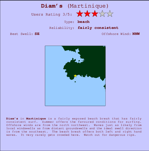
Diam's Surf Guide
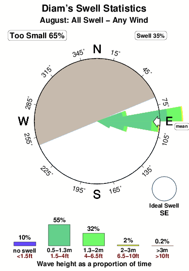
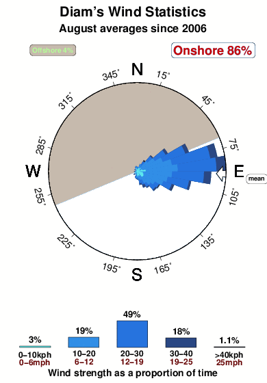
Diam's on the South Coast is a quite exposed beach break that has quite reliable surf. Summer offers the favoured conditions for surfing. Offshore winds blow from the north northwest. Tends to receive a mix of groundswells and windswells and the ideal swell angle is from the southeast. Waves at the beach are both lefts and rights. Relatively few surfers here, even on good days. Watch out for dangerous rips.
Diam's Spot Info
| Type: | Rating: | Reliability: | Todays Sea Temp*: |
|---|---|---|---|
| fairly consistent | 28.5°C*ocean temperature recorded from satellite |
Surfing Diam's:
The best conditions reported for surf at Diam's occur when a Southeast swell combines with an offshore wind direction from the North-northwest.

Voorspelde Golfenergie (Kracht): 12 uur


Diam's Surf:
Saturday, 1 August 2026, 16:07 Local time| Saturday 01 | Sun | |||
| 5PM | 8PM | 11PM | 2AM | |
| Wave (m) | ||||
| Periode (s) | 8 | 8 | 8 | 8 |
| Wind (km/h) | ||||
| Wind | cross | cross | cross | cross |
- /breaks/Diams/forecasts/latest
Diam's Surf Guide
Diam's on the South Coast is a quite exposed beach break that has quite reliable surf. Summer offers the favoured conditions for surfing. Offshore winds blow from the north northwest. Tends to receive a mix of groundswells and windswells and the ideal swell angle is from the southeast. Waves at the beach are both lefts and rights. Relatively few surfers here, even on good days. Watch out for dangerous rips.
Diam's Spot Info
Type: Rating: Reliability: Todays Sea Temp*:  Beach
Beach 3
3fairly consistent 28.5°C*ocean temperature recorded from satelliteSurfing Diam's:
The best conditions reported for surf at Diam's occur when a Southeast swell combines with an offshore wind direction from the North-northwest.
Voorspelde Golfenergie (Kracht): 12 uur
Gebruik de tabbladen hierboven om de zeewatertemperatuur bij Diam's te bekijken, foto's van Diam's, Diam's gedetailleerde golfvoorspellingen, wind- en weersvoorspellingen, Diam's webcams, actuele wind in Martinique live weerstations en Diam's getijdenvoorspellingen. De link van Martinique golfkaarten opent een grote afbeelding van Martinique en de omliggende zeeën. Deze golfkaarten kunnen worden dynamisch gemaakt worden met de verschillende golfcomponenten, golfenergie, golfperiode, golfhoogte, samen met de wind en weersvoorspellingen, het actuele weer en de zeetoestand volgens golfboeien uit Martinique, langskomende schepen en weerstations op de kust. Elk voorspelling pagina's voor dit surfstrand zijn voorzien van een wereldwijde en regionale golfzoeker om de beste surfsomstandigheden in het gebied rond Diam's te vinden.
Diam's Surf:
Saturday, 1 August 2026, 16:07 Local timeSaturday 01 Sun 5PM 8PM 11PM 2AM Wave (m) Periode (s) 8 8 8 8 Wind (km/h) Wind cross cross cross cross - /breaks/Diams/forecasts/latest
- /breaks/Diams/forecasts/latest/six_day
Diam's Surf Guide
Diam's on the South Coast is a quite exposed beach break that has quite reliable surf. Summer offers the favoured conditions for surfing. Offshore winds blow from the north northwest. Tends to receive a mix of groundswells and windswells and the ideal swell angle is from the southeast. Waves at the beach are both lefts and rights. Relatively few surfers here, even on good days. Watch out for dangerous rips.
Diam's Spot Info
Type: Rating: Reliability: Todays Sea Temp*: Beach3fairly consistent 28.5°C*ocean temperature recorded from satelliteSurfing Diam's:
The best conditions reported for surf at Diam's occur when a Southeast swell combines with an offshore wind direction from the North-northwest.
Voorspelde Golfenergie (Kracht): 12 uur
Gebruik de tabbladen hierboven om de zeewatertemperatuur bij Diam's te bekijken, foto's van Diam's, Diam's gedetailleerde golfvoorspellingen, wind- en weersvoorspellingen, Diam's webcams, actuele wind in Martinique live weerstations en Diam's getijdenvoorspellingen. De link van Martinique golfkaarten opent een grote afbeelding van Martinique en de omliggende zeeën. Deze golfkaarten kunnen worden dynamisch gemaakt worden met de verschillende golfcomponenten, golfenergie, golfperiode, golfhoogte, samen met de wind en weersvoorspellingen, het actuele weer en de zeetoestand volgens golfboeien uit Martinique, langskomende schepen en weerstations op de kust. Elk voorspelling pagina's voor dit surfstrand zijn voorzien van een wereldwijde en regionale golfzoeker om de beste surfsomstandigheden in het gebied rond Diam's te vinden.
Diam's Surf:
Saturday, 1 August 2026, 16:07 Local timeSaturday 01 Sun 5PM 8PM 11PM 2AM Wave (m) Periode (s) 8 8 8 8 Wind (km/h) Wind cross cross cross cross - /breaks/Diams/forecasts/latest
Diam's Surf Guide
Diam's on the South Coast is a quite exposed beach break that has quite reliable surf. Summer offers the favoured conditions for surfing. Offshore winds blow from the north northwest. Tends to receive a mix of groundswells and windswells and the ideal swell angle is from the southeast. Waves at the beach are both lefts and rights. Relatively few surfers here, even on good days. Watch out for dangerous rips.
Diam's Spot Info
Type: Rating: Reliability: Todays Sea Temp*: Beach3fairly consistent 28.5°C*ocean temperature recorded from satelliteSurfing Diam's:
The best conditions reported for surf at Diam's occur when a Southeast swell combines with an offshore wind direction from the North-northwest.
Voorspelde Golfenergie (Kracht): 12 uur
Gebruik de tabbladen hierboven om de zeewatertemperatuur bij Diam's te bekijken, foto's van Diam's, Diam's gedetailleerde golfvoorspellingen, wind- en weersvoorspellingen, Diam's webcams, actuele wind in Martinique live weerstations en Diam's getijdenvoorspellingen. De link van Martinique golfkaarten opent een grote afbeelding van Martinique en de omliggende zeeën. Deze golfkaarten kunnen worden dynamisch gemaakt worden met de verschillende golfcomponenten, golfenergie, golfperiode, golfhoogte, samen met de wind en weersvoorspellingen, het actuele weer en de zeetoestand volgens golfboeien uit Martinique, langskomende schepen en weerstations op de kust. Elk voorspelling pagina's voor dit surfstrand zijn voorzien van een wereldwijde en regionale golfzoeker om de beste surfsomstandigheden in het gebied rond Diam's te vinden.
Diam's Surf:
Saturday, 1 August 2026, 16:07 Local timeSaturday 01 Sun 5PM 8PM 11PM 2AM Wave (m) Periode (s) 8 8 8 8 Wind (km/h) Wind cross cross cross cross Tide Times:
Voor Les Trois-Ilets, %{dist} %{km} van %{location}.
VOLGENDE IS OM (lokale tijd) resterende tijd hoog water laag water Diam's Tide Times and Tide Chart
Live Weather:
At Lamentin -Aero, 15 km from Diam's.
wind obs. (14 kph from 160 degs) was rejected
(km/h)
no reportAir temperature
27.1°COverall Diam's Surf Consistency and Wind Distribution in August
surffoto's uit
de galerijContourlijnen: Wegen & Rivieren: Kies een surflokatie uit het menu 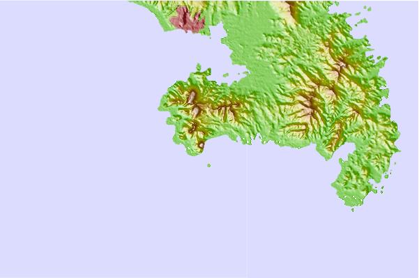
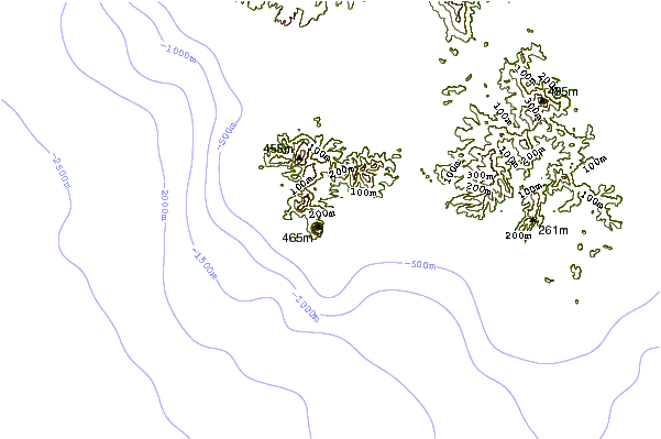
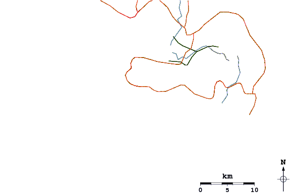
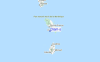
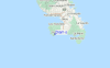
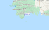
Gebruik deze reliëfkaart om naar de surfspots en de getijdenstations van Martinique toe te gaan, in de buurt van Diam's.
Andere Dichtbijzijnde Surflocaties van Diam's:
(klik op locatienaam voor meer informatie)- Closest Locatie1 mi
- Second closest Locatie14 mi
- Third closest Locatie22 mi
- Fourth closest Locatie22 mi
- Fifth closest Locatie23 mi
Dichtstbijzijnde golfboeien bij Diam's:
- Closest golfboei216 mi
- Second closest golfboei324 mi
- Third closest golfboei359 mi
- Fourth closest golfboei393 mi
- Fifth closest golfboei433 mi
Getijdenstations in de buurt van Diam's:
- Closest getijdenstationLes Trois-Ilets4 mi
- Second closest getijdenstationFort de France8 mi
- Third closest getijdenstationDucos8 mi
- Fourth closest getijdenstationLe Lamentin9 mi
- Fifth closest getijdenstationRiviere-Pilote10 mi
Airports
- The closest passenger airport to Diam's is Le Lamentin (Fort-de-france) Airport (FDF) in Antilles, 14 km (9 miles) away (directly).
- The second nearest airport to Diam's is George F L Charles (Castries) Airport (SLU) in St. Lucia Island, 50 km (31 miles) away.
- Third is Hewanorra International (Hewandorra) Airport (UVF) in St. Lucia Island, 83 km (52 miles) away.
- Canefield Airport (DCF) in Dominica is 103 km (64 miles) away.
- Melville Hall (Dominica) Airport (DOM), also in Dominica is the fifth nearest airport to Diam's and is 123 km (76 miles) away.
- /breaks/Diams/forecasts/latest


 Nearest