
Dom Hue Surf Guide
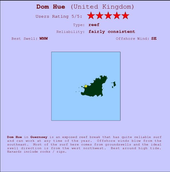
Dom Hue in Guernsey is an exposed reef break that has quite consistent surf and can work at any time of the year. Works best in offshore winds from the southeast. Most of the surf here comes from groundswells and the ideal swell direction is from the west northwest.. Best around high tide. Beware of rocks / rips.
Dom Hue Spot Info
| Type: | Rating: | Reliability: | Todays Sea Temp*: |
|---|---|---|---|
| fairly consistent | 17.3°C*ocean temperature recorded from satellite |
Surfing Dom Hue:
The best conditions reported for surf at Dom Hue occur when a West-northwest swell combines with an offshore wind direction from the Southeast.
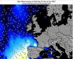
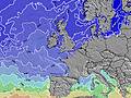
Voorspelde Golfenergie (Kracht): 12 uur


Dom Hue Surf:
Thursday, 16 July 2026, 06:46 Local time| Wed | Thursday 16 | |||
| 10PM | 1AM | 4AM | 7AM | |
| Wave (m) | ||||
| Periode (s) | 9 | 9 | 9 | 9 |
| Wind (km/h) | ||||
| Wind | cross- off |
cross- off |
cross | cross |
- /breaks/Dom-Hue/forecasts/latest
Dom Hue Surf Guide
Dom Hue in Guernsey is an exposed reef break that has quite consistent surf and can work at any time of the year. Works best in offshore winds from the southeast. Most of the surf here comes from groundswells and the ideal swell direction is from the west northwest.. Best around high tide. Beware of rocks / rips.
Dom Hue Spot Info
Type: Rating: Reliability: Todays Sea Temp*:  Reef
Reef 5
5fairly consistent 17.3°C*ocean temperature recorded from satelliteSurfing Dom Hue:
The best conditions reported for surf at Dom Hue occur when a West-northwest swell combines with an offshore wind direction from the Southeast.
Voorspelde Golfenergie (Kracht): 12 uur
Gebruik de tabbladen hierboven om de zeewatertemperatuur bij Dom Hue te bekijken, foto's van Dom Hue, Dom Hue gedetailleerde golfvoorspellingen, wind- en weersvoorspellingen, Dom Hue webcams, actuele wind in Guernsey live weerstations en Dom Hue getijdenvoorspellingen. De link van United Kingdom golfkaarten opent een grote afbeelding van United Kingdom en de omliggende zeeën. Deze golfkaarten kunnen worden dynamisch gemaakt worden met de verschillende golfcomponenten, golfenergie, golfperiode, golfhoogte, samen met de wind en weersvoorspellingen, het actuele weer en de zeetoestand volgens golfboeien uit United Kingdom, langskomende schepen en weerstations op de kust. Elk voorspelling pagina's voor dit surfstrand zijn voorzien van een wereldwijde en regionale golfzoeker om de beste surfsomstandigheden in het gebied rond Dom Hue te vinden.
Dom Hue Surf:
Thursday, 16 July 2026, 06:46 Local timeWed Thursday 16 10PM 1AM 4AM 7AM Wave (m) Periode (s) 9 9 9 9 Wind (km/h) Wind cross-
offcross-
offcross cross - /breaks/Dom-Hue/forecasts/latest
- /breaks/Dom-Hue/forecasts/latest/six_day
Dom Hue Surf Guide
Dom Hue in Guernsey is an exposed reef break that has quite consistent surf and can work at any time of the year. Works best in offshore winds from the southeast. Most of the surf here comes from groundswells and the ideal swell direction is from the west northwest.. Best around high tide. Beware of rocks / rips.
Dom Hue Spot Info
Type: Rating: Reliability: Todays Sea Temp*: Reef5fairly consistent 17.3°C*ocean temperature recorded from satelliteSurfing Dom Hue:
The best conditions reported for surf at Dom Hue occur when a West-northwest swell combines with an offshore wind direction from the Southeast.
Voorspelde Golfenergie (Kracht): 12 uur
Gebruik de tabbladen hierboven om de zeewatertemperatuur bij Dom Hue te bekijken, foto's van Dom Hue, Dom Hue gedetailleerde golfvoorspellingen, wind- en weersvoorspellingen, Dom Hue webcams, actuele wind in Guernsey live weerstations en Dom Hue getijdenvoorspellingen. De link van United Kingdom golfkaarten opent een grote afbeelding van United Kingdom en de omliggende zeeën. Deze golfkaarten kunnen worden dynamisch gemaakt worden met de verschillende golfcomponenten, golfenergie, golfperiode, golfhoogte, samen met de wind en weersvoorspellingen, het actuele weer en de zeetoestand volgens golfboeien uit United Kingdom, langskomende schepen en weerstations op de kust. Elk voorspelling pagina's voor dit surfstrand zijn voorzien van een wereldwijde en regionale golfzoeker om de beste surfsomstandigheden in het gebied rond Dom Hue te vinden.
Dom Hue Surf:
Thursday, 16 July 2026, 06:46 Local timeWed Thursday 16 10PM 1AM 4AM 7AM Wave (m) Periode (s) 9 9 9 9 Wind (km/h) Wind cross-
offcross-
offcross cross - /breaks/Dom-Hue/forecasts/latest
Dom Hue Surf Guide
Dom Hue in Guernsey is an exposed reef break that has quite consistent surf and can work at any time of the year. Works best in offshore winds from the southeast. Most of the surf here comes from groundswells and the ideal swell direction is from the west northwest.. Best around high tide. Beware of rocks / rips.
Dom Hue Spot Info
Type: Rating: Reliability: Todays Sea Temp*: Reef5fairly consistent 17.3°C*ocean temperature recorded from satelliteSurfing Dom Hue:
The best conditions reported for surf at Dom Hue occur when a West-northwest swell combines with an offshore wind direction from the Southeast.
Voorspelde Golfenergie (Kracht): 12 uur
Gebruik de tabbladen hierboven om de zeewatertemperatuur bij Dom Hue te bekijken, foto's van Dom Hue, Dom Hue gedetailleerde golfvoorspellingen, wind- en weersvoorspellingen, Dom Hue webcams, actuele wind in Guernsey live weerstations en Dom Hue getijdenvoorspellingen. De link van United Kingdom golfkaarten opent een grote afbeelding van United Kingdom en de omliggende zeeën. Deze golfkaarten kunnen worden dynamisch gemaakt worden met de verschillende golfcomponenten, golfenergie, golfperiode, golfhoogte, samen met de wind en weersvoorspellingen, het actuele weer en de zeetoestand volgens golfboeien uit United Kingdom, langskomende schepen en weerstations op de kust. Elk voorspelling pagina's voor dit surfstrand zijn voorzien van een wereldwijde en regionale golfzoeker om de beste surfsomstandigheden in het gebied rond Dom Hue te vinden.
Dom Hue Surf:
Thursday, 16 July 2026, 06:46 Local timeWed Thursday 16 10PM 1AM 4AM 7AM Wave (m) Periode (s) 9 9 9 9 Wind (km/h) Wind cross-
offcross-
offcross cross Tide Times:
Voor Saint Peter Port, %{dist} %{km} van %{location}.
VOLGENDE IS OM (lokale tijd) resterende tijd hoog water laag water Dom Hue Tide Times and Tide Chart
Live Weather:
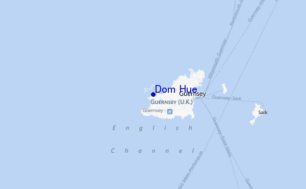
At Guernsey Airport, 6 km from Dom Hue.
moderate winds from the NE
(km/h)Air temperature
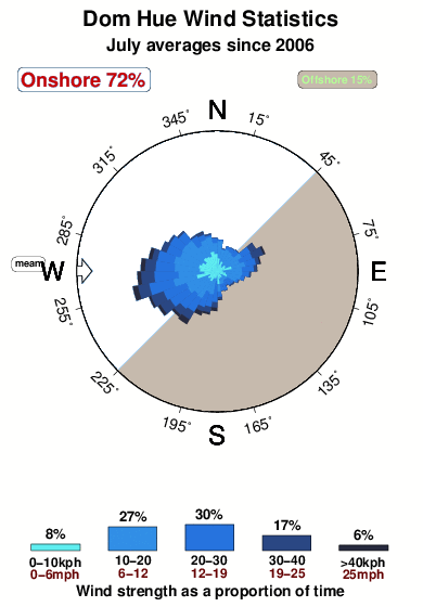
Q1018°COverall Dom Hue Surf Consistency and Wind Distribution in July
surffoto's uit
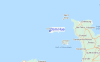
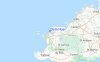
de galerijContourlijnen: Wegen & Rivieren: Kies een surflokatie uit het menu 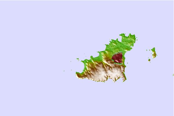
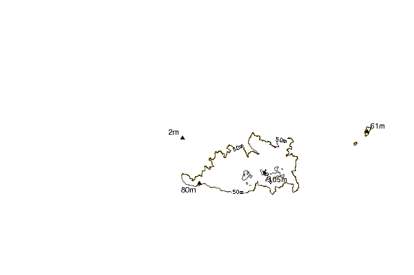
Gebruik deze reliëfkaart om naar de surfspots en de getijdenstations van Guernsey toe te gaan, in de buurt van Dom Hue.
Andere Dichtbijzijnde Surflocaties van Dom Hue:
(klik op locatienaam voor meer informatie)- Closest Locatie1 mi
- Second closest Locatie1 mi
- Third closest Locatie1 mi
- Fourth closest Locatie1 mi
- Fifth closest Locatie2 mi
Dichtstbijzijnde golfboeien bij Dom Hue:
- Closest golfboei32 mi
- Second closest golfboei72 mi
- Third closest golfboei78 mi
- Fourth closest golfboei80 mi
- Fifth closest golfboei81 mi
Getijdenstations in de buurt van Dom Hue:
- Closest getijdenstationSaint Peter Port5 mi
- Second closest getijdenstationSaint Helier, Jersey, Channel Islands30 mi
- Third closest getijdenstationLes Heaux de Brehat43 mi
- Fourth closest getijdenstationQuerqueville45 mi
- Fifth closest getijdenstationOcteville46 mi
Airports
- The closest passenger airport to Dom Hue is Guernsey Airport (GCI) in Guernsey Isld., 4 km (2 miles) away (directly).
- The second nearest airport to Dom Hue is Jersey Airport (JER) in England, 43 km (27 miles) away.
- Third is Maupertus (Cherbourg) Airport (CER) in France, 87 km (54 miles) away.
- Lannion Airport (LAI) in France is 99 km (61 miles) away.
- Armor (St.-brieuc Armor) Airport (SBK), also in France is the fifth nearest airport to Dom Hue and is 104 km (65 miles) away.
- /breaks/Dom-Hue/forecasts/latest


 Nearest