
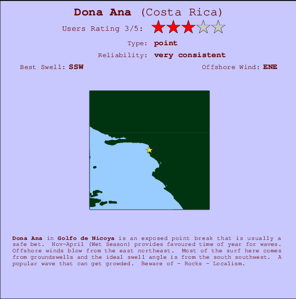
Dona Ana Surf Guide
Dona Ana in Golfo de Nicoya is an exposed point break that has very reliable surf. Nov-April (Wet Season) provides optimum time of year for waves. Works best in offshore winds from the east northeast. Clean groundswells prevail and the ideal swell angle is from the south southwest. Often Crowded. Watch out for - Rocks - Localism.
Dona Ana Spot Info
| Type: | Rating: | Reliability: | Todays Sea Temp*: |
|---|---|---|---|
| very consistent | 30.2°C*ocean temperature recorded from satellite |
Surfing Dona Ana:
The best conditions reported for surf at Dona Ana occur when a South-southwest swell combines with an offshore wind direction from the East-northeast.

Voorspelde Golfenergie (Kracht): 12 uur


Dona Ana Surf:
Saturday, 18 July 2026, 04:22 Local time| Saturday 18 | ||||
| 3AM | 6AM | 9AM | 12PM | |
| Wave (m) | ||||
| Periode (s) | 13 | 13 | 13 | 12 |
| Wind (km/h) | ||||
| Wind | cross- off |
cross- off |
cross | cross |
- /breaks/Dona-Ana/forecasts/latest
Dona Ana Surf Guide
Dona Ana in Golfo de Nicoya is an exposed point break that has very reliable surf. Nov-April (Wet Season) provides optimum time of year for waves. Works best in offshore winds from the east northeast. Clean groundswells prevail and the ideal swell angle is from the south southwest. Often Crowded. Watch out for - Rocks - Localism.
Dona Ana Spot Info
Type: Rating: Reliability: Todays Sea Temp*:  Point
Point 3
3very consistent 30.2°C*ocean temperature recorded from satelliteSurfing Dona Ana:
The best conditions reported for surf at Dona Ana occur when a South-southwest swell combines with an offshore wind direction from the East-northeast.
Voorspelde Golfenergie (Kracht): 12 uur
Gebruik de tabbladen hierboven om de zeewatertemperatuur bij Dona Ana te bekijken, foto's van Dona Ana, Dona Ana gedetailleerde golfvoorspellingen, wind- en weersvoorspellingen, Dona Ana webcams, actuele wind in Golfo de Nicoya live weerstations en Dona Ana getijdenvoorspellingen. De link van Costa Rica golfkaarten opent een grote afbeelding van Costa Rica en de omliggende zeeën. Deze golfkaarten kunnen worden dynamisch gemaakt worden met de verschillende golfcomponenten, golfenergie, golfperiode, golfhoogte, samen met de wind en weersvoorspellingen, het actuele weer en de zeetoestand volgens golfboeien uit Costa Rica, langskomende schepen en weerstations op de kust. Elk voorspelling pagina's voor dit surfstrand zijn voorzien van een wereldwijde en regionale golfzoeker om de beste surfsomstandigheden in het gebied rond Dona Ana te vinden.
Dona Ana Surf:
Saturday, 18 July 2026, 04:22 Local timeSaturday 18 3AM 6AM 9AM 12PM Wave (m) Periode (s) 13 13 13 12 Wind (km/h) Wind cross-
offcross-
offcross cross - /breaks/Dona-Ana/forecasts/latest
- /breaks/Dona-Ana/forecasts/latest/six_day
Dona Ana Surf Guide
Dona Ana in Golfo de Nicoya is an exposed point break that has very reliable surf. Nov-April (Wet Season) provides optimum time of year for waves. Works best in offshore winds from the east northeast. Clean groundswells prevail and the ideal swell angle is from the south southwest. Often Crowded. Watch out for - Rocks - Localism.
Dona Ana Spot Info
Type: Rating: Reliability: Todays Sea Temp*: Point3very consistent 30.2°C*ocean temperature recorded from satelliteSurfing Dona Ana:
The best conditions reported for surf at Dona Ana occur when a South-southwest swell combines with an offshore wind direction from the East-northeast.
Voorspelde Golfenergie (Kracht): 12 uur
Gebruik de tabbladen hierboven om de zeewatertemperatuur bij Dona Ana te bekijken, foto's van Dona Ana, Dona Ana gedetailleerde golfvoorspellingen, wind- en weersvoorspellingen, Dona Ana webcams, actuele wind in Golfo de Nicoya live weerstations en Dona Ana getijdenvoorspellingen. De link van Costa Rica golfkaarten opent een grote afbeelding van Costa Rica en de omliggende zeeën. Deze golfkaarten kunnen worden dynamisch gemaakt worden met de verschillende golfcomponenten, golfenergie, golfperiode, golfhoogte, samen met de wind en weersvoorspellingen, het actuele weer en de zeetoestand volgens golfboeien uit Costa Rica, langskomende schepen en weerstations op de kust. Elk voorspelling pagina's voor dit surfstrand zijn voorzien van een wereldwijde en regionale golfzoeker om de beste surfsomstandigheden in het gebied rond Dona Ana te vinden.
Dona Ana Surf:
Saturday, 18 July 2026, 04:22 Local timeSaturday 18 3AM 6AM 9AM 12PM Wave (m) Periode (s) 13 13 13 12 Wind (km/h) Wind cross-
offcross-
offcross cross - /breaks/Dona-Ana/forecasts/latest
Dona Ana Surf Guide
Dona Ana in Golfo de Nicoya is an exposed point break that has very reliable surf. Nov-April (Wet Season) provides optimum time of year for waves. Works best in offshore winds from the east northeast. Clean groundswells prevail and the ideal swell angle is from the south southwest. Often Crowded. Watch out for - Rocks - Localism.
Dona Ana Spot Info
Type: Rating: Reliability: Todays Sea Temp*: Point3very consistent 30.2°C*ocean temperature recorded from satelliteSurfing Dona Ana:
The best conditions reported for surf at Dona Ana occur when a South-southwest swell combines with an offshore wind direction from the East-northeast.
Voorspelde Golfenergie (Kracht): 12 uur
Gebruik de tabbladen hierboven om de zeewatertemperatuur bij Dona Ana te bekijken, foto's van Dona Ana, Dona Ana gedetailleerde golfvoorspellingen, wind- en weersvoorspellingen, Dona Ana webcams, actuele wind in Golfo de Nicoya live weerstations en Dona Ana getijdenvoorspellingen. De link van Costa Rica golfkaarten opent een grote afbeelding van Costa Rica en de omliggende zeeën. Deze golfkaarten kunnen worden dynamisch gemaakt worden met de verschillende golfcomponenten, golfenergie, golfperiode, golfhoogte, samen met de wind en weersvoorspellingen, het actuele weer en de zeetoestand volgens golfboeien uit Costa Rica, langskomende schepen en weerstations op de kust. Elk voorspelling pagina's voor dit surfstrand zijn voorzien van een wereldwijde en regionale golfzoeker om de beste surfsomstandigheden in het gebied rond Dona Ana te vinden.
Dona Ana Surf:
Saturday, 18 July 2026, 04:22 Local timeSaturday 18 3AM 6AM 9AM 12PM Wave (m) Periode (s) 13 13 13 12 Wind (km/h) Wind cross-
offcross-
offcross cross Tide Times:
Voor Chacarita, %{dist} %{km} van %{location}.
VOLGENDE IS OM (lokale tijd) resterende tijd hoog water laag water Dona Ana Tide Times and Tide Chart
Live Weather:
At lightning 7km SW of Jaco, 43 km from Dona Ana.

ThunderstormAir temperature
°COverall Dona Ana Surf Consistency and Wind Distribution in July
surffoto's uit
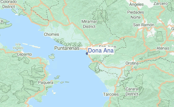
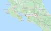
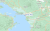
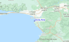
de galerijContourlijnen: Wegen & Rivieren: Kies een surflokatie uit het menu 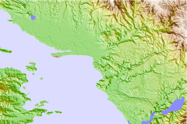
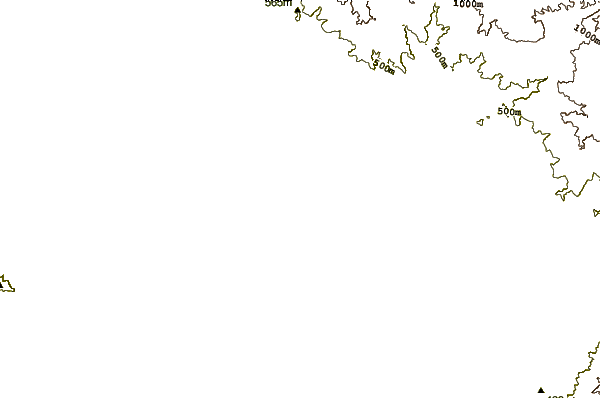
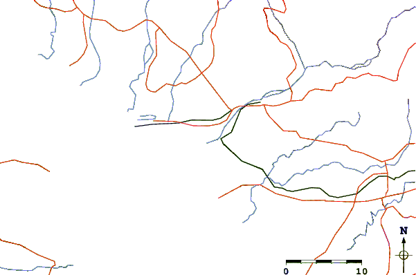
Gebruik deze reliëfkaart om naar de surfspots en de getijdenstations van Golfo de Nicoya toe te gaan, in de buurt van Dona Ana.
Andere Dichtbijzijnde Surflocaties van Dona Ana:
(klik op locatienaam voor meer informatie)- Closest Locatie0 mi
- Second closest Locatie1 mi
- Third closest Locatie2 mi
- Fourth closest Locatie3 mi
- Fifth closest Locatie4 mi
Dichtstbijzijnde golfboeien bij Dona Ana:
- Closest golfboei523 mi
- Second closest golfboei686 mi
- Third closest golfboei1037 mi
- Fourth closest golfboei1091 mi
- Fifth closest golfboei1108 mi
Getijdenstations in de buurt van Dona Ana:
- Closest getijdenstationChacarita4 mi
- Second closest getijdenstationPunta Arenas6 mi
- Third closest getijdenstationSan Juan del Norte (Greytown)97 mi
- Fourth closest getijdenstationLimon116 mi
- Fifth closest getijdenstationSan Juan del Sur117 mi
Airports
- The closest passenger airport to Dona Ana is Juan Santamaria International Airport (SJO) in Costa Rica, 58 km (36 miles) away (directly).
- The second nearest airport to Dona Ana is Quepos Managua Airport (XQP), also in Costa Rica, 88 km (55 miles) away.
- Third is Nosara Airport (NOB) in Costa Rica, 100 km (62 miles) away.
- Daniel Oduber Quiros International (Liberia) Airport (LIR) in Costa Rica is 113 km (70 miles) away.
- Palmar Sur Airport (PMZ), also in Costa Rica is the fifth nearest airport to Dona Ana and is 179 km (111 miles) away.
- /breaks/Dona-Ana/forecasts/latest


 Nearest