
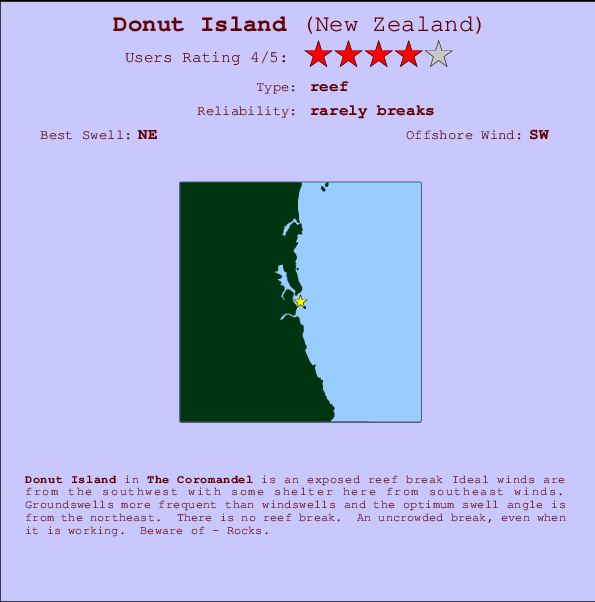
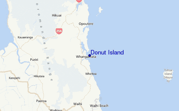
Donut Island Surf Guide
Donut Island in The Coromandel is an exposed reef break Offshore winds blow from the southwest with some shelter here from southeast winds. Most of the surf here comes from groundswells and the ideal swell direction is from the northeast. There is no reef break. The location means that it never gets crowded. Take care of - Rocks.
Donut Island Spot Info
| Type: | Rating: | Reliability: | Todays Sea Temp*: |
|---|---|---|---|
| rarely breaks | 15.2°C*ocean temperature recorded from satellite |
Surfing Donut Island:
The best conditions reported for surf at Donut Island occur when a Northeast swell combines with an offshore wind direction from the Southwest.

Voorspelde Golfenergie (Kracht): 12 uur


Donut Island Surf:
Thursday, 16 July 2026, 06:05 Local time| Thursday 16 | ||||
| 3AM | 6AM | 9AM | 12PM | |
| Wave (m) | ||||
| Periode (s) | 11 | 11 | 13 | 12 |
| Wind (km/h) | ||||
| Wind | cross- off |
cross- off |
cross- off |
cross- off |
- /breaks/Donut-Island/forecasts/latest
Donut Island Surf Guide
Donut Island in The Coromandel is an exposed reef break Offshore winds blow from the southwest with some shelter here from southeast winds. Most of the surf here comes from groundswells and the ideal swell direction is from the northeast. There is no reef break. The location means that it never gets crowded. Take care of - Rocks.
Donut Island Spot Info
Type: Rating: Reliability: Todays Sea Temp*:  Reef
Reef 4
4rarely breaks 15.2°C*ocean temperature recorded from satelliteSurfing Donut Island:
The best conditions reported for surf at Donut Island occur when a Northeast swell combines with an offshore wind direction from the Southwest.
Voorspelde Golfenergie (Kracht): 12 uur
Gebruik de tabbladen hierboven om de zeewatertemperatuur bij Donut Island te bekijken, foto's van Donut Island, Donut Island gedetailleerde golfvoorspellingen, wind- en weersvoorspellingen, Donut Island webcams, actuele wind in Coromandel live weerstations en Donut Island getijdenvoorspellingen. De link van New Zealand golfkaarten opent een grote afbeelding van New Zealand en de omliggende zeeën. Deze golfkaarten kunnen worden dynamisch gemaakt worden met de verschillende golfcomponenten, golfenergie, golfperiode, golfhoogte, samen met de wind en weersvoorspellingen, het actuele weer en de zeetoestand volgens golfboeien uit New Zealand, langskomende schepen en weerstations op de kust. Elk voorspelling pagina's voor dit surfstrand zijn voorzien van een wereldwijde en regionale golfzoeker om de beste surfsomstandigheden in het gebied rond Donut Island te vinden.
Donut Island Surf:
Thursday, 16 July 2026, 06:05 Local timeThursday 16 3AM 6AM 9AM 12PM Wave (m) Periode (s) 11 11 13 12 Wind (km/h) Wind cross-
offcross-
offcross-
offcross-
off- /breaks/Donut-Island/forecasts/latest
- /breaks/Donut-Island/forecasts/latest/six_day
Donut Island Surf Guide
Donut Island in The Coromandel is an exposed reef break Offshore winds blow from the southwest with some shelter here from southeast winds. Most of the surf here comes from groundswells and the ideal swell direction is from the northeast. There is no reef break. The location means that it never gets crowded. Take care of - Rocks.
Donut Island Spot Info
Type: Rating: Reliability: Todays Sea Temp*: Reef4rarely breaks 15.2°C*ocean temperature recorded from satelliteSurfing Donut Island:
The best conditions reported for surf at Donut Island occur when a Northeast swell combines with an offshore wind direction from the Southwest.
Voorspelde Golfenergie (Kracht): 12 uur
Gebruik de tabbladen hierboven om de zeewatertemperatuur bij Donut Island te bekijken, foto's van Donut Island, Donut Island gedetailleerde golfvoorspellingen, wind- en weersvoorspellingen, Donut Island webcams, actuele wind in Coromandel live weerstations en Donut Island getijdenvoorspellingen. De link van New Zealand golfkaarten opent een grote afbeelding van New Zealand en de omliggende zeeën. Deze golfkaarten kunnen worden dynamisch gemaakt worden met de verschillende golfcomponenten, golfenergie, golfperiode, golfhoogte, samen met de wind en weersvoorspellingen, het actuele weer en de zeetoestand volgens golfboeien uit New Zealand, langskomende schepen en weerstations op de kust. Elk voorspelling pagina's voor dit surfstrand zijn voorzien van een wereldwijde en regionale golfzoeker om de beste surfsomstandigheden in het gebied rond Donut Island te vinden.
Donut Island Surf:
Thursday, 16 July 2026, 06:05 Local timeThursday 16 3AM 6AM 9AM 12PM Wave (m) Periode (s) 11 11 13 12 Wind (km/h) Wind cross-
offcross-
offcross-
offcross-
off- /breaks/Donut-Island/forecasts/latest
Donut Island Surf Guide
Donut Island in The Coromandel is an exposed reef break Offshore winds blow from the southwest with some shelter here from southeast winds. Most of the surf here comes from groundswells and the ideal swell direction is from the northeast. There is no reef break. The location means that it never gets crowded. Take care of - Rocks.
Donut Island Spot Info
Type: Rating: Reliability: Todays Sea Temp*: Reef4rarely breaks 15.2°C*ocean temperature recorded from satelliteSurfing Donut Island:
The best conditions reported for surf at Donut Island occur when a Northeast swell combines with an offshore wind direction from the Southwest.
Voorspelde Golfenergie (Kracht): 12 uur
Gebruik de tabbladen hierboven om de zeewatertemperatuur bij Donut Island te bekijken, foto's van Donut Island, Donut Island gedetailleerde golfvoorspellingen, wind- en weersvoorspellingen, Donut Island webcams, actuele wind in Coromandel live weerstations en Donut Island getijdenvoorspellingen. De link van New Zealand golfkaarten opent een grote afbeelding van New Zealand en de omliggende zeeën. Deze golfkaarten kunnen worden dynamisch gemaakt worden met de verschillende golfcomponenten, golfenergie, golfperiode, golfhoogte, samen met de wind en weersvoorspellingen, het actuele weer en de zeetoestand volgens golfboeien uit New Zealand, langskomende schepen en weerstations op de kust. Elk voorspelling pagina's voor dit surfstrand zijn voorzien van een wereldwijde en regionale golfzoeker om de beste surfsomstandigheden in het gebied rond Donut Island te vinden.
Donut Island Surf:
Thursday, 16 July 2026, 06:05 Local timeThursday 16 3AM 6AM 9AM 12PM Wave (m) Periode (s) 11 11 13 12 Wind (km/h) Wind cross-
offcross-
offcross-
offcross-
offTide Times:
Voor Clark Island, %{dist} %{km} van %{location}.
VOLGENDE IS OM (lokale tijd) resterende tijd hoog water laag water Donut Island Tide Times and Tide Chart
Live Weather:
At Whangamata 2, 10 km from Donut Island.
light winds from the W
(km/h)
DryAir temperature
11°COverall Donut Island Surf Consistency and Wind Distribution in July


Wind stats for Donut Island: see the variation in direction and stength by month.
surffoto's uit
de galerijContourlijnen: Wegen & Rivieren: Kies een surflokatie uit het menu 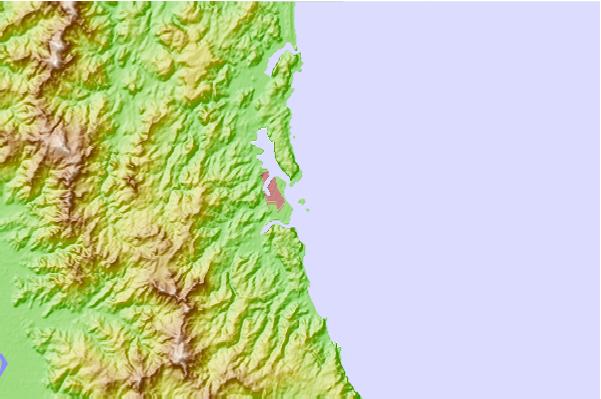
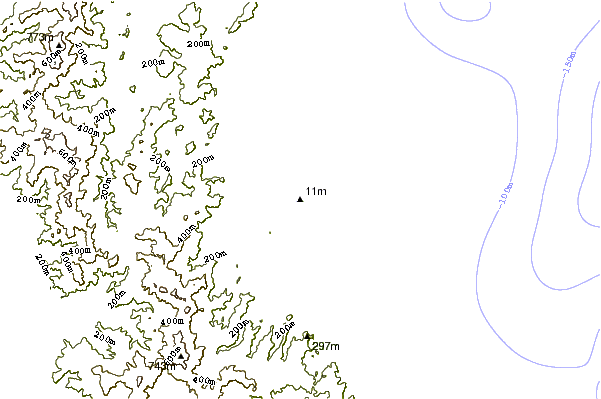
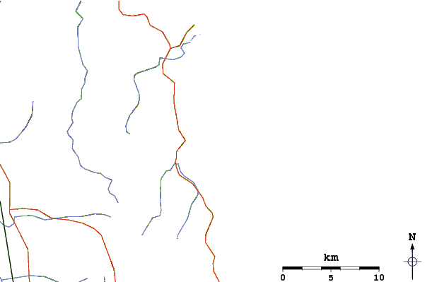
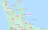
Gebruik deze reliëfkaart om naar de surfspots en de getijdenstations van Coromandel toe te gaan, in de buurt van Donut Island.
Andere Dichtbijzijnde Surflocaties van Donut Island:
(klik op locatienaam voor meer informatie)- Closest Locatie1 mi
- Second closest Locatie1 mi
- Third closest Locatie1 mi
- Fourth closest Locatie1 mi
- Fifth closest Locatie4 mi
Dichtstbijzijnde golfboeien bij Donut Island:
- Closest golfboei52 mi
- Second closest golfboei119 mi
- Third closest golfboei288 mi
- Fourth closest golfboei289 mi
- Fifth closest golfboei313 mi
Getijdenstations in de buurt van Donut Island:
- Closest getijdenstationSlipper Island12 mi
- Second closest getijdenstationTairua15 mi
- Third closest getijdenstationRocky Point (Thames)22 mi
- Fourth closest getijdenstationWhitianga29 mi
- Fifth closest getijdenstationTauranga34 mi
Airports
- The closest passenger airport to Donut Island is Tauranga Airport (TRG) in New Zealand, 57 km (35 miles) away (directly).
- The second nearest airport to Donut Island is Hamilton Airport (HLZ), also in New Zealand, 88 km (55 miles) away.
- Third is Auckland International Airport (AKL) in New Zealand, 100 km (62 miles) away.
- Rotorua Airport (ROT) in New Zealand is 106 km (66 miles) away.
- Whakatane Airport (WHK), also in New Zealand is the fifth nearest airport to Donut Island and is 119 km (74 miles) away.
- /breaks/Donut-Island/forecasts/latest

 Nearest