

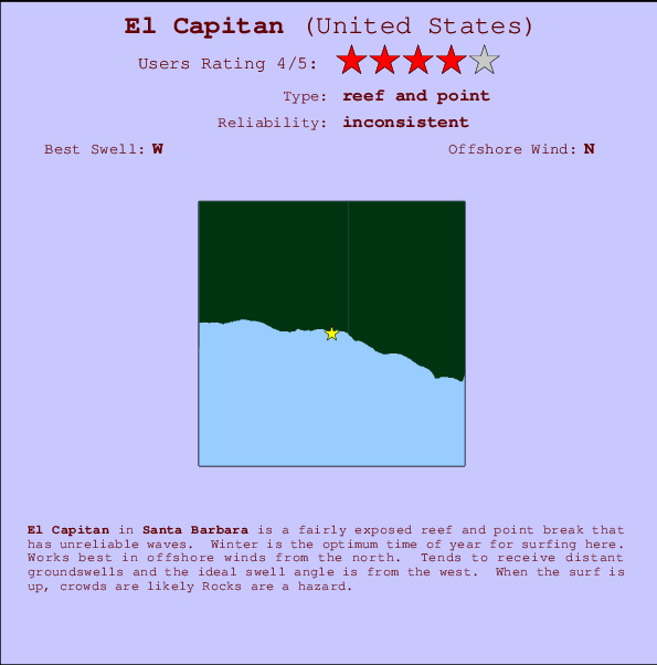
El Capitan Surf Guide
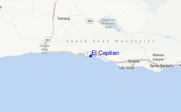
El Capitan in Santa Barbara is a fairly exposed reef and point break that has inconsistent surf. Winter is the best time of year for surfing here. Offshore winds blow from the north. Tends to receive distant groundswells and the best swell direction is from the west. Often Crowded. Rocks are a hazard.
El Capitan Spot Info
| Type: | Rating: | Reliability: | Todays Sea Temp*: |
|---|---|---|---|
| inconsistent | 21.0°C*ocean temperature recorded from satellite |
Surfing El Capitan:
The best conditions reported for surf at El Capitan occur when a West swell combines with an offshore wind direction from the North.

Voorspelde Golfenergie (Kracht): 12 uur


El Capitan Surf:
Monday, 3 August 2026, 10:54 Local time| Monday 03 | ||||
| 8AM | 11AM | 2PM | 5PM | |
| Wave (m) | ||||
| Periode (s) | 9 | 9 | 10 | 9 |
| Wind (km/h) | ||||
| Wind | glass | cross- on |
cross- on |
cross- on |
- /breaks/El-Capitan/forecasts/latest
El Capitan Surf Guide
El Capitan in Santa Barbara is a fairly exposed reef and point break that has inconsistent surf. Winter is the best time of year for surfing here. Offshore winds blow from the north. Tends to receive distant groundswells and the best swell direction is from the west. Often Crowded. Rocks are a hazard.
El Capitan Spot Info
Type: Rating: Reliability: Todays Sea Temp*:  Reef and point
 4
4inconsistent 21.0°C*ocean temperature recorded from satelliteSurfing El Capitan:
The best conditions reported for surf at El Capitan occur when a West swell combines with an offshore wind direction from the North.
Voorspelde Golfenergie (Kracht): 12 uur
Gebruik de tabbladen hierboven om de zeewatertemperatuur bij El Capitan te bekijken, foto's van El Capitan, El Capitan gedetailleerde golfvoorspellingen, wind- en weersvoorspellingen, El Capitan webcams, actuele wind in CAL - Santa Barbara live weerstations en El Capitan getijdenvoorspellingen. De link van United States golfkaarten opent een grote afbeelding van United States en de omliggende zeeën. Deze golfkaarten kunnen worden dynamisch gemaakt worden met de verschillende golfcomponenten, golfenergie, golfperiode, golfhoogte, samen met de wind en weersvoorspellingen, het actuele weer en de zeetoestand volgens golfboeien uit United States, langskomende schepen en weerstations op de kust. Elk voorspelling pagina's voor dit surfstrand zijn voorzien van een wereldwijde en regionale golfzoeker om de beste surfsomstandigheden in het gebied rond El Capitan te vinden.
El Capitan Surf:
Monday, 3 August 2026, 10:54 Local timeMonday 03 8AM 11AM 2PM 5PM Wave (m) Periode (s) 9 9 10 9 Wind (km/h) Wind glass cross-
oncross-
oncross-
on- /breaks/El-Capitan/forecasts/latest
- /breaks/El-Capitan/forecasts/latest/six_day
El Capitan Surf Guide
El Capitan in Santa Barbara is a fairly exposed reef and point break that has inconsistent surf. Winter is the best time of year for surfing here. Offshore winds blow from the north. Tends to receive distant groundswells and the best swell direction is from the west. Often Crowded. Rocks are a hazard.
El Capitan Spot Info
Type: Rating: Reliability: Todays Sea Temp*: Reef and point4inconsistent 21.0°C*ocean temperature recorded from satelliteSurfing El Capitan:
The best conditions reported for surf at El Capitan occur when a West swell combines with an offshore wind direction from the North.
Voorspelde Golfenergie (Kracht): 12 uur
Gebruik de tabbladen hierboven om de zeewatertemperatuur bij El Capitan te bekijken, foto's van El Capitan, El Capitan gedetailleerde golfvoorspellingen, wind- en weersvoorspellingen, El Capitan webcams, actuele wind in CAL - Santa Barbara live weerstations en El Capitan getijdenvoorspellingen. De link van United States golfkaarten opent een grote afbeelding van United States en de omliggende zeeën. Deze golfkaarten kunnen worden dynamisch gemaakt worden met de verschillende golfcomponenten, golfenergie, golfperiode, golfhoogte, samen met de wind en weersvoorspellingen, het actuele weer en de zeetoestand volgens golfboeien uit United States, langskomende schepen en weerstations op de kust. Elk voorspelling pagina's voor dit surfstrand zijn voorzien van een wereldwijde en regionale golfzoeker om de beste surfsomstandigheden in het gebied rond El Capitan te vinden.
El Capitan Surf:
Monday, 3 August 2026, 10:54 Local timeMonday 03 8AM 11AM 2PM 5PM Wave (m) Periode (s) 9 9 10 9 Wind (km/h) Wind glass cross-
oncross-
oncross-
on- /breaks/El-Capitan/forecasts/latest
El Capitan Surf Guide
El Capitan in Santa Barbara is a fairly exposed reef and point break that has inconsistent surf. Winter is the best time of year for surfing here. Offshore winds blow from the north. Tends to receive distant groundswells and the best swell direction is from the west. Often Crowded. Rocks are a hazard.
El Capitan Spot Info
Type: Rating: Reliability: Todays Sea Temp*: Reef and point4inconsistent 21.0°C*ocean temperature recorded from satelliteSurfing El Capitan:
The best conditions reported for surf at El Capitan occur when a West swell combines with an offshore wind direction from the North.
Voorspelde Golfenergie (Kracht): 12 uur
Gebruik de tabbladen hierboven om de zeewatertemperatuur bij El Capitan te bekijken, foto's van El Capitan, El Capitan gedetailleerde golfvoorspellingen, wind- en weersvoorspellingen, El Capitan webcams, actuele wind in CAL - Santa Barbara live weerstations en El Capitan getijdenvoorspellingen. De link van United States golfkaarten opent een grote afbeelding van United States en de omliggende zeeën. Deze golfkaarten kunnen worden dynamisch gemaakt worden met de verschillende golfcomponenten, golfenergie, golfperiode, golfhoogte, samen met de wind en weersvoorspellingen, het actuele weer en de zeetoestand volgens golfboeien uit United States, langskomende schepen en weerstations op de kust. Elk voorspelling pagina's voor dit surfstrand zijn voorzien van een wereldwijde en regionale golfzoeker om de beste surfsomstandigheden in het gebied rond El Capitan te vinden.
El Capitan Surf:
Monday, 3 August 2026, 10:54 Local timeMonday 03 8AM 11AM 2PM 5PM Wave (m) Periode (s) 9 9 10 9 Wind (km/h) Wind glass cross-
oncross-
oncross-
onTide Times:
Voor Beavers, %{dist} %{km} van %{location}.
VOLGENDE IS OM (lokale tijd) resterende tijd hoog water laag water El Capitan Tide Times and Tide Chart
Live Weather:
At Santa Barbara Airport, 16 km from El Capitan.
wind obs. (7 kph from 250 degs) was rejected
(km/h)
Mist -Air temperature
18.9°CCurrent weather near El Capitan
Buoy Data:
At East Santa Barbara Buoy, 18 miles from El Capitan.
3AM 4AM 5AM 6AM Gegevens Leeftijd 6 hr 5 hr 4 hr 3 hr Golfhoogte (m) 

Overall El Capitan Surf Consistency and Wind Distribution in August
surffoto's uit
de galerijContourlijnen: Wegen & Rivieren: Kies een surflokatie uit het menu 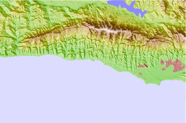
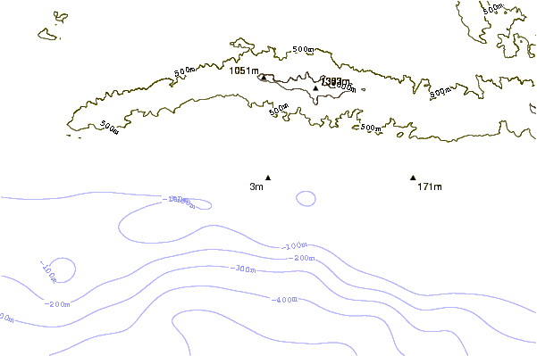
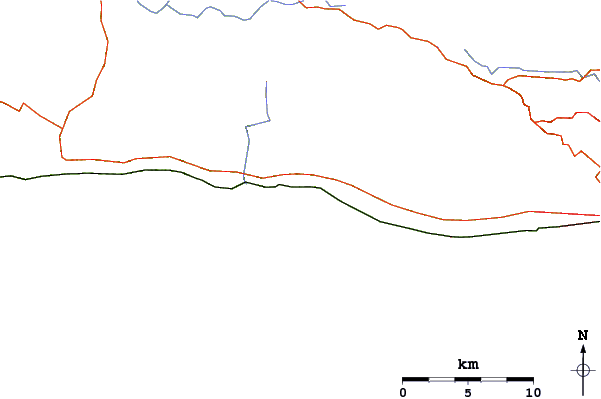
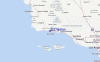
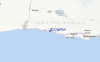
Gebruik deze reliëfkaart om naar de surfspots en de getijdenstations van CAL - Santa Barbara toe te gaan, in de buurt van El Capitan.
Andere Dichtbijzijnde Surflocaties van El Capitan:
(klik op locatienaam voor meer informatie)- Closest Locatie2 mi
- Second closest Locatie2 mi
- Third closest Locatie3 mi
- Fourth closest Locatie4 mi
- Fifth closest Locatie5 mi
Dichtstbijzijnde golfboeien bij El Capitan:
- Closest golfboei18 mi
- Second closest golfboei28 mi
- Third closest golfboei39 mi
- Fourth closest golfboei43 mi
- Fifth closest golfboei55 mi
Getijdenstations in de buurt van El Capitan:
- Closest getijdenstationIsla Vista10 mi
- Second closest getijdenstationGaviota11 mi
- Third closest getijdenstationGoleta11 mi
- Fourth closest getijdenstationSanta Barbara19 mi
- Fifth closest getijdenstationMontecito22 mi
Airports
- The closest passenger airport to El Capitan is Vandenberg Afb (Lompoc) Airport (VBG) in USA, 59 km (37 miles) away (directly).
- The second nearest airport to El Capitan is Point Mugu Nas Airport (NTD), also in USA, 91 km (57 miles) away.
- Third is Meadows Fld (Bakersfield) Airport (BFL) in USA, 140 km (87 miles) away.
- Burbank Glendale Pasadena Airport (BUR) in USA is 155 km (96 miles) away.
- Los Angeles International Airport (LAX), also in USA is the fifth nearest airport to El Capitan and is 159 km (99 miles) away.
- /breaks/El-Capitan/forecasts/latest


 Nearest