

Fannie Bay Surf Guide
Fannie Bay in Darwin - Northern Territories is a quite exposed beach break Offshore winds blow from the east northeast with some shelter here from north winds. Waves just as likely from local windswells as from distant groundswells and the ideal swell angle is from the northwest. The beach break provides left and right handers. Rarely crowded here. Beware of Box Jelly Fish, Crocodile, Sharks, Rays, rips.
Fannie Bay Spot Info
| Type: | Rating: | Reliability: | Todays Sea Temp*: |
|---|---|---|---|
| rarely breaks | 26.4°C*ocean temperature recorded from satellite |
Surfing Fannie Bay:
The best conditions reported for surf at Fannie Bay occur when a Northwest swell combines with an offshore wind direction from the East-northeast.
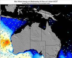
Voorspelde Golfenergie (Kracht): 12 uur
Fannie Bay Surf:
Saturday, 18 July 2026, 23:55 Local time| Sunday 19 | ||||
| 0:30AM | 3:30AM | 6:30AM | 9:30AM | |
| Wave (m) | ||||
| Periode (s) | - | - | - | - |
| Wind (km/h) | ||||
| Wind | cross- off |
cross- off |
cross- off |
cross- off |
- /breaks/Fannie-Bay/forecasts/latest
Fannie Bay Surf Guide
Fannie Bay in Darwin - Northern Territories is a quite exposed beach break Offshore winds blow from the east northeast with some shelter here from north winds. Waves just as likely from local windswells as from distant groundswells and the ideal swell angle is from the northwest. The beach break provides left and right handers. Rarely crowded here. Beware of Box Jelly Fish, Crocodile, Sharks, Rays, rips.
Fannie Bay Spot Info
Type: Rating: Reliability: Todays Sea Temp*:  Beach
Beach 2
2rarely breaks 26.4°C*ocean temperature recorded from satelliteSurfing Fannie Bay:
The best conditions reported for surf at Fannie Bay occur when a Northwest swell combines with an offshore wind direction from the East-northeast.
Voorspelde Golfenergie (Kracht): 12 uur
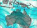
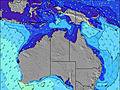
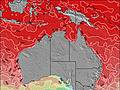
Gebruik de tabbladen hierboven om de zeewatertemperatuur bij Fannie Bay te bekijken, foto's van Fannie Bay, Fannie Bay gedetailleerde golfvoorspellingen, wind- en weersvoorspellingen, Fannie Bay webcams, actuele wind in NT - Darwin live weerstations en Fannie Bay getijdenvoorspellingen. De link van Australia golfkaarten opent een grote afbeelding van Australia en de omliggende zeeën. Deze golfkaarten kunnen worden dynamisch gemaakt worden met de verschillende golfcomponenten, golfenergie, golfperiode, golfhoogte, samen met de wind en weersvoorspellingen, het actuele weer en de zeetoestand volgens golfboeien uit Australia, langskomende schepen en weerstations op de kust. Elk voorspelling pagina's voor dit surfstrand zijn voorzien van een wereldwijde en regionale golfzoeker om de beste surfsomstandigheden in het gebied rond Fannie Bay te vinden.
Fannie Bay Surf:
Saturday, 18 July 2026, 23:55 Local timeSunday 19 0:30AM 3:30AM 6:30AM 9:30AM Wave (m) Periode (s) - - - - Wind (km/h) Wind cross-
offcross-
offcross-
offcross-
off- /breaks/Fannie-Bay/forecasts/latest
- /breaks/Fannie-Bay/forecasts/latest/six_day
Fannie Bay Surf Guide
Fannie Bay in Darwin - Northern Territories is a quite exposed beach break Offshore winds blow from the east northeast with some shelter here from north winds. Waves just as likely from local windswells as from distant groundswells and the ideal swell angle is from the northwest. The beach break provides left and right handers. Rarely crowded here. Beware of Box Jelly Fish, Crocodile, Sharks, Rays, rips.
Fannie Bay Spot Info
Type: Rating: Reliability: Todays Sea Temp*: Beach2rarely breaks 26.4°C*ocean temperature recorded from satelliteSurfing Fannie Bay:
The best conditions reported for surf at Fannie Bay occur when a Northwest swell combines with an offshore wind direction from the East-northeast.
Voorspelde Golfenergie (Kracht): 12 uur
Gebruik de tabbladen hierboven om de zeewatertemperatuur bij Fannie Bay te bekijken, foto's van Fannie Bay, Fannie Bay gedetailleerde golfvoorspellingen, wind- en weersvoorspellingen, Fannie Bay webcams, actuele wind in NT - Darwin live weerstations en Fannie Bay getijdenvoorspellingen. De link van Australia golfkaarten opent een grote afbeelding van Australia en de omliggende zeeën. Deze golfkaarten kunnen worden dynamisch gemaakt worden met de verschillende golfcomponenten, golfenergie, golfperiode, golfhoogte, samen met de wind en weersvoorspellingen, het actuele weer en de zeetoestand volgens golfboeien uit Australia, langskomende schepen en weerstations op de kust. Elk voorspelling pagina's voor dit surfstrand zijn voorzien van een wereldwijde en regionale golfzoeker om de beste surfsomstandigheden in het gebied rond Fannie Bay te vinden.
Fannie Bay Surf:
Saturday, 18 July 2026, 23:55 Local timeSunday 19 0:30AM 3:30AM 6:30AM 9:30AM Wave (m) Periode (s) - - - - Wind (km/h) Wind cross-
offcross-
offcross-
offcross-
off- /breaks/Fannie-Bay/forecasts/latest
Fannie Bay Surf Guide
Fannie Bay in Darwin - Northern Territories is a quite exposed beach break Offshore winds blow from the east northeast with some shelter here from north winds. Waves just as likely from local windswells as from distant groundswells and the ideal swell angle is from the northwest. The beach break provides left and right handers. Rarely crowded here. Beware of Box Jelly Fish, Crocodile, Sharks, Rays, rips.
Fannie Bay Spot Info
Type: Rating: Reliability: Todays Sea Temp*: Beach2rarely breaks 26.4°C*ocean temperature recorded from satelliteSurfing Fannie Bay:
The best conditions reported for surf at Fannie Bay occur when a Northwest swell combines with an offshore wind direction from the East-northeast.
Voorspelde Golfenergie (Kracht): 12 uur
Gebruik de tabbladen hierboven om de zeewatertemperatuur bij Fannie Bay te bekijken, foto's van Fannie Bay, Fannie Bay gedetailleerde golfvoorspellingen, wind- en weersvoorspellingen, Fannie Bay webcams, actuele wind in NT - Darwin live weerstations en Fannie Bay getijdenvoorspellingen. De link van Australia golfkaarten opent een grote afbeelding van Australia en de omliggende zeeën. Deze golfkaarten kunnen worden dynamisch gemaakt worden met de verschillende golfcomponenten, golfenergie, golfperiode, golfhoogte, samen met de wind en weersvoorspellingen, het actuele weer en de zeetoestand volgens golfboeien uit Australia, langskomende schepen en weerstations op de kust. Elk voorspelling pagina's voor dit surfstrand zijn voorzien van een wereldwijde en regionale golfzoeker om de beste surfsomstandigheden in het gebied rond Fannie Bay te vinden.
Fannie Bay Surf:
Saturday, 18 July 2026, 23:55 Local timeSunday 19 0:30AM 3:30AM 6:30AM 9:30AM Wave (m) Periode (s) - - - - Wind (km/h) Wind cross-
offcross-
offcross-
offcross-
offTide Times:
Voor Night Cliff, Australia, %{dist} %{km} van %{location}.
VOLGENDE IS OM (lokale tijd) resterende tijd hoog water laag water Fannie Bay Tide Times and Tide Chart
Live Weather:
At Darwin Airport, 4 km from Fannie Bay.
light winds from the ESE
(km/h)
Dry and partly cloudyAir temperature
19°COverall Fannie Bay Surf Consistency and Wind Distribution in July
surffoto's uit
de galerijContourlijnen: Wegen & Rivieren: Kies een surflokatie uit het menu 


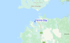
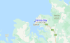
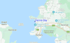
Gebruik deze reliëfkaart om naar de surfspots en de getijdenstations van NT - Darwin toe te gaan, in de buurt van Fannie Bay.
Andere Dichtbijzijnde Surflocaties van Fannie Bay:
(klik op locatienaam voor meer informatie)- Closest Locatie4 mi
- Second closest Locatie4 mi
- Third closest Locatie4 mi
- Fourth closest Locatie11 mi
- Fifth closest Locatie433 mi
Dichtstbijzijnde golfboeien bij Fannie Bay:
- Closest golfboei732 mi
- Second closest golfboei1039 mi
- Third closest golfboei1175 mi
- Fourth closest golfboei1255 mi
- Fifth closest golfboei1357 mi
Getijdenstations in de buurt van Fannie Bay:
- Closest getijdenstationNight Cliff2 mi
- Second closest getijdenstationDarwin3 mi
- Third closest getijdenstationTapa Bay16 mi
- Fourth closest getijdenstationBurge Point21 mi
- Fifth closest getijdenstationCape Hotham40 mi
Airports
- The nearest passenger airport to Fannie Bay is Kununurra Airport (KNX) in Australia, which is 438 km (272 miles) away (directly).
- The second closest airport to Fannie Bay is El Tari (Kupang) Airport (KOE) in Indonesia, 820 km (509 miles) away.

- /breaks/Fannie-Bay/forecasts/latest


 Nearest