
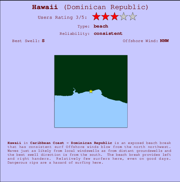
Hawaii Surf Guide
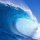
Hawaii on the South Coast is an exposed beach break that has dependable surf Offshore winds are from the north northwest. Most of the surf here comes from groundswells and the ideal swell direction is from the south. The beach breaks offer lefts and rights. Relatively few surfers here, even on good days. Watch out for dangerous rips.
Hawaii Spot Info
| Type: | Rating: | Reliability: | Todays Sea Temp*: |
|---|---|---|---|
| consistent | 28.9°C*ocean temperature recorded from satellite |
Surfing Hawaii:
The best conditions reported for surf at Hawaii occur when a South swell combines with an offshore wind direction from the North-northwest.

Voorspelde Golfenergie (Kracht): 12 uur


Hawaii Surf:
Friday, 24 July 2026, 20:29 Local time| Friday 24 | Sat | |||
| 5PM | 8PM | 11PM | 2AM | |
| Wave (m) | ||||
| Periode (s) | 7 | 7 | 7 | 7 |
| Wind (km/h) | ||||
| Wind | on | cross | cross- off |
cross- off |
- /breaks/Hawaii/forecasts/latest

Hawaii Surf Guide
Hawaii on the South Coast is an exposed beach break that has dependable surf Offshore winds are from the north northwest. Most of the surf here comes from groundswells and the ideal swell direction is from the south. The beach breaks offer lefts and rights. Relatively few surfers here, even on good days. Watch out for dangerous rips.
Hawaii Spot Info
Type: Rating: Reliability: Todays Sea Temp*:  Beach
Beach 3
3consistent 28.9°C*ocean temperature recorded from satelliteSurfing Hawaii:
The best conditions reported for surf at Hawaii occur when a South swell combines with an offshore wind direction from the North-northwest.
Voorspelde Golfenergie (Kracht): 12 uur
Gebruik de tabbladen hierboven om de zeewatertemperatuur bij Hawaii te bekijken, foto's van Hawaii, Hawaii gedetailleerde golfvoorspellingen, wind- en weersvoorspellingen, Hawaii webcams, actuele wind in Caribbean Coast live weerstations en Hawaii getijdenvoorspellingen. De link van Dominican Republic golfkaarten opent een grote afbeelding van Dominican Republic en de omliggende zeeën. Deze golfkaarten kunnen worden dynamisch gemaakt worden met de verschillende golfcomponenten, golfenergie, golfperiode, golfhoogte, samen met de wind en weersvoorspellingen, het actuele weer en de zeetoestand volgens golfboeien uit Dominican Republic, langskomende schepen en weerstations op de kust. Elk voorspelling pagina's voor dit surfstrand zijn voorzien van een wereldwijde en regionale golfzoeker om de beste surfsomstandigheden in het gebied rond Hawaii te vinden.
Hawaii Surf:
Friday, 24 July 2026, 20:29 Local timeFriday 24 Sat 5PM 8PM 11PM 2AM Wave (m) Periode (s) 7 7 7 7 Wind (km/h) Wind on cross cross-
offcross-
off- /breaks/Hawaii/forecasts/latest
- /breaks/Hawaii/forecasts/latest/six_day
Hawaii Surf Guide
Hawaii on the South Coast is an exposed beach break that has dependable surf Offshore winds are from the north northwest. Most of the surf here comes from groundswells and the ideal swell direction is from the south. The beach breaks offer lefts and rights. Relatively few surfers here, even on good days. Watch out for dangerous rips.
Hawaii Spot Info
Type: Rating: Reliability: Todays Sea Temp*: Beach3consistent 28.9°C*ocean temperature recorded from satelliteSurfing Hawaii:
The best conditions reported for surf at Hawaii occur when a South swell combines with an offshore wind direction from the North-northwest.
Voorspelde Golfenergie (Kracht): 12 uur
Gebruik de tabbladen hierboven om de zeewatertemperatuur bij Hawaii te bekijken, foto's van Hawaii, Hawaii gedetailleerde golfvoorspellingen, wind- en weersvoorspellingen, Hawaii webcams, actuele wind in Caribbean Coast live weerstations en Hawaii getijdenvoorspellingen. De link van Dominican Republic golfkaarten opent een grote afbeelding van Dominican Republic en de omliggende zeeën. Deze golfkaarten kunnen worden dynamisch gemaakt worden met de verschillende golfcomponenten, golfenergie, golfperiode, golfhoogte, samen met de wind en weersvoorspellingen, het actuele weer en de zeetoestand volgens golfboeien uit Dominican Republic, langskomende schepen en weerstations op de kust. Elk voorspelling pagina's voor dit surfstrand zijn voorzien van een wereldwijde en regionale golfzoeker om de beste surfsomstandigheden in het gebied rond Hawaii te vinden.
Hawaii Surf:
Friday, 24 July 2026, 20:29 Local timeFriday 24 Sat 5PM 8PM 11PM 2AM Wave (m) Periode (s) 7 7 7 7 Wind (km/h) Wind on cross cross-
offcross-
off- /breaks/Hawaii/forecasts/latest
Hawaii Surf Guide
Hawaii on the South Coast is an exposed beach break that has dependable surf Offshore winds are from the north northwest. Most of the surf here comes from groundswells and the ideal swell direction is from the south. The beach breaks offer lefts and rights. Relatively few surfers here, even on good days. Watch out for dangerous rips.
Hawaii Spot Info
Type: Rating: Reliability: Todays Sea Temp*: Beach3consistent 28.9°C*ocean temperature recorded from satelliteSurfing Hawaii:
The best conditions reported for surf at Hawaii occur when a South swell combines with an offshore wind direction from the North-northwest.
Voorspelde Golfenergie (Kracht): 12 uur
Gebruik de tabbladen hierboven om de zeewatertemperatuur bij Hawaii te bekijken, foto's van Hawaii, Hawaii gedetailleerde golfvoorspellingen, wind- en weersvoorspellingen, Hawaii webcams, actuele wind in Caribbean Coast live weerstations en Hawaii getijdenvoorspellingen. De link van Dominican Republic golfkaarten opent een grote afbeelding van Dominican Republic en de omliggende zeeën. Deze golfkaarten kunnen worden dynamisch gemaakt worden met de verschillende golfcomponenten, golfenergie, golfperiode, golfhoogte, samen met de wind en weersvoorspellingen, het actuele weer en de zeetoestand volgens golfboeien uit Dominican Republic, langskomende schepen en weerstations op de kust. Elk voorspelling pagina's voor dit surfstrand zijn voorzien van een wereldwijde en regionale golfzoeker om de beste surfsomstandigheden in het gebied rond Hawaii te vinden.
Hawaii Surf:
Friday, 24 July 2026, 20:29 Local timeFriday 24 Sat 5PM 8PM 11PM 2AM Wave (m) Periode (s) 7 7 7 7 Wind (km/h) Wind on cross cross-
offcross-
offTide Times:
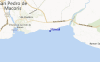
Voor San Pedro de Macoris, %{dist} %{km} van %{location}.
VOLGENDE IS OM (lokale tijd) resterende tijd hoog water laag water Hawaii Tide Times and Tide Chart
Live Weather:
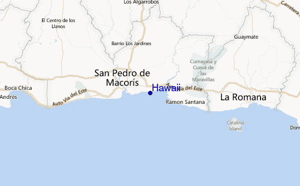
At La Romana International Airport, 31 km from Hawaii.
light winds from the ESE
(km/h)Air temperature
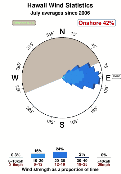
32°COverall Hawaii Surf Consistency and Wind Distribution in July
surffoto's uit
de galerijContourlijnen: Wegen & Rivieren: Kies een surflokatie uit het menu 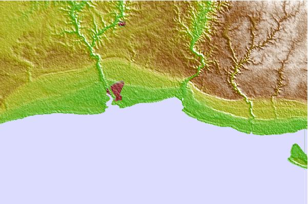
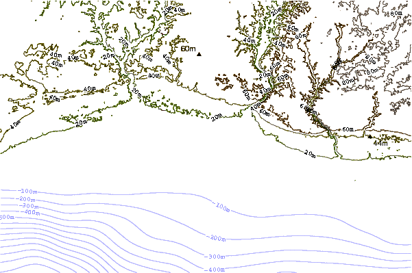
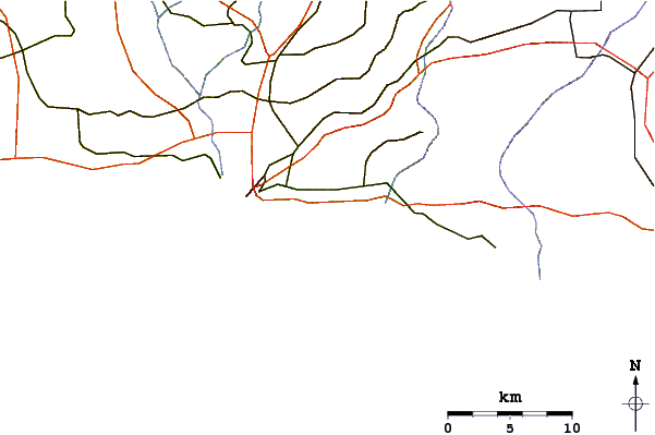
Gebruik deze reliëfkaart om naar de surfspots en de getijdenstations van Caribbean Coast toe te gaan, in de buurt van Hawaii.
Andere Dichtbijzijnde Surflocaties van Hawaii:
(klik op locatienaam voor meer informatie)- Closest Locatie5 mi
- Second closest Locatie5 mi
- Third closest Locatie6 mi
- Fourth closest Locatie7 mi
- Fifth closest Locatie8 mi
Dichtstbijzijnde golfboeien bij Hawaii:
- Closest golfboei129 mi
- Second closest golfboei183 mi
- Third closest golfboei206 mi
- Fourth closest golfboei249 mi
- Fifth closest golfboei295 mi
Getijdenstations in de buurt van Hawaii:
- Closest getijdenstationSan Pedro de Macoris4 mi
- Second closest getijdenstationLa Romana18 mi
- Third closest getijdenstationBoca Chica24 mi
- Fourth closest getijdenstationMiches40 mi
- Fifth closest getijdenstationSanto Domingo (Ciudad Trujillo)42 mi
Airports
- The closest passenger airport to Hawaii is La Romana International Airport (LRM) in Dominican Republic, 35 km (22 miles) away (directly).
- The second nearest airport to Hawaii is Las Americas International (Santo Domingo) Airport (SDQ), also in Dominican Republic, 45 km (28 miles) away.
- Third is Herrera International (Santo Domingo) Airport (HEX) in Dominican Republic, 76 km (47 miles) away.
- Punta Cana International Airport (PUJ) in Dominican Republic is 94 km (58 miles) away.
- Cibao International (Santiago) Airport (STI), also in Dominican Republic is the fifth nearest airport to Hawaii and is 180 km (112 miles) away.
- /breaks/Hawaii/forecasts/latest


 Nearest