

Holland Surf Guide
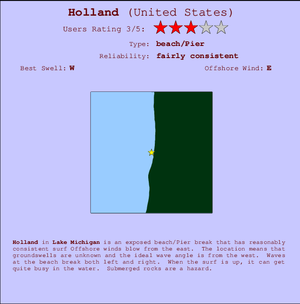
Holland in Lake Michigan is an exposed beach/Pier break that has quite reliable surf Offshore winds are from the east. Short period wind swells are the rule and the best wave direction is from the west. Waves at the beach are both lefts and rights. Sometimes crowded. Watch out for rocks.
Holland Spot Info
| Type: | Rating: | Reliability: | Todays Sea Temp*: |
|---|---|---|---|
| fairly consistent | 21.8°C*ocean temperature recorded from satellite |
Surfing Holland:
The best conditions reported for surf at Holland occur when a West swell combines with an offshore wind direction from the East.
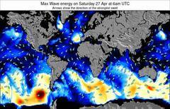
Voorspelde Golfenergie (Kracht): 12 uur

Holland Surf:
Wednesday, 15 July 2026, 18:45 Local time| Wednesday 15 | Thu | |||
| 5PM | 8PM | 11PM | 2AM | |
| Wave (m) | ||||
| Periode (s) | 3 | 3 | 4 | 5 |
| Wind (km/h) | ||||
| Wind | on | cross- on |
cross | off |
- /breaks/Holland/forecasts/latest
Holland Surf Guide
Holland in Lake Michigan is an exposed beach/Pier break that has quite reliable surf Offshore winds are from the east. Short period wind swells are the rule and the best wave direction is from the west. Waves at the beach are both lefts and rights. Sometimes crowded. Watch out for rocks.
Holland Spot Info
Type: Rating: Reliability: Todays Sea Temp*:  Beach/pier
 3
3fairly consistent 21.8°C*ocean temperature recorded from satelliteSurfing Holland:
The best conditions reported for surf at Holland occur when a West swell combines with an offshore wind direction from the East.
Voorspelde Golfenergie (Kracht): 12 uur
Gebruik de tabbladen hierboven om de zeewatertemperatuur bij Holland te bekijken, foto's van Holland, Holland gedetailleerde golfvoorspellingen, wind- en weersvoorspellingen, Holland webcams, actuele wind in Lake Michigan live weerstations en Holland getijdenvoorspellingen. De link van United States golfkaarten opent een grote afbeelding van United States en de omliggende zeeën. Deze golfkaarten kunnen worden dynamisch gemaakt worden met de verschillende golfcomponenten, golfenergie, golfperiode, golfhoogte, samen met de wind en weersvoorspellingen, het actuele weer en de zeetoestand volgens golfboeien uit United States, langskomende schepen en weerstations op de kust. Elk voorspelling pagina's voor dit surfstrand zijn voorzien van een wereldwijde en regionale golfzoeker om de beste surfsomstandigheden in het gebied rond Holland te vinden.
Holland Surf:
Wednesday, 15 July 2026, 18:45 Local timeWednesday 15 Thu 5PM 8PM 11PM 2AM Wave (m) Periode (s) 3 3 4 5 Wind (km/h) Wind on cross-
oncross off - /breaks/Holland/forecasts/latest
- /breaks/Holland/forecasts/latest/six_day
Holland Surf Guide
Holland in Lake Michigan is an exposed beach/Pier break that has quite reliable surf Offshore winds are from the east. Short period wind swells are the rule and the best wave direction is from the west. Waves at the beach are both lefts and rights. Sometimes crowded. Watch out for rocks.
Holland Spot Info
Type: Rating: Reliability: Todays Sea Temp*: Beach/pier3fairly consistent 21.8°C*ocean temperature recorded from satelliteSurfing Holland:
The best conditions reported for surf at Holland occur when a West swell combines with an offshore wind direction from the East.
Voorspelde Golfenergie (Kracht): 12 uur
Gebruik de tabbladen hierboven om de zeewatertemperatuur bij Holland te bekijken, foto's van Holland, Holland gedetailleerde golfvoorspellingen, wind- en weersvoorspellingen, Holland webcams, actuele wind in Lake Michigan live weerstations en Holland getijdenvoorspellingen. De link van United States golfkaarten opent een grote afbeelding van United States en de omliggende zeeën. Deze golfkaarten kunnen worden dynamisch gemaakt worden met de verschillende golfcomponenten, golfenergie, golfperiode, golfhoogte, samen met de wind en weersvoorspellingen, het actuele weer en de zeetoestand volgens golfboeien uit United States, langskomende schepen en weerstations op de kust. Elk voorspelling pagina's voor dit surfstrand zijn voorzien van een wereldwijde en regionale golfzoeker om de beste surfsomstandigheden in het gebied rond Holland te vinden.
Holland Surf:
Wednesday, 15 July 2026, 18:45 Local timeWednesday 15 Thu 5PM 8PM 11PM 2AM Wave (m) Periode (s) 3 3 4 5 Wind (km/h) Wind on cross-
oncross off - /breaks/Holland/forecasts/latest
Holland Surf Guide
Holland in Lake Michigan is an exposed beach/Pier break that has quite reliable surf Offshore winds are from the east. Short period wind swells are the rule and the best wave direction is from the west. Waves at the beach are both lefts and rights. Sometimes crowded. Watch out for rocks.
Holland Spot Info
Type: Rating: Reliability: Todays Sea Temp*: Beach/pier3fairly consistent 21.8°C*ocean temperature recorded from satelliteSurfing Holland:
The best conditions reported for surf at Holland occur when a West swell combines with an offshore wind direction from the East.
Voorspelde Golfenergie (Kracht): 12 uur
Gebruik de tabbladen hierboven om de zeewatertemperatuur bij Holland te bekijken, foto's van Holland, Holland gedetailleerde golfvoorspellingen, wind- en weersvoorspellingen, Holland webcams, actuele wind in Lake Michigan live weerstations en Holland getijdenvoorspellingen. De link van United States golfkaarten opent een grote afbeelding van United States en de omliggende zeeën. Deze golfkaarten kunnen worden dynamisch gemaakt worden met de verschillende golfcomponenten, golfenergie, golfperiode, golfhoogte, samen met de wind en weersvoorspellingen, het actuele weer en de zeetoestand volgens golfboeien uit United States, langskomende schepen en weerstations op de kust. Elk voorspelling pagina's voor dit surfstrand zijn voorzien van een wereldwijde en regionale golfzoeker om de beste surfsomstandigheden in het gebied rond Holland te vinden.
Holland Surf:
Wednesday, 15 July 2026, 18:45 Local timeWednesday 15 Thu 5PM 8PM 11PM 2AM Wave (m) Periode (s) 3 3 4 5 Wind (km/h) Wind on cross-
oncross off Tide Times:
Voor Chain Bridge, DC, %{dist} %{km} van %{location}.
VOLGENDE IS OM (lokale tijd) resterende tijd hoog water laag water Holland Tide Times and Tide Chart
Live Weather:
At BUOY-HLNM4, 8 km from Holland.
light winds from the WNW
(km/h)Air temperature
25.4°CBuoy Data:
At Holland Buoy, 14 miles from Holland.
1PM 2PM 3PM 4PM Gegevens Leeftijd 4 hr 3 hr 2 hr 1 hr Golfhoogte (m) 

Dominante Periode (s) 2 2 2 3 surffoto's uit
de galerijContourlijnen: Wegen & Rivieren: Kies een surflokatie uit het menu 
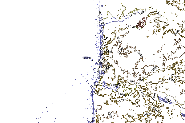
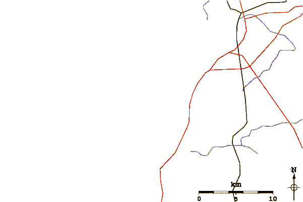
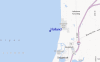
Gebruik deze reliëfkaart om naar de surfspots en de getijdenstations van Lake Michigan toe te gaan, in de buurt van Holland.
Andere Dichtbijzijnde Surflocaties van Holland:
(klik op locatienaam voor meer informatie)- Closest Locatie11 mi
- Second closest Locatie20 mi
- Third closest Locatie79 mi
- Fourth closest Locatie80 mi
- Fifth closest Locatie81 mi
Dichtstbijzijnde golfboeien bij Holland:
- Closest golfboei14 mi
- Second closest golfboei21 mi
- Third closest golfboei34 mi
- Fourth closest golfboei41 mi
- Fifth closest golfboei53 mi
Getijdenstations in de buurt van Holland:
- Closest getijdenstationChain Bridge543 mi
- Second closest getijdenstationChain Bridge, one miles below544 mi
- Third closest getijdenstationKey Bridge546 mi
- Fourth closest getijdenstationWoodbridge547 mi
- Fifth closest getijdenstationTriangle547 mi
Airports
- The closest passenger airport to Holland is Gerald R Ford International (Grand Rapids) Airport (GRR) in USA, 61 km (38 miles) away (directly).
- The second nearest airport to Holland is Capital City (Lansing) Airport (LAN), also in USA, 134 km (83 miles) away.
- Third is Waukegan Rgnl (Chicago) Airport (UGN) in USA, 138 km (86 miles) away.
- General Mitchell International (Milwaukee) Airport (MKE) in USA is 139 km (86 miles) away.
- Chicago Ohare International Airport (ORD), also in USA is the fifth nearest airport to Holland and is 159 km (99 miles) away.
- /breaks/Holland/forecasts/latest

 Nearest