

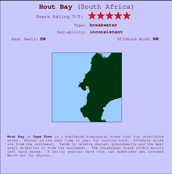
Hout Bay Surf Guide
Hout Bay in Cape Peninsula is a sheltered beach break that does not work very often. Winter is the optimum time of year for surfing here. The best wind direction is from the northwest. Groundswells more frequent than windswells and the optimum swell angle is from the southwest. The beach breaks offer lefts and rights. Sometimes crowded. Hazards include sharks,.
Hout Bay Spot Info
| Type: | Rating: | Reliability: | Todays Sea Temp*: |
|---|---|---|---|
| inconsistent | 14.4°C*ocean temperature recorded from satellite |
Surfing Hout Bay:
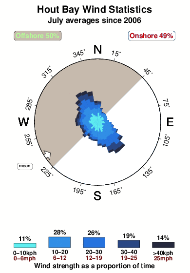
The best conditions reported for surf at Hout Bay occur when a Southwest swell combines with an offshore wind direction from the Northwest.
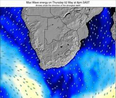
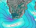
Voorspelde Golfenergie (Kracht): 12 uur

Hout Bay Surf:
Tuesday, 28 July 2026, 07:33 Local time| Tuesday 28 | ||||
| 5AM | 8AM | 11AM | 2PM | |
| Wave (m) | ||||
| Periode (s) | 15 | 15 | 14 | 14 |
| Wind (km/h) | ||||
| Wind | on | on | on | on |
- /breaks/Hout-Bay/forecasts/latest
Hout Bay Surf Guide
Hout Bay in Cape Peninsula is a sheltered beach break that does not work very often. Winter is the optimum time of year for surfing here. The best wind direction is from the northwest. Groundswells more frequent than windswells and the optimum swell angle is from the southwest. The beach breaks offer lefts and rights. Sometimes crowded. Hazards include sharks,.
Hout Bay Spot Info
Type: Rating: Reliability: Todays Sea Temp*:  Breakwater
 5
5inconsistent 14.4°C*ocean temperature recorded from satelliteSurfing Hout Bay:
The best conditions reported for surf at Hout Bay occur when a Southwest swell combines with an offshore wind direction from the Northwest.
Voorspelde Golfenergie (Kracht): 12 uur
Gebruik de tabbladen hierboven om de zeewatertemperatuur bij Hout Bay te bekijken, foto's van Hout Bay, Hout Bay gedetailleerde golfvoorspellingen, wind- en weersvoorspellingen, Hout Bay webcams, actuele wind in Cape Town live weerstations en Hout Bay getijdenvoorspellingen. De link van South Africa golfkaarten opent een grote afbeelding van South Africa en de omliggende zeeën. Deze golfkaarten kunnen worden dynamisch gemaakt worden met de verschillende golfcomponenten, golfenergie, golfperiode, golfhoogte, samen met de wind en weersvoorspellingen, het actuele weer en de zeetoestand volgens golfboeien uit South Africa, langskomende schepen en weerstations op de kust. Elk voorspelling pagina's voor dit surfstrand zijn voorzien van een wereldwijde en regionale golfzoeker om de beste surfsomstandigheden in het gebied rond Hout Bay te vinden.
Hout Bay Surf:
Tuesday, 28 July 2026, 07:33 Local timeTuesday 28 5AM 8AM 11AM 2PM Wave (m) Periode (s) 15 15 14 14 Wind (km/h) Wind on on on on - /breaks/Hout-Bay/forecasts/latest
- /breaks/Hout-Bay/forecasts/latest/six_day
Hout Bay Surf Guide
Hout Bay in Cape Peninsula is a sheltered beach break that does not work very often. Winter is the optimum time of year for surfing here. The best wind direction is from the northwest. Groundswells more frequent than windswells and the optimum swell angle is from the southwest. The beach breaks offer lefts and rights. Sometimes crowded. Hazards include sharks,.
Hout Bay Spot Info
Type: Rating: Reliability: Todays Sea Temp*: Breakwater5inconsistent 14.4°C*ocean temperature recorded from satelliteSurfing Hout Bay:
The best conditions reported for surf at Hout Bay occur when a Southwest swell combines with an offshore wind direction from the Northwest.
Voorspelde Golfenergie (Kracht): 12 uur
Gebruik de tabbladen hierboven om de zeewatertemperatuur bij Hout Bay te bekijken, foto's van Hout Bay, Hout Bay gedetailleerde golfvoorspellingen, wind- en weersvoorspellingen, Hout Bay webcams, actuele wind in Cape Town live weerstations en Hout Bay getijdenvoorspellingen. De link van South Africa golfkaarten opent een grote afbeelding van South Africa en de omliggende zeeën. Deze golfkaarten kunnen worden dynamisch gemaakt worden met de verschillende golfcomponenten, golfenergie, golfperiode, golfhoogte, samen met de wind en weersvoorspellingen, het actuele weer en de zeetoestand volgens golfboeien uit South Africa, langskomende schepen en weerstations op de kust. Elk voorspelling pagina's voor dit surfstrand zijn voorzien van een wereldwijde en regionale golfzoeker om de beste surfsomstandigheden in het gebied rond Hout Bay te vinden.
Hout Bay Surf:
Tuesday, 28 July 2026, 07:33 Local timeTuesday 28 5AM 8AM 11AM 2PM Wave (m) Periode (s) 15 15 14 14 Wind (km/h) Wind on on on on - /breaks/Hout-Bay/forecasts/latest
Hout Bay Surf Guide
Hout Bay in Cape Peninsula is a sheltered beach break that does not work very often. Winter is the optimum time of year for surfing here. The best wind direction is from the northwest. Groundswells more frequent than windswells and the optimum swell angle is from the southwest. The beach breaks offer lefts and rights. Sometimes crowded. Hazards include sharks,.
Hout Bay Spot Info
Type: Rating: Reliability: Todays Sea Temp*: Breakwater5inconsistent 14.4°C*ocean temperature recorded from satelliteSurfing Hout Bay:
The best conditions reported for surf at Hout Bay occur when a Southwest swell combines with an offshore wind direction from the Northwest.
Voorspelde Golfenergie (Kracht): 12 uur
Gebruik de tabbladen hierboven om de zeewatertemperatuur bij Hout Bay te bekijken, foto's van Hout Bay, Hout Bay gedetailleerde golfvoorspellingen, wind- en weersvoorspellingen, Hout Bay webcams, actuele wind in Cape Town live weerstations en Hout Bay getijdenvoorspellingen. De link van South Africa golfkaarten opent een grote afbeelding van South Africa en de omliggende zeeën. Deze golfkaarten kunnen worden dynamisch gemaakt worden met de verschillende golfcomponenten, golfenergie, golfperiode, golfhoogte, samen met de wind en weersvoorspellingen, het actuele weer en de zeetoestand volgens golfboeien uit South Africa, langskomende schepen en weerstations op de kust. Elk voorspelling pagina's voor dit surfstrand zijn voorzien van een wereldwijde en regionale golfzoeker om de beste surfsomstandigheden in het gebied rond Hout Bay te vinden.
Hout Bay Surf:
Tuesday, 28 July 2026, 07:33 Local timeTuesday 28 5AM 8AM 11AM 2PM Wave (m) Periode (s) 15 15 14 14 Wind (km/h) Wind on on on on Tide Times:
Op Hout Bay (0 km).
VOLGENDE IS OM (lokale tijd) resterende tijd hoog water laag water Hout Bay Tide Times and Tide Chart
Live Weather:
At Shoebury Heights wx, 7 km from Hout Bay.
calm
(km/h)
dryAir temperature
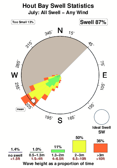
12°COverall Hout Bay Surf Consistency and Wind Distribution in July
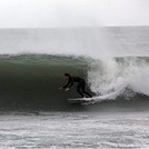
surffoto's uit
de galerijContourlijnen: Wegen & Rivieren: Kies een surflokatie uit het menu 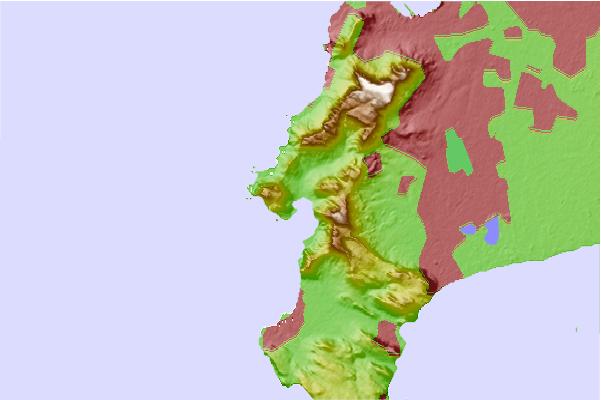
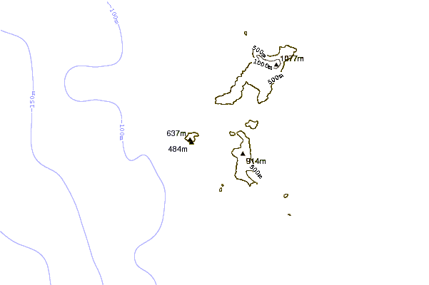
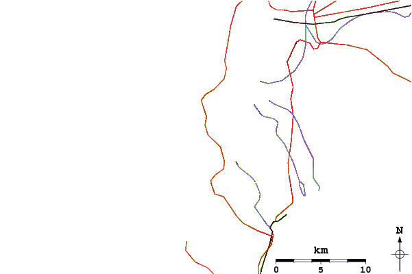
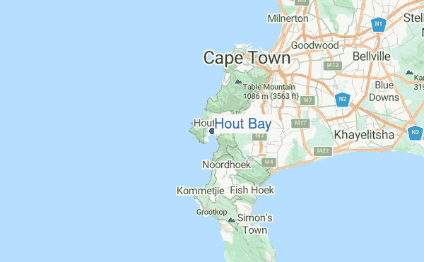
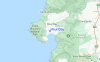
Gebruik deze reliëfkaart om naar de surfspots en de getijdenstations van Cape Town toe te gaan, in de buurt van Hout Bay.
Dichtstbijzijnde golfboeien bij Hout Bay:
- Closest golfboei2637 mi
- Second closest golfboei3903 mi
- Third closest golfboei5122 mi
- Fourth closest golfboei5161 mi
- Fifth closest golfboei5195 mi
Getijdenstations in de buurt van Hout Bay:
- Closest getijdenstationCape Town11 mi
- Second closest getijdenstationKhayelitsha18 mi
- Third closest getijdenstationHermanus57 mi
- Fourth closest getijdenstationSaldanha75 mi
- Fifth closest getijdenstationMosselbaai218 mi
Airports
- The nearest passenger airport to Hout Bay is Cape Town International Airport (CPT) in South Africa, which is 25 km (16 miles) away (directly).
- The second closest airport to Hout Bay is Oudtshoorn Airport (DUH), also in South Africa, 358 km (222 miles) away.
- /breaks/Hout-Bay/forecasts/latest


 Nearest