

Imperial Pier (North and South) Surf Guide
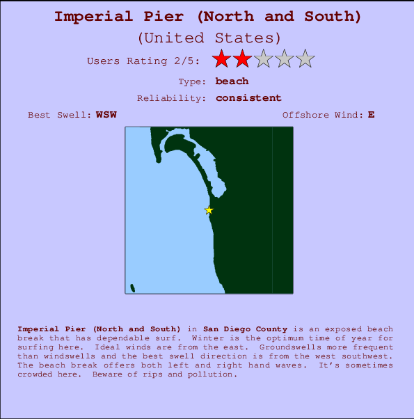
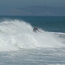
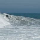
Imperial Pier (North and South) in San Diego County is an exposed beach break that has consistent surf. Winter is the best time of year for surfing here. Offshore winds blow from the east. Tends to receive distant groundswells and the best swell direction is from the west southwest. The beach breaks offer lefts and rights. Sometimes crowded. Beware of rips and pollution.
Imperial Pier (North and South) Spot Info
| Type: | Rating: | Reliability: | Todays Sea Temp*: |
|---|---|---|---|
| consistent | 21.6°C*ocean temperature recorded from satellite |
Surfing Imperial Pier (North and South):
The best conditions reported for surf at Imperial Pier (North and South) occur when a West-southwest swell combines with an offshore wind direction from the East.

Voorspelde Golfenergie (Kracht): 12 uur


Imperial Pier (North and South) Surf:
Sunday, 19 July 2026, 16:33 Local time| Sunday 19 | ||||
| 2PM | 5PM | 8PM | 11PM | |
| Wave (m) | ||||
| Periode (s) | 12 | 17 | 17 | 12 |
| Wind (km/h) | ||||
| Wind | on | on | on | on |
- /breaks/Imperial-Pier/forecasts/latest
Imperial Pier (North and South) Surf Guide
Imperial Pier (North and South) in San Diego County is an exposed beach break that has consistent surf. Winter is the best time of year for surfing here. Offshore winds blow from the east. Tends to receive distant groundswells and the best swell direction is from the west southwest. The beach breaks offer lefts and rights. Sometimes crowded. Beware of rips and pollution.
Imperial Pier (North and South) Spot Info
Type: Rating: Reliability: Todays Sea Temp*:  Beach
Beach 2
2consistent 21.6°C*ocean temperature recorded from satelliteSurfing Imperial Pier (North and South):
The best conditions reported for surf at Imperial Pier (North and South) occur when a West-southwest swell combines with an offshore wind direction from the East.
Voorspelde Golfenergie (Kracht): 12 uur
Gebruik de tabbladen hierboven om de zeewatertemperatuur bij Imperial Pier (North and South) te bekijken, foto's van Imperial Pier (North and South), Imperial Pier (North and South) gedetailleerde golfvoorspellingen, wind- en weersvoorspellingen, Imperial Pier (North and South) webcams, actuele wind in CAL - San Diego County live weerstations en Imperial Pier (North and South) getijdenvoorspellingen. De link van United States golfkaarten opent een grote afbeelding van United States en de omliggende zeeën. Deze golfkaarten kunnen worden dynamisch gemaakt worden met de verschillende golfcomponenten, golfenergie, golfperiode, golfhoogte, samen met de wind en weersvoorspellingen, het actuele weer en de zeetoestand volgens golfboeien uit United States, langskomende schepen en weerstations op de kust. Elk voorspelling pagina's voor dit surfstrand zijn voorzien van een wereldwijde en regionale golfzoeker om de beste surfsomstandigheden in het gebied rond Imperial Pier (North and South) te vinden.
Imperial Pier (North and South) Surf:
Sunday, 19 July 2026, 16:33 Local timeSunday 19 2PM 5PM 8PM 11PM Wave (m) Periode (s) 12 17 17 12 Wind (km/h) Wind on on on on - /breaks/Imperial-Pier/forecasts/latest
- /breaks/Imperial-Pier/forecasts/latest/six_day
Imperial Pier (North and South) Surf Guide
Imperial Pier (North and South) in San Diego County is an exposed beach break that has consistent surf. Winter is the best time of year for surfing here. Offshore winds blow from the east. Tends to receive distant groundswells and the best swell direction is from the west southwest. The beach breaks offer lefts and rights. Sometimes crowded. Beware of rips and pollution.
Imperial Pier (North and South) Spot Info
Type: Rating: Reliability: Todays Sea Temp*: Beach2consistent 21.6°C*ocean temperature recorded from satelliteSurfing Imperial Pier (North and South):
The best conditions reported for surf at Imperial Pier (North and South) occur when a West-southwest swell combines with an offshore wind direction from the East.
Voorspelde Golfenergie (Kracht): 12 uur
Gebruik de tabbladen hierboven om de zeewatertemperatuur bij Imperial Pier (North and South) te bekijken, foto's van Imperial Pier (North and South), Imperial Pier (North and South) gedetailleerde golfvoorspellingen, wind- en weersvoorspellingen, Imperial Pier (North and South) webcams, actuele wind in CAL - San Diego County live weerstations en Imperial Pier (North and South) getijdenvoorspellingen. De link van United States golfkaarten opent een grote afbeelding van United States en de omliggende zeeën. Deze golfkaarten kunnen worden dynamisch gemaakt worden met de verschillende golfcomponenten, golfenergie, golfperiode, golfhoogte, samen met de wind en weersvoorspellingen, het actuele weer en de zeetoestand volgens golfboeien uit United States, langskomende schepen en weerstations op de kust. Elk voorspelling pagina's voor dit surfstrand zijn voorzien van een wereldwijde en regionale golfzoeker om de beste surfsomstandigheden in het gebied rond Imperial Pier (North and South) te vinden.
Imperial Pier (North and South) Surf:
Sunday, 19 July 2026, 16:33 Local timeSunday 19 2PM 5PM 8PM 11PM Wave (m) Periode (s) 12 17 17 12 Wind (km/h) Wind on on on on - /breaks/Imperial-Pier/forecasts/latest
Imperial Pier (North and South) Surf Guide
Imperial Pier (North and South) in San Diego County is an exposed beach break that has consistent surf. Winter is the best time of year for surfing here. Offshore winds blow from the east. Tends to receive distant groundswells and the best swell direction is from the west southwest. The beach breaks offer lefts and rights. Sometimes crowded. Beware of rips and pollution.
Imperial Pier (North and South) Spot Info
Type: Rating: Reliability: Todays Sea Temp*: Beach2consistent 21.6°C*ocean temperature recorded from satelliteSurfing Imperial Pier (North and South):
The best conditions reported for surf at Imperial Pier (North and South) occur when a West-southwest swell combines with an offshore wind direction from the East.
Voorspelde Golfenergie (Kracht): 12 uur
Gebruik de tabbladen hierboven om de zeewatertemperatuur bij Imperial Pier (North and South) te bekijken, foto's van Imperial Pier (North and South), Imperial Pier (North and South) gedetailleerde golfvoorspellingen, wind- en weersvoorspellingen, Imperial Pier (North and South) webcams, actuele wind in CAL - San Diego County live weerstations en Imperial Pier (North and South) getijdenvoorspellingen. De link van United States golfkaarten opent een grote afbeelding van United States en de omliggende zeeën. Deze golfkaarten kunnen worden dynamisch gemaakt worden met de verschillende golfcomponenten, golfenergie, golfperiode, golfhoogte, samen met de wind en weersvoorspellingen, het actuele weer en de zeetoestand volgens golfboeien uit United States, langskomende schepen en weerstations op de kust. Elk voorspelling pagina's voor dit surfstrand zijn voorzien van een wereldwijde en regionale golfzoeker om de beste surfsomstandigheden in het gebied rond Imperial Pier (North and South) te vinden.
Imperial Pier (North and South) Surf:
Sunday, 19 July 2026, 16:33 Local timeSunday 19 2PM 5PM 8PM 11PM Wave (m) Periode (s) 12 17 17 12 Wind (km/h) Wind on on on on Tide Times:
Op Imperial Beach, California (0 km).
VOLGENDE IS OM (lokale tijd) resterende tijd hoog water laag water Imperial Pier (North and South) Tide Times and Tide Chart
Live Weather:
At BUOY-TIXC1, 0 km from Imperial Pier (North and South).
light winds from the WNW
(km/h)Air temperature
24.4°COverall Imperial Pier (North and South) Surf Consistency and Wind Distribution in July


Surf stats for Imperial Pier (North and South): see the swell variation by month.

Wind stats for Imperial Pier (North and South): see the variation in direction and stength by month.
surffoto's uit
de galerijContourlijnen: Wegen & Rivieren: Kies een surflokatie uit het menu 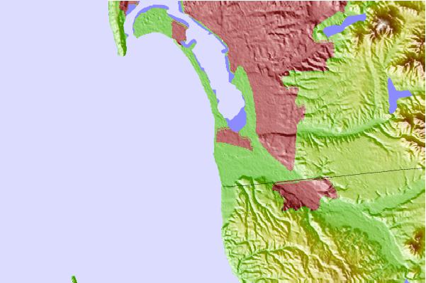

Gebruik deze reliëfkaart om naar de surfspots en de getijdenstations van CAL - San Diego County toe te gaan, in de buurt van Imperial Pier (North and South).
Andere Dichtbijzijnde Surflocaties van Imperial Pier (North and South):
(klik op locatienaam voor meer informatie)- Closest Locatie1 mi
- Second closest Locatie2 mi
- Third closest Locatie8 mi
- Fourth closest Locatie8 mi
- Fifth closest Locatie9 mi
Dichtstbijzijnde golfboeien bij Imperial Pier (North and South):
- Closest golfboei2 mi
- Second closest golfboei17 mi
- Third closest golfboei21 mi
- Fourth closest golfboei22 mi
- Fifth closest golfboei24 mi
Getijdenstations in de buurt van Imperial Pier (North and South):
- Closest getijdenstationImperial Beach0 mi
- Second closest getijdenstationChula Vista4 mi
- Third closest getijdenstationNational City, San Diego Bay6 mi
- Fourth closest getijdenstationTijuana6 mi
- Fifth closest getijdenstationPoint Loma8 mi
Airports
- The closest passenger airport to Imperial Pier (North and South) is North Island Nas (San Diego) Airport (NZY) in USA, 15 km (9 miles) away (directly).
- The second nearest airport to Imperial Pier (North and South) is General Abelardo L Rodriguez International (Tijuana) Airport (TIJ) in Mexico, 16 km (10 miles) away.
- Third is San Diego International Lindbergh Fld Airport (SAN) in USA, 18 km (11 miles) away.
- Miramar Mcas Airport (NKX) in USA is 32 km (20 miles) away.
- General Alberto L Salinas C International (Ensenada) Airport (ESE) in Mexico is the fifth nearest airport to Imperial Pier (North and South) and is 101 km (63 miles) away.
- /breaks/Imperial-Pier/forecasts/latest

 Nearest