

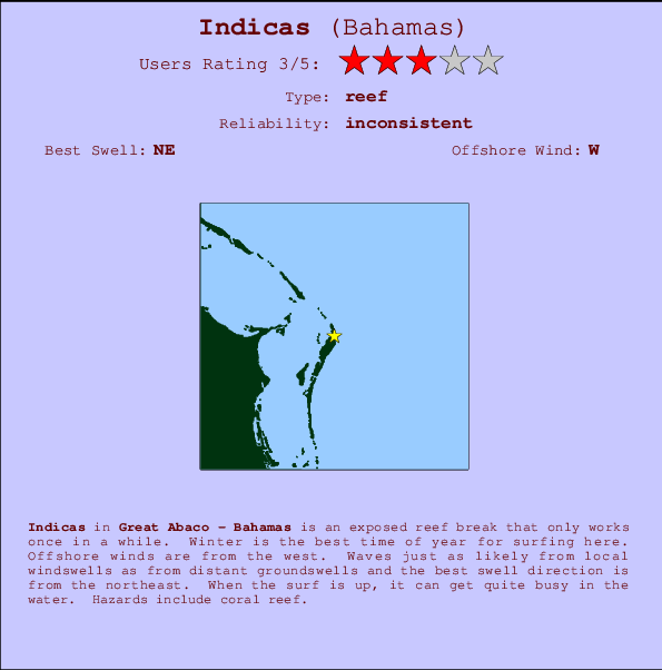
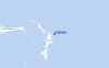
Indicas Surf Guide
Indicas in Great Abaco is an exposed reef break that only works once in a while. Winter is the best time of year for surfing here. The best wind direction is from the west. Tends to receive a mix of groundswells and windswells and the ideal swell angle is from the northeast. A reef breaks left. When it's working here, it can get crowded. Hazards include coral reef.
Indicas Spot Info
| Type: | Rating: | Reliability: | Todays Sea Temp*: |
|---|---|---|---|
| inconsistent | 30.4°C*ocean temperature recorded from satellite |
Surfing Indicas:
The best conditions reported for surf at Indicas occur when a Northeast swell combines with an offshore wind direction from the West.
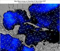
Voorspelde Golfenergie (Kracht): 12 uur

Indicas Surf:
Friday, 17 July 2026, 15:15 Local time| Friday 17 | ||||
| 11AM | 2PM | 5PM | 8PM | |
| Wave (m) | ||||
| Periode (s) | 8 | 8 | 8 | 8 |
| Wind (km/h) | ||||
| Wind | cross | cross- on |
cross- on |
cross- on |
- /breaks/Indicas/forecasts/latest
Indicas Surf Guide
Indicas in Great Abaco is an exposed reef break that only works once in a while. Winter is the best time of year for surfing here. The best wind direction is from the west. Tends to receive a mix of groundswells and windswells and the ideal swell angle is from the northeast. A reef breaks left. When it's working here, it can get crowded. Hazards include coral reef.
Indicas Spot Info
Type: Rating: Reliability: Todays Sea Temp*:  Reef
Reef 3
3inconsistent 30.4°C*ocean temperature recorded from satelliteSurfing Indicas:
The best conditions reported for surf at Indicas occur when a Northeast swell combines with an offshore wind direction from the West.
Voorspelde Golfenergie (Kracht): 12 uur
Gebruik de tabbladen hierboven om de zeewatertemperatuur bij Indicas te bekijken, foto's van Indicas, Indicas gedetailleerde golfvoorspellingen, wind- en weersvoorspellingen, Indicas webcams, actuele wind in Great Abaco live weerstations en Indicas getijdenvoorspellingen. De link van Bahamas golfkaarten opent een grote afbeelding van Bahamas en de omliggende zeeën. Deze golfkaarten kunnen worden dynamisch gemaakt worden met de verschillende golfcomponenten, golfenergie, golfperiode, golfhoogte, samen met de wind en weersvoorspellingen, het actuele weer en de zeetoestand volgens golfboeien uit Bahamas, langskomende schepen en weerstations op de kust. Elk voorspelling pagina's voor dit surfstrand zijn voorzien van een wereldwijde en regionale golfzoeker om de beste surfsomstandigheden in het gebied rond Indicas te vinden.
Indicas Surf:
Friday, 17 July 2026, 15:15 Local timeFriday 17 11AM 2PM 5PM 8PM Wave (m) Periode (s) 8 8 8 8 Wind (km/h) Wind cross cross-
oncross-
oncross-
on- /breaks/Indicas/forecasts/latest
- /breaks/Indicas/forecasts/latest/six_day
Indicas Surf Guide
Indicas in Great Abaco is an exposed reef break that only works once in a while. Winter is the best time of year for surfing here. The best wind direction is from the west. Tends to receive a mix of groundswells and windswells and the ideal swell angle is from the northeast. A reef breaks left. When it's working here, it can get crowded. Hazards include coral reef.
Indicas Spot Info
Type: Rating: Reliability: Todays Sea Temp*: Reef3inconsistent 30.4°C*ocean temperature recorded from satelliteSurfing Indicas:
The best conditions reported for surf at Indicas occur when a Northeast swell combines with an offshore wind direction from the West.
Voorspelde Golfenergie (Kracht): 12 uur
Gebruik de tabbladen hierboven om de zeewatertemperatuur bij Indicas te bekijken, foto's van Indicas, Indicas gedetailleerde golfvoorspellingen, wind- en weersvoorspellingen, Indicas webcams, actuele wind in Great Abaco live weerstations en Indicas getijdenvoorspellingen. De link van Bahamas golfkaarten opent een grote afbeelding van Bahamas en de omliggende zeeën. Deze golfkaarten kunnen worden dynamisch gemaakt worden met de verschillende golfcomponenten, golfenergie, golfperiode, golfhoogte, samen met de wind en weersvoorspellingen, het actuele weer en de zeetoestand volgens golfboeien uit Bahamas, langskomende schepen en weerstations op de kust. Elk voorspelling pagina's voor dit surfstrand zijn voorzien van een wereldwijde en regionale golfzoeker om de beste surfsomstandigheden in het gebied rond Indicas te vinden.
Indicas Surf:
Friday, 17 July 2026, 15:15 Local timeFriday 17 11AM 2PM 5PM 8PM Wave (m) Periode (s) 8 8 8 8 Wind (km/h) Wind cross cross-
oncross-
oncross-
on- /breaks/Indicas/forecasts/latest
Indicas Surf Guide
Indicas in Great Abaco is an exposed reef break that only works once in a while. Winter is the best time of year for surfing here. The best wind direction is from the west. Tends to receive a mix of groundswells and windswells and the ideal swell angle is from the northeast. A reef breaks left. When it's working here, it can get crowded. Hazards include coral reef.
Indicas Spot Info
Type: Rating: Reliability: Todays Sea Temp*: Reef3inconsistent 30.4°C*ocean temperature recorded from satelliteSurfing Indicas:
The best conditions reported for surf at Indicas occur when a Northeast swell combines with an offshore wind direction from the West.
Voorspelde Golfenergie (Kracht): 12 uur
Gebruik de tabbladen hierboven om de zeewatertemperatuur bij Indicas te bekijken, foto's van Indicas, Indicas gedetailleerde golfvoorspellingen, wind- en weersvoorspellingen, Indicas webcams, actuele wind in Great Abaco live weerstations en Indicas getijdenvoorspellingen. De link van Bahamas golfkaarten opent een grote afbeelding van Bahamas en de omliggende zeeën. Deze golfkaarten kunnen worden dynamisch gemaakt worden met de verschillende golfcomponenten, golfenergie, golfperiode, golfhoogte, samen met de wind en weersvoorspellingen, het actuele weer en de zeetoestand volgens golfboeien uit Bahamas, langskomende schepen en weerstations op de kust. Elk voorspelling pagina's voor dit surfstrand zijn voorzien van een wereldwijde en regionale golfzoeker om de beste surfsomstandigheden in het gebied rond Indicas te vinden.
Indicas Surf:
Friday, 17 July 2026, 15:15 Local timeFriday 17 11AM 2PM 5PM 8PM Wave (m) Periode (s) 8 8 8 8 Wind (km/h) Wind cross cross-
oncross-
oncross-
onTide Times:
Voor Four Rocks, %{dist} %{km} van %{location}.
VOLGENDE IS OM (lokale tijd) resterende tijd hoog water laag water Indicas Tide Times and Tide Chart
Live Weather:
At lightning 26km WNW of Marsh Harbour, 36 km from Indicas.

ThunderstormAir temperature
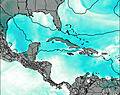
°COverall Indicas Surf Consistency and Wind Distribution in July
surffoto's uit
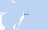
de galerijContourlijnen: Wegen & Rivieren: Kies een surflokatie uit het menu 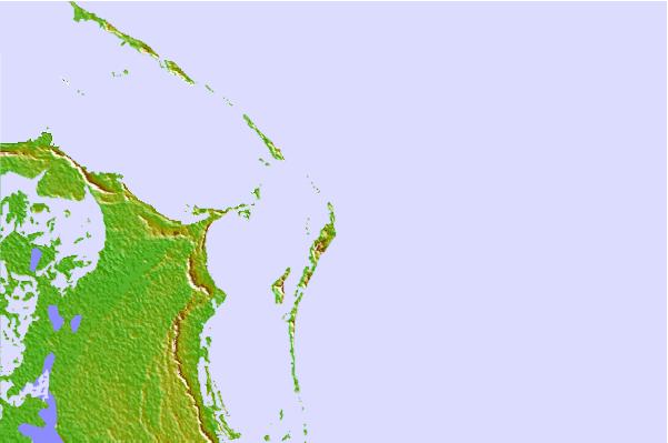
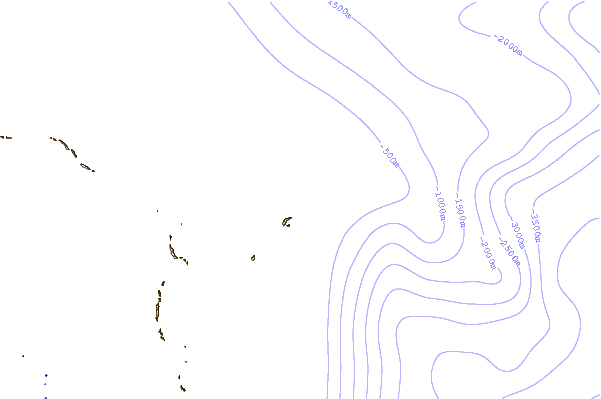
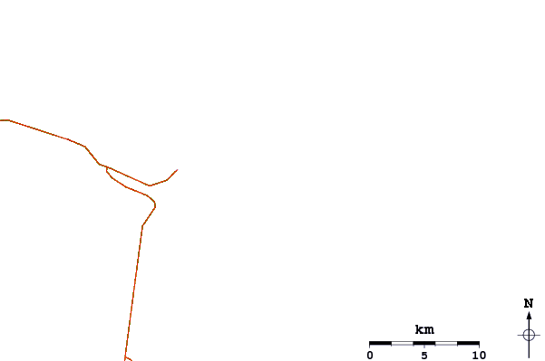
Gebruik deze reliëfkaart om naar de surfspots en de getijdenstations van Great Abaco toe te gaan, in de buurt van Indicas.
Andere Dichtbijzijnde Surflocaties van Indicas:
(klik op locatienaam voor meer informatie)- Closest Locatie1 mi
- Second closest Locatie1 mi
- Third closest Locatie2 mi
- Fourth closest Locatie2 mi
- Fifth closest Locatie3 mi
Dichtstbijzijnde golfboeien bij Indicas:
- Closest golfboei188 mi
- Second closest golfboei213 mi
- Third closest golfboei239 mi
- Fourth closest golfboei254 mi
- Fifth closest golfboei264 mi
Getijdenstations in de buurt van Indicas:
- Closest getijdenstationMarsh Harbour7 mi
- Second closest getijdenstationPelican Harbour, Abaco Island11 mi
- Third closest getijdenstationGreen Turtle Cay26 mi
- Fourth closest getijdenstationCooper's Town41 mi
- Fifth closest getijdenstationEleuthera Island (west coast)98 mi
Airports
- The closest passenger airport to Indicas is Marsh Harbour Airport (MHH) in Bahamas, 13 km (8 miles) away (directly).
- The second nearest airport to Indicas is Treasure Cay Airport (TCB), also in Bahamas, 48 km (30 miles) away.
- Third is North Eleuthera Airport (ELH) in Bahamas, 122 km (76 miles) away.
- Governors Harbour (Governor's Harbor) Airport (GHB) in Bahamas is 154 km (96 miles) away.
- Chub Cay Airport (CCZ), also in Bahamas is the fifth nearest airport to Indicas and is 156 km (97 miles) away.
- /breaks/Indicas/forecasts/latest


 Nearest