

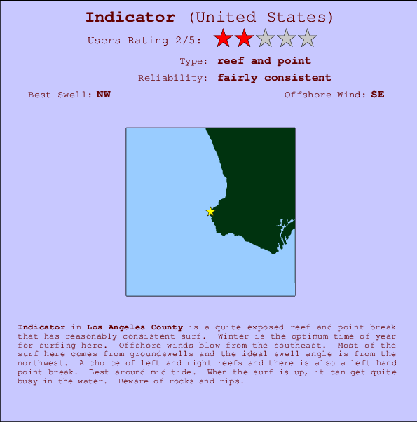
Indicator Surf Guide
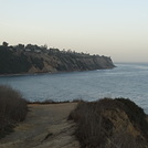
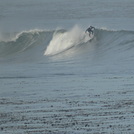
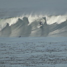
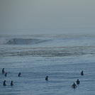
Indicator in LA County is a reasonably exposed reef and point break that has reasonably consistent surf. Winter is the best time of year for surfing here. Offshore winds are from the southeast. Most of the surf here comes from groundswells and the ideal swell direction is from the northwest. Reef breaks provide lefts and rights and there is also a left hand point break. Best around mid tide. A fairly popluar wave that can sometimes get crowded Hazards include rocks and rips.
Indicator Spot Info
| Type: | Rating: | Reliability: | Todays Sea Temp*: |
|---|---|---|---|
| fairly consistent | 22.0°C*ocean temperature recorded from satellite |
Surfing Indicator:
The best conditions reported for surf at Indicator occur when a Northwest swell combines with an offshore wind direction from the Southeast.

Voorspelde Golfenergie (Kracht): 12 uur


Indicator Surf:
Monday, 20 July 2026, 22:07 Local time| Mon | Tue | |||
| 8PM | 11PM | 2AM | 5AM | |
| Wave (m) | ||||
| Periode (s) | 16 | - | 13 | 13 |
| Wind (km/h) | ||||
| Wind | cross | cross- off |
cross- off |
off |
- /breaks/Indicator/forecasts/latest
Indicator Surf Guide
Indicator in LA County is a reasonably exposed reef and point break that has reasonably consistent surf. Winter is the best time of year for surfing here. Offshore winds are from the southeast. Most of the surf here comes from groundswells and the ideal swell direction is from the northwest. Reef breaks provide lefts and rights and there is also a left hand point break. Best around mid tide. A fairly popluar wave that can sometimes get crowded Hazards include rocks and rips.
Indicator Spot Info
Type: Rating: Reliability: Todays Sea Temp*:  Reef and point
 2
2fairly consistent 22.0°C*ocean temperature recorded from satelliteSurfing Indicator:
The best conditions reported for surf at Indicator occur when a Northwest swell combines with an offshore wind direction from the Southeast.
Voorspelde Golfenergie (Kracht): 12 uur
Gebruik de tabbladen hierboven om de zeewatertemperatuur bij Indicator te bekijken, foto's van Indicator, Indicator gedetailleerde golfvoorspellingen, wind- en weersvoorspellingen, Indicator webcams, actuele wind in CAL - LA County live weerstations en Indicator getijdenvoorspellingen. De link van United States golfkaarten opent een grote afbeelding van United States en de omliggende zeeën. Deze golfkaarten kunnen worden dynamisch gemaakt worden met de verschillende golfcomponenten, golfenergie, golfperiode, golfhoogte, samen met de wind en weersvoorspellingen, het actuele weer en de zeetoestand volgens golfboeien uit United States, langskomende schepen en weerstations op de kust. Elk voorspelling pagina's voor dit surfstrand zijn voorzien van een wereldwijde en regionale golfzoeker om de beste surfsomstandigheden in het gebied rond Indicator te vinden.
Indicator Surf:
Monday, 20 July 2026, 22:07 Local timeMon Tue 8PM 11PM 2AM 5AM Wave (m) Periode (s) 16 - 13 13 Wind (km/h) Wind cross cross-
offcross-
offoff - /breaks/Indicator/forecasts/latest
- /breaks/Indicator/forecasts/latest/six_day
Indicator Surf Guide
Indicator in LA County is a reasonably exposed reef and point break that has reasonably consistent surf. Winter is the best time of year for surfing here. Offshore winds are from the southeast. Most of the surf here comes from groundswells and the ideal swell direction is from the northwest. Reef breaks provide lefts and rights and there is also a left hand point break. Best around mid tide. A fairly popluar wave that can sometimes get crowded Hazards include rocks and rips.
Indicator Spot Info
Type: Rating: Reliability: Todays Sea Temp*: Reef and point2fairly consistent 22.0°C*ocean temperature recorded from satelliteSurfing Indicator:
The best conditions reported for surf at Indicator occur when a Northwest swell combines with an offshore wind direction from the Southeast.
Voorspelde Golfenergie (Kracht): 12 uur
Gebruik de tabbladen hierboven om de zeewatertemperatuur bij Indicator te bekijken, foto's van Indicator, Indicator gedetailleerde golfvoorspellingen, wind- en weersvoorspellingen, Indicator webcams, actuele wind in CAL - LA County live weerstations en Indicator getijdenvoorspellingen. De link van United States golfkaarten opent een grote afbeelding van United States en de omliggende zeeën. Deze golfkaarten kunnen worden dynamisch gemaakt worden met de verschillende golfcomponenten, golfenergie, golfperiode, golfhoogte, samen met de wind en weersvoorspellingen, het actuele weer en de zeetoestand volgens golfboeien uit United States, langskomende schepen en weerstations op de kust. Elk voorspelling pagina's voor dit surfstrand zijn voorzien van een wereldwijde en regionale golfzoeker om de beste surfsomstandigheden in het gebied rond Indicator te vinden.
Indicator Surf:
Monday, 20 July 2026, 22:07 Local timeMon Tue 8PM 11PM 2AM 5AM Wave (m) Periode (s) 16 - 13 13 Wind (km/h) Wind cross cross-
offcross-
offoff - /breaks/Indicator/forecasts/latest
Indicator Surf Guide
Indicator in LA County is a reasonably exposed reef and point break that has reasonably consistent surf. Winter is the best time of year for surfing here. Offshore winds are from the southeast. Most of the surf here comes from groundswells and the ideal swell direction is from the northwest. Reef breaks provide lefts and rights and there is also a left hand point break. Best around mid tide. A fairly popluar wave that can sometimes get crowded Hazards include rocks and rips.
Indicator Spot Info
Type: Rating: Reliability: Todays Sea Temp*: Reef and point2fairly consistent 22.0°C*ocean temperature recorded from satelliteSurfing Indicator:
The best conditions reported for surf at Indicator occur when a Northwest swell combines with an offshore wind direction from the Southeast.
Voorspelde Golfenergie (Kracht): 12 uur
Gebruik de tabbladen hierboven om de zeewatertemperatuur bij Indicator te bekijken, foto's van Indicator, Indicator gedetailleerde golfvoorspellingen, wind- en weersvoorspellingen, Indicator webcams, actuele wind in CAL - LA County live weerstations en Indicator getijdenvoorspellingen. De link van United States golfkaarten opent een grote afbeelding van United States en de omliggende zeeën. Deze golfkaarten kunnen worden dynamisch gemaakt worden met de verschillende golfcomponenten, golfenergie, golfperiode, golfhoogte, samen met de wind en weersvoorspellingen, het actuele weer en de zeetoestand volgens golfboeien uit United States, langskomende schepen en weerstations op de kust. Elk voorspelling pagina's voor dit surfstrand zijn voorzien van een wereldwijde en regionale golfzoeker om de beste surfsomstandigheden in het gebied rond Indicator te vinden.
Indicator Surf:
Monday, 20 July 2026, 22:07 Local timeMon Tue 8PM 11PM 2AM 5AM Wave (m) Periode (s) 16 - 13 13 Wind (km/h) Wind cross cross-
offcross-
offoff Tide Times:
Voor Palos Verdes Estates, %{dist} %{km} van %{location}.
VOLGENDE IS OM (lokale tijd) resterende tijd hoog water laag water Indicator Tide Times and Tide Chart
Live Weather:
At Torrance Municipal Airport, 10 km from Indicator.
wind obs. (17 kph from 320 degs) was rejected
(km/h)
ClearAir temperature
21.7°CCurrent weather near Indicator
Buoy Data:
At San Pedro, CA, 12 miles from Indicator.
5PM 6PM 7PM 8PM Gegevens Leeftijd 4 hr 3 hr 2 hr 1 hr Golfhoogte (m) 

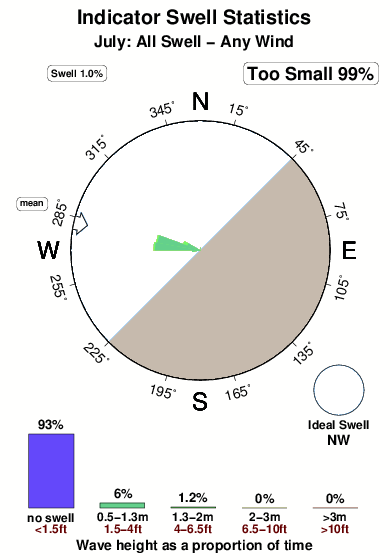
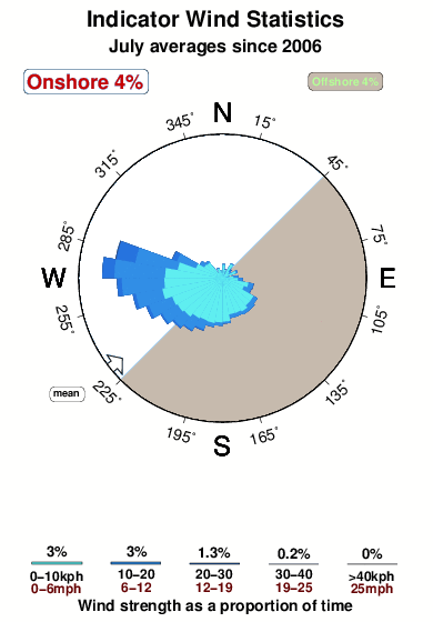
Dominante Periode (s) 13 13 14 13 Overall Indicator Surf Consistency and Wind Distribution in July
surffoto's uit
de galerijContourlijnen: Wegen & Rivieren: Kies een surflokatie uit het menu 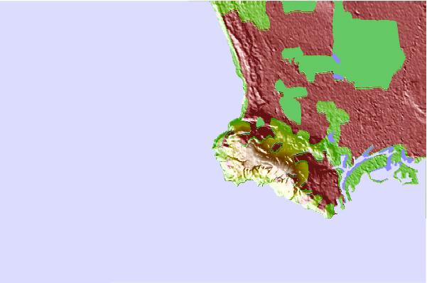
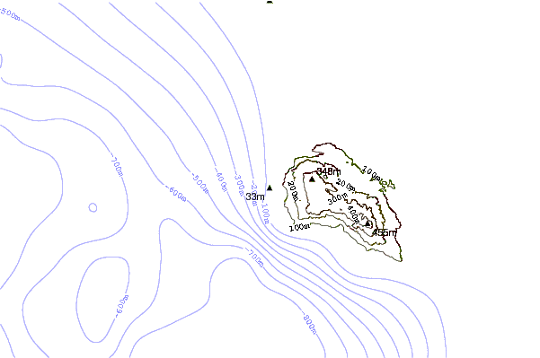
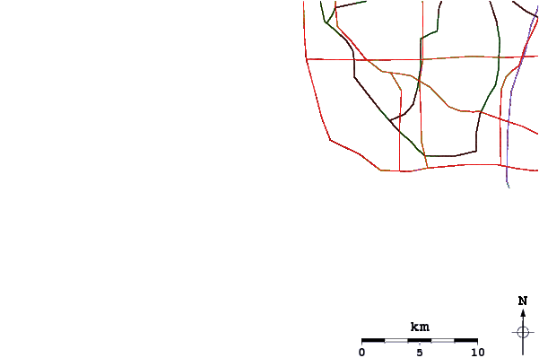
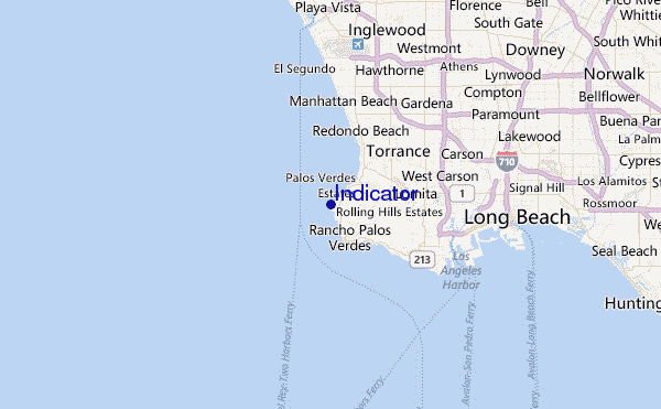
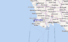
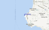
Gebruik deze reliëfkaart om naar de surfspots en de getijdenstations van CAL - LA County toe te gaan, in de buurt van Indicator.
Andere Dichtbijzijnde Surflocaties van Indicator:
(klik op locatienaam voor meer informatie)- Closest Locatie0 mi
- Second closest Locatie1 mi
- Third closest Locatie1 mi
- Fourth closest Locatie1 mi
- Fifth closest Locatie2 mi
Dichtstbijzijnde golfboeien bij Indicator:
- Closest golfboei12 mi
- Second closest golfboei13 mi
- Third closest golfboei14 mi
- Fourth closest golfboei20 mi
- Fifth closest golfboei34 mi
Getijdenstations in de buurt van Indicator:
- Closest getijdenstationPalos Verdes Estates2 mi
- Second closest getijdenstationRancho Palos Verdes3 mi
- Third closest getijdenstationKing Harbor, Santa Monica Bay5 mi
- Fourth closest getijdenstationLomita6 mi
- Fifth closest getijdenstationManhattan Beach7 mi
Airports
- The closest passenger airport to Indicator is Jack Northrop Fld Hawthorne Muni Airport (HHR) in USA, 18 km (11 miles) away (directly).
- The second nearest airport to Indicator is Los Angeles International Airport (LAX), also in USA, 18 km (11 miles) away.
- Third is Long Beach Airport (LGB) in USA, 26 km (16 miles) away.
- Burbank Glendale Pasadena Airport (BUR) in USA is 47 km (29 miles) away.
- John Wayne Arpt Orange Co (Santa Ana) Airport (SNA), also in USA is the fifth nearest airport to Indicator and is 53 km (33 miles) away.
- /breaks/Indicator/forecasts/latest


 Nearest