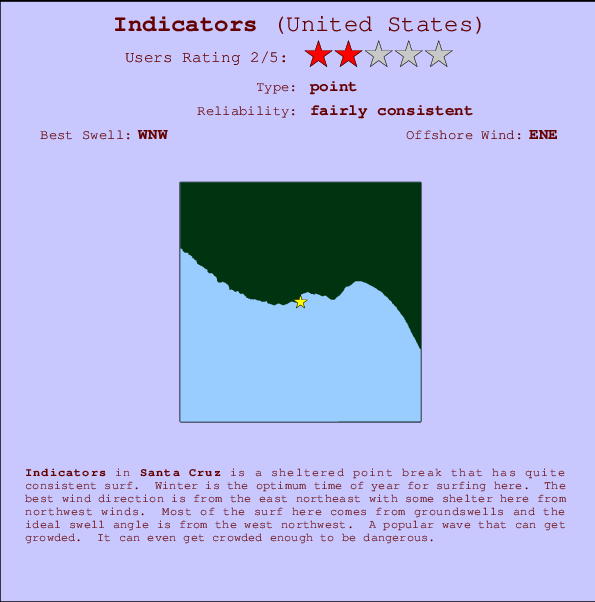
Indicators Surf Guide
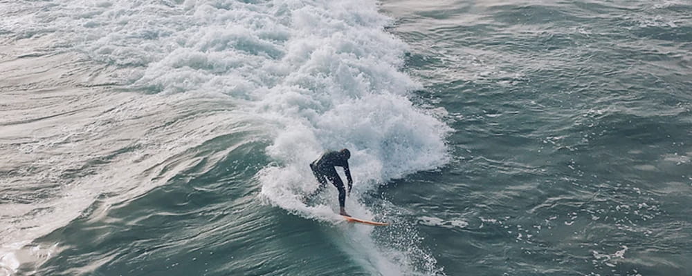
Indicators in Santa Cruz is a sheltered point break that has reasonably consistent surf. Winter is the optimum time of year for surfing here. The best wind direction is from the east northeast with some shelter here from northwest winds. Groundswells more frequent than windswells and the optimum swell angle is from the west northwest. Often Crowded. Overcrowding can even make surfing hazardous.
Indicators Spot Info
| Type: | Rating: | Reliability: | Todays Sea Temp*: |
|---|---|---|---|
| fairly consistent | 15.4°C*ocean temperature recorded from satellite |
Surfing Indicators:
The best conditions reported for surf at Indicators occur when a West-northwest swell combines with an offshore wind direction from the East-northeast.

Voorspelde Golfenergie (Kracht): 12 uur


Indicators Surf:
Saturday, 18 July 2026, 02:05 Local time| Saturday 18 | ||||
| 2AM | 5AM | 8AM | 11AM | |
| Wave (m) | ||||
| Periode (s) | 16 | 16 | 16 | 17 |
| Wind (km/h) | ||||
| Wind | glass | glass | glass | on |
- /breaks/Indicators/forecasts/latest
Indicators Surf Guide
Indicators in Santa Cruz is a sheltered point break that has reasonably consistent surf. Winter is the optimum time of year for surfing here. The best wind direction is from the east northeast with some shelter here from northwest winds. Groundswells more frequent than windswells and the optimum swell angle is from the west northwest. Often Crowded. Overcrowding can even make surfing hazardous.
Indicators Spot Info
Type: Rating: Reliability: Todays Sea Temp*:  Point
Point 2
2fairly consistent 15.4°C*ocean temperature recorded from satelliteSurfing Indicators:
The best conditions reported for surf at Indicators occur when a West-northwest swell combines with an offshore wind direction from the East-northeast.
Voorspelde Golfenergie (Kracht): 12 uur
Gebruik de tabbladen hierboven om de zeewatertemperatuur bij Indicators te bekijken, foto's van Indicators, Indicators gedetailleerde golfvoorspellingen, wind- en weersvoorspellingen, Indicators webcams, actuele wind in CAL - Santa Cruz live weerstations en Indicators getijdenvoorspellingen. De link van United States golfkaarten opent een grote afbeelding van United States en de omliggende zeeën. Deze golfkaarten kunnen worden dynamisch gemaakt worden met de verschillende golfcomponenten, golfenergie, golfperiode, golfhoogte, samen met de wind en weersvoorspellingen, het actuele weer en de zeetoestand volgens golfboeien uit United States, langskomende schepen en weerstations op de kust. Elk voorspelling pagina's voor dit surfstrand zijn voorzien van een wereldwijde en regionale golfzoeker om de beste surfsomstandigheden in het gebied rond Indicators te vinden.
Indicators Surf:
Saturday, 18 July 2026, 02:05 Local timeSaturday 18 2AM 5AM 8AM 11AM Wave (m) Periode (s) 16 16 16 17 Wind (km/h) Wind glass glass glass on - /breaks/Indicators/forecasts/latest
- /breaks/Indicators/forecasts/latest/six_day
Indicators Surf Guide
Indicators in Santa Cruz is a sheltered point break that has reasonably consistent surf. Winter is the optimum time of year for surfing here. The best wind direction is from the east northeast with some shelter here from northwest winds. Groundswells more frequent than windswells and the optimum swell angle is from the west northwest. Often Crowded. Overcrowding can even make surfing hazardous.
Indicators Spot Info
Type: Rating: Reliability: Todays Sea Temp*: Point2fairly consistent 15.4°C*ocean temperature recorded from satelliteSurfing Indicators:
The best conditions reported for surf at Indicators occur when a West-northwest swell combines with an offshore wind direction from the East-northeast.
Voorspelde Golfenergie (Kracht): 12 uur
Gebruik de tabbladen hierboven om de zeewatertemperatuur bij Indicators te bekijken, foto's van Indicators, Indicators gedetailleerde golfvoorspellingen, wind- en weersvoorspellingen, Indicators webcams, actuele wind in CAL - Santa Cruz live weerstations en Indicators getijdenvoorspellingen. De link van United States golfkaarten opent een grote afbeelding van United States en de omliggende zeeën. Deze golfkaarten kunnen worden dynamisch gemaakt worden met de verschillende golfcomponenten, golfenergie, golfperiode, golfhoogte, samen met de wind en weersvoorspellingen, het actuele weer en de zeetoestand volgens golfboeien uit United States, langskomende schepen en weerstations op de kust. Elk voorspelling pagina's voor dit surfstrand zijn voorzien van een wereldwijde en regionale golfzoeker om de beste surfsomstandigheden in het gebied rond Indicators te vinden.
Indicators Surf:
Saturday, 18 July 2026, 02:05 Local timeSaturday 18 2AM 5AM 8AM 11AM Wave (m) Periode (s) 16 16 16 17 Wind (km/h) Wind glass glass glass on - /breaks/Indicators/forecasts/latest
Indicators Surf Guide
Indicators in Santa Cruz is a sheltered point break that has reasonably consistent surf. Winter is the optimum time of year for surfing here. The best wind direction is from the east northeast with some shelter here from northwest winds. Groundswells more frequent than windswells and the optimum swell angle is from the west northwest. Often Crowded. Overcrowding can even make surfing hazardous.
Indicators Spot Info
Type: Rating: Reliability: Todays Sea Temp*: Point2fairly consistent 15.4°C*ocean temperature recorded from satelliteSurfing Indicators:
The best conditions reported for surf at Indicators occur when a West-northwest swell combines with an offshore wind direction from the East-northeast.
Voorspelde Golfenergie (Kracht): 12 uur
Gebruik de tabbladen hierboven om de zeewatertemperatuur bij Indicators te bekijken, foto's van Indicators, Indicators gedetailleerde golfvoorspellingen, wind- en weersvoorspellingen, Indicators webcams, actuele wind in CAL - Santa Cruz live weerstations en Indicators getijdenvoorspellingen. De link van United States golfkaarten opent een grote afbeelding van United States en de omliggende zeeën. Deze golfkaarten kunnen worden dynamisch gemaakt worden met de verschillende golfcomponenten, golfenergie, golfperiode, golfhoogte, samen met de wind en weersvoorspellingen, het actuele weer en de zeetoestand volgens golfboeien uit United States, langskomende schepen en weerstations op de kust. Elk voorspelling pagina's voor dit surfstrand zijn voorzien van een wereldwijde en regionale golfzoeker om de beste surfsomstandigheden in het gebied rond Indicators te vinden.
Indicators Surf:
Saturday, 18 July 2026, 02:05 Local timeSaturday 18 2AM 5AM 8AM 11AM Wave (m) Periode (s) 16 16 16 17 Wind (km/h) Wind glass glass glass on Tide Times:
Voor Santa Cruz, California, %{dist} %{km} van %{location}.
VOLGENDE IS OM (lokale tijd) resterende tijd hoog water laag water Indicators Tide Times and Tide Chart
Live Weather:
At Santa Cruz, 2 km from Indicators.
calm
(km/h)
dryAir temperature
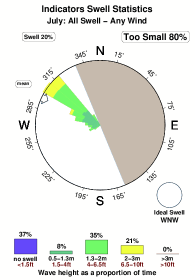
14°COverall Indicators Surf Consistency and Wind Distribution in July
surffoto's uit
de galerijContourlijnen: Wegen & Rivieren: Kies een surflokatie uit het menu 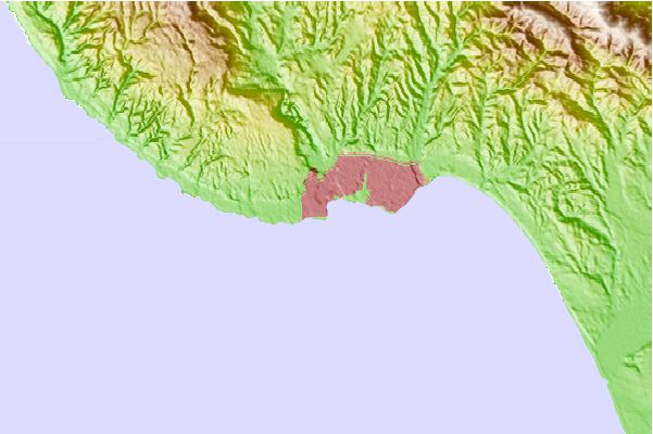
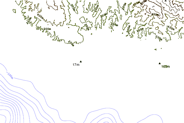
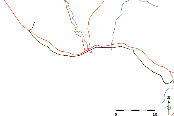
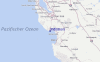
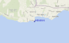
Gebruik deze reliëfkaart om naar de surfspots en de getijdenstations van CAL - Santa Cruz toe te gaan, in de buurt van Indicators.
Andere Dichtbijzijnde Surflocaties van Indicators:
(klik op locatienaam voor meer informatie)- Closest Locatie0 mi
- Second closest Locatie0 mi
- Third closest Locatie0 mi
- Fourth closest Locatie1 mi
- Fifth closest Locatie1 mi
Dichtstbijzijnde golfboeien bij Indicators:
- Closest golfboei23 mi
- Second closest golfboei24 mi
- Third closest golfboei24 mi
- Fourth closest golfboei42 mi
- Fifth closest golfboei55 mi
Getijdenstations in de buurt van Indicators:
- Closest getijdenstationSanta Cruz1 mi
- Second closest getijdenstationLive Oak3 mi
- Third closest getijdenstationRio Del Mar7 mi
- Fourth closest getijdenstationAptos7 mi
- Fifth closest getijdenstationElkhorn Slough railroad bridge16 mi
Airports
- The closest passenger airport to Indicators is Norman Y Mineta San Jose International Airport (SJC) in USA, 46 km (29 miles) away (directly).
- The second nearest airport to Indicators is Moffett Federal Afld (Mountain View) Airport (NUQ), also in USA, 52 km (32 miles) away.
- Third is San Francisco International Airport (SFO) in USA, 80 km (50 miles) away.
- Metropolitan Oakland International Airport (OAK) in USA is 87 km (54 miles) away.
- Modesto City Co Harry Sham Airport (MOD), also in USA is the fifth nearest airport to Indicators and is 121 km (75 miles) away.
- /breaks/Indicators/forecasts/latest


 Nearest