

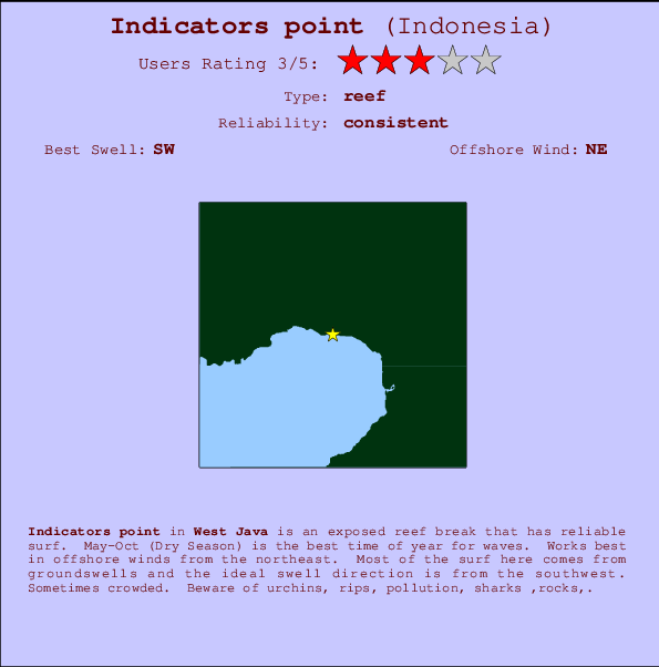
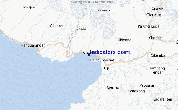
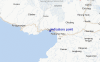
Indicators point Surf Guide
Indicators point in West Java is an exposed reef break that has reliable surf. May-Oct (Dry Season) is the best time of year for waves. Works best in offshore winds from the northeast. Tends to receive distant groundswells and the optimum swell angle is from the southwest. A reef breaks right. Sometimes crowded. Take care of urchins, rips, pollution, sharks ,rocks,.
Indicators point Spot Info
| Type: | Rating: | Reliability: | Todays Sea Temp*: |
|---|---|---|---|
| consistent | 28.0°C*ocean temperature recorded from satellite |
Surfing Indicators point:
The best conditions reported for surf at Indicators point occur when a Southwest swell combines with an offshore wind direction from the Northeast.

Voorspelde Golfenergie (Kracht): 12 uur


Indicators point Surf:
Tuesday, 21 July 2026, 02:36 Local time| Mon | Tuesday 21 | |||
| 10PM | 1AM | 4AM | 7AM | |
| Wave (m) | ||||
| Periode (s) | 15 | 15 | 14 | 14 |
| Wind (km/h) | ||||
| Wind | cross- off |
cross- off |
cross- off |
cross- off |
- /breaks/Indicatorspoint/forecasts/latest
Indicators point Surf Guide
Indicators point in West Java is an exposed reef break that has reliable surf. May-Oct (Dry Season) is the best time of year for waves. Works best in offshore winds from the northeast. Tends to receive distant groundswells and the optimum swell angle is from the southwest. A reef breaks right. Sometimes crowded. Take care of urchins, rips, pollution, sharks ,rocks,.
Indicators point Spot Info
Type: Rating: Reliability: Todays Sea Temp*:  Reef
Reef 3
3consistent 28.0°C*ocean temperature recorded from satelliteSurfing Indicators point:
The best conditions reported for surf at Indicators point occur when a Southwest swell combines with an offshore wind direction from the Northeast.
Voorspelde Golfenergie (Kracht): 12 uur
Gebruik de tabbladen hierboven om de zeewatertemperatuur bij Indicators point te bekijken, foto's van Indicators point, Indicators point gedetailleerde golfvoorspellingen, wind- en weersvoorspellingen, Indicators point webcams, actuele wind in Java - West live weerstations en Indicators point getijdenvoorspellingen. De link van Indonesia golfkaarten opent een grote afbeelding van Indonesia en de omliggende zeeën. Deze golfkaarten kunnen worden dynamisch gemaakt worden met de verschillende golfcomponenten, golfenergie, golfperiode, golfhoogte, samen met de wind en weersvoorspellingen, het actuele weer en de zeetoestand volgens golfboeien uit Indonesia, langskomende schepen en weerstations op de kust. Elk voorspelling pagina's voor dit surfstrand zijn voorzien van een wereldwijde en regionale golfzoeker om de beste surfsomstandigheden in het gebied rond Indicators point te vinden.
Indicators point Surf:
Tuesday, 21 July 2026, 02:36 Local timeMon Tuesday 21 10PM 1AM 4AM 7AM Wave (m) Periode (s) 15 15 14 14 Wind (km/h) Wind cross-
offcross-
offcross-
offcross-
off- /breaks/Indicatorspoint/forecasts/latest
- /breaks/Indicatorspoint/forecasts/latest/six_day
Indicators point Surf Guide
Indicators point in West Java is an exposed reef break that has reliable surf. May-Oct (Dry Season) is the best time of year for waves. Works best in offshore winds from the northeast. Tends to receive distant groundswells and the optimum swell angle is from the southwest. A reef breaks right. Sometimes crowded. Take care of urchins, rips, pollution, sharks ,rocks,.
Indicators point Spot Info
Type: Rating: Reliability: Todays Sea Temp*: Reef3consistent 28.0°C*ocean temperature recorded from satelliteSurfing Indicators point:
The best conditions reported for surf at Indicators point occur when a Southwest swell combines with an offshore wind direction from the Northeast.
Voorspelde Golfenergie (Kracht): 12 uur
Gebruik de tabbladen hierboven om de zeewatertemperatuur bij Indicators point te bekijken, foto's van Indicators point, Indicators point gedetailleerde golfvoorspellingen, wind- en weersvoorspellingen, Indicators point webcams, actuele wind in Java - West live weerstations en Indicators point getijdenvoorspellingen. De link van Indonesia golfkaarten opent een grote afbeelding van Indonesia en de omliggende zeeën. Deze golfkaarten kunnen worden dynamisch gemaakt worden met de verschillende golfcomponenten, golfenergie, golfperiode, golfhoogte, samen met de wind en weersvoorspellingen, het actuele weer en de zeetoestand volgens golfboeien uit Indonesia, langskomende schepen en weerstations op de kust. Elk voorspelling pagina's voor dit surfstrand zijn voorzien van een wereldwijde en regionale golfzoeker om de beste surfsomstandigheden in het gebied rond Indicators point te vinden.
Indicators point Surf:
Tuesday, 21 July 2026, 02:36 Local timeMon Tuesday 21 10PM 1AM 4AM 7AM Wave (m) Periode (s) 15 15 14 14 Wind (km/h) Wind cross-
offcross-
offcross-
offcross-
off- /breaks/Indicatorspoint/forecasts/latest
Indicators point Surf Guide
Indicators point in West Java is an exposed reef break that has reliable surf. May-Oct (Dry Season) is the best time of year for waves. Works best in offshore winds from the northeast. Tends to receive distant groundswells and the optimum swell angle is from the southwest. A reef breaks right. Sometimes crowded. Take care of urchins, rips, pollution, sharks ,rocks,.
Indicators point Spot Info
Type: Rating: Reliability: Todays Sea Temp*: Reef3consistent 28.0°C*ocean temperature recorded from satelliteSurfing Indicators point:
The best conditions reported for surf at Indicators point occur when a Southwest swell combines with an offshore wind direction from the Northeast.
Voorspelde Golfenergie (Kracht): 12 uur
Gebruik de tabbladen hierboven om de zeewatertemperatuur bij Indicators point te bekijken, foto's van Indicators point, Indicators point gedetailleerde golfvoorspellingen, wind- en weersvoorspellingen, Indicators point webcams, actuele wind in Java - West live weerstations en Indicators point getijdenvoorspellingen. De link van Indonesia golfkaarten opent een grote afbeelding van Indonesia en de omliggende zeeën. Deze golfkaarten kunnen worden dynamisch gemaakt worden met de verschillende golfcomponenten, golfenergie, golfperiode, golfhoogte, samen met de wind en weersvoorspellingen, het actuele weer en de zeetoestand volgens golfboeien uit Indonesia, langskomende schepen en weerstations op de kust. Elk voorspelling pagina's voor dit surfstrand zijn voorzien van een wereldwijde en regionale golfzoeker om de beste surfsomstandigheden in het gebied rond Indicators point te vinden.
Indicators point Surf:
Tuesday, 21 July 2026, 02:36 Local timeMon Tuesday 21 10PM 1AM 4AM 7AM Wave (m) Periode (s) 15 15 14 14 Wind (km/h) Wind cross-
offcross-
offcross-
offcross-
offTide Times:
Voor Karang Haji - Ocean Queen Hotel, %{dist} %{km} van %{location}.
VOLGENDE IS OM (lokale tijd) resterende tijd hoog water laag water Indicators point Tide Times and Tide Chart
Live Weather:
At Genteng wx, 50 km from Indicators point.
calm
(km/h)Air temperature
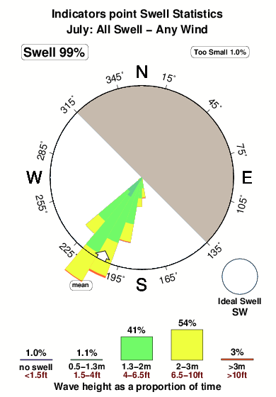
-°COverall Indicators point Surf Consistency and Wind Distribution in July


Wind stats for Indicators point: see the variation in direction and stength by month.
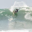
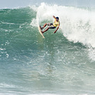
surffoto's uit
de galerijContourlijnen: Wegen & Rivieren: Kies een surflokatie uit het menu 
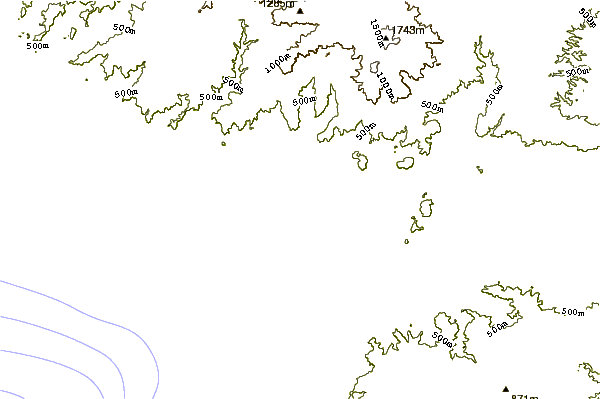
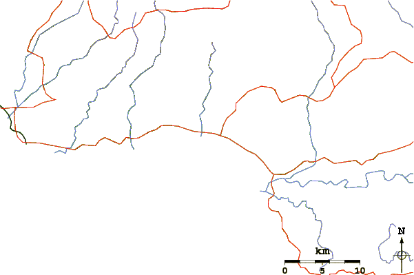
Gebruik deze reliëfkaart om naar de surfspots en de getijdenstations van Java - West toe te gaan, in de buurt van Indicators point.
Andere Dichtbijzijnde Surflocaties van Indicators point:
(klik op locatienaam voor meer informatie)- Closest Locatie1 mi
- Second closest Locatie2 mi
- Third closest Locatie4 mi
- Fourth closest Locatie6 mi
- Fifth closest Locatie17 mi
Dichtstbijzijnde golfboeien bij Indicators point:
- Closest golfboei2428 mi
- Second closest golfboei2470 mi
- Third closest golfboei2536 mi
- Fourth closest golfboei2700 mi
- Fifth closest golfboei2711 mi
Getijdenstations in de buurt van Indicators point:
- Closest getijdenstationPelabuhanratu5 mi
- Second closest getijdenstationJakarta60 mi
- Third closest getijdenstationLabuhan61 mi
- Fourth closest getijdenstationTanjung Priok65 mi
- Fifth closest getijdenstationBandar Lampung132 mi
Airports
- The closest passenger airport to Indicators point is Pondok Cabe (Jakarta) Airport (PCB) in Indonesia, 76 km (47 miles) away (directly).
- The second nearest airport to Indicators point is Halim Perdanakusuma International (Jakarta) Airport (HLP), also in Indonesia, 90 km (56 miles) away.
- Third is Soekarno Hatta International (Jakarta) Airport (CGK) in Indonesia, 95 km (59 miles) away.
- Husein Sastranegara (Bandung) Airport (BDO) in Indonesia is 121 km (75 miles) away.
- Penggung (Cirebon) Airport (CBN), also in Indonesia is the fifth nearest airport to Indicators point and is 228 km (142 miles) away.
- /breaks/Indicatorspoint/forecasts/latest


 Nearest