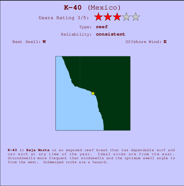
K-40 Surf Guide
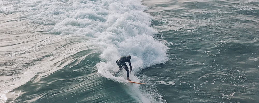
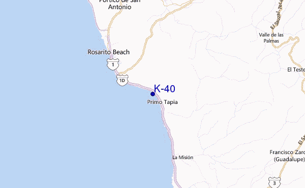
K-40 in Baja Norte is an exposed reef break that has consistent surf and can work at any time of the year. Offshore winds blow from the east. Groundswells more frequent than windswells and the ideal swell angle is from the west. A choice of left and right reefs. Submerged rocks are a hazard.
K-40 Spot Info
| Type: | Rating: | Reliability: | Todays Sea Temp*: |
|---|---|---|---|
| consistent | 20.9°C*ocean temperature recorded from satellite |
Surfing K-40:
The best conditions reported for surf at K-40 occur when a West swell combines with an offshore wind direction from the East.
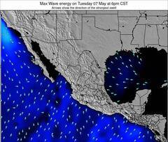
Voorspelde Golfenergie (Kracht): 12 uur


K-40 Surf:
Friday, 17 July 2026, 03:13 Local time| Friday 17 | ||||
| 2AM | 5AM | 8AM | 11AM | |
| Wave (m) | ||||
| Periode (s) | 19 | 19 | 19 | 19 |
| Wind (km/h) | ||||
| Wind | cross- off |
cross- off |
cross | cross |
- /breaks/K-40/forecasts/latest
K-40 Surf Guide
K-40 in Baja Norte is an exposed reef break that has consistent surf and can work at any time of the year. Offshore winds blow from the east. Groundswells more frequent than windswells and the ideal swell angle is from the west. A choice of left and right reefs. Submerged rocks are a hazard.
K-40 Spot Info
Type: Rating: Reliability: Todays Sea Temp*:  Reef
Reef 3
3consistent 20.9°C*ocean temperature recorded from satelliteSurfing K-40:
The best conditions reported for surf at K-40 occur when a West swell combines with an offshore wind direction from the East.
Voorspelde Golfenergie (Kracht): 12 uur
Gebruik de tabbladen hierboven om de zeewatertemperatuur bij K-40 te bekijken, foto's van K-40, K-40 gedetailleerde golfvoorspellingen, wind- en weersvoorspellingen, K-40 webcams, actuele wind in Baja Norte live weerstations en K-40 getijdenvoorspellingen. De link van Mexico golfkaarten opent een grote afbeelding van Mexico en de omliggende zeeën. Deze golfkaarten kunnen worden dynamisch gemaakt worden met de verschillende golfcomponenten, golfenergie, golfperiode, golfhoogte, samen met de wind en weersvoorspellingen, het actuele weer en de zeetoestand volgens golfboeien uit Mexico, langskomende schepen en weerstations op de kust. Elk voorspelling pagina's voor dit surfstrand zijn voorzien van een wereldwijde en regionale golfzoeker om de beste surfsomstandigheden in het gebied rond K-40 te vinden.
K-40 Surf:
Friday, 17 July 2026, 03:13 Local timeFriday 17 2AM 5AM 8AM 11AM Wave (m) Periode (s) 19 19 19 19 Wind (km/h) Wind cross-
offcross-
offcross cross - /breaks/K-40/forecasts/latest
- /breaks/K-40/forecasts/latest/six_day
K-40 Surf Guide
K-40 in Baja Norte is an exposed reef break that has consistent surf and can work at any time of the year. Offshore winds blow from the east. Groundswells more frequent than windswells and the ideal swell angle is from the west. A choice of left and right reefs. Submerged rocks are a hazard.
K-40 Spot Info
Type: Rating: Reliability: Todays Sea Temp*: Reef3consistent 20.9°C*ocean temperature recorded from satelliteSurfing K-40:
The best conditions reported for surf at K-40 occur when a West swell combines with an offshore wind direction from the East.
Voorspelde Golfenergie (Kracht): 12 uur
Gebruik de tabbladen hierboven om de zeewatertemperatuur bij K-40 te bekijken, foto's van K-40, K-40 gedetailleerde golfvoorspellingen, wind- en weersvoorspellingen, K-40 webcams, actuele wind in Baja Norte live weerstations en K-40 getijdenvoorspellingen. De link van Mexico golfkaarten opent een grote afbeelding van Mexico en de omliggende zeeën. Deze golfkaarten kunnen worden dynamisch gemaakt worden met de verschillende golfcomponenten, golfenergie, golfperiode, golfhoogte, samen met de wind en weersvoorspellingen, het actuele weer en de zeetoestand volgens golfboeien uit Mexico, langskomende schepen en weerstations op de kust. Elk voorspelling pagina's voor dit surfstrand zijn voorzien van een wereldwijde en regionale golfzoeker om de beste surfsomstandigheden in het gebied rond K-40 te vinden.
K-40 Surf:
Friday, 17 July 2026, 03:13 Local timeFriday 17 2AM 5AM 8AM 11AM Wave (m) Periode (s) 19 19 19 19 Wind (km/h) Wind cross-
offcross-
offcross cross - /breaks/K-40/forecasts/latest
K-40 Surf Guide
K-40 in Baja Norte is an exposed reef break that has consistent surf and can work at any time of the year. Offshore winds blow from the east. Groundswells more frequent than windswells and the ideal swell angle is from the west. A choice of left and right reefs. Submerged rocks are a hazard.
K-40 Spot Info
Type: Rating: Reliability: Todays Sea Temp*: Reef3consistent 20.9°C*ocean temperature recorded from satelliteSurfing K-40:
The best conditions reported for surf at K-40 occur when a West swell combines with an offshore wind direction from the East.
Voorspelde Golfenergie (Kracht): 12 uur
Gebruik de tabbladen hierboven om de zeewatertemperatuur bij K-40 te bekijken, foto's van K-40, K-40 gedetailleerde golfvoorspellingen, wind- en weersvoorspellingen, K-40 webcams, actuele wind in Baja Norte live weerstations en K-40 getijdenvoorspellingen. De link van Mexico golfkaarten opent een grote afbeelding van Mexico en de omliggende zeeën. Deze golfkaarten kunnen worden dynamisch gemaakt worden met de verschillende golfcomponenten, golfenergie, golfperiode, golfhoogte, samen met de wind en weersvoorspellingen, het actuele weer en de zeetoestand volgens golfboeien uit Mexico, langskomende schepen en weerstations op de kust. Elk voorspelling pagina's voor dit surfstrand zijn voorzien van een wereldwijde en regionale golfzoeker om de beste surfsomstandigheden in het gebied rond K-40 te vinden.
K-40 Surf:
Friday, 17 July 2026, 03:13 Local timeFriday 17 2AM 5AM 8AM 11AM Wave (m) Periode (s) 19 19 19 19 Wind (km/h) Wind cross-
offcross-
offcross cross Tide Times:
Voor Primo Tapia, %{dist} %{km} van %{location}.
VOLGENDE IS OM (lokale tijd) resterende tijd hoog water laag water K-40 Tide Times and Tide Chart
Live Weather:
At Tijuana International Airport, 33 km from K-40.
wind obs. (11 kph from 310 degs) was rejected
(km/h)
Dry and partly cloudyAir temperature
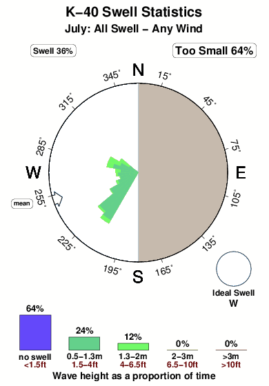
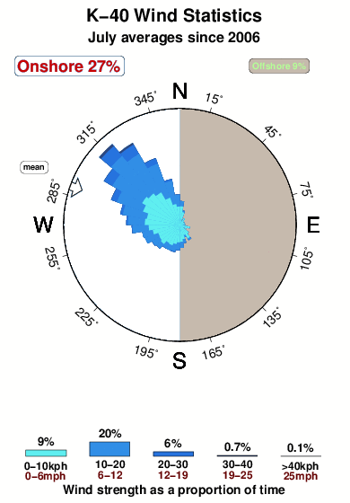
22°COverall K-40 Surf Consistency and Wind Distribution in July
surffoto's uit
de galerijContourlijnen: Wegen & Rivieren: Kies een surflokatie uit het menu 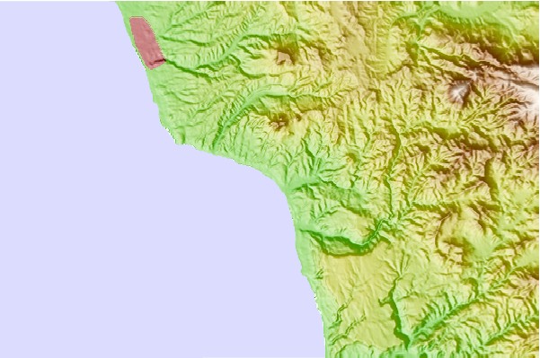
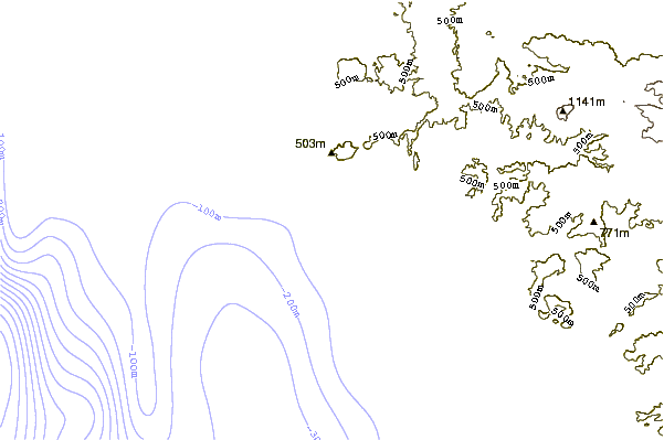
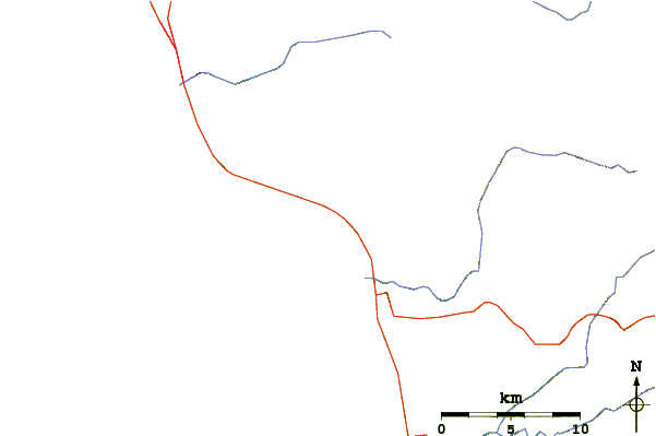
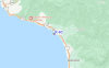
Gebruik deze reliëfkaart om naar de surfspots en de getijdenstations van Baja Norte toe te gaan, in de buurt van K-40.
Andere Dichtbijzijnde Surflocaties van K-40:
(klik op locatienaam voor meer informatie)- Closest Locatie1 mi
- Second closest Locatie2 mi
- Third closest Locatie2 mi
- Fourth closest Locatie3 mi
- Fifth closest Locatie4 mi
Dichtstbijzijnde golfboeien bij K-40:
- Closest golfboei27 mi
- Second closest golfboei35 mi
- Third closest golfboei47 mi
- Fourth closest golfboei48 mi
- Fifth closest golfboei48 mi
Getijdenstations in de buurt van K-40:
- Closest getijdenstationPrimo Tapia2 mi
- Second closest getijdenstationRosarito9 mi
- Third closest getijdenstationTijuana20 mi
- Fourth closest getijdenstationChula Vista26 mi
- Fifth closest getijdenstationImperial Beach26 mi
Airports
- The closest passenger airport to K-40 is General Abelardo L Rodriguez International (Tijuana) Airport (TIJ) in Mexico, 34 km (21 miles) away (directly).
- The second nearest airport to K-40 is North Island Nas (San Diego) Airport (NZY) in USA, 57 km (35 miles) away.
- Third is General Alberto L Salinas C International (Ensenada) Airport (ESE) in Mexico, 59 km (37 miles) away.
- San Diego International Lindbergh Fld Airport (SAN) in USA is 60 km (37 miles) away.
- Miramar Mcas Airport (NKX), also in USA is the fifth nearest airport to K-40 and is 72 km (45 miles) away.
- /breaks/K-40/forecasts/latest


 Nearest