
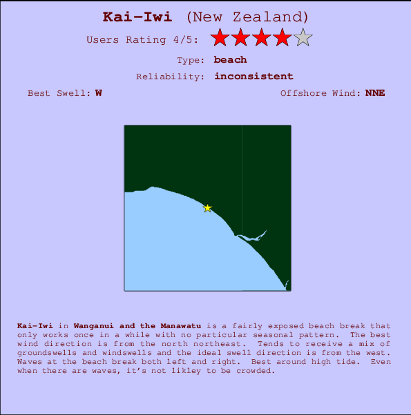
Kai-Iwi Surf Guide
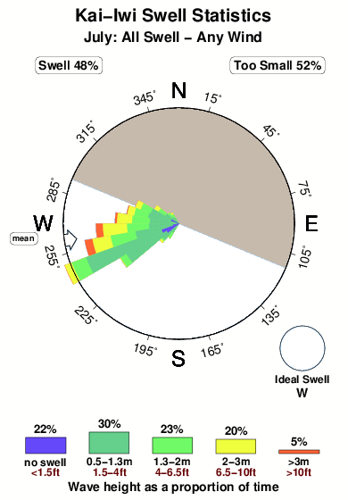
Kai-Iwi in Wanganui-Manawatu is a fairly exposed beach break that has inconsistent surf with no particular seasonal pattern. Works best in offshore winds from the north northeast. Windswells and groundswells in equal measure and the best swell direction is from the west. The beach breaks offer lefts and rights. Best around high tide. Rarely crowded here.
Kai-Iwi Spot Info
| Type: | Rating: | Reliability: | Todays Sea Temp*: |
|---|---|---|---|
| inconsistent | 13.2°C*ocean temperature recorded from satellite |
Surfing Kai-Iwi:
The best conditions reported for surf at Kai-Iwi occur when a West swell combines with an offshore wind direction from the North-northeast.

Voorspelde Golfenergie (Kracht): 12 uur


Kai-Iwi Surf:
Thursday, 16 July 2026, 05:39 Local time| Thursday 16 | ||||
| 3AM | 6AM | 9AM | 12PM | |
| Wave (m) | ||||
| Periode (s) | 15 | 15 | 15 | 15 |
| Wind (km/h) | ||||
| Wind | cross- off |
cross- off |
cross- off |
cross- off |
- /breaks/Kai-Iwi/forecasts/latest
Kai-Iwi Surf Guide
Kai-Iwi in Wanganui-Manawatu is a fairly exposed beach break that has inconsistent surf with no particular seasonal pattern. Works best in offshore winds from the north northeast. Windswells and groundswells in equal measure and the best swell direction is from the west. The beach breaks offer lefts and rights. Best around high tide. Rarely crowded here.
Kai-Iwi Spot Info
Type: Rating: Reliability: Todays Sea Temp*:  Beach
Beach 4
4inconsistent 13.2°C*ocean temperature recorded from satelliteSurfing Kai-Iwi:
The best conditions reported for surf at Kai-Iwi occur when a West swell combines with an offshore wind direction from the North-northeast.
Voorspelde Golfenergie (Kracht): 12 uur
Gebruik de tabbladen hierboven om de zeewatertemperatuur bij Kai-Iwi te bekijken, foto's van Kai-Iwi, Kai-Iwi gedetailleerde golfvoorspellingen, wind- en weersvoorspellingen, Kai-Iwi webcams, actuele wind in Wanganui-Manawatu live weerstations en Kai-Iwi getijdenvoorspellingen. De link van New Zealand golfkaarten opent een grote afbeelding van New Zealand en de omliggende zeeën. Deze golfkaarten kunnen worden dynamisch gemaakt worden met de verschillende golfcomponenten, golfenergie, golfperiode, golfhoogte, samen met de wind en weersvoorspellingen, het actuele weer en de zeetoestand volgens golfboeien uit New Zealand, langskomende schepen en weerstations op de kust. Elk voorspelling pagina's voor dit surfstrand zijn voorzien van een wereldwijde en regionale golfzoeker om de beste surfsomstandigheden in het gebied rond Kai-Iwi te vinden.
Kai-Iwi Surf:
Thursday, 16 July 2026, 05:39 Local timeThursday 16 3AM 6AM 9AM 12PM Wave (m) Periode (s) 15 15 15 15 Wind (km/h) Wind cross-
offcross-
offcross-
offcross-
off- /breaks/Kai-Iwi/forecasts/latest
- /breaks/Kai-Iwi/forecasts/latest/six_day
Kai-Iwi Surf Guide
Kai-Iwi in Wanganui-Manawatu is a fairly exposed beach break that has inconsistent surf with no particular seasonal pattern. Works best in offshore winds from the north northeast. Windswells and groundswells in equal measure and the best swell direction is from the west. The beach breaks offer lefts and rights. Best around high tide. Rarely crowded here.
Kai-Iwi Spot Info
Type: Rating: Reliability: Todays Sea Temp*: Beach4inconsistent 13.2°C*ocean temperature recorded from satelliteSurfing Kai-Iwi:
The best conditions reported for surf at Kai-Iwi occur when a West swell combines with an offshore wind direction from the North-northeast.
Voorspelde Golfenergie (Kracht): 12 uur
Gebruik de tabbladen hierboven om de zeewatertemperatuur bij Kai-Iwi te bekijken, foto's van Kai-Iwi, Kai-Iwi gedetailleerde golfvoorspellingen, wind- en weersvoorspellingen, Kai-Iwi webcams, actuele wind in Wanganui-Manawatu live weerstations en Kai-Iwi getijdenvoorspellingen. De link van New Zealand golfkaarten opent een grote afbeelding van New Zealand en de omliggende zeeën. Deze golfkaarten kunnen worden dynamisch gemaakt worden met de verschillende golfcomponenten, golfenergie, golfperiode, golfhoogte, samen met de wind en weersvoorspellingen, het actuele weer en de zeetoestand volgens golfboeien uit New Zealand, langskomende schepen en weerstations op de kust. Elk voorspelling pagina's voor dit surfstrand zijn voorzien van een wereldwijde en regionale golfzoeker om de beste surfsomstandigheden in het gebied rond Kai-Iwi te vinden.
Kai-Iwi Surf:
Thursday, 16 July 2026, 05:39 Local timeThursday 16 3AM 6AM 9AM 12PM Wave (m) Periode (s) 15 15 15 15 Wind (km/h) Wind cross-
offcross-
offcross-
offcross-
off- /breaks/Kai-Iwi/forecasts/latest
Kai-Iwi Surf Guide
Kai-Iwi in Wanganui-Manawatu is a fairly exposed beach break that has inconsistent surf with no particular seasonal pattern. Works best in offshore winds from the north northeast. Windswells and groundswells in equal measure and the best swell direction is from the west. The beach breaks offer lefts and rights. Best around high tide. Rarely crowded here.
Kai-Iwi Spot Info
Type: Rating: Reliability: Todays Sea Temp*: Beach4inconsistent 13.2°C*ocean temperature recorded from satelliteSurfing Kai-Iwi:
The best conditions reported for surf at Kai-Iwi occur when a West swell combines with an offshore wind direction from the North-northeast.
Voorspelde Golfenergie (Kracht): 12 uur
Gebruik de tabbladen hierboven om de zeewatertemperatuur bij Kai-Iwi te bekijken, foto's van Kai-Iwi, Kai-Iwi gedetailleerde golfvoorspellingen, wind- en weersvoorspellingen, Kai-Iwi webcams, actuele wind in Wanganui-Manawatu live weerstations en Kai-Iwi getijdenvoorspellingen. De link van New Zealand golfkaarten opent een grote afbeelding van New Zealand en de omliggende zeeën. Deze golfkaarten kunnen worden dynamisch gemaakt worden met de verschillende golfcomponenten, golfenergie, golfperiode, golfhoogte, samen met de wind en weersvoorspellingen, het actuele weer en de zeetoestand volgens golfboeien uit New Zealand, langskomende schepen en weerstations op de kust. Elk voorspelling pagina's voor dit surfstrand zijn voorzien van een wereldwijde en regionale golfzoeker om de beste surfsomstandigheden in het gebied rond Kai-Iwi te vinden.
Kai-Iwi Surf:
Thursday, 16 July 2026, 05:39 Local timeThursday 16 3AM 6AM 9AM 12PM Wave (m) Periode (s) 15 15 15 15 Wind (km/h) Wind cross-
offcross-
offcross-
offcross-
offTide Times:
Voor Whanganui River Entrance, New Zealand, %{dist} %{km} van %{location}.
VOLGENDE IS OM (lokale tijd) resterende tijd hoog water laag water Kai-Iwi Tide Times and Tide Chart
Live Weather:
At Rapanui, 2 km from Kai-Iwi.
calm
(km/h)
DryAir temperature
11.9°COverall Kai-Iwi Surf Consistency and Wind Distribution in July
surffoto's uit
de galerijContourlijnen: Wegen & Rivieren: Kies een surflokatie uit het menu 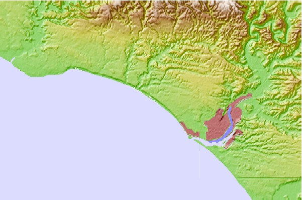
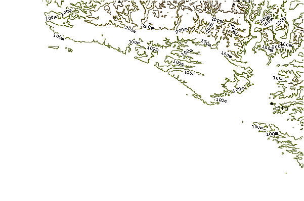
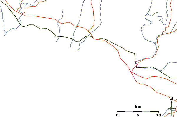
Gebruik deze reliëfkaart om naar de surfspots en de getijdenstations van Wanganui-Manawatu toe te gaan, in de buurt van Kai-Iwi.
Andere Dichtbijzijnde Surflocaties van Kai-Iwi:
(klik op locatienaam voor meer informatie)- Closest Locatie4 mi
- Second closest Locatie4 mi
- Third closest Locatie5 mi
- Fourth closest Locatie5 mi
- Fifth closest Locatie7 mi
Dichtstbijzijnde golfboeien bij Kai-Iwi:
- Closest golfboei96 mi
- Second closest golfboei119 mi
- Third closest golfboei128 mi
- Fourth closest golfboei178 mi
- Fifth closest golfboei278 mi
Getijdenstations in de buurt van Kai-Iwi:
- Closest getijdenstationWhanganui River Entrance5 mi
- Second closest getijdenstationWanganui7 mi
- Third closest getijdenstationPatea24 mi
- Fourth closest getijdenstationHawera40 mi
- Fifth closest getijdenstationManawatu River Entrance42 mi
Airports
- The closest passenger airport to Kai-Iwi is Wanganui Airport (WAG) in New Zealand, 11 km (7 miles) away (directly).
- The second nearest airport to Kai-Iwi is Palmerston North Airport (PMR), also in New Zealand, 76 km (47 miles) away.
- Third is Paraparaumu Airport (PPQ) in New Zealand, 112 km (70 miles) away.
- New Plymouth Airport (NPL) in New Zealand is 118 km (73 miles) away.
- Masterton Airport (MRO), also in New Zealand is the fifth nearest airport to Kai-Iwi and is 134 km (83 miles) away.
- /breaks/Kai-Iwi/forecasts/latest


 Nearest