

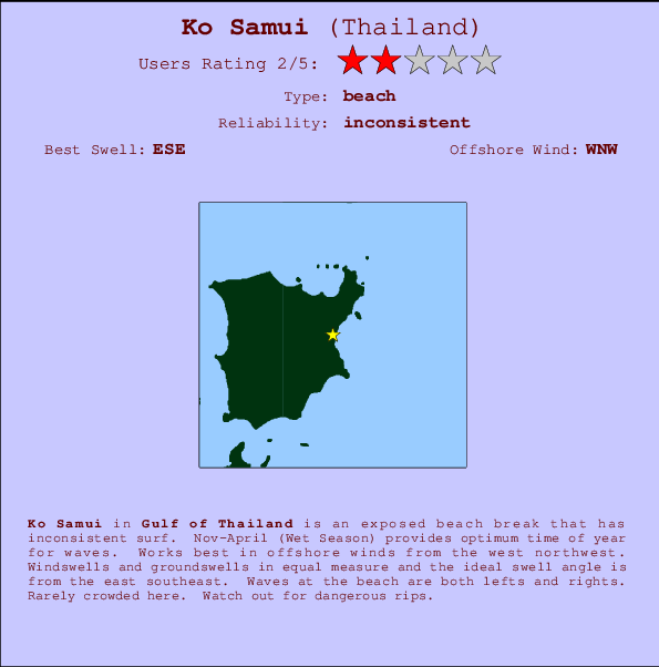
Ko Samui Surf Guide
Ko Samui in Gulf of Thailand is an exposed beach break that only works once in a while. Nov-April (Wet Season) provides best time of year for waves. Offshore winds are from the west northwest. Groundswells and windswells are equally likely and the best swell direction is from the east southeast. Waves at the beach are both lefts and rights. Unlikely to be too crowded, even when the surf is up. Watch out for dangerous rips.
Ko Samui Spot Info
| Type: | Rating: | Reliability: | Todays Sea Temp*: |
|---|---|---|---|
| inconsistent | 30.3°C*ocean temperature recorded from satellite |
Surfing Ko Samui:
The best conditions reported for surf at Ko Samui occur when a East-southeast swell combines with an offshore wind direction from the West-northwest.
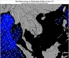
Voorspelde Golfenergie (Kracht): 12 uur

Ko Samui Surf:
Saturday, 18 July 2026, 02:15 Local time| Fri | Saturday 18 | |||
| 10PM | 1AM | 4AM | 7AM | |
| Wave (m) | ||||
| Periode (s) | 5 | 5 | 4 | 6 |
| Wind (km/h) | ||||
| Wind | off | off | cross- off |
cross- off |
- /breaks/Ko-Samui/forecasts/latest
Ko Samui Surf Guide
Ko Samui in Gulf of Thailand is an exposed beach break that only works once in a while. Nov-April (Wet Season) provides best time of year for waves. Offshore winds are from the west northwest. Groundswells and windswells are equally likely and the best swell direction is from the east southeast. Waves at the beach are both lefts and rights. Unlikely to be too crowded, even when the surf is up. Watch out for dangerous rips.
Ko Samui Spot Info
Type: Rating: Reliability: Todays Sea Temp*:  Beach
Beach 2
2inconsistent 30.3°C*ocean temperature recorded from satelliteSurfing Ko Samui:
The best conditions reported for surf at Ko Samui occur when a East-southeast swell combines with an offshore wind direction from the West-northwest.
Voorspelde Golfenergie (Kracht): 12 uur
Gebruik de tabbladen hierboven om de zeewatertemperatuur bij Ko Samui te bekijken, foto's van Ko Samui, Ko Samui gedetailleerde golfvoorspellingen, wind- en weersvoorspellingen, Ko Samui webcams, actuele wind in Gulf of Thailand live weerstations en Ko Samui getijdenvoorspellingen. De link van Thailand golfkaarten opent een grote afbeelding van Thailand en de omliggende zeeën. Deze golfkaarten kunnen worden dynamisch gemaakt worden met de verschillende golfcomponenten, golfenergie, golfperiode, golfhoogte, samen met de wind en weersvoorspellingen, het actuele weer en de zeetoestand volgens golfboeien uit Thailand, langskomende schepen en weerstations op de kust. Elk voorspelling pagina's voor dit surfstrand zijn voorzien van een wereldwijde en regionale golfzoeker om de beste surfsomstandigheden in het gebied rond Ko Samui te vinden.
Ko Samui Surf:
Saturday, 18 July 2026, 02:15 Local timeFri Saturday 18 10PM 1AM 4AM 7AM Wave (m) Periode (s) 5 5 4 6 Wind (km/h) Wind off off cross-
offcross-
off- /breaks/Ko-Samui/forecasts/latest
- /breaks/Ko-Samui/forecasts/latest/six_day
Ko Samui Surf Guide
Ko Samui in Gulf of Thailand is an exposed beach break that only works once in a while. Nov-April (Wet Season) provides best time of year for waves. Offshore winds are from the west northwest. Groundswells and windswells are equally likely and the best swell direction is from the east southeast. Waves at the beach are both lefts and rights. Unlikely to be too crowded, even when the surf is up. Watch out for dangerous rips.
Ko Samui Spot Info
Type: Rating: Reliability: Todays Sea Temp*: Beach2inconsistent 30.3°C*ocean temperature recorded from satelliteSurfing Ko Samui:
The best conditions reported for surf at Ko Samui occur when a East-southeast swell combines with an offshore wind direction from the West-northwest.
Voorspelde Golfenergie (Kracht): 12 uur
Gebruik de tabbladen hierboven om de zeewatertemperatuur bij Ko Samui te bekijken, foto's van Ko Samui, Ko Samui gedetailleerde golfvoorspellingen, wind- en weersvoorspellingen, Ko Samui webcams, actuele wind in Gulf of Thailand live weerstations en Ko Samui getijdenvoorspellingen. De link van Thailand golfkaarten opent een grote afbeelding van Thailand en de omliggende zeeën. Deze golfkaarten kunnen worden dynamisch gemaakt worden met de verschillende golfcomponenten, golfenergie, golfperiode, golfhoogte, samen met de wind en weersvoorspellingen, het actuele weer en de zeetoestand volgens golfboeien uit Thailand, langskomende schepen en weerstations op de kust. Elk voorspelling pagina's voor dit surfstrand zijn voorzien van een wereldwijde en regionale golfzoeker om de beste surfsomstandigheden in het gebied rond Ko Samui te vinden.
Ko Samui Surf:
Saturday, 18 July 2026, 02:15 Local timeFri Saturday 18 10PM 1AM 4AM 7AM Wave (m) Periode (s) 5 5 4 6 Wind (km/h) Wind off off cross-
offcross-
off- /breaks/Ko-Samui/forecasts/latest
Ko Samui Surf Guide
Ko Samui in Gulf of Thailand is an exposed beach break that only works once in a while. Nov-April (Wet Season) provides best time of year for waves. Offshore winds are from the west northwest. Groundswells and windswells are equally likely and the best swell direction is from the east southeast. Waves at the beach are both lefts and rights. Unlikely to be too crowded, even when the surf is up. Watch out for dangerous rips.
Ko Samui Spot Info
Type: Rating: Reliability: Todays Sea Temp*: Beach2inconsistent 30.3°C*ocean temperature recorded from satelliteSurfing Ko Samui:
The best conditions reported for surf at Ko Samui occur when a East-southeast swell combines with an offshore wind direction from the West-northwest.
Voorspelde Golfenergie (Kracht): 12 uur
Gebruik de tabbladen hierboven om de zeewatertemperatuur bij Ko Samui te bekijken, foto's van Ko Samui, Ko Samui gedetailleerde golfvoorspellingen, wind- en weersvoorspellingen, Ko Samui webcams, actuele wind in Gulf of Thailand live weerstations en Ko Samui getijdenvoorspellingen. De link van Thailand golfkaarten opent een grote afbeelding van Thailand en de omliggende zeeën. Deze golfkaarten kunnen worden dynamisch gemaakt worden met de verschillende golfcomponenten, golfenergie, golfperiode, golfhoogte, samen met de wind en weersvoorspellingen, het actuele weer en de zeetoestand volgens golfboeien uit Thailand, langskomende schepen en weerstations op de kust. Elk voorspelling pagina's voor dit surfstrand zijn voorzien van een wereldwijde en regionale golfzoeker om de beste surfsomstandigheden in het gebied rond Ko Samui te vinden.
Ko Samui Surf:
Saturday, 18 July 2026, 02:15 Local timeFri Saturday 18 10PM 1AM 4AM 7AM Wave (m) Periode (s) 5 5 4 6 Wind (km/h) Wind off off cross-
offcross-
offTide Times:
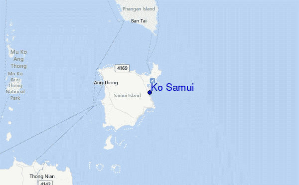
Voor Chaweng Malibu, %{dist} %{km} van %{location}.
VOLGENDE IS OM (lokale tijd) resterende tijd hoog water laag water Ko Samui Tide Times and Tide Chart
Live Weather:
At KO Samui, 7 km from Ko Samui.
light winds from the WNW
(km/h)
no reportAir temperature
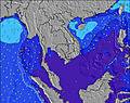
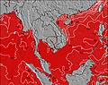
31.6°COverall Ko Samui Surf Consistency and Wind Distribution in July
surffoto's uit
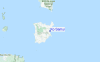
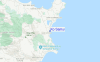
de galerijContourlijnen: Wegen & Rivieren: Kies een surflokatie uit het menu 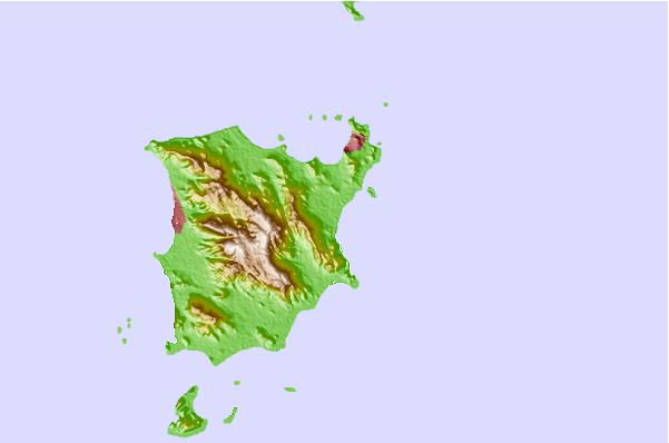
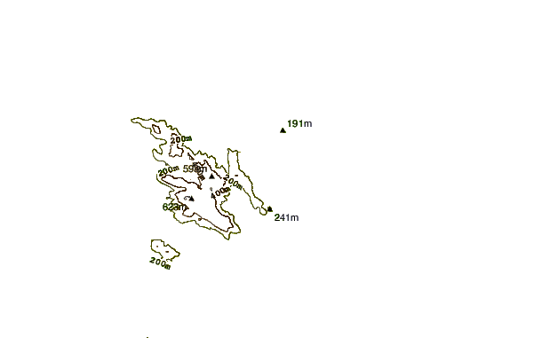
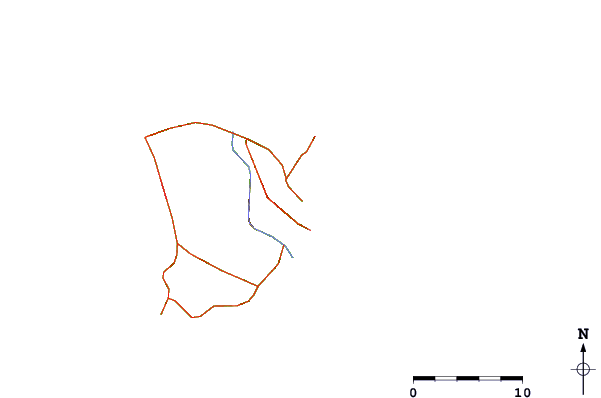
Gebruik deze reliëfkaart om naar de surfspots en de getijdenstations van Gulf of Thailand toe te gaan, in de buurt van Ko Samui.
Andere Dichtbijzijnde Surflocaties van Ko Samui:
(klik op locatienaam voor meer informatie)- Closest Locatie1 mi
- Second closest Locatie11 mi
- Third closest Locatie114 mi
- Fourth closest Locatie122 mi
- Fifth closest Locatie122 mi
Dichtstbijzijnde golfboeien bij Ko Samui:
- Closest golfboei1888 mi
- Second closest golfboei1967 mi
- Third closest golfboei2145 mi
- Fourth closest golfboei2162 mi
- Fifth closest golfboei2318 mi
Getijdenstations in de buurt van Ko Samui:
- Closest getijdenstationKo Pha Ngan17 mi
- Second closest getijdenstationDon Sak29 mi
- Third closest getijdenstationPak Phanang81 mi
- Fourth closest getijdenstationRanong102 mi
- Fifth closest getijdenstationPulau Besin112 mi
Airports
- The nearest passenger airport to Ko Samui is Cha Ian (Nakhon Si Thammarat) Airport (NST) in Thailand, which is 116 km (72 miles) away (directly).
- The second closest airport to Ko Samui is Trang Airport (TST), also in Thailand, 228 km (142 miles) away.
- /breaks/Ko-Samui/forecasts/latest


 Nearest