

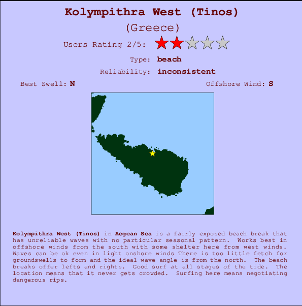
Kolympithra West (Tinos) Surf Guide
Kolympithra West (Tinos) in Aegean Sea is a reasonably exposed beach break that has inconsistent surf with no particular seasonal pattern. Offshore winds blow from the south with some shelter here from west winds. Still reasonable in light onshore winds There is too little fetch for groundswells to form and the ideal wave direction is from the north. Waves at the beach are both lefts and rights. The quality of the surf isn't affected by the tide. Even when the surf is up, crowds are unknown. Take care of the strong rips here.
Kolympithra West (Tinos) Spot Info
| Type: | Rating: | Reliability: | Todays Sea Temp*: |
|---|---|---|---|
| inconsistent | 24.4°C*ocean temperature recorded from satellite |
Surfing Kolympithra West (Tinos):
The best conditions reported for surf at Kolympithra West (Tinos) occur when a North swell combines with an offshore wind direction from the South.
Voorspelde Golfenergie (Kracht): 12 uur

Kolympithra West (Tinos) Surf:
Friday, 17 July 2026, 16:22 Local time| Friday 17 | ||||
| 12PM | 3PM | 6PM | 9PM | |
| Wave (m) | ||||
| Periode (s) | 6 | 6 | 6 | 6 |
| Wind (km/h) | ||||
| Wind | on | on | on | on |
- /breaks/Kolympithra-West-Tinos/forecasts/latest
Kolympithra West (Tinos) Surf Guide
Kolympithra West (Tinos) in Aegean Sea is a reasonably exposed beach break that has inconsistent surf with no particular seasonal pattern. Offshore winds blow from the south with some shelter here from west winds. Still reasonable in light onshore winds There is too little fetch for groundswells to form and the ideal wave direction is from the north. Waves at the beach are both lefts and rights. The quality of the surf isn't affected by the tide. Even when the surf is up, crowds are unknown. Take care of the strong rips here.
Kolympithra West (Tinos) Spot Info
Type: Rating: Reliability: Todays Sea Temp*:  Beach
Beach 2
2inconsistent 24.4°C*ocean temperature recorded from satelliteSurfing Kolympithra West (Tinos):
The best conditions reported for surf at Kolympithra West (Tinos) occur when a North swell combines with an offshore wind direction from the South.
Voorspelde Golfenergie (Kracht): 12 uur
Gebruik de tabbladen hierboven om de zeewatertemperatuur bij Kolympithra West (Tinos) te bekijken, foto's van Kolympithra West (Tinos), Kolympithra West (Tinos) gedetailleerde golfvoorspellingen, wind- en weersvoorspellingen, Kolympithra West (Tinos) webcams, actuele wind in Aegean Sea live weerstations en Kolympithra West (Tinos) getijdenvoorspellingen. De link van Greece golfkaarten opent een grote afbeelding van Greece en de omliggende zeeën. Deze golfkaarten kunnen worden dynamisch gemaakt worden met de verschillende golfcomponenten, golfenergie, golfperiode, golfhoogte, samen met de wind en weersvoorspellingen, het actuele weer en de zeetoestand volgens golfboeien uit Greece, langskomende schepen en weerstations op de kust. Elk voorspelling pagina's voor dit surfstrand zijn voorzien van een wereldwijde en regionale golfzoeker om de beste surfsomstandigheden in het gebied rond Kolympithra West (Tinos) te vinden.
Kolympithra West (Tinos) Surf:
Friday, 17 July 2026, 16:22 Local timeFriday 17 12PM 3PM 6PM 9PM Wave (m) Periode (s) 6 6 6 6 Wind (km/h) Wind on on on on - /breaks/Kolympithra-West-Tinos/forecasts/latest
- /breaks/Kolympithra-West-Tinos/forecasts/latest/six_day
Kolympithra West (Tinos) Surf Guide
Kolympithra West (Tinos) in Aegean Sea is a reasonably exposed beach break that has inconsistent surf with no particular seasonal pattern. Offshore winds blow from the south with some shelter here from west winds. Still reasonable in light onshore winds There is too little fetch for groundswells to form and the ideal wave direction is from the north. Waves at the beach are both lefts and rights. The quality of the surf isn't affected by the tide. Even when the surf is up, crowds are unknown. Take care of the strong rips here.
Kolympithra West (Tinos) Spot Info
Type: Rating: Reliability: Todays Sea Temp*: Beach2inconsistent 24.4°C*ocean temperature recorded from satelliteSurfing Kolympithra West (Tinos):
The best conditions reported for surf at Kolympithra West (Tinos) occur when a North swell combines with an offshore wind direction from the South.
Voorspelde Golfenergie (Kracht): 12 uur
Gebruik de tabbladen hierboven om de zeewatertemperatuur bij Kolympithra West (Tinos) te bekijken, foto's van Kolympithra West (Tinos), Kolympithra West (Tinos) gedetailleerde golfvoorspellingen, wind- en weersvoorspellingen, Kolympithra West (Tinos) webcams, actuele wind in Aegean Sea live weerstations en Kolympithra West (Tinos) getijdenvoorspellingen. De link van Greece golfkaarten opent een grote afbeelding van Greece en de omliggende zeeën. Deze golfkaarten kunnen worden dynamisch gemaakt worden met de verschillende golfcomponenten, golfenergie, golfperiode, golfhoogte, samen met de wind en weersvoorspellingen, het actuele weer en de zeetoestand volgens golfboeien uit Greece, langskomende schepen en weerstations op de kust. Elk voorspelling pagina's voor dit surfstrand zijn voorzien van een wereldwijde en regionale golfzoeker om de beste surfsomstandigheden in het gebied rond Kolympithra West (Tinos) te vinden.
Kolympithra West (Tinos) Surf:
Friday, 17 July 2026, 16:22 Local timeFriday 17 12PM 3PM 6PM 9PM Wave (m) Periode (s) 6 6 6 6 Wind (km/h) Wind on on on on - /breaks/Kolympithra-West-Tinos/forecasts/latest
Kolympithra West (Tinos) Surf Guide
Kolympithra West (Tinos) in Aegean Sea is a reasonably exposed beach break that has inconsistent surf with no particular seasonal pattern. Offshore winds blow from the south with some shelter here from west winds. Still reasonable in light onshore winds There is too little fetch for groundswells to form and the ideal wave direction is from the north. Waves at the beach are both lefts and rights. The quality of the surf isn't affected by the tide. Even when the surf is up, crowds are unknown. Take care of the strong rips here.
Kolympithra West (Tinos) Spot Info
Type: Rating: Reliability: Todays Sea Temp*: Beach2inconsistent 24.4°C*ocean temperature recorded from satelliteSurfing Kolympithra West (Tinos):
The best conditions reported for surf at Kolympithra West (Tinos) occur when a North swell combines with an offshore wind direction from the South.
Voorspelde Golfenergie (Kracht): 12 uur
Gebruik de tabbladen hierboven om de zeewatertemperatuur bij Kolympithra West (Tinos) te bekijken, foto's van Kolympithra West (Tinos), Kolympithra West (Tinos) gedetailleerde golfvoorspellingen, wind- en weersvoorspellingen, Kolympithra West (Tinos) webcams, actuele wind in Aegean Sea live weerstations en Kolympithra West (Tinos) getijdenvoorspellingen. De link van Greece golfkaarten opent een grote afbeelding van Greece en de omliggende zeeën. Deze golfkaarten kunnen worden dynamisch gemaakt worden met de verschillende golfcomponenten, golfenergie, golfperiode, golfhoogte, samen met de wind en weersvoorspellingen, het actuele weer en de zeetoestand volgens golfboeien uit Greece, langskomende schepen en weerstations op de kust. Elk voorspelling pagina's voor dit surfstrand zijn voorzien van een wereldwijde en regionale golfzoeker om de beste surfsomstandigheden in het gebied rond Kolympithra West (Tinos) te vinden.
Kolympithra West (Tinos) Surf:
Friday, 17 July 2026, 16:22 Local timeFriday 17 12PM 3PM 6PM 9PM Wave (m) Periode (s) 6 6 6 6 Wind (km/h) Wind on on on on Tide Times:
Voor Kolympithra East (Tinos), %{dist} %{km} van %{location}.
VOLGENDE IS OM (lokale tijd) resterende tijd hoog water laag water Kolympithra West (Tinos) Tide Times and Tide Chart
Live Weather:
At Mikonos Island Airport, 28 km from Kolympithra West (Tinos).
strong winds from the N
(km/h)Air temperature
Q1009°Csurffoto's uit
de galerijContourlijnen: Wegen & Rivieren: Kies een surflokatie uit het menu 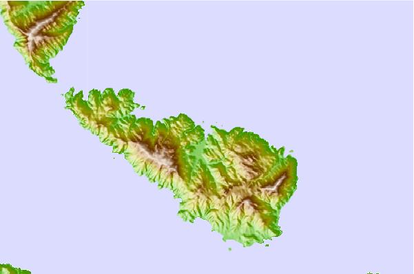
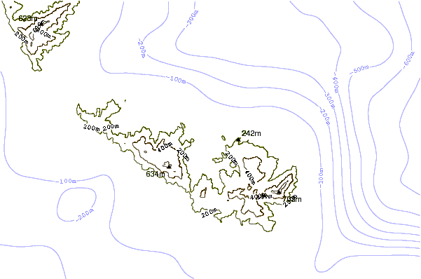

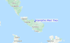
Gebruik deze reliëfkaart om naar de surfspots en de getijdenstations van Aegean Sea toe te gaan, in de buurt van Kolympithra West (Tinos).
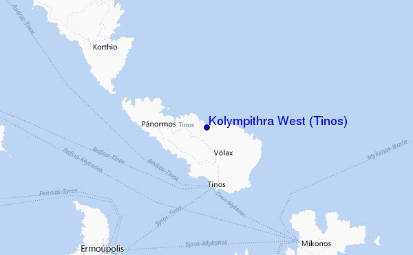
Andere Dichtbijzijnde Surflocaties van Kolympithra West (Tinos):
(klik op locatienaam voor meer informatie)- Closest Locatie0 mi
- Second closest Locatie1 mi
- Third closest Locatie6 mi
- Fourth closest Locatie19 mi
- Fifth closest Locatie25 mi
Dichtstbijzijnde golfboeien bij Kolympithra West (Tinos):
- Closest golfboei993 mi
- Second closest golfboei1125 mi
- Third closest golfboei1469 mi
- Fourth closest golfboei1472 mi
- Fifth closest golfboei1489 mi
Getijdenstations in de buurt van Kolympithra West (Tinos):
- Closest getijdenstationMykonos16 mi
- Second closest getijdenstationErmoupolis17 mi
- Third closest getijdenstationNaxos39 mi
- Fourth closest getijdenstationKáristos48 mi
- Fifth closest getijdenstationLavrion60 mi
Airports
- The closest passenger airport to Kolympithra West (Tinos) is Mikonos (Mykonos) Airport (JMK) in Greece, 28 km (17 miles) away (directly).
- The second nearest airport to Kolympithra West (Tinos) is Chios Airport (JKH), also in Greece, 118 km (73 miles) away.
- Third is Athinai (Athens) Airport (HEW) in Greece, 127 km (79 miles) away.
- Santorini Airport (JTR) in Greece is 140 km (87 miles) away.
- Leros Airport (LRS), also in Greece is the fifth nearest airport to Kolympithra West (Tinos) and is 155 km (96 miles) away.
- /breaks/Kolympithra-West-Tinos/forecasts/latest
 Nearest