
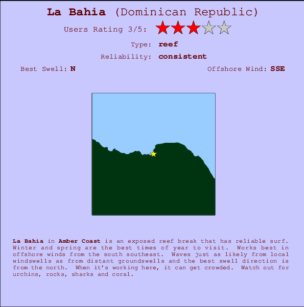
La Bahia Surf Guide
La Bahia in Amber Coast is an exposed reef break that has consistent surf. Winter and spring are the optimum times of year to visit. Offshore winds are from the south southeast. Most of the surf here comes from groundswells and the optimum swell angle is from the north. A reef breaks left. When the surf is up, it can get quite busy in the water. Beware of urchins, rocks, sharks and coral.
La Bahia Spot Info
| Type: | Rating: | Reliability: | Todays Sea Temp*: |
|---|---|---|---|
| consistent | 28.2°C*ocean temperature recorded from satellite |
Surfing La Bahia:
The best conditions reported for surf at La Bahia occur when a North swell combines with an offshore wind direction from the South-southeast.

Voorspelde Golfenergie (Kracht): 12 uur


La Bahia Surf:
Wednesday, 15 July 2026, 17:18 Local time| Wednesday 15 | Thu | |||
| 5PM | 8PM | 11PM | 2AM | |
| Wave (m) | ||||
| Periode (s) | 9 | 8 | 8 | 8 |
| Wind (km/h) | ||||
| Wind | cross- off |
cross- off |
cross- off |
off |
- /breaks/La-Bahia/forecasts/latest
La Bahia Surf Guide
La Bahia in Amber Coast is an exposed reef break that has consistent surf. Winter and spring are the optimum times of year to visit. Offshore winds are from the south southeast. Most of the surf here comes from groundswells and the optimum swell angle is from the north. A reef breaks left. When the surf is up, it can get quite busy in the water. Beware of urchins, rocks, sharks and coral.
La Bahia Spot Info
Type: Rating: Reliability: Todays Sea Temp*:  Reef
Reef 3
3consistent 28.2°C*ocean temperature recorded from satelliteSurfing La Bahia:
The best conditions reported for surf at La Bahia occur when a North swell combines with an offshore wind direction from the South-southeast.
Voorspelde Golfenergie (Kracht): 12 uur
Gebruik de tabbladen hierboven om de zeewatertemperatuur bij La Bahia te bekijken, foto's van La Bahia, La Bahia gedetailleerde golfvoorspellingen, wind- en weersvoorspellingen, La Bahia webcams, actuele wind in Amber Coast live weerstations en La Bahia getijdenvoorspellingen. De link van Dominican Republic golfkaarten opent een grote afbeelding van Dominican Republic en de omliggende zeeën. Deze golfkaarten kunnen worden dynamisch gemaakt worden met de verschillende golfcomponenten, golfenergie, golfperiode, golfhoogte, samen met de wind en weersvoorspellingen, het actuele weer en de zeetoestand volgens golfboeien uit Dominican Republic, langskomende schepen en weerstations op de kust. Elk voorspelling pagina's voor dit surfstrand zijn voorzien van een wereldwijde en regionale golfzoeker om de beste surfsomstandigheden in het gebied rond La Bahia te vinden.
La Bahia Surf:
Wednesday, 15 July 2026, 17:18 Local timeWednesday 15 Thu 5PM 8PM 11PM 2AM Wave (m) Periode (s) 9 8 8 8 Wind (km/h) Wind cross-
offcross-
offcross-
offoff - /breaks/La-Bahia/forecasts/latest
- /breaks/La-Bahia/forecasts/latest/six_day
La Bahia Surf Guide
La Bahia in Amber Coast is an exposed reef break that has consistent surf. Winter and spring are the optimum times of year to visit. Offshore winds are from the south southeast. Most of the surf here comes from groundswells and the optimum swell angle is from the north. A reef breaks left. When the surf is up, it can get quite busy in the water. Beware of urchins, rocks, sharks and coral.
La Bahia Spot Info
Type: Rating: Reliability: Todays Sea Temp*: Reef3consistent 28.2°C*ocean temperature recorded from satelliteSurfing La Bahia:
The best conditions reported for surf at La Bahia occur when a North swell combines with an offshore wind direction from the South-southeast.
Voorspelde Golfenergie (Kracht): 12 uur
Gebruik de tabbladen hierboven om de zeewatertemperatuur bij La Bahia te bekijken, foto's van La Bahia, La Bahia gedetailleerde golfvoorspellingen, wind- en weersvoorspellingen, La Bahia webcams, actuele wind in Amber Coast live weerstations en La Bahia getijdenvoorspellingen. De link van Dominican Republic golfkaarten opent een grote afbeelding van Dominican Republic en de omliggende zeeën. Deze golfkaarten kunnen worden dynamisch gemaakt worden met de verschillende golfcomponenten, golfenergie, golfperiode, golfhoogte, samen met de wind en weersvoorspellingen, het actuele weer en de zeetoestand volgens golfboeien uit Dominican Republic, langskomende schepen en weerstations op de kust. Elk voorspelling pagina's voor dit surfstrand zijn voorzien van een wereldwijde en regionale golfzoeker om de beste surfsomstandigheden in het gebied rond La Bahia te vinden.
La Bahia Surf:
Wednesday, 15 July 2026, 17:18 Local timeWednesday 15 Thu 5PM 8PM 11PM 2AM Wave (m) Periode (s) 9 8 8 8 Wind (km/h) Wind cross-
offcross-
offcross-
offoff - /breaks/La-Bahia/forecasts/latest
La Bahia Surf Guide
La Bahia in Amber Coast is an exposed reef break that has consistent surf. Winter and spring are the optimum times of year to visit. Offshore winds are from the south southeast. Most of the surf here comes from groundswells and the optimum swell angle is from the north. A reef breaks left. When the surf is up, it can get quite busy in the water. Beware of urchins, rocks, sharks and coral.
La Bahia Spot Info
Type: Rating: Reliability: Todays Sea Temp*: Reef3consistent 28.2°C*ocean temperature recorded from satelliteSurfing La Bahia:
The best conditions reported for surf at La Bahia occur when a North swell combines with an offshore wind direction from the South-southeast.
Voorspelde Golfenergie (Kracht): 12 uur
Gebruik de tabbladen hierboven om de zeewatertemperatuur bij La Bahia te bekijken, foto's van La Bahia, La Bahia gedetailleerde golfvoorspellingen, wind- en weersvoorspellingen, La Bahia webcams, actuele wind in Amber Coast live weerstations en La Bahia getijdenvoorspellingen. De link van Dominican Republic golfkaarten opent een grote afbeelding van Dominican Republic en de omliggende zeeën. Deze golfkaarten kunnen worden dynamisch gemaakt worden met de verschillende golfcomponenten, golfenergie, golfperiode, golfhoogte, samen met de wind en weersvoorspellingen, het actuele weer en de zeetoestand volgens golfboeien uit Dominican Republic, langskomende schepen en weerstations op de kust. Elk voorspelling pagina's voor dit surfstrand zijn voorzien van een wereldwijde en regionale golfzoeker om de beste surfsomstandigheden in het gebied rond La Bahia te vinden.
La Bahia Surf:
Wednesday, 15 July 2026, 17:18 Local timeWednesday 15 Thu 5PM 8PM 11PM 2AM Wave (m) Periode (s) 9 8 8 8 Wind (km/h) Wind cross-
offcross-
offcross-
offoff Tide Times:
Voor Sosua, %{dist} %{km} van %{location}.
VOLGENDE IS OM (lokale tijd) resterende tijd hoog water laag water La Bahia Tide Times and Tide Chart
Live Weather:
At Puerto Plata IN Airport, 5 km from La Bahia.
light winds from the E
(km/h)Air temperature
32°COverall La Bahia Surf Consistency and Wind Distribution in July
surffoto's uit
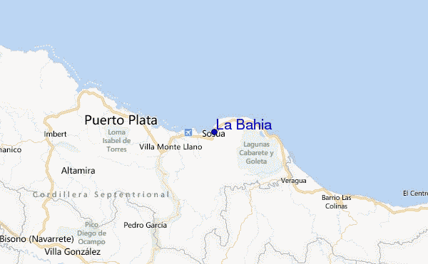
de galerijContourlijnen: Wegen & Rivieren: Kies een surflokatie uit het menu 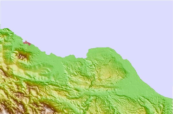
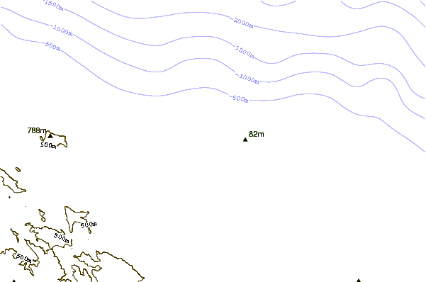
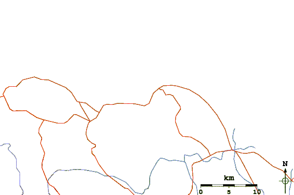
Gebruik deze reliëfkaart om naar de surfspots en de getijdenstations van Amber Coast toe te gaan, in de buurt van La Bahia.
Dichtstbijzijnde golfboeien bij La Bahia:
- Closest golfboei232 mi
- Second closest golfboei285 mi
- Third closest golfboei293 mi
- Fourth closest golfboei302 mi
- Fifth closest golfboei346 mi
Getijdenstations in de buurt van La Bahia:
- Closest getijdenstationSosua1 mi
- Second closest getijdenstationPuerto Plata12 mi
- Third closest getijdenstationGaspar Hernandez18 mi
- Fourth closest getijdenstationRio San Juan29 mi
- Fifth closest getijdenstationNagua51 mi
Airports
- The closest passenger airport to La Bahia is Gregorio Luperon International (Puerto Plata) Airport (POP) in Dominican Republic, 5 km (3 miles) away (directly).
- The second nearest airport to La Bahia is Cibao International (Santiago) Airport (STI), also in Dominican Republic, 40 km (25 miles) away.
- Third is Herrera International (Santo Domingo) Airport (HEX) in Dominican Republic, 154 km (96 miles) away.
- Las Americas International (Santo Domingo) Airport (SDQ) in Dominican Republic is 173 km (107 miles) away.
- Cap Haitien Airport (CAP) in Haiti is the fifth nearest airport to La Bahia and is 175 km (109 miles) away.
- /breaks/La-Bahia/forecasts/latest


 Nearest