
La Isla Surf Guide
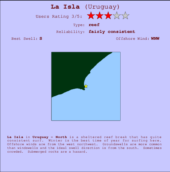
La Isla in West Uruguay is a sheltered reef break that has quite reliable surf. Winter is the best time of year for surfing here. The best wind direction is from the northwest. Groundswells more frequent than windswells and the ideal swell angle is from the south. A reef breaks right. Sometimes crowded. Rocks are a hazard.
La Isla Spot Info
| Type: | Rating: | Reliability: | Todays Sea Temp*: |
|---|---|---|---|
| fairly consistent | 11.7°C*ocean temperature recorded from satellite |
Surfing La Isla:
The best conditions reported for surf at La Isla occur when a South swell combines with an offshore wind direction from the West-northwest.
Voorspelde Golfenergie (Kracht): 12 uur


La Isla Surf:
Sunday, 26 July 2026, 13:12 Local time| Sunday 26 | ||||
| 12PM | 3PM | 6PM | 9PM | |
| Wave (m) | ||||
| Periode (s) | 12 | 12 | 11 | 7 |
| Wind (km/h) | ||||
| Wind | cross | cross- on |
cross- on |
on |
- /breaks/La-Isla_2/forecasts/latest
La Isla Surf Guide
La Isla in West Uruguay is a sheltered reef break that has quite reliable surf. Winter is the best time of year for surfing here. The best wind direction is from the northwest. Groundswells more frequent than windswells and the ideal swell angle is from the south. A reef breaks right. Sometimes crowded. Rocks are a hazard.
La Isla Spot Info
Type: Rating: Reliability: Todays Sea Temp*:  Reef
Reef 3
3fairly consistent 11.7°C*ocean temperature recorded from satelliteSurfing La Isla:
The best conditions reported for surf at La Isla occur when a South swell combines with an offshore wind direction from the West-northwest.
Voorspelde Golfenergie (Kracht): 12 uur
Gebruik de tabbladen hierboven om de zeewatertemperatuur bij La Isla te bekijken, foto's van La Isla, La Isla gedetailleerde golfvoorspellingen, wind- en weersvoorspellingen, La Isla webcams, actuele wind in North live weerstations en La Isla getijdenvoorspellingen. De link van Uruguay golfkaarten opent een grote afbeelding van Uruguay en de omliggende zeeën. Deze golfkaarten kunnen worden dynamisch gemaakt worden met de verschillende golfcomponenten, golfenergie, golfperiode, golfhoogte, samen met de wind en weersvoorspellingen, het actuele weer en de zeetoestand volgens golfboeien uit Uruguay, langskomende schepen en weerstations op de kust. Elk voorspelling pagina's voor dit surfstrand zijn voorzien van een wereldwijde en regionale golfzoeker om de beste surfsomstandigheden in het gebied rond La Isla te vinden.
La Isla Surf:
Sunday, 26 July 2026, 13:12 Local timeSunday 26 12PM 3PM 6PM 9PM Wave (m) Periode (s) 12 12 11 7 Wind (km/h) Wind cross cross-
oncross-
onon - /breaks/La-Isla_2/forecasts/latest
- /breaks/La-Isla_2/forecasts/latest/six_day
La Isla Surf Guide
La Isla in West Uruguay is a sheltered reef break that has quite reliable surf. Winter is the best time of year for surfing here. The best wind direction is from the northwest. Groundswells more frequent than windswells and the ideal swell angle is from the south. A reef breaks right. Sometimes crowded. Rocks are a hazard.
La Isla Spot Info
Type: Rating: Reliability: Todays Sea Temp*: Reef3fairly consistent 11.7°C*ocean temperature recorded from satelliteSurfing La Isla:
The best conditions reported for surf at La Isla occur when a South swell combines with an offshore wind direction from the West-northwest.
Voorspelde Golfenergie (Kracht): 12 uur
Gebruik de tabbladen hierboven om de zeewatertemperatuur bij La Isla te bekijken, foto's van La Isla, La Isla gedetailleerde golfvoorspellingen, wind- en weersvoorspellingen, La Isla webcams, actuele wind in North live weerstations en La Isla getijdenvoorspellingen. De link van Uruguay golfkaarten opent een grote afbeelding van Uruguay en de omliggende zeeën. Deze golfkaarten kunnen worden dynamisch gemaakt worden met de verschillende golfcomponenten, golfenergie, golfperiode, golfhoogte, samen met de wind en weersvoorspellingen, het actuele weer en de zeetoestand volgens golfboeien uit Uruguay, langskomende schepen en weerstations op de kust. Elk voorspelling pagina's voor dit surfstrand zijn voorzien van een wereldwijde en regionale golfzoeker om de beste surfsomstandigheden in het gebied rond La Isla te vinden.
La Isla Surf:
Sunday, 26 July 2026, 13:12 Local timeSunday 26 12PM 3PM 6PM 9PM Wave (m) Periode (s) 12 12 11 7 Wind (km/h) Wind cross cross-
oncross-
onon - /breaks/La-Isla_2/forecasts/latest
La Isla Surf Guide
La Isla in West Uruguay is a sheltered reef break that has quite reliable surf. Winter is the best time of year for surfing here. The best wind direction is from the northwest. Groundswells more frequent than windswells and the ideal swell angle is from the south. A reef breaks right. Sometimes crowded. Rocks are a hazard.
La Isla Spot Info
Type: Rating: Reliability: Todays Sea Temp*: Reef3fairly consistent 11.7°C*ocean temperature recorded from satelliteSurfing La Isla:
The best conditions reported for surf at La Isla occur when a South swell combines with an offshore wind direction from the West-northwest.
Voorspelde Golfenergie (Kracht): 12 uur
Gebruik de tabbladen hierboven om de zeewatertemperatuur bij La Isla te bekijken, foto's van La Isla, La Isla gedetailleerde golfvoorspellingen, wind- en weersvoorspellingen, La Isla webcams, actuele wind in North live weerstations en La Isla getijdenvoorspellingen. De link van Uruguay golfkaarten opent een grote afbeelding van Uruguay en de omliggende zeeën. Deze golfkaarten kunnen worden dynamisch gemaakt worden met de verschillende golfcomponenten, golfenergie, golfperiode, golfhoogte, samen met de wind en weersvoorspellingen, het actuele weer en de zeetoestand volgens golfboeien uit Uruguay, langskomende schepen en weerstations op de kust. Elk voorspelling pagina's voor dit surfstrand zijn voorzien van een wereldwijde en regionale golfzoeker om de beste surfsomstandigheden in het gebied rond La Isla te vinden.
La Isla Surf:
Sunday, 26 July 2026, 13:12 Local timeSunday 26 12PM 3PM 6PM 9PM Wave (m) Periode (s) 12 12 11 7 Wind (km/h) Wind cross cross-
oncross-
onon Tide Times:
Voor Cocoloco, %{dist} %{km} van %{location}.
VOLGENDE IS OM (lokale tijd) resterende tijd hoog water laag water La Isla Tide Times and Tide Chart
Live Weather:
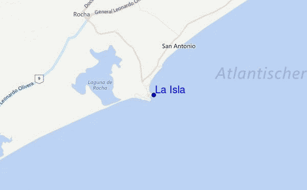
At Rocha, 24 km from La Isla.
calm
(km/h)
no reportAir temperature
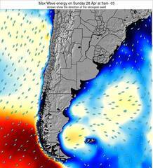
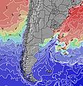
11.1°COverall La Isla Surf Consistency and Wind Distribution in July
surffoto's uit
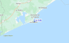
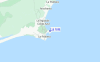
de galerijContourlijnen: Wegen & Rivieren: Kies een surflokatie uit het menu 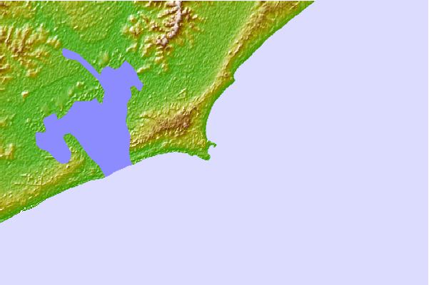
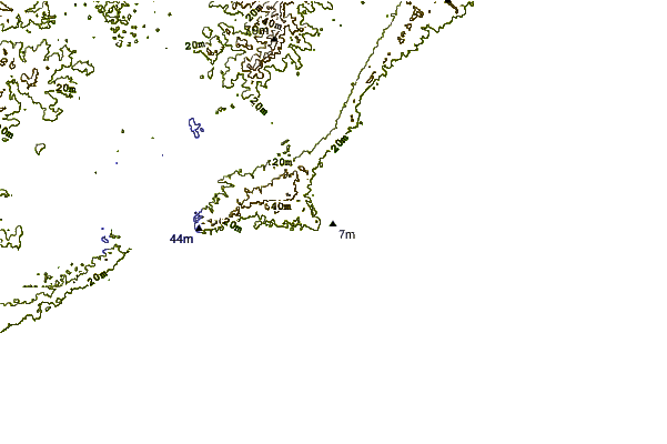
Gebruik deze reliëfkaart om naar de surfspots en de getijdenstations van North toe te gaan, in de buurt van La Isla.
Andere Dichtbijzijnde Surflocaties van La Isla:
(klik op locatienaam voor meer informatie)- Closest Locatie0 mi
- Second closest Locatie1 mi
- Third closest Locatie1 mi
- Fourth closest Locatie1 mi
- Fifth closest Locatie1 mi
Dichtstbijzijnde golfboeien bij La Isla:
- Closest golfboei329 mi
- Second closest golfboei2163 mi
- Third closest golfboei3397 mi
- Fourth closest golfboei3408 mi
- Fifth closest golfboei3430 mi
Getijdenstations in de buurt van La Isla:
- Closest getijdenstationMaldonado49 mi
- Second closest getijdenstationPunta del Este50 mi
- Third closest getijdenstationPiriapolis66 mi
- Fourth closest getijdenstationPaso de Carrasco109 mi
- Fifth closest getijdenstationMontevideo119 mi
Airports
- The closest passenger airport to La Isla is El Jaguel International (Punta Del Este) Airport (PDP) in Uruguay, which is 77 km (48 miles) away (directly).
- The second nearest airport to La Isla is Carrasco International (Montevideo) Airport (MVD), also in Uruguay, 174 km (108 miles) away.
- The third closest airport is Angel S Adami (Montevideo) Airport (MVD), also in Uruguay, 194 km (120 miles) away.
- /breaks/La-Isla_2/forecasts/latest


 Nearest