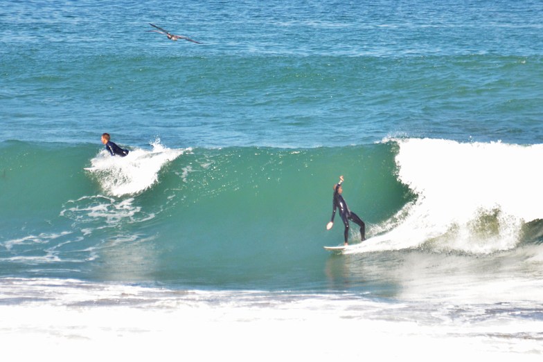

La Jolla Shores Surf Guide
La Jolla Shores in San Diego County is a fairly exposed beach break. Winter is the favoured time of year for surfing here. Works best in offshore winds from the east southeast. Groundswells more frequent than windswells and the best swell direction is from the west. Good surf at all stages of the tide. When the surf is up, it can get quite busy in the water. Watch out for - Rips / undertow - Localism.
La Jolla Shores Spot Info
| Type: | Rating: | Reliability: | Todays Sea Temp*: |
|---|---|---|---|
22.2°C*ocean temperature recorded from satellite |
Surfing La Jolla Shores:
The best conditions reported for surf at La Jolla Shores occur when a West swell combines with an offshore wind direction from the East-southeast.

Voorspelde Golfenergie (Kracht): 12 uur


La Jolla Shores Surf:
Thursday, 16 July 2026, 20:44 Local time| Thu | Fri | |||
| 8PM | 11PM | 2AM | 5AM | |
| Wave (m) | ||||
| Periode (s) | 16 | 15 | 19 | 19 |
| Wind (km/h) | ||||
| Wind | cross- off |
cross- off |
cross- off |
cross- off |
- /breaks/La-Jolla-Shores/forecasts/latest
La Jolla Shores Surf Guide
La Jolla Shores in San Diego County is a fairly exposed beach break. Winter is the favoured time of year for surfing here. Works best in offshore winds from the east southeast. Groundswells more frequent than windswells and the best swell direction is from the west. Good surf at all stages of the tide. When the surf is up, it can get quite busy in the water. Watch out for - Rips / undertow - Localism.
La Jolla Shores Spot Info
Type: Rating: Reliability: Todays Sea Temp*:  Beach
Beach 222.2°C*ocean temperature recorded from satellite
Surfing La Jolla Shores:
The best conditions reported for surf at La Jolla Shores occur when a West swell combines with an offshore wind direction from the East-southeast.
Voorspelde Golfenergie (Kracht): 12 uur
Gebruik de tabbladen hierboven om de zeewatertemperatuur bij La Jolla Shores te bekijken, foto's van La Jolla Shores, La Jolla Shores gedetailleerde golfvoorspellingen, wind- en weersvoorspellingen, La Jolla Shores webcams, actuele wind in CAL - San Diego County live weerstations en La Jolla Shores getijdenvoorspellingen. De link van United States golfkaarten opent een grote afbeelding van United States en de omliggende zeeën. Deze golfkaarten kunnen worden dynamisch gemaakt worden met de verschillende golfcomponenten, golfenergie, golfperiode, golfhoogte, samen met de wind en weersvoorspellingen, het actuele weer en de zeetoestand volgens golfboeien uit United States, langskomende schepen en weerstations op de kust. Elk voorspelling pagina's voor dit surfstrand zijn voorzien van een wereldwijde en regionale golfzoeker om de beste surfsomstandigheden in het gebied rond La Jolla Shores te vinden.
La Jolla Shores Surf:
Thursday, 16 July 2026, 20:44 Local timeThu Fri 8PM 11PM 2AM 5AM Wave (m) Periode (s) 16 15 19 19 Wind (km/h) Wind cross-
offcross-
offcross-
offcross-
off- /breaks/La-Jolla-Shores/forecasts/latest
- /breaks/La-Jolla-Shores/forecasts/latest/six_day
La Jolla Shores Surf Guide
La Jolla Shores in San Diego County is a fairly exposed beach break. Winter is the favoured time of year for surfing here. Works best in offshore winds from the east southeast. Groundswells more frequent than windswells and the best swell direction is from the west. Good surf at all stages of the tide. When the surf is up, it can get quite busy in the water. Watch out for - Rips / undertow - Localism.
La Jolla Shores Spot Info
Type: Rating: Reliability: Todays Sea Temp*: Beach222.2°C*ocean temperature recorded from satelliteSurfing La Jolla Shores:
The best conditions reported for surf at La Jolla Shores occur when a West swell combines with an offshore wind direction from the East-southeast.
Voorspelde Golfenergie (Kracht): 12 uur
Gebruik de tabbladen hierboven om de zeewatertemperatuur bij La Jolla Shores te bekijken, foto's van La Jolla Shores, La Jolla Shores gedetailleerde golfvoorspellingen, wind- en weersvoorspellingen, La Jolla Shores webcams, actuele wind in CAL - San Diego County live weerstations en La Jolla Shores getijdenvoorspellingen. De link van United States golfkaarten opent een grote afbeelding van United States en de omliggende zeeën. Deze golfkaarten kunnen worden dynamisch gemaakt worden met de verschillende golfcomponenten, golfenergie, golfperiode, golfhoogte, samen met de wind en weersvoorspellingen, het actuele weer en de zeetoestand volgens golfboeien uit United States, langskomende schepen en weerstations op de kust. Elk voorspelling pagina's voor dit surfstrand zijn voorzien van een wereldwijde en regionale golfzoeker om de beste surfsomstandigheden in het gebied rond La Jolla Shores te vinden.
La Jolla Shores Surf:
Thursday, 16 July 2026, 20:44 Local timeThu Fri 8PM 11PM 2AM 5AM Wave (m) Periode (s) 16 15 19 19 Wind (km/h) Wind cross-
offcross-
offcross-
offcross-
off- /breaks/La-Jolla-Shores/forecasts/latest
La Jolla Shores Surf Guide
La Jolla Shores in San Diego County is a fairly exposed beach break. Winter is the favoured time of year for surfing here. Works best in offshore winds from the east southeast. Groundswells more frequent than windswells and the best swell direction is from the west. Good surf at all stages of the tide. When the surf is up, it can get quite busy in the water. Watch out for - Rips / undertow - Localism.
La Jolla Shores Spot Info
Type: Rating: Reliability: Todays Sea Temp*: Beach222.2°C*ocean temperature recorded from satelliteSurfing La Jolla Shores:
The best conditions reported for surf at La Jolla Shores occur when a West swell combines with an offshore wind direction from the East-southeast.
Voorspelde Golfenergie (Kracht): 12 uur
Gebruik de tabbladen hierboven om de zeewatertemperatuur bij La Jolla Shores te bekijken, foto's van La Jolla Shores, La Jolla Shores gedetailleerde golfvoorspellingen, wind- en weersvoorspellingen, La Jolla Shores webcams, actuele wind in CAL - San Diego County live weerstations en La Jolla Shores getijdenvoorspellingen. De link van United States golfkaarten opent een grote afbeelding van United States en de omliggende zeeën. Deze golfkaarten kunnen worden dynamisch gemaakt worden met de verschillende golfcomponenten, golfenergie, golfperiode, golfhoogte, samen met de wind en weersvoorspellingen, het actuele weer en de zeetoestand volgens golfboeien uit United States, langskomende schepen en weerstations op de kust. Elk voorspelling pagina's voor dit surfstrand zijn voorzien van een wereldwijde en regionale golfzoeker om de beste surfsomstandigheden in het gebied rond La Jolla Shores te vinden.
La Jolla Shores Surf:
Thursday, 16 July 2026, 20:44 Local timeThu Fri 8PM 11PM 2AM 5AM Wave (m) Periode (s) 16 15 19 19 Wind (km/h) Wind cross-
offcross-
offcross-
offcross-
offTide Times:
Voor La Jolla, Scripps Pier, California, %{dist} %{km} van %{location}.
VOLGENDE IS OM (lokale tijd) resterende tijd hoog water laag water La Jolla Shores Tide Times and Tide Chart
Live Weather:
At La Jolla- CA, 1 km from La Jolla Shores.
light winds from the SSW
(km/h)Air temperature
-°CCurrent weather near La Jolla Shores
Buoy Data:
At La Jolla, CA, 1 miles from La Jolla Shores.
3PM 4PM 5PM 6PM Gegevens Leeftijd 4 hr 3 hr 2 hr 1 hr Golfhoogte (m) 

Dominante Periode (s) 8 8 7 9 Overall La Jolla Shores Surf Consistency and Wind Distribution in July


Wind stats for La Jolla Shores: see the variation in direction and stength by month.
surffoto's uit
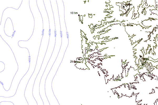
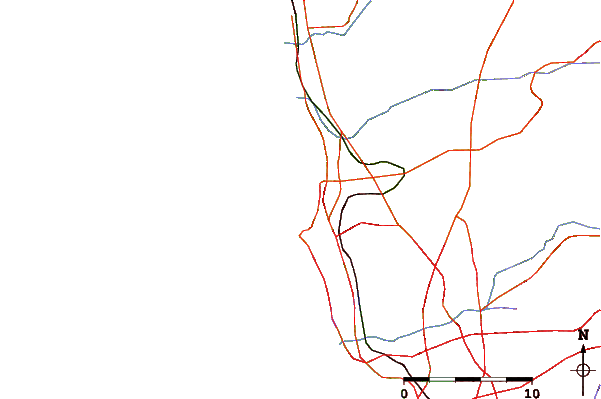
de galerijContourlijnen: Wegen & Rivieren: Kies een surflokatie uit het menu 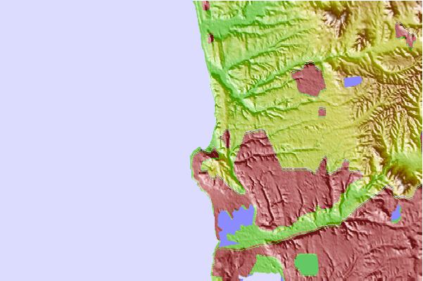
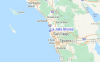
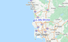
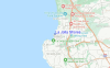
Gebruik deze reliëfkaart om naar de surfspots en de getijdenstations van CAL - San Diego County toe te gaan, in de buurt van La Jolla Shores.
Andere Dichtbijzijnde Surflocaties van La Jolla Shores:
(klik op locatienaam voor meer informatie)- Closest Locatie1 mi
- Second closest Locatie1 mi
- Third closest Locatie1 mi
- Fourth closest Locatie2 mi
- Fifth closest Locatie2 mi
Dichtstbijzijnde golfboeien bij La Jolla Shores:
- Closest golfboei1 mi
- Second closest golfboei1 mi
- Third closest golfboei9 mi
- Fourth closest golfboei16 mi
- Fifth closest golfboei21 mi
Getijdenstations in de buurt van La Jolla Shores:
- Closest getijdenstationLa Jolla, Scripps Pier1 mi
- Second closest getijdenstationCrown Point, Mission Bay6 mi
- Third closest getijdenstationQuivira Basin, Mission Bay7 mi
- Fourth closest getijdenstationSolana Beach9 mi
- Fifth closest getijdenstationSan Diego11 mi
Airports
- The closest passenger airport to La Jolla Shores is Miramar Mcas Airport (NKX) in USA, 11 km (7 miles) away (directly).
- The second nearest airport to La Jolla Shores is San Diego International Lindbergh Fld Airport (SAN), also in USA, 15 km (9 miles) away.
- Third is North Island Nas (San Diego) Airport (NZY) in USA, 18 km (11 miles) away.
- General Abelardo L Rodriguez International (Tijuana) Airport (TIJ) in Mexico is 44 km (27 miles) away.
- John Wayne Arpt Orange Co (Santa Ana) Airport (SNA) in USA is the fifth nearest airport to La Jolla Shores and is 107 km (66 miles) away.

- /breaks/La-Jolla-Shores/forecasts/latest


 Nearest