

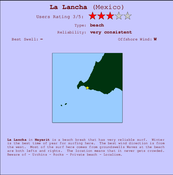
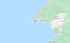
La Lancha Surf Guide
La Lancha in Nayarit is an exposed point break that is often working. Winter is the best time of year for surfing here. The best wind direction is from the west. Clean groundswells prevail The point break offers both left and right hand waves. A remote wave spot that never gets crowded. Beware of - Urchins - Rocks - Private beach - Localism.
La Lancha Spot Info
| Type: | Rating: | Reliability: | Todays Sea Temp*: |
|---|---|---|---|
| very consistent | 31.5°C*ocean temperature recorded from satellite |
Surfing La Lancha:
The best conditions reported for surf at La Lancha occur when a West-northwest swell combines with an offshore wind direction from the West.
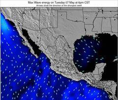
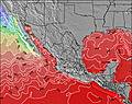
Voorspelde Golfenergie (Kracht): 12 uur


La Lancha Surf:
Wednesday, 15 July 2026, 18:40 Local time| Wednesday 15 | Thu | |||
| 3PM | 6PM | 9PM | 0AM | |
| Wave (m) | ||||
| Periode (s) | 16 | 16 | 16 | 16 |
| Wind (km/h) | ||||
| Wind | cross- off |
cross- off |
cross | cross- on |
- /breaks/La-Lancha/forecasts/latest
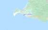
La Lancha Surf Guide
La Lancha in Nayarit is an exposed point break that is often working. Winter is the best time of year for surfing here. The best wind direction is from the west. Clean groundswells prevail The point break offers both left and right hand waves. A remote wave spot that never gets crowded. Beware of - Urchins - Rocks - Private beach - Localism.
La Lancha Spot Info
Type: Rating: Reliability: Todays Sea Temp*:  Point
Point 3
3very consistent 31.5°C*ocean temperature recorded from satelliteSurfing La Lancha:
The best conditions reported for surf at La Lancha occur when a West-northwest swell combines with an offshore wind direction from the West.
Voorspelde Golfenergie (Kracht): 12 uur
Gebruik de tabbladen hierboven om de zeewatertemperatuur bij La Lancha te bekijken, foto's van La Lancha, La Lancha gedetailleerde golfvoorspellingen, wind- en weersvoorspellingen, La Lancha webcams, actuele wind in Nayarit live weerstations en La Lancha getijdenvoorspellingen. De link van Mexico golfkaarten opent een grote afbeelding van Mexico en de omliggende zeeën. Deze golfkaarten kunnen worden dynamisch gemaakt worden met de verschillende golfcomponenten, golfenergie, golfperiode, golfhoogte, samen met de wind en weersvoorspellingen, het actuele weer en de zeetoestand volgens golfboeien uit Mexico, langskomende schepen en weerstations op de kust. Elk voorspelling pagina's voor dit surfstrand zijn voorzien van een wereldwijde en regionale golfzoeker om de beste surfsomstandigheden in het gebied rond La Lancha te vinden.
La Lancha Surf:
Wednesday, 15 July 2026, 18:40 Local timeWednesday 15 Thu 3PM 6PM 9PM 0AM Wave (m) Periode (s) 16 16 16 16 Wind (km/h) Wind cross-
offcross-
offcross cross-
on- /breaks/La-Lancha/forecasts/latest
- /breaks/La-Lancha/forecasts/latest/six_day
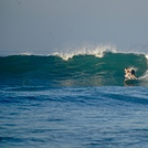
La Lancha Surf Guide
La Lancha in Nayarit is an exposed point break that is often working. Winter is the best time of year for surfing here. The best wind direction is from the west. Clean groundswells prevail The point break offers both left and right hand waves. A remote wave spot that never gets crowded. Beware of - Urchins - Rocks - Private beach - Localism.
La Lancha Spot Info
Type: Rating: Reliability: Todays Sea Temp*: Point3very consistent 31.5°C*ocean temperature recorded from satelliteSurfing La Lancha:
The best conditions reported for surf at La Lancha occur when a West-northwest swell combines with an offshore wind direction from the West.
Voorspelde Golfenergie (Kracht): 12 uur
Gebruik de tabbladen hierboven om de zeewatertemperatuur bij La Lancha te bekijken, foto's van La Lancha, La Lancha gedetailleerde golfvoorspellingen, wind- en weersvoorspellingen, La Lancha webcams, actuele wind in Nayarit live weerstations en La Lancha getijdenvoorspellingen. De link van Mexico golfkaarten opent een grote afbeelding van Mexico en de omliggende zeeën. Deze golfkaarten kunnen worden dynamisch gemaakt worden met de verschillende golfcomponenten, golfenergie, golfperiode, golfhoogte, samen met de wind en weersvoorspellingen, het actuele weer en de zeetoestand volgens golfboeien uit Mexico, langskomende schepen en weerstations op de kust. Elk voorspelling pagina's voor dit surfstrand zijn voorzien van een wereldwijde en regionale golfzoeker om de beste surfsomstandigheden in het gebied rond La Lancha te vinden.
La Lancha Surf:
Wednesday, 15 July 2026, 18:40 Local timeWednesday 15 Thu 3PM 6PM 9PM 0AM Wave (m) Periode (s) 16 16 16 16 Wind (km/h) Wind cross-
offcross-
offcross cross-
on- /breaks/La-Lancha/forecasts/latest
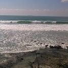
La Lancha Surf Guide
La Lancha in Nayarit is an exposed point break that is often working. Winter is the best time of year for surfing here. The best wind direction is from the west. Clean groundswells prevail The point break offers both left and right hand waves. A remote wave spot that never gets crowded. Beware of - Urchins - Rocks - Private beach - Localism.
La Lancha Spot Info
Type: Rating: Reliability: Todays Sea Temp*: Point3very consistent 31.5°C*ocean temperature recorded from satelliteSurfing La Lancha:
The best conditions reported for surf at La Lancha occur when a West-northwest swell combines with an offshore wind direction from the West.
Voorspelde Golfenergie (Kracht): 12 uur
Gebruik de tabbladen hierboven om de zeewatertemperatuur bij La Lancha te bekijken, foto's van La Lancha, La Lancha gedetailleerde golfvoorspellingen, wind- en weersvoorspellingen, La Lancha webcams, actuele wind in Nayarit live weerstations en La Lancha getijdenvoorspellingen. De link van Mexico golfkaarten opent een grote afbeelding van Mexico en de omliggende zeeën. Deze golfkaarten kunnen worden dynamisch gemaakt worden met de verschillende golfcomponenten, golfenergie, golfperiode, golfhoogte, samen met de wind en weersvoorspellingen, het actuele weer en de zeetoestand volgens golfboeien uit Mexico, langskomende schepen en weerstations op de kust. Elk voorspelling pagina's voor dit surfstrand zijn voorzien van een wereldwijde en regionale golfzoeker om de beste surfsomstandigheden in het gebied rond La Lancha te vinden.
La Lancha Surf:
Wednesday, 15 July 2026, 18:40 Local timeWednesday 15 Thu 3PM 6PM 9PM 0AM Wave (m) Periode (s) 16 16 16 16 Wind (km/h) Wind cross-
offcross-
offcross cross-
onTide Times:
Voor Bahia, %{dist} %{km} van %{location}.
VOLGENDE IS OM (lokale tijd) resterende tijd hoog water laag water La Lancha Tide Times and Tide Chart
Live Weather:
At Puerto Vallarta, 31 km from La Lancha.
wind obs. (10 kph from 190 degs) was rejected
(km/h)
dryAir temperature
33°Csurffoto's uit
de galerijContourlijnen: Wegen & Rivieren: Kies een surflokatie uit het menu 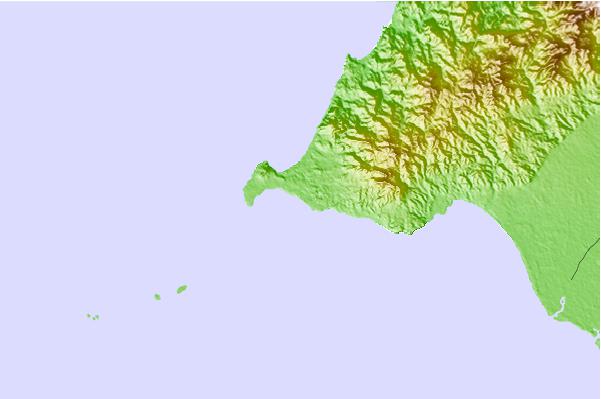
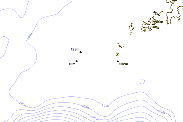
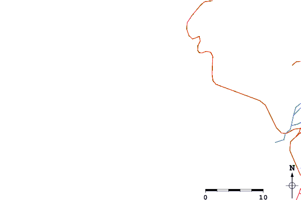
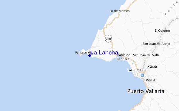
Gebruik deze reliëfkaart om naar de surfspots en de getijdenstations van Nayarit toe te gaan, in de buurt van La Lancha.
Andere Dichtbijzijnde Surflocaties van La Lancha:
(klik op locatienaam voor meer informatie)- Closest Locatie1 mi
- Second closest Locatie2 mi
- Third closest Locatie2 mi
- Fourth closest Locatie2 mi
- Fifth closest Locatie2 mi
Dichtstbijzijnde golfboeien bij La Lancha:
- Closest golfboei702 mi
- Second closest golfboei741 mi
- Third closest golfboei807 mi
- Fourth closest golfboei827 mi
- Fifth closest golfboei907 mi
Getijdenstations in de buurt van La Lancha:
- Closest getijdenstationBucerias11 mi
- Second closest getijdenstationPuerto Vallarta19 mi
- Third closest getijdenstationSan Blas54 mi
- Fourth closest getijdenstationSan Patricio119 mi
- Fifth closest getijdenstationIsla del Bosque138 mi
Airports
- The nearest passenger airport to La Lancha is Licenciado Gustavo Diaz Ordaz International (Puerto Vallarta) Airport (PVR) in Mexico, which is 26 km (16 miles) away (directly).
- The second closest airport to La Lancha is Tepic Airport (TPQ), also in Mexico, 99 km (61 miles) away.
- /breaks/La-Lancha/forecasts/latest


 Nearest