
Lagundri-Indicators Surf Guide
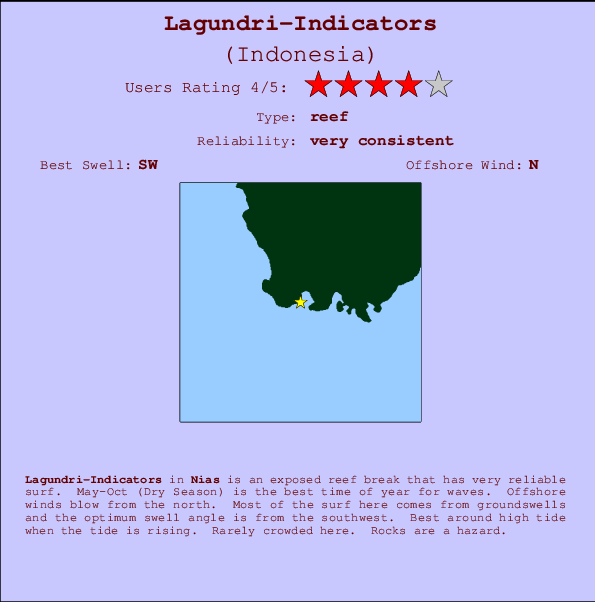
Lagundri-Indicators in Nias, Hinako Islands is an exposed reef break that is usually a safe bet. May-Oct (Dry Season) is the optimum time of year for waves. The best wind direction is from the north. Tends to receive distant groundswells and the best swell direction is from the southwest. There is a right breaking reef. Best around high tide when the tide is rising. Unlikely to be too crowded, even when the surf is up. Take care of rocks in the line up.
Lagundri-Indicators Spot Info
| Type: | Rating: | Reliability: | Todays Sea Temp*: |
|---|---|---|---|
| very consistent | 30.1°C*ocean temperature recorded from satellite |
Surfing Lagundri-Indicators:
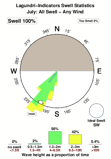
The best conditions reported for surf at Lagundri-Indicators occur when a Southwest swell combines with an offshore wind direction from the North.

Voorspelde Golfenergie (Kracht): 12 uur


Lagundri-Indicators Surf:
Saturday, 18 July 2026, 03:53 Local time| Saturday 18 | ||||
| 4AM | 7AM | 10AM | 1PM | |
| Wave (m) | ||||
| Periode (s) | 14 | 14 | 14 | 14 |
| Wind (km/h) | ||||
| Wind | cross- off |
cross- off |
off | off |
- /breaks/Lagundri-Indicators/forecasts/latest
Lagundri-Indicators Surf Guide
Lagundri-Indicators in Nias, Hinako Islands is an exposed reef break that is usually a safe bet. May-Oct (Dry Season) is the optimum time of year for waves. The best wind direction is from the north. Tends to receive distant groundswells and the best swell direction is from the southwest. There is a right breaking reef. Best around high tide when the tide is rising. Unlikely to be too crowded, even when the surf is up. Take care of rocks in the line up.
Lagundri-Indicators Spot Info
Type: Rating: Reliability: Todays Sea Temp*:  Reef
Reef 4
4very consistent 30.1°C*ocean temperature recorded from satelliteSurfing Lagundri-Indicators:
The best conditions reported for surf at Lagundri-Indicators occur when a Southwest swell combines with an offshore wind direction from the North.
Voorspelde Golfenergie (Kracht): 12 uur
Gebruik de tabbladen hierboven om de zeewatertemperatuur bij Lagundri-Indicators te bekijken, foto's van Lagundri-Indicators, Lagundri-Indicators gedetailleerde golfvoorspellingen, wind- en weersvoorspellingen, Lagundri-Indicators webcams, actuele wind in Nias live weerstations en Lagundri-Indicators getijdenvoorspellingen. De link van Indonesia golfkaarten opent een grote afbeelding van Indonesia en de omliggende zeeën. Deze golfkaarten kunnen worden dynamisch gemaakt worden met de verschillende golfcomponenten, golfenergie, golfperiode, golfhoogte, samen met de wind en weersvoorspellingen, het actuele weer en de zeetoestand volgens golfboeien uit Indonesia, langskomende schepen en weerstations op de kust. Elk voorspelling pagina's voor dit surfstrand zijn voorzien van een wereldwijde en regionale golfzoeker om de beste surfsomstandigheden in het gebied rond Lagundri-Indicators te vinden.
Lagundri-Indicators Surf:
Saturday, 18 July 2026, 03:53 Local timeSaturday 18 4AM 7AM 10AM 1PM Wave (m) Periode (s) 14 14 14 14 Wind (km/h) Wind cross-
offcross-
offoff off - /breaks/Lagundri-Indicators/forecasts/latest
- /breaks/Lagundri-Indicators/forecasts/latest/six_day
Lagundri-Indicators Surf Guide
Lagundri-Indicators in Nias, Hinako Islands is an exposed reef break that is usually a safe bet. May-Oct (Dry Season) is the optimum time of year for waves. The best wind direction is from the north. Tends to receive distant groundswells and the best swell direction is from the southwest. There is a right breaking reef. Best around high tide when the tide is rising. Unlikely to be too crowded, even when the surf is up. Take care of rocks in the line up.
Lagundri-Indicators Spot Info
Type: Rating: Reliability: Todays Sea Temp*: Reef4very consistent 30.1°C*ocean temperature recorded from satelliteSurfing Lagundri-Indicators:
The best conditions reported for surf at Lagundri-Indicators occur when a Southwest swell combines with an offshore wind direction from the North.
Voorspelde Golfenergie (Kracht): 12 uur
Gebruik de tabbladen hierboven om de zeewatertemperatuur bij Lagundri-Indicators te bekijken, foto's van Lagundri-Indicators, Lagundri-Indicators gedetailleerde golfvoorspellingen, wind- en weersvoorspellingen, Lagundri-Indicators webcams, actuele wind in Nias live weerstations en Lagundri-Indicators getijdenvoorspellingen. De link van Indonesia golfkaarten opent een grote afbeelding van Indonesia en de omliggende zeeën. Deze golfkaarten kunnen worden dynamisch gemaakt worden met de verschillende golfcomponenten, golfenergie, golfperiode, golfhoogte, samen met de wind en weersvoorspellingen, het actuele weer en de zeetoestand volgens golfboeien uit Indonesia, langskomende schepen en weerstations op de kust. Elk voorspelling pagina's voor dit surfstrand zijn voorzien van een wereldwijde en regionale golfzoeker om de beste surfsomstandigheden in het gebied rond Lagundri-Indicators te vinden.
Lagundri-Indicators Surf:
Saturday, 18 July 2026, 03:53 Local timeSaturday 18 4AM 7AM 10AM 1PM Wave (m) Periode (s) 14 14 14 14 Wind (km/h) Wind cross-
offcross-
offoff off - /breaks/Lagundri-Indicators/forecasts/latest
Lagundri-Indicators Surf Guide
Lagundri-Indicators in Nias, Hinako Islands is an exposed reef break that is usually a safe bet. May-Oct (Dry Season) is the optimum time of year for waves. The best wind direction is from the north. Tends to receive distant groundswells and the best swell direction is from the southwest. There is a right breaking reef. Best around high tide when the tide is rising. Unlikely to be too crowded, even when the surf is up. Take care of rocks in the line up.
Lagundri-Indicators Spot Info
Type: Rating: Reliability: Todays Sea Temp*: Reef4very consistent 30.1°C*ocean temperature recorded from satelliteSurfing Lagundri-Indicators:
The best conditions reported for surf at Lagundri-Indicators occur when a Southwest swell combines with an offshore wind direction from the North.
Voorspelde Golfenergie (Kracht): 12 uur
Gebruik de tabbladen hierboven om de zeewatertemperatuur bij Lagundri-Indicators te bekijken, foto's van Lagundri-Indicators, Lagundri-Indicators gedetailleerde golfvoorspellingen, wind- en weersvoorspellingen, Lagundri-Indicators webcams, actuele wind in Nias live weerstations en Lagundri-Indicators getijdenvoorspellingen. De link van Indonesia golfkaarten opent een grote afbeelding van Indonesia en de omliggende zeeën. Deze golfkaarten kunnen worden dynamisch gemaakt worden met de verschillende golfcomponenten, golfenergie, golfperiode, golfhoogte, samen met de wind en weersvoorspellingen, het actuele weer en de zeetoestand volgens golfboeien uit Indonesia, langskomende schepen en weerstations op de kust. Elk voorspelling pagina's voor dit surfstrand zijn voorzien van een wereldwijde en regionale golfzoeker om de beste surfsomstandigheden in het gebied rond Lagundri-Indicators te vinden.
Lagundri-Indicators Surf:
Saturday, 18 July 2026, 03:53 Local timeSaturday 18 4AM 7AM 10AM 1PM Wave (m) Periode (s) 14 14 14 14 Wind (km/h) Wind cross-
offcross-
offoff off Tide Times:
Op Lagundri-Indicators (0 km).
VOLGENDE IS OM (lokale tijd) resterende tijd hoog water laag water Lagundri-Indicators Tide Times and Tide Chart
Live Weather:
At Minangkabau Airport, 323 km from Lagundri-Indicators.
light winds from the NNE
(km/h)Air temperature
25°COverall Lagundri-Indicators Surf Consistency and Wind Distribution in July
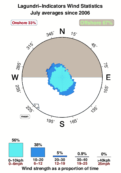


Wind stats for Lagundri-Indicators: see the variation in direction and stength by month.
surffoto's uit
de galerijContourlijnen: Wegen & Rivieren: Kies een surflokatie uit het menu 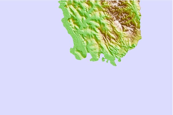
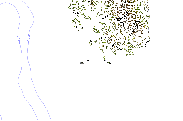
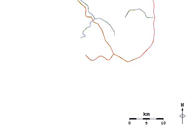
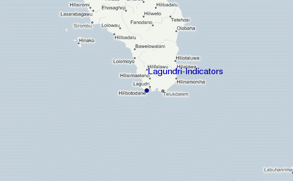
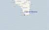
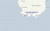
Gebruik deze reliëfkaart om naar de surfspots en de getijdenstations van Nias toe te gaan, in de buurt van Lagundri-Indicators.
Andere Dichtbijzijnde Surflocaties van Lagundri-Indicators:
(klik op locatienaam voor meer informatie)- Closest Locatie1 mi
- Second closest Locatie1 mi
- Third closest Locatie7 mi
- Fourth closest Locatie9 mi
- Fifth closest Locatie12 mi
Dichtstbijzijnde golfboeien bij Lagundri-Indicators:
- Closest golfboei2414 mi
- Second closest golfboei2491 mi
- Third closest golfboei2669 mi
- Fourth closest golfboei2684 mi
- Fifth closest golfboei2853 mi
Getijdenstations in de buurt van Lagundri-Indicators:
- Closest getijdenstationSibolga109 mi
- Second closest getijdenstationSinabang161 mi
- Third closest getijdenstationPariaman185 mi
- Fourth closest getijdenstationTeluk Nibung222 mi
- Fifth closest getijdenstationBelawan236 mi
Airports
- The nearest passenger airport to Lagundri-Indicators is Binaka (Gunung Sitoli) Airport (GNS) in Indonesia, which is 66 km (41 miles) away (directly).
- The second closest airport to Lagundri-Indicators is Tabing (Padang) Airport (PDG), also in Indonesia, 334 km (207 miles) away.
- /breaks/Lagundri-Indicators/forecasts/latest
 Nearest