

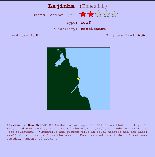
Lajinha Surf Guide
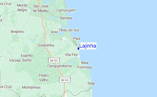
Lajinha in Rio Grande Do Norte is an exposed reef break that has consistent surf and can work at any time of the year. Works best in offshore winds from the west southwest. Most of the surf here comes from groundswells and the best swell direction is from the east. A right hand reef break. Best around low tide. Sometimes crowded. Hazards include rocks,.
Lajinha Spot Info
| Type: | Rating: | Reliability: | Todays Sea Temp*: |
|---|---|---|---|
| consistent | 27.1°C*ocean temperature recorded from satellite |
Surfing Lajinha:
The best conditions reported for surf at Lajinha occur when a East swell combines with an offshore wind direction from the West-southwest.
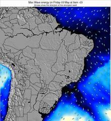
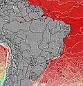
Voorspelde Golfenergie (Kracht): 12 uur


Lajinha Surf:
Tuesday, 14 July 2026, 09:54 Local time| Tuesday 14 | ||||
| 6AM | 9AM | 12PM | 3PM | |
| Wave (m) | ||||
| Periode (s) | 7 | 7 | 7 | 7 |
| Wind (km/h) | ||||
| Wind | on | on | on | on |
- /breaks/Lajinha/forecasts/latest
Lajinha Surf Guide
Lajinha in Rio Grande Do Norte is an exposed reef break that has consistent surf and can work at any time of the year. Works best in offshore winds from the west southwest. Most of the surf here comes from groundswells and the best swell direction is from the east. A right hand reef break. Best around low tide. Sometimes crowded. Hazards include rocks,.
Lajinha Spot Info
Type: Rating: Reliability: Todays Sea Temp*:  Reef
Reef 2
2consistent 27.1°C*ocean temperature recorded from satelliteSurfing Lajinha:
The best conditions reported for surf at Lajinha occur when a East swell combines with an offshore wind direction from the West-southwest.
Voorspelde Golfenergie (Kracht): 12 uur
Gebruik de tabbladen hierboven om de zeewatertemperatuur bij Lajinha te bekijken, foto's van Lajinha, Lajinha gedetailleerde golfvoorspellingen, wind- en weersvoorspellingen, Lajinha webcams, actuele wind in Rio Grande Do Norte live weerstations en Lajinha getijdenvoorspellingen. De link van Brazil golfkaarten opent een grote afbeelding van Brazil en de omliggende zeeën. Deze golfkaarten kunnen worden dynamisch gemaakt worden met de verschillende golfcomponenten, golfenergie, golfperiode, golfhoogte, samen met de wind en weersvoorspellingen, het actuele weer en de zeetoestand volgens golfboeien uit Brazil, langskomende schepen en weerstations op de kust. Elk voorspelling pagina's voor dit surfstrand zijn voorzien van een wereldwijde en regionale golfzoeker om de beste surfsomstandigheden in het gebied rond Lajinha te vinden.
Lajinha Surf:
Tuesday, 14 July 2026, 09:54 Local timeTuesday 14 6AM 9AM 12PM 3PM Wave (m) Periode (s) 7 7 7 7 Wind (km/h) Wind on on on on - /breaks/Lajinha/forecasts/latest
- /breaks/Lajinha/forecasts/latest/six_day
Lajinha Surf Guide
Lajinha in Rio Grande Do Norte is an exposed reef break that has consistent surf and can work at any time of the year. Works best in offshore winds from the west southwest. Most of the surf here comes from groundswells and the best swell direction is from the east. A right hand reef break. Best around low tide. Sometimes crowded. Hazards include rocks,.
Lajinha Spot Info
Type: Rating: Reliability: Todays Sea Temp*: Reef2consistent 27.1°C*ocean temperature recorded from satelliteSurfing Lajinha:
The best conditions reported for surf at Lajinha occur when a East swell combines with an offshore wind direction from the West-southwest.
Voorspelde Golfenergie (Kracht): 12 uur
Gebruik de tabbladen hierboven om de zeewatertemperatuur bij Lajinha te bekijken, foto's van Lajinha, Lajinha gedetailleerde golfvoorspellingen, wind- en weersvoorspellingen, Lajinha webcams, actuele wind in Rio Grande Do Norte live weerstations en Lajinha getijdenvoorspellingen. De link van Brazil golfkaarten opent een grote afbeelding van Brazil en de omliggende zeeën. Deze golfkaarten kunnen worden dynamisch gemaakt worden met de verschillende golfcomponenten, golfenergie, golfperiode, golfhoogte, samen met de wind en weersvoorspellingen, het actuele weer en de zeetoestand volgens golfboeien uit Brazil, langskomende schepen en weerstations op de kust. Elk voorspelling pagina's voor dit surfstrand zijn voorzien van een wereldwijde en regionale golfzoeker om de beste surfsomstandigheden in het gebied rond Lajinha te vinden.
Lajinha Surf:
Tuesday, 14 July 2026, 09:54 Local timeTuesday 14 6AM 9AM 12PM 3PM Wave (m) Periode (s) 7 7 7 7 Wind (km/h) Wind on on on on - /breaks/Lajinha/forecasts/latest
Lajinha Surf Guide
Lajinha in Rio Grande Do Norte is an exposed reef break that has consistent surf and can work at any time of the year. Works best in offshore winds from the west southwest. Most of the surf here comes from groundswells and the best swell direction is from the east. A right hand reef break. Best around low tide. Sometimes crowded. Hazards include rocks,.
Lajinha Spot Info
Type: Rating: Reliability: Todays Sea Temp*: Reef2consistent 27.1°C*ocean temperature recorded from satelliteSurfing Lajinha:
The best conditions reported for surf at Lajinha occur when a East swell combines with an offshore wind direction from the West-southwest.
Voorspelde Golfenergie (Kracht): 12 uur
Gebruik de tabbladen hierboven om de zeewatertemperatuur bij Lajinha te bekijken, foto's van Lajinha, Lajinha gedetailleerde golfvoorspellingen, wind- en weersvoorspellingen, Lajinha webcams, actuele wind in Rio Grande Do Norte live weerstations en Lajinha getijdenvoorspellingen. De link van Brazil golfkaarten opent een grote afbeelding van Brazil en de omliggende zeeën. Deze golfkaarten kunnen worden dynamisch gemaakt worden met de verschillende golfcomponenten, golfenergie, golfperiode, golfhoogte, samen met de wind en weersvoorspellingen, het actuele weer en de zeetoestand volgens golfboeien uit Brazil, langskomende schepen en weerstations op de kust. Elk voorspelling pagina's voor dit surfstrand zijn voorzien van een wereldwijde en regionale golfzoeker om de beste surfsomstandigheden in het gebied rond Lajinha te vinden.
Lajinha Surf:
Tuesday, 14 July 2026, 09:54 Local timeTuesday 14 6AM 9AM 12PM 3PM Wave (m) Periode (s) 7 7 7 7 Wind (km/h) Wind on on on on Tide Times:
Voor Abacateiro, %{dist} %{km} van %{location}.
VOLGENDE IS OM (lokale tijd) resterende tijd hoog water laag water Lajinha Tide Times and Tide Chart
Live Weather:
At Camaratuba, 38 km from Lajinha.
calm
(km/h)
no reportAir temperature
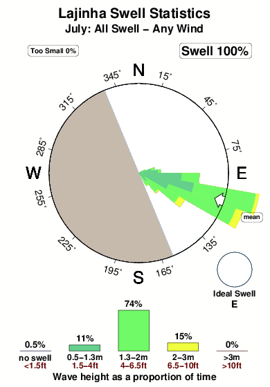
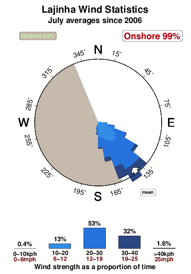
23.2°COverall Lajinha Surf Consistency and Wind Distribution in July
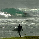
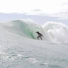
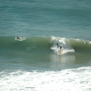
surffoto's uit
de galerijContourlijnen: Wegen & Rivieren: Kies een surflokatie uit het menu 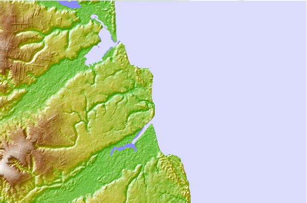
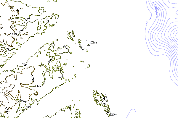
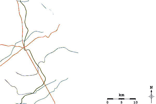
Gebruik deze reliëfkaart om naar de surfspots en de getijdenstations van Rio Grande Do Norte toe te gaan, in de buurt van Lajinha.
Andere Dichtbijzijnde Surflocaties van Lajinha:
(klik op locatienaam voor meer informatie)- Closest Locatie1 mi
- Second closest Locatie1 mi
- Third closest Locatie2 mi
- Fourth closest Locatie3 mi
- Fifth closest Locatie3 mi
Dichtstbijzijnde golfboeien bij Lajinha:
- Closest golfboei1613 mi
- Second closest golfboei1892 mi
- Third closest golfboei1991 mi
- Fourth closest golfboei2047 mi
- Fifth closest golfboei2456 mi
Getijdenstations in de buurt van Lajinha:
- Closest getijdenstationAres11 mi
- Second closest getijdenstationNatal36 mi
- Third closest getijdenstationCabedelo50 mi
- Fourth closest getijdenstationJoãoPessoa58 mi
- Fifth closest getijdenstationTambau58 mi
Airports
- The nearest passenger airport to Lajinha is Augusto Severo (Natal) Airport (NAT) in Brazil, which is 47 km (29 miles) away (directly).
- The second closest airport to Lajinha is Intl. Pres. Castro Pinto (Joao Pessoa) Airport (JPA), also in Brazil, 145 km (90 miles) away.
- /breaks/Lajinha/forecasts/latest


 Nearest