
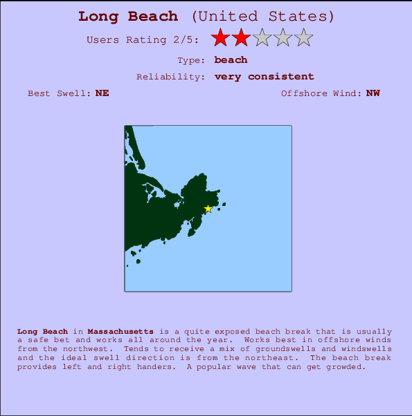
Long Beach Surf Guide
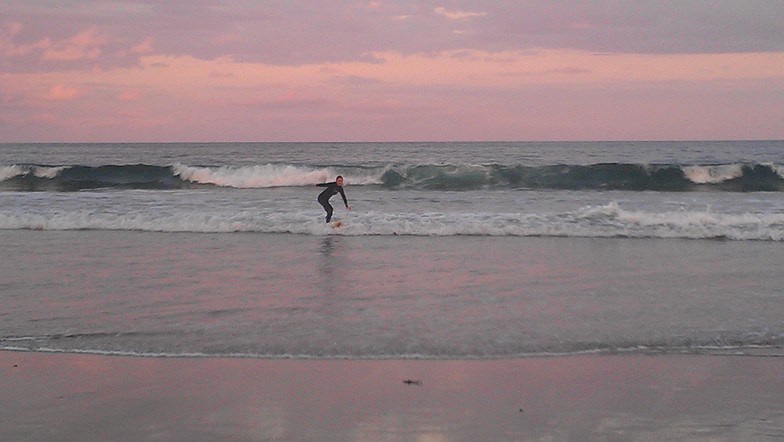
Long Beach in Massachusetts is a fairly exposed beach break that is usually a safe bet and works all around the year. The best wind direction is from the northwest. Tends to receive a mix of groundswells and windswells and the optimum swell angle is from the northeast. The beach break provides left and right handers. Often Crowded.
Long Beach Spot Info
| Type: | Rating: | Reliability: | Todays Sea Temp*: |
|---|---|---|---|
| very consistent | 18.4°C*ocean temperature recorded from satellite |
Surfing Long Beach:
The best conditions reported for surf at Long Beach occur when a Northeast swell combines with an offshore wind direction from the Northwest.

Voorspelde Golfenergie (Kracht): 12 uur


Long Beach Surf:
Sunday, 2 August 2026, 15:47 Local time| Sunday 02 | ||||
| 11AM | 2PM | 5PM | 8PM | |
| Wave (m) | ||||
| Periode (s) | 7 | 4 | 5 | 5 |
| Wind (km/h) | ||||
| Wind | cross- on |
cross- on |
cross- on |
cross- on |
- /breaks/Long-Beach/forecasts/latest
Long Beach Surf Guide
Long Beach in Massachusetts is a fairly exposed beach break that is usually a safe bet and works all around the year. The best wind direction is from the northwest. Tends to receive a mix of groundswells and windswells and the optimum swell angle is from the northeast. The beach break provides left and right handers. Often Crowded.
Long Beach Spot Info
Type: Rating: Reliability: Todays Sea Temp*:  Beach
Beach 2
2very consistent 18.4°C*ocean temperature recorded from satelliteSurfing Long Beach:
The best conditions reported for surf at Long Beach occur when a Northeast swell combines with an offshore wind direction from the Northwest.
Voorspelde Golfenergie (Kracht): 12 uur
Gebruik de tabbladen hierboven om de zeewatertemperatuur bij Long Beach te bekijken, foto's van Long Beach, Long Beach gedetailleerde golfvoorspellingen, wind- en weersvoorspellingen, Long Beach webcams, actuele wind in Massachusetts live weerstations en Long Beach getijdenvoorspellingen. De link van United States golfkaarten opent een grote afbeelding van United States en de omliggende zeeën. Deze golfkaarten kunnen worden dynamisch gemaakt worden met de verschillende golfcomponenten, golfenergie, golfperiode, golfhoogte, samen met de wind en weersvoorspellingen, het actuele weer en de zeetoestand volgens golfboeien uit United States, langskomende schepen en weerstations op de kust. Elk voorspelling pagina's voor dit surfstrand zijn voorzien van een wereldwijde en regionale golfzoeker om de beste surfsomstandigheden in het gebied rond Long Beach te vinden.
Long Beach Surf:
Sunday, 2 August 2026, 15:47 Local timeSunday 02 11AM 2PM 5PM 8PM Wave (m) Periode (s) 7 4 5 5 Wind (km/h) Wind cross-
oncross-
oncross-
oncross-
on- /breaks/Long-Beach/forecasts/latest
- /breaks/Long-Beach/forecasts/latest/six_day
Long Beach Surf Guide
Long Beach in Massachusetts is a fairly exposed beach break that is usually a safe bet and works all around the year. The best wind direction is from the northwest. Tends to receive a mix of groundswells and windswells and the optimum swell angle is from the northeast. The beach break provides left and right handers. Often Crowded.
Long Beach Spot Info
Type: Rating: Reliability: Todays Sea Temp*: Beach2very consistent 18.4°C*ocean temperature recorded from satelliteSurfing Long Beach:
The best conditions reported for surf at Long Beach occur when a Northeast swell combines with an offshore wind direction from the Northwest.
Voorspelde Golfenergie (Kracht): 12 uur
Gebruik de tabbladen hierboven om de zeewatertemperatuur bij Long Beach te bekijken, foto's van Long Beach, Long Beach gedetailleerde golfvoorspellingen, wind- en weersvoorspellingen, Long Beach webcams, actuele wind in Massachusetts live weerstations en Long Beach getijdenvoorspellingen. De link van United States golfkaarten opent een grote afbeelding van United States en de omliggende zeeën. Deze golfkaarten kunnen worden dynamisch gemaakt worden met de verschillende golfcomponenten, golfenergie, golfperiode, golfhoogte, samen met de wind en weersvoorspellingen, het actuele weer en de zeetoestand volgens golfboeien uit United States, langskomende schepen en weerstations op de kust. Elk voorspelling pagina's voor dit surfstrand zijn voorzien van een wereldwijde en regionale golfzoeker om de beste surfsomstandigheden in het gebied rond Long Beach te vinden.
Long Beach Surf:
Sunday, 2 August 2026, 15:47 Local timeSunday 02 11AM 2PM 5PM 8PM Wave (m) Periode (s) 7 4 5 5 Wind (km/h) Wind cross-
oncross-
oncross-
oncross-
on- /breaks/Long-Beach/forecasts/latest
Long Beach Surf Guide
Long Beach in Massachusetts is a fairly exposed beach break that is usually a safe bet and works all around the year. The best wind direction is from the northwest. Tends to receive a mix of groundswells and windswells and the optimum swell angle is from the northeast. The beach break provides left and right handers. Often Crowded.
Long Beach Spot Info
Type: Rating: Reliability: Todays Sea Temp*: Beach2very consistent 18.4°C*ocean temperature recorded from satelliteSurfing Long Beach:
The best conditions reported for surf at Long Beach occur when a Northeast swell combines with an offshore wind direction from the Northwest.
Voorspelde Golfenergie (Kracht): 12 uur
Gebruik de tabbladen hierboven om de zeewatertemperatuur bij Long Beach te bekijken, foto's van Long Beach, Long Beach gedetailleerde golfvoorspellingen, wind- en weersvoorspellingen, Long Beach webcams, actuele wind in Massachusetts live weerstations en Long Beach getijdenvoorspellingen. De link van United States golfkaarten opent een grote afbeelding van United States en de omliggende zeeën. Deze golfkaarten kunnen worden dynamisch gemaakt worden met de verschillende golfcomponenten, golfenergie, golfperiode, golfhoogte, samen met de wind en weersvoorspellingen, het actuele weer en de zeetoestand volgens golfboeien uit United States, langskomende schepen en weerstations op de kust. Elk voorspelling pagina's voor dit surfstrand zijn voorzien van een wereldwijde en regionale golfzoeker om de beste surfsomstandigheden in het gebied rond Long Beach te vinden.
Long Beach Surf:
Sunday, 2 August 2026, 15:47 Local timeSunday 02 11AM 2PM 5PM 8PM Wave (m) Periode (s) 7 4 5 5 Wind (km/h) Wind cross-
oncross-
oncross-
oncross-
onTide Times:
Voor Rockport, Massachusetts, %{dist} %{km} van %{location}.
VOLGENDE IS OM (lokale tijd) resterende tijd hoog water laag water Long Beach Tide Times and Tide Chart
Live Weather:
At Rockport, 3 km from Long Beach.
wind obs. (8 kph from 225 degs) was rejected
(km/h)
dryAir temperature
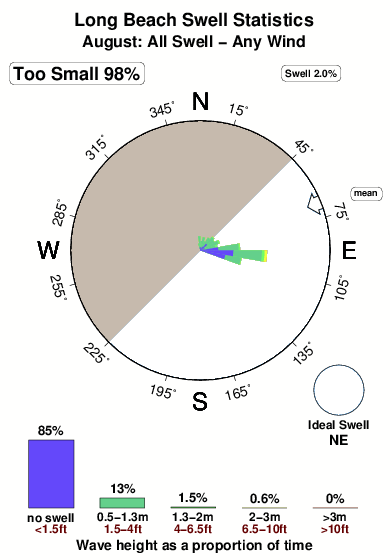
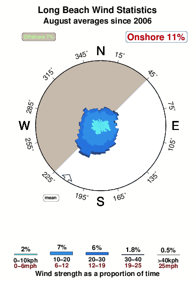
26°COverall Long Beach Surf Consistency and Wind Distribution in August
surffoto's uit
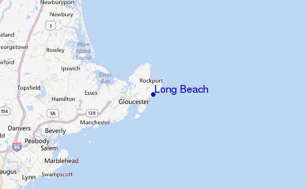
de galerijContourlijnen: Wegen & Rivieren: Kies een surflokatie uit het menu 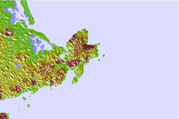
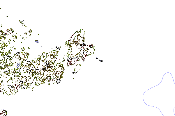
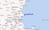
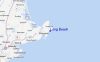
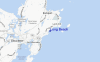
Gebruik deze reliëfkaart om naar de surfspots en de getijdenstations van Massachusetts toe te gaan, in de buurt van Long Beach.
Andere Dichtbijzijnde Surflocaties van Long Beach:
(klik op locatienaam voor meer informatie)- Closest Locatie1 mi
- Second closest Locatie3 mi
- Third closest Locatie11 mi
- Fourth closest Locatie14 mi
- Fifth closest Locatie16 mi
Dichtstbijzijnde golfboeien bij Long Beach:
- Closest golfboei8 mi
- Second closest golfboei19 mi
- Third closest golfboei25 mi
- Fourth closest golfboei39 mi
- Fifth closest golfboei57 mi
Getijdenstations in de buurt van Long Beach:
- Closest getijdenstationRockport2 mi
- Second closest getijdenstationGloucester Harbor (Ten Pound Island)3 mi
- Third closest getijdenstationAnnisquam4 mi
- Fourth closest getijdenstationEssex8 mi
- Fifth closest getijdenstationManchester Harbor9 mi
Airports
- The closest passenger airport to Long Beach is General Edward Lawrence Logan International (Boston) Airport (BOS) in USA, 43 km (27 miles) away (directly).
- The second nearest airport to Long Beach is Laurence G Hanscom Fld (Bedford) Airport (BED), also in USA, 58 km (36 miles) away.
- Third is North Central State (Smithfield) Airport (SFZ) in USA, 107 km (66 miles) away.
- Otis Angb (Falmouth) Airport (FMH) in USA is 108 km (67 miles) away.
- Portland International Jetport Airport (PWM), also in USA is the fifth nearest airport to Long Beach and is 116 km (72 miles) away.
- /breaks/Long-Beach/forecasts/latest


 Nearest